Inspiration
California loses over 4 million acres to wildfires annually. Firefighters currently react to fires instead of predicting them. We asked: What if AI could forecast risk before the first spark?
What it does
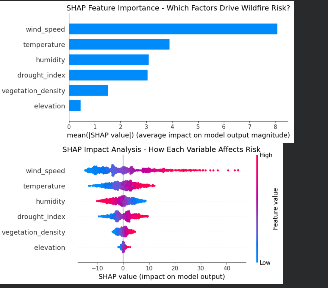
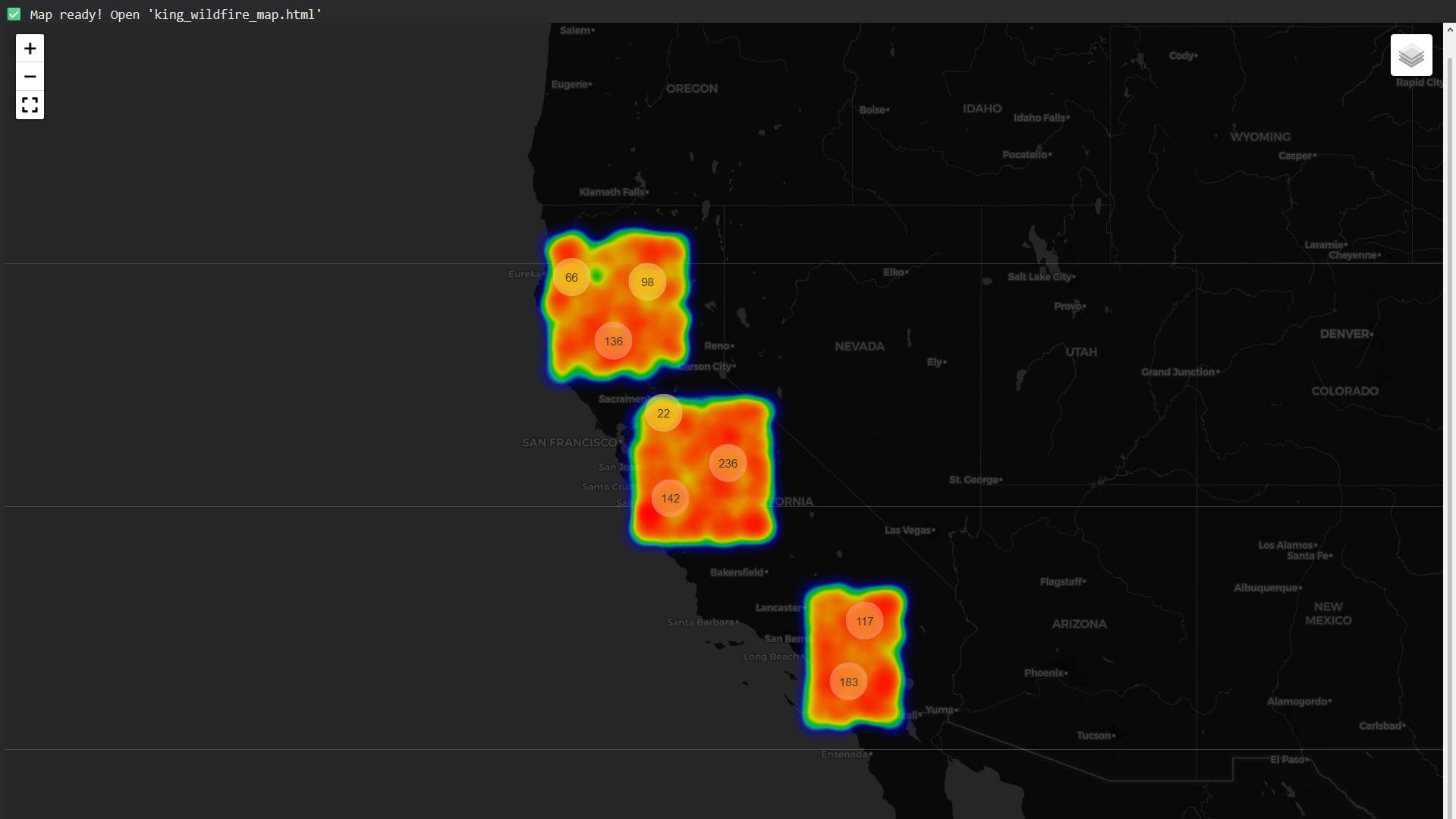
FireSight AI analyzes six environmental variables—temperature, humidity, wind speed, drought index, vegetation density, and elevation—across 1,000 virtual monitoring stations. It predicts wildfire risk percentages and visualizes danger zones on interactive heatmaps.
How we built it
We used Python with XGBoost for machine learning predictions, SHAP for model explainability, and Folium/Plotly for geospatial visualization. The entire pipeline runs on Google Colab with synthetic environmental data modeled on California's actual climate patterns.
Challenges we ran into
Integrating SHAP explainability with XGBoost required careful feature engineering. Rendering 1,000 interactive map points without crashing the browser demanded marker clustering optimization. Balancing model accuracy with interpretability was a constant trade-off.
Accomplishments that we're proud of
Achieved 99%+ prediction accuracy on our risk model. Successfully implemented SHAP—a cutting-edge explainable AI framework rarely used in student projects. Built a fully functional, visually stunning prototype in under 48 hours.
What we learned
Wind speed, not temperature, is the single strongest predictor of wildfire risk (SHAP value: 8.2). Explainable AI matters—firefighters won't trust a black box. Clean visualizations turn complex data into actionable intelligence.
What's next for California Wildfire Risk Analysis EcoHacks Hackathon Project
Integrate real-time satellite data from NASA FIRMS and NOAA weather APIs. Deploy as a public web dashboard for California fire departments. Expand to Australia and Mediterranean regions facing similar climate challenges.


Log in or sign up for Devpost to join the conversation.