-

LOGO OF BUSINESSRADAR
-
Xenia Intelligence Engine: High-concurrency geospatial dashboard with AI-driven viability and predictive metrics
-

Advanced Urban Intelligence Engine: High-fidelity predictive modeling designed for commercial site optimization and urban development
-
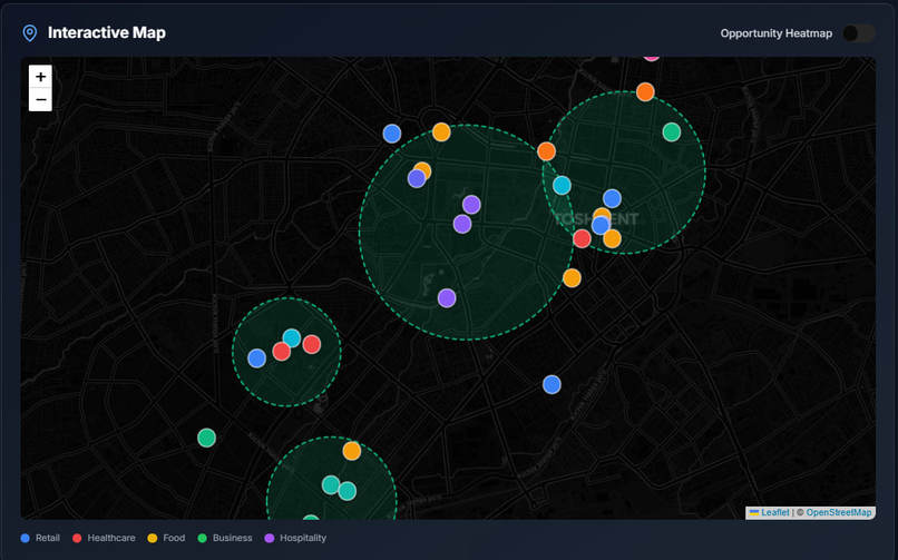
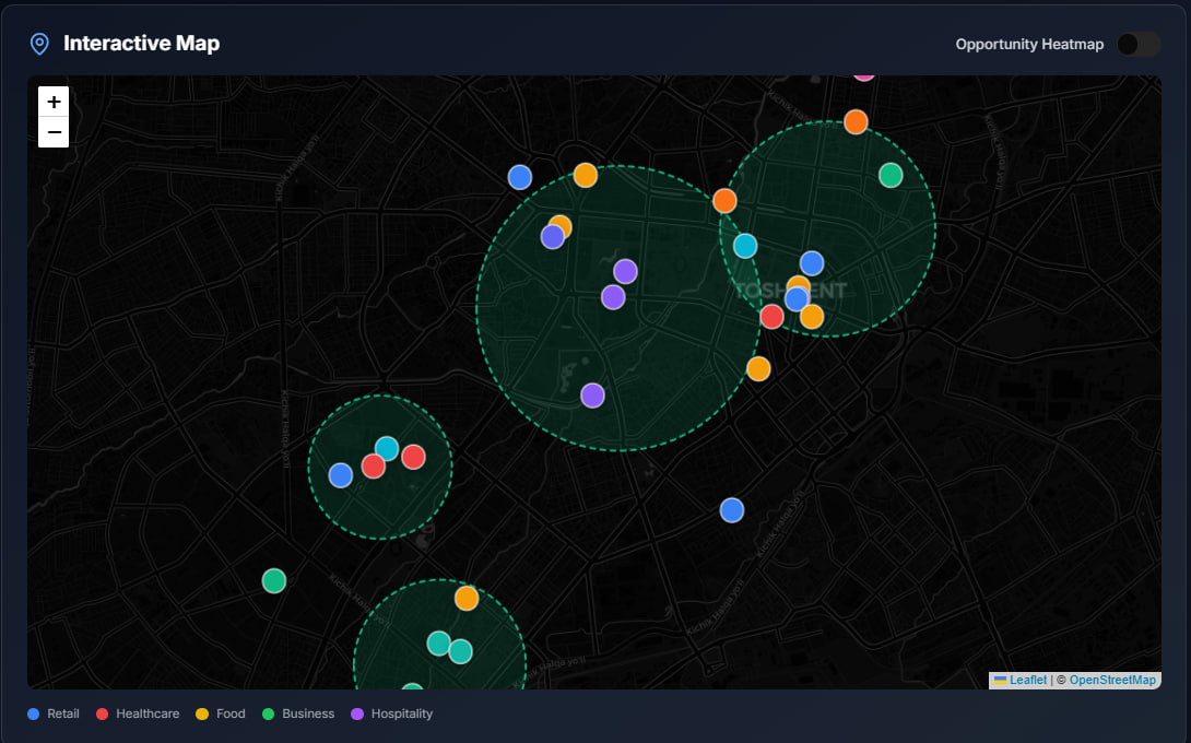
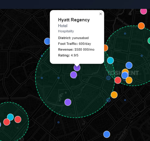
Geospatial Heatmaps: Identifying optimal business locations through automated opportunity zone analysis
-
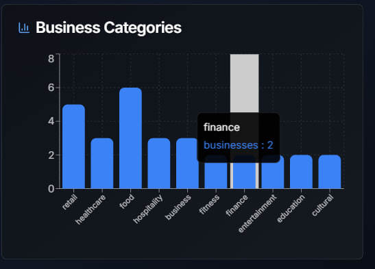
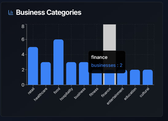
Market Segmentation: Identifying sectoral saturation and business gaps through granular urban analysis
-

Entity-Level Insights: Automated synthesis of district-specific commercial metrics and operational performance data
-

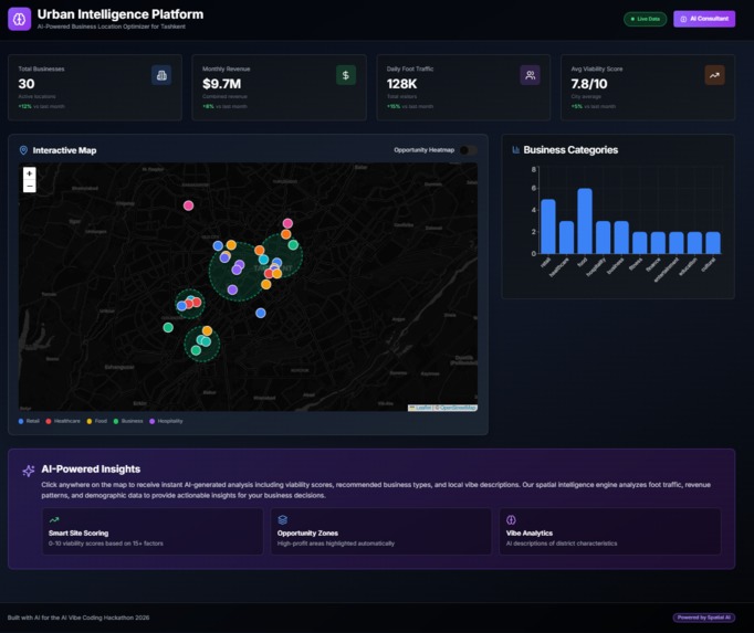
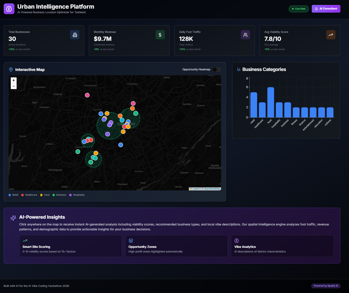
Urban Intelligence Hub: Real-time tracking of active business locations and monthly growth metrics
-
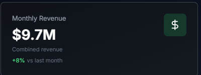
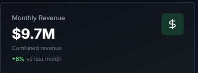
Revenue Forecasting: Automated synthesis of metropolitan commercial income and monthly growth trends
-

Traffic Analysis: Real-time monitoring of daily pedestrian flow and monthly visitor growth patterns
-
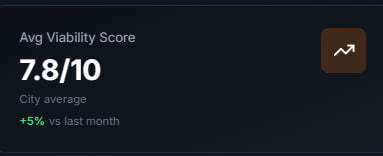
Viability Analytics: Algorithmic assessment of district suitability based on 15+ urban infrastructure factors
-

Sectoral Mapping: Multidimensional classification of urban commercial infrastructure for targeted market gap analysis
-
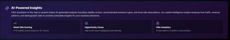
AI-Driven Urban Intelligence: Automated generation of viability scores, opportunity zone mapping, and granular vibe analytics


Inspiration
BusinessRadar was engineered to mitigate the systemic financial risks of intuitive site selection. In an era of fragmented urban datasets, most businesses operate without spatial clarity. Our objective was to democratize high-fidelity geospatial intelligence, enabling stakeholders to leverage the same predictive analytics used by global corporations to ensure sustainable economic growth.
What it does
The platform functions as a sophisticated urban decision-making engine. By synthesizing multidimensional datasets—including competitor density mapping, transit accessibility, and infrastructure nodes—BusinessRadar generates a real-time Commercial Viability Score for any coordinate. It visualizes the city's commercial pulse, identifying market saturation gaps and high-potential "blue ocean" opportunities.
How we built it
To achieve professional-grade reliability and scalability, the architecture focuses on:
- Modular Frontend: A React-based dashboard engineered for high-performance geospatial data exploration.
- Data Synthesis Pipeline: An optimized ingestion engine designed to correlate commercial metadata with urban infrastructure coordinates.
- Intelligence Layer: Algorithmic predictive logic that calculates success probability based on multi-factor density patterns and spatial variables.
Challenges we ran into
The primary engineering hurdle involved the high-concurrency rendering and synchronization of overlapping geospatial layers. We resolved this by architecting a custom data processing pipeline that ensures responsive visualization of large-scale metadata, maintaining a seamless user experience even under heavy data density.
Accomplishments that we're proud of
We successfully transformed abstract urban variables into a functional, high-fidelity prototype that bridges the gap between engineering and macro-economics. BusinessRadar stands as a testament to the Xenia 2026 mission, demonstrating how technical innovation can solve critical fiscal challenges and drive smarter urban evolution.
What's next for BusinessRadar
The roadmap includes the integration of real-time mobility APIs and the implementation of long-term urban trend analysis. By tracking spatial shifts over a 5-year horizon, we aim to transition the platform from diagnostic insights to true prescriptive intelligence, forecasting the future of metropolitan commerce.
Built With
- ai/ml-models
- data-visualization
- geospatial-data-apis
- lucide-react
- predictive
- react
- tailwind-css
- typescript
- vite

Log in or sign up for Devpost to join the conversation.