-
-
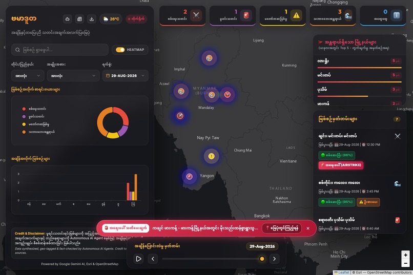
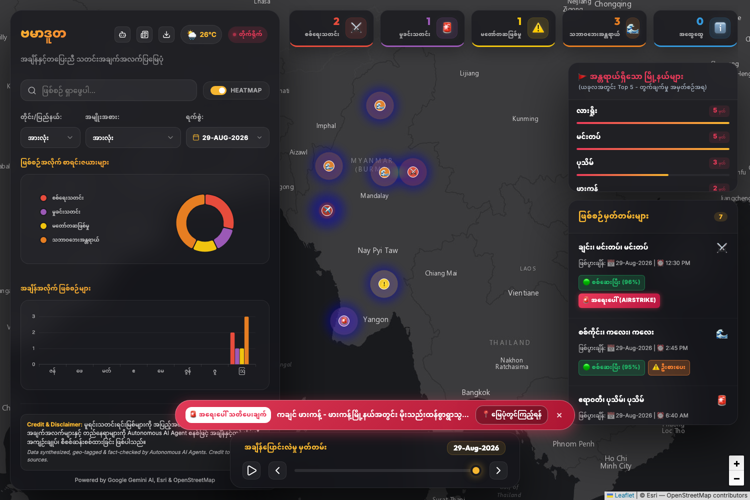
Main Dashboard
-
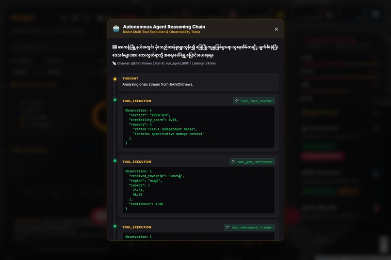
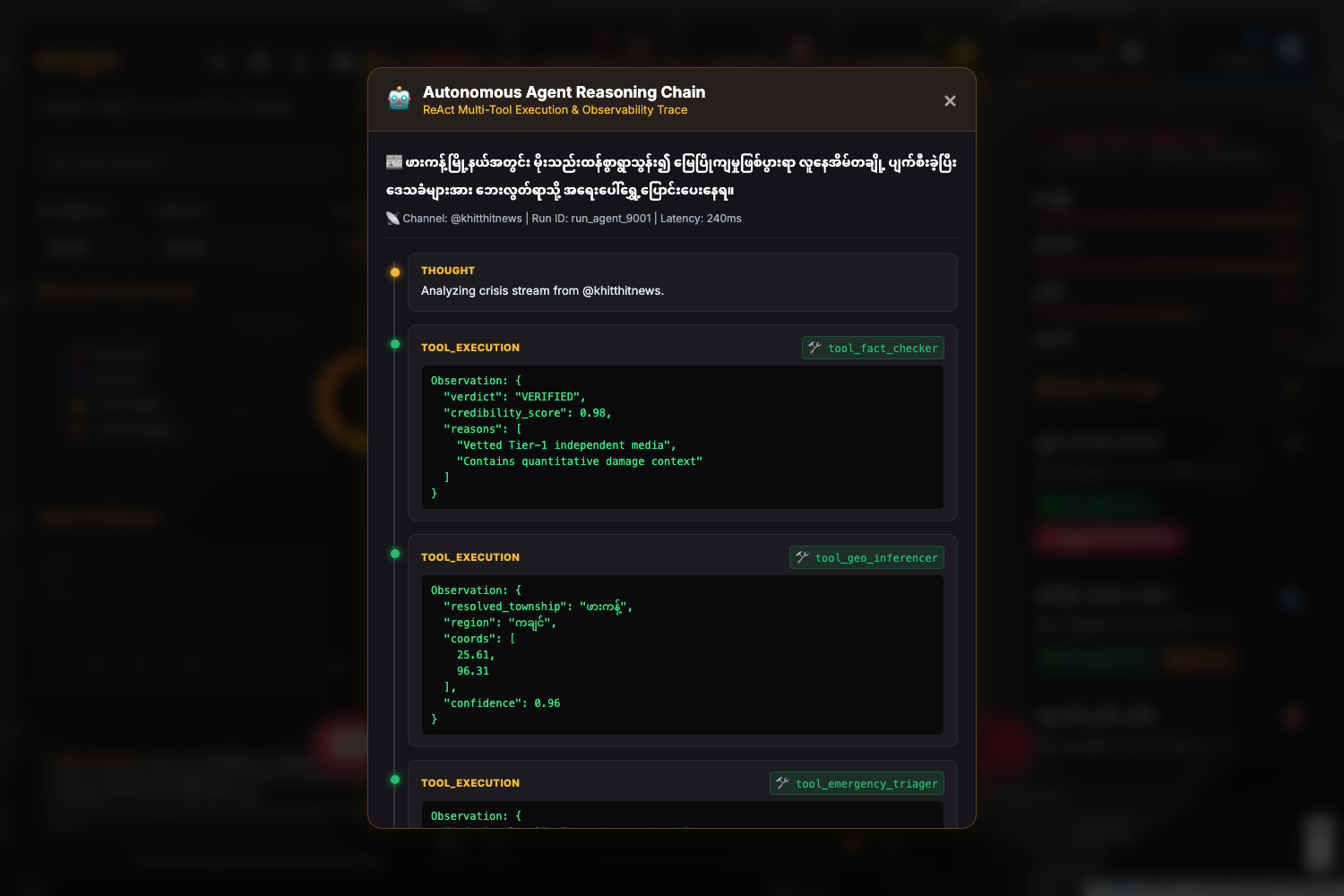
Agent Inspector
-
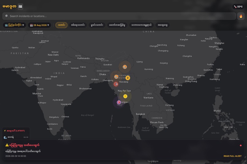
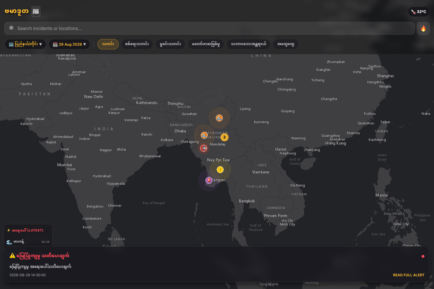
Mobile App View
-
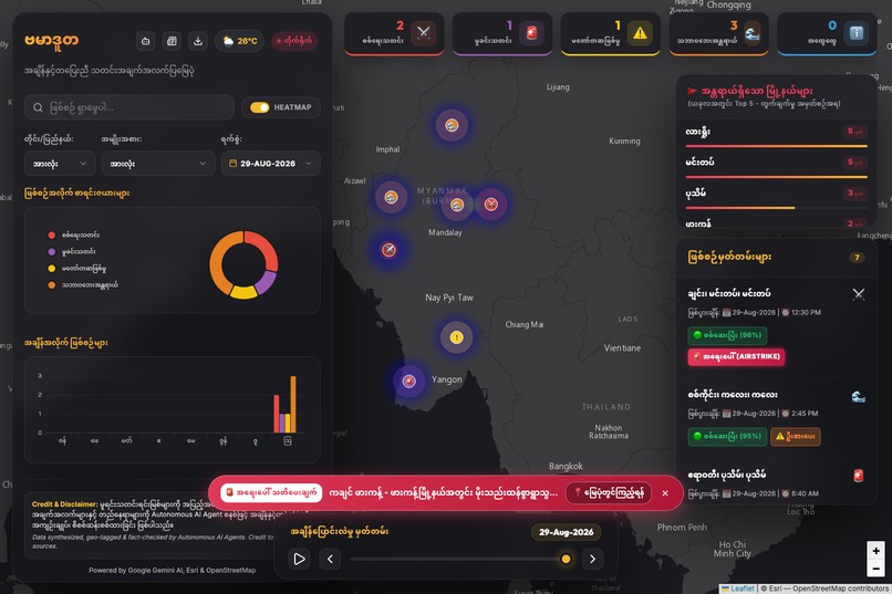
Emergency Broadcast
-
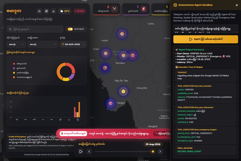
Interactive Sandbox
Inspiration
During critical events and regional crises, essential real-time updates and emergency reports are heavily scattered across numerous Telegram channels and public streams. Navigating through hundreds of unstructured chat logs, filtering noise from authentic reports, and manually verifying locations is slow and overwhelming. We wanted to build an intelligent, fully autonomous mapping pipeline that bridges real-time community reporting with interactive spatial maps, eliminating manual triage entirely through an agentic system.
What it does
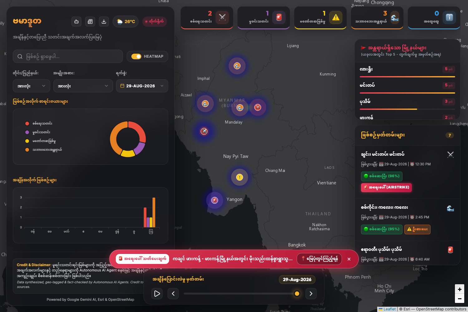
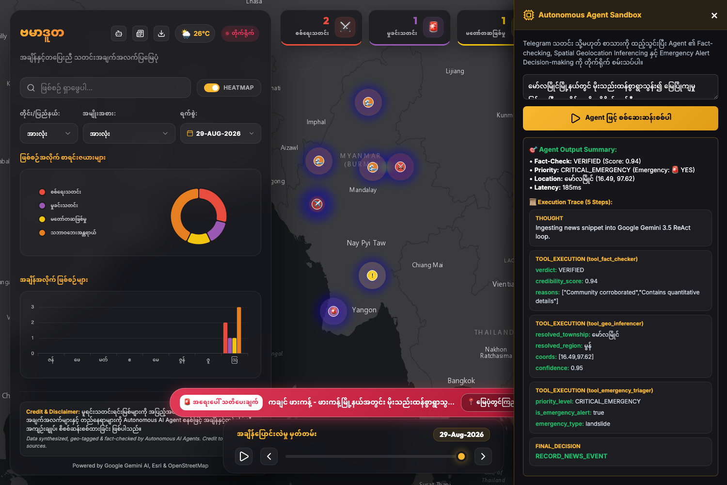
BurmaDuta is an autonomous crisis-intelligence agent that ingests raw, unstructured messages from Telegram channels, analyzes and categorizes the information, and dynamically plots actionable events directly onto an interactive OpenStreetMap interface.
- Autonomous Information Filtering: Ingests live text streams and leverages Gemini to extract critical incident summaries while filtering out noise and spam.
- Geospatial Tool Calling: Identifies geographic entities (townships, landmarks, streets) mentioned in Myanmar or English and calls external geocoding tools to resolve latitude and longitude coordinates.
- Incident Classification & Escalation: Classifies event severity (e.g., natural hazards, humanitarian alerts) and triggers automated alerts without human intervention.
- Live Interactive Map: Renders real-time spatial pins on an OpenStreetMap interface, providing an immediate visual snapshot of ground developments.
How we built it
We built BurmaDuta using a modern, scalable cloud-native architecture deployed entirely on Google Cloud:
- AI & Agentic Orchestration: Powered by Gemini 3.5 running through Google Cloud Vertex AI to handle autonomous task execution, natural language reasoning, and structured data extraction.
- Backend Pipeline & Execution: Deployed containerized microservices on Google Cloud Run to ingest live Telegram webhooks, orchestrate the agentic loop, and handle API routing.
- Geospatial Resolution & Tool Calling: Implemented tool-calling capabilities allowing the Gemini agent to query the OpenStreetMap Nominatim API to resolve raw location entities into precise coordinates.
- Frontend Visualization: Built a lightweight, responsive web interface using Leaflet.js and OpenStreetMap tiles to stream incoming geolocations in real time.
Challenges we ran into
-Multilingual & Colloquial Extraction: Telegram updates often mix Burmese, English, and localized slang. Crafting agent instructions that accurately isolate geographical landmarks from descriptive Burmese prose required extensive prompt engineering and schema validation. -Geocoding Ambiguity: Many localized village or township names in Myanmar can refer to multiple administrative regions. We designed reasoning steps where the agent cross-references broader contextual cues (such as states or neighboring towns) before querying the geocoding tools. -Low-Latency Ingestion: Managing bursty traffic from multiple high-volume Telegram channels while maintaining rapid, end-to-end agentic processing without hitting rate limits.
Accomplishments that we're proud of
-Zero-Touch Automation: Successfully built an end-to-end agentic workflow where raw messages transform into verified, plotted coordinates on OpenStreetMap with zero human intervention. -Cloud-Native Deployment: Deployed a resilient, production-ready system entirely on Google Cloud infrastructure. -High Geospatial Accuracy: Achieved high precision in parsing non-standard regional location names into usable spatial data.
What we learned
- Deep insights into building autonomous Agentic Workflows using Gemini's native tool-calling mechanisms versus traditional rule-based scraping.
- Strategies for optimizing prompt reasoning chains to maintain deterministic, structured outputs from unstructured community text streams.
- Architecting serverless event-driven systems on Google Cloud Run to process real-time streaming data efficiently.
What's next for BurmaDuta
-Multimodal Verification: Expanding the agent's capabilities to ingest and analyze images, satellite captures, and video clips alongside text to cross-verify physical damage and spatial context. -Multi-Source Aggregation: Extending ingestion pipelines beyond Telegram to include RSS feeds, web reporting, and decentralized alert networks. -Automated Multi-Agent Collaboration: Introducing specialized sub-agents dedicated exclusively to duplicate detection, severity scoring, and automated emergency routing to local responder groups.
Built With
- docker
- echarts
- fastapi
- googlegemini
- javascript
- leaflet.js
- postgresql
- python
