-
-
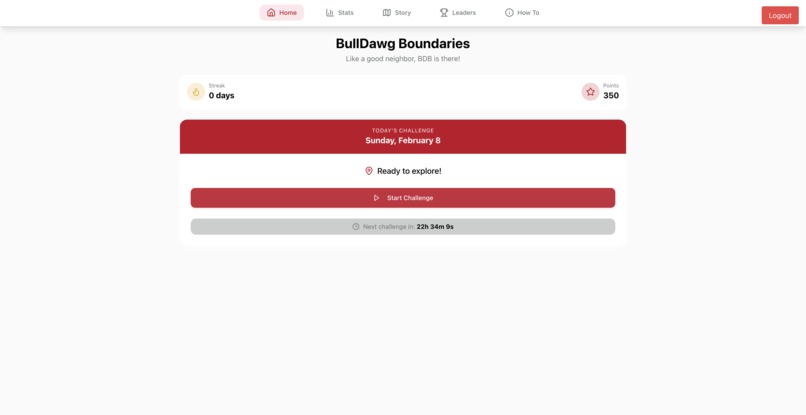
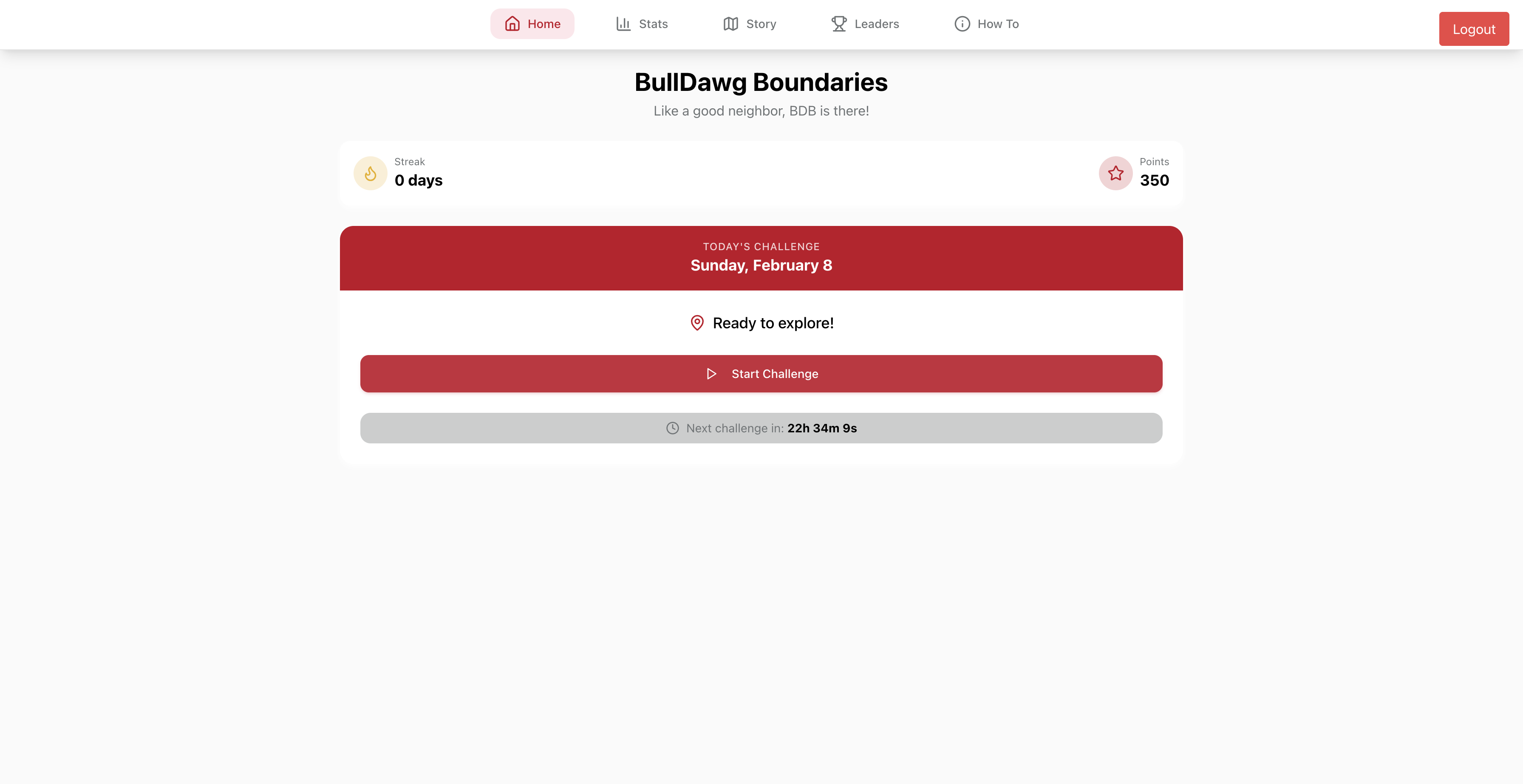
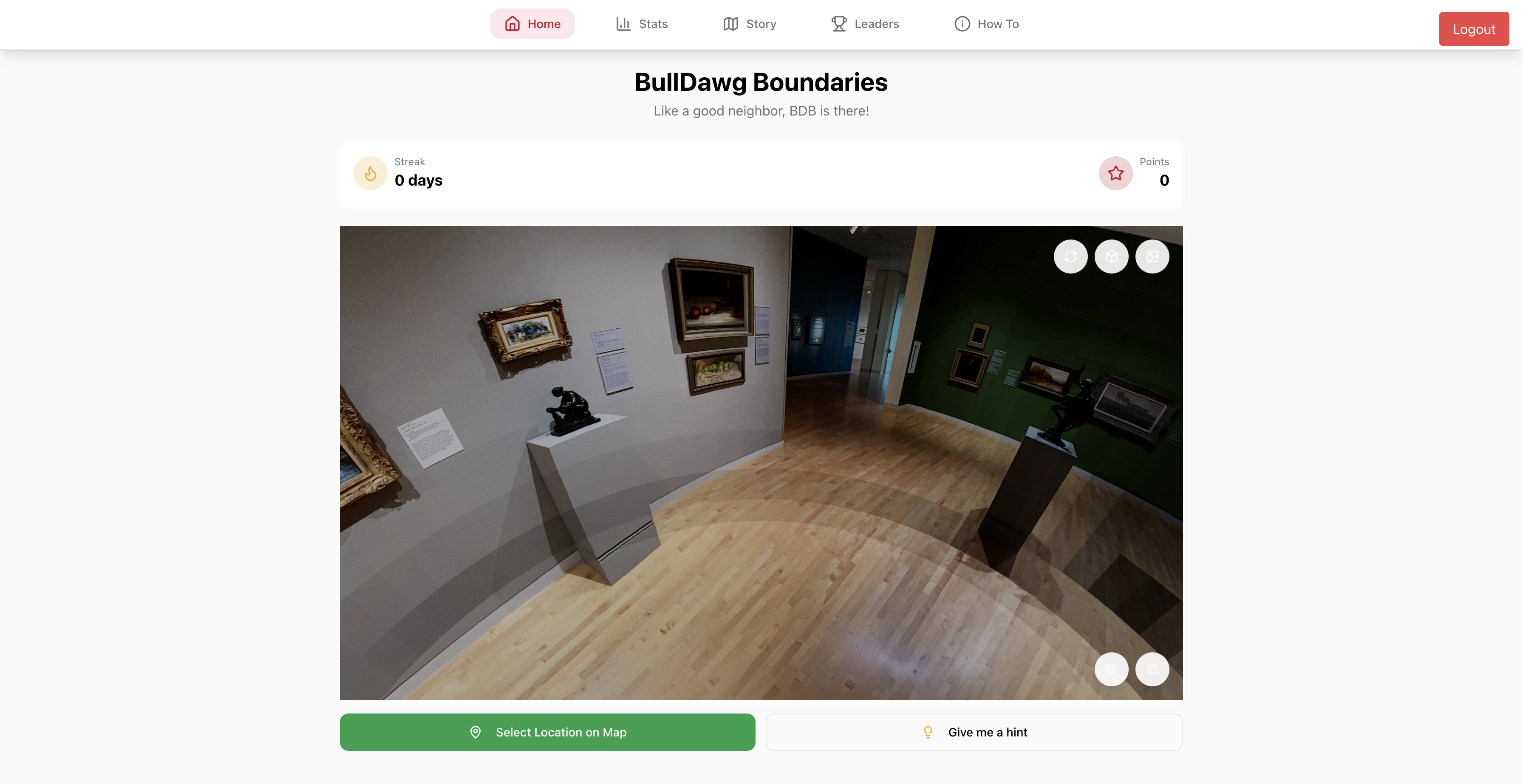
Main Dashboard
-
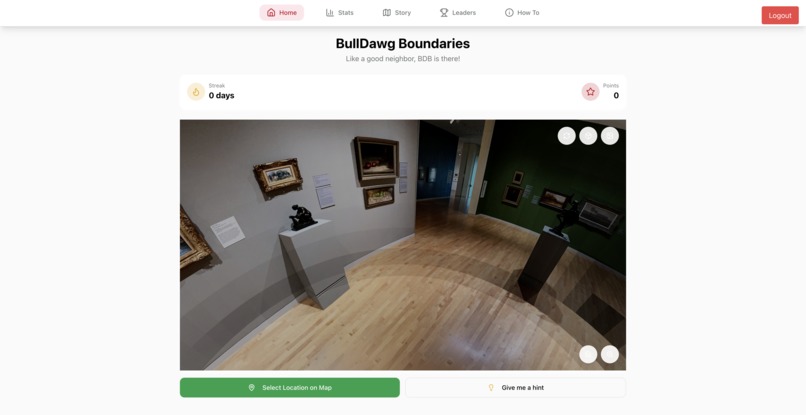
360 Camera View
-
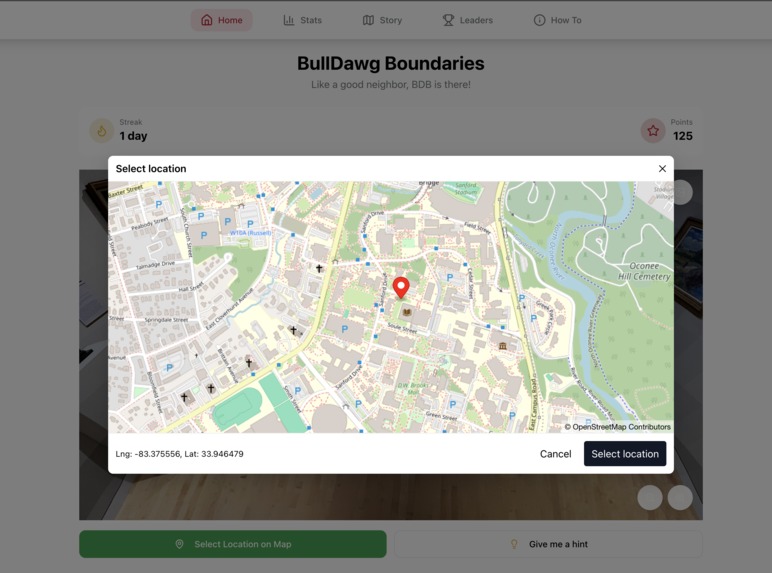
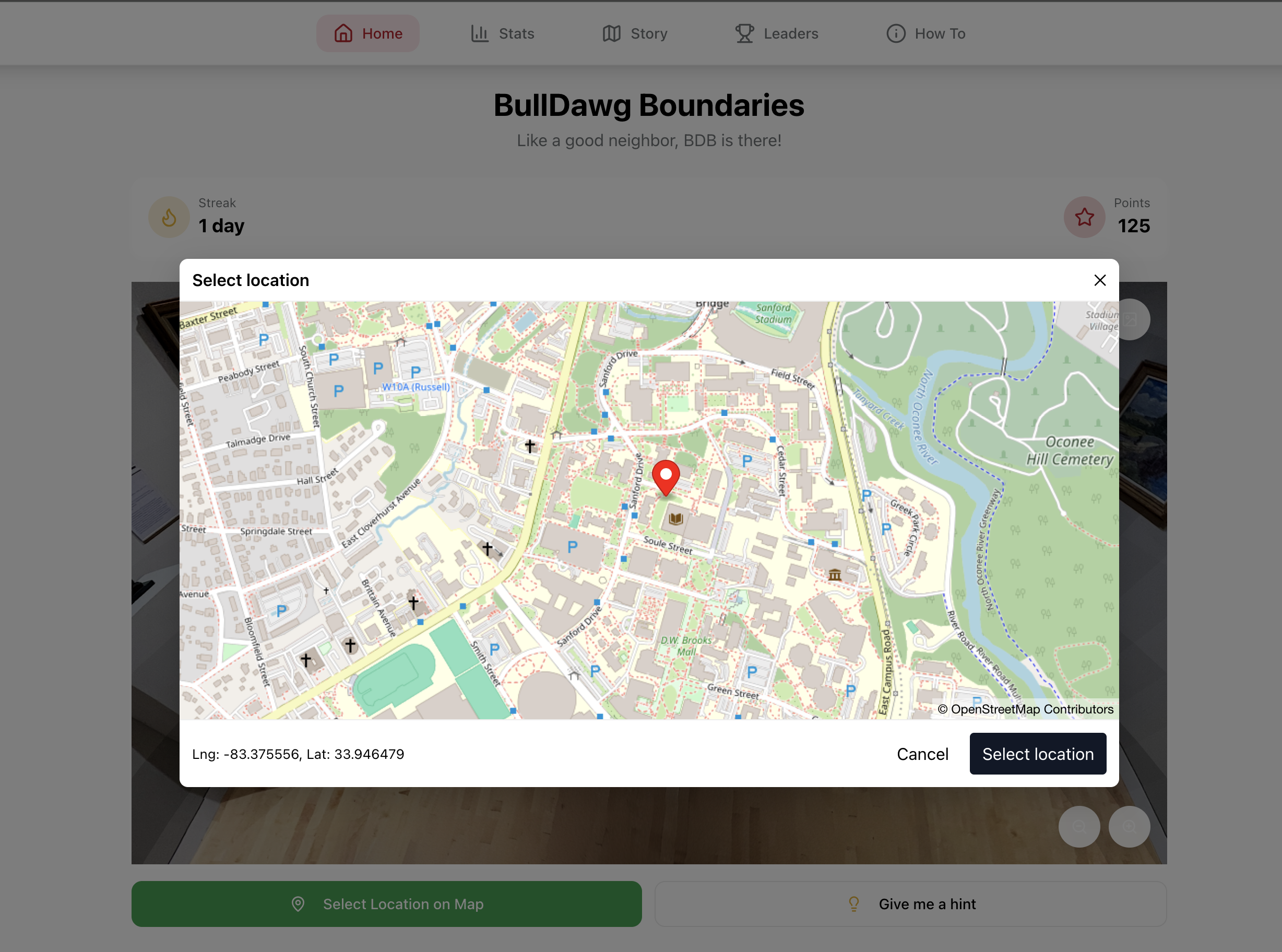
Location Guessing Map
-

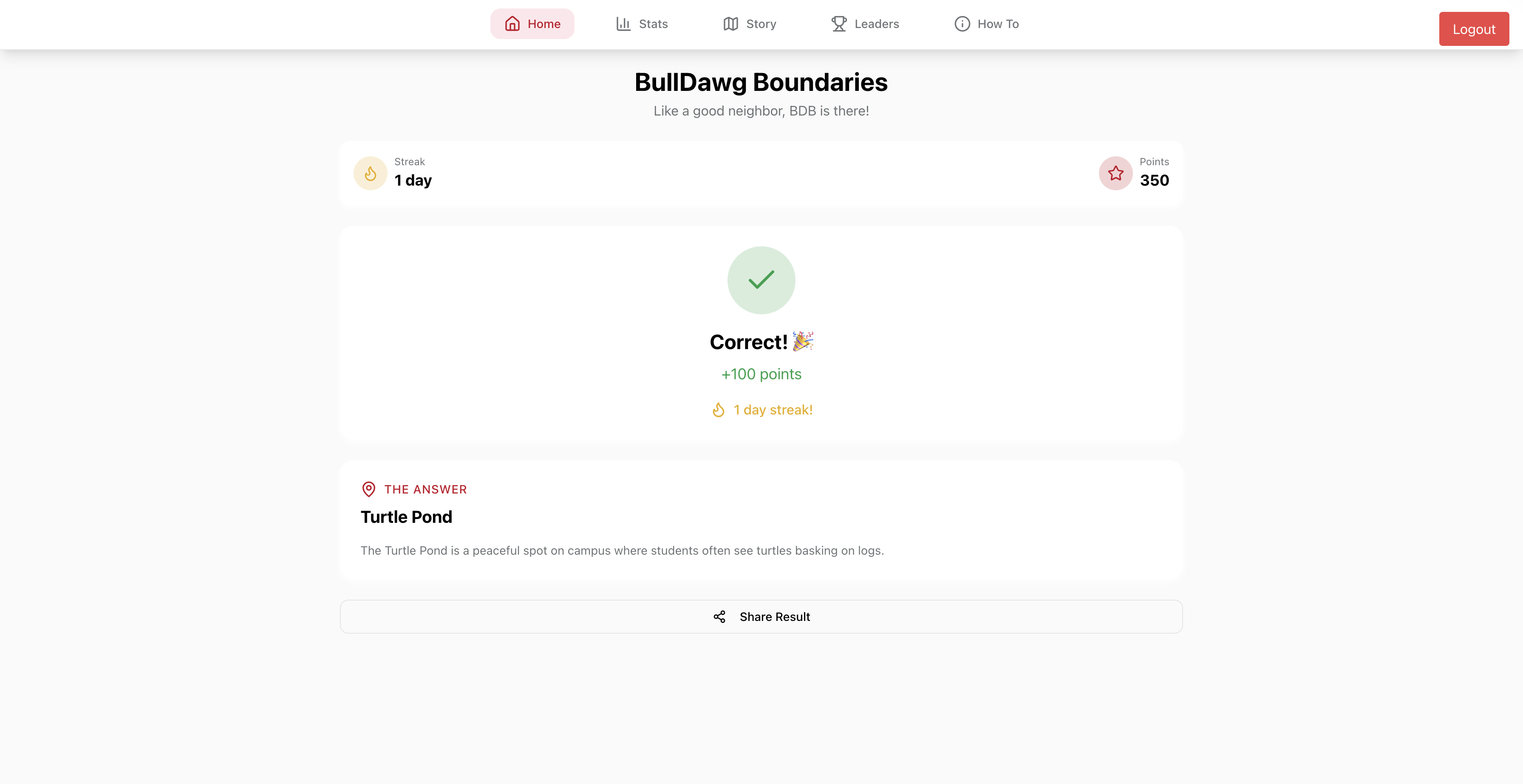
Page if correctly guessed
-
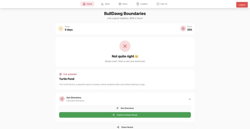
Page if incorrectly guessed
-
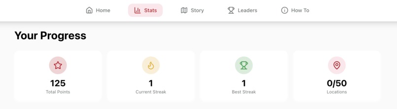
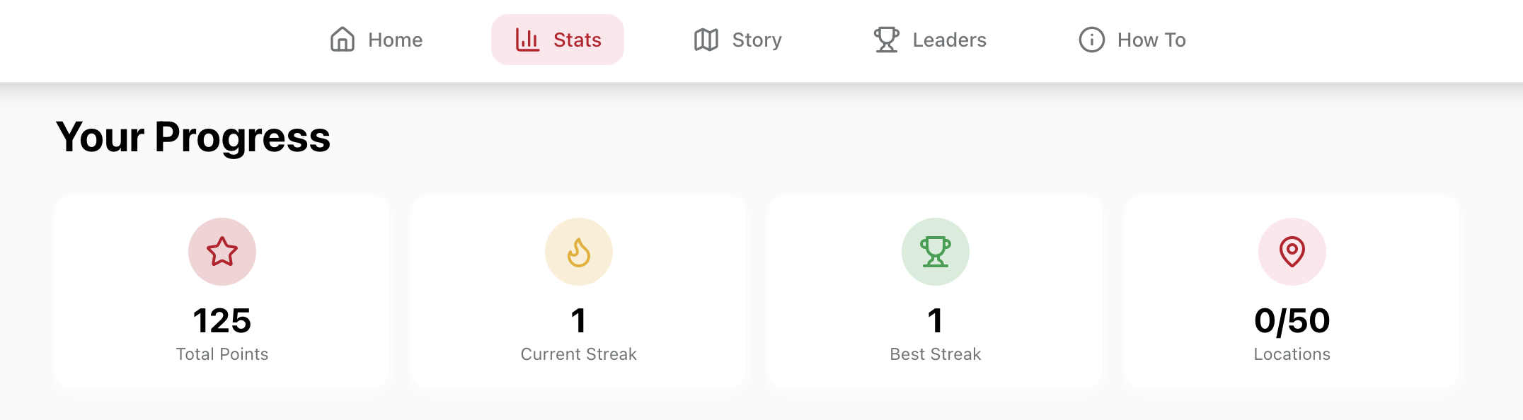
stats page
-
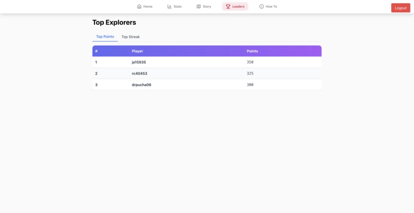
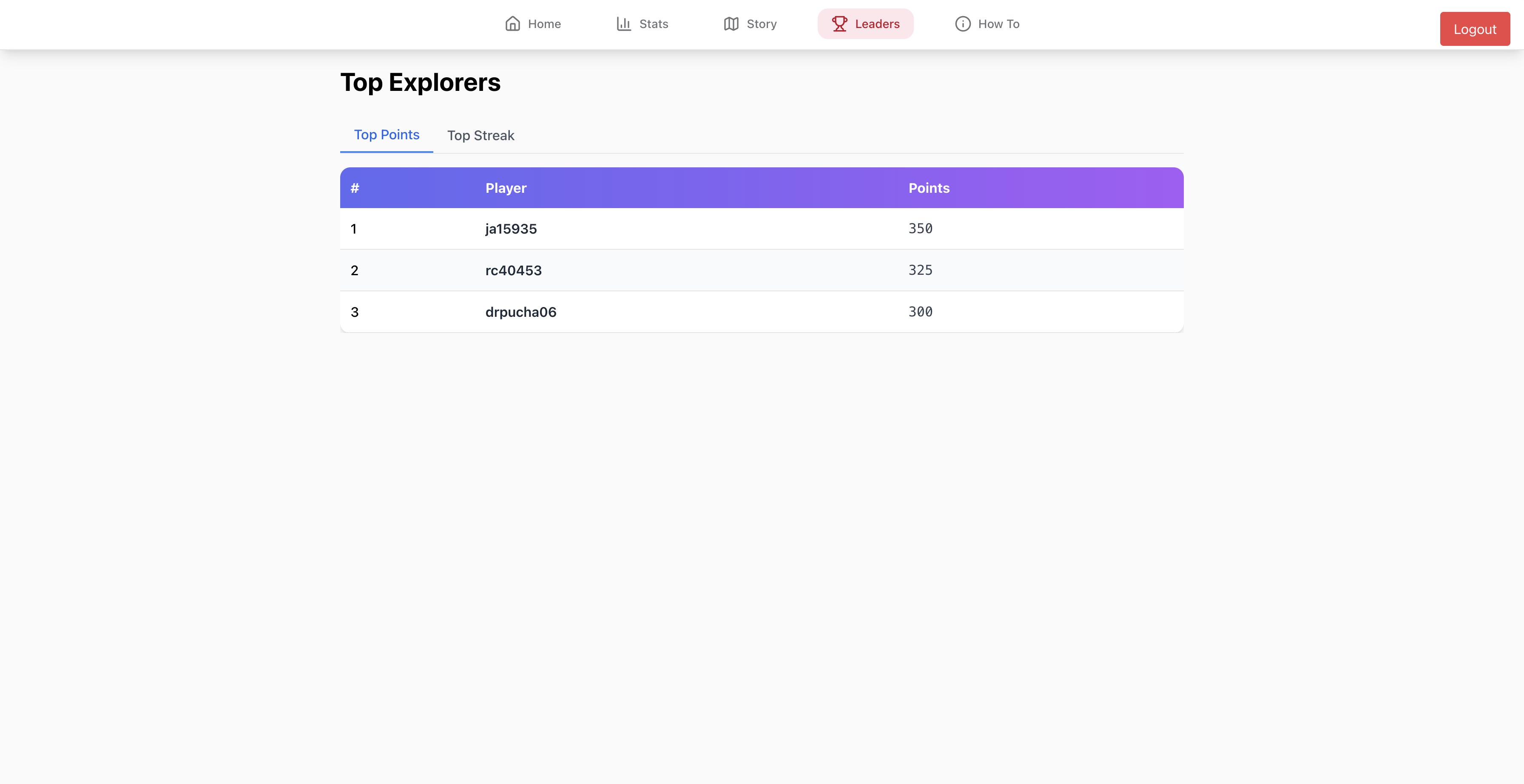
Leaderboard
-
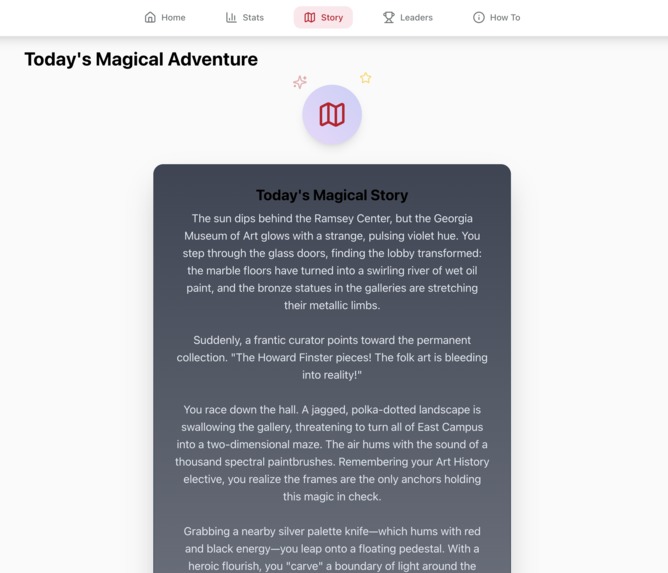
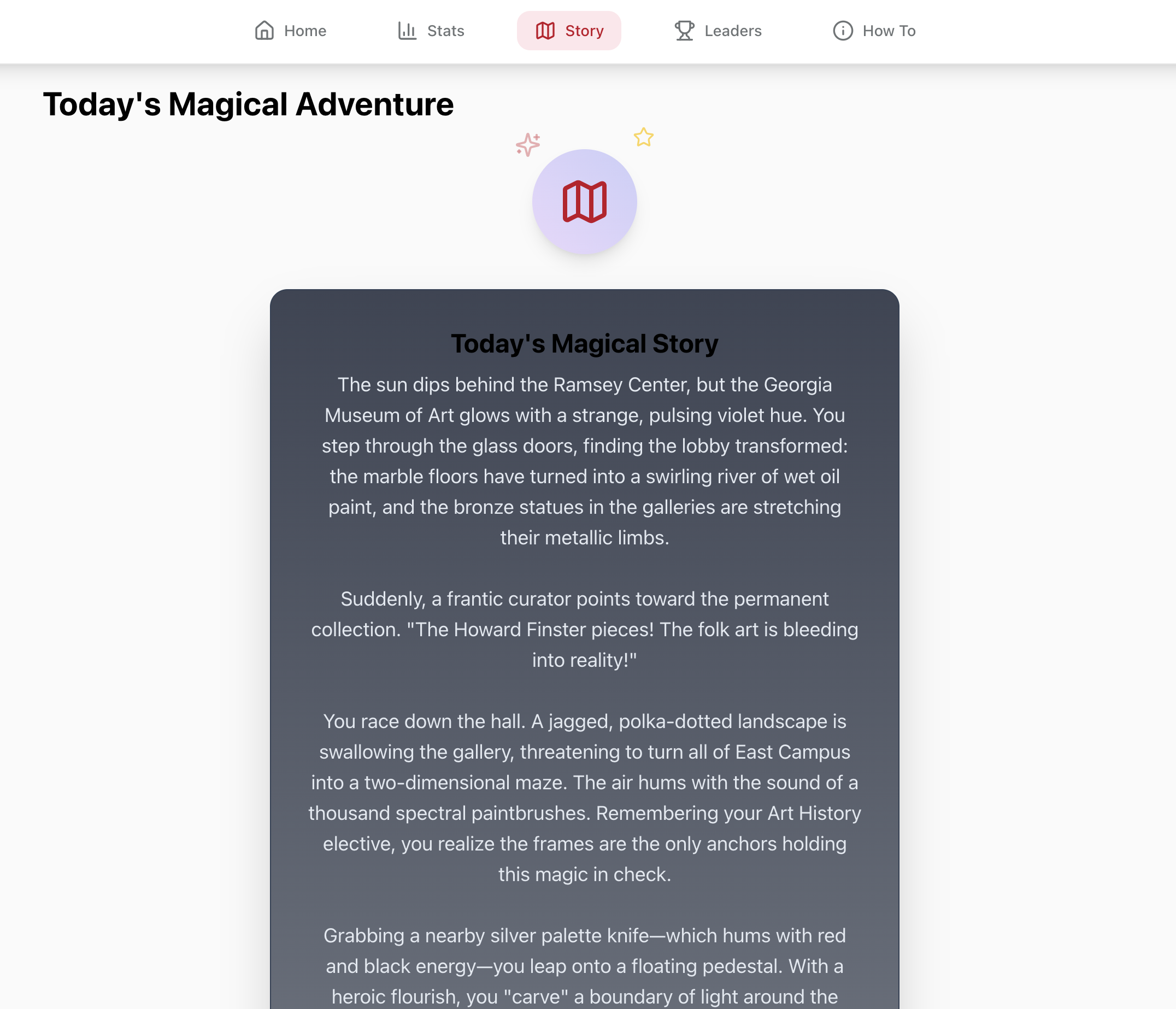
Magical Story

Inspiration
We wanted to create a app where we can help the community of UGA. It mainly started when we didnt know all the buildings in UGA cause when we were registering for new classes we never heard of most buildings. Then we got an idea where people can play a geo guesser for the UGA campus each day to be able to experience more locations and buildings they never knew.
What it does
BullDawg Boundaries is a daily, immersive gamified geography challenge. Every 24 hours, all users are presented with the same high-resolution 360° view of a location on the UGA campus. Their Mission is to pinpoint your exact location on a custom-styled MapTiler map. The Stakes of this app is to get your pin the closest to the 360° image, the higher your score. The social aspect of this app is to have a leaderboard, after playing, users can see who has the highest streaks and total points and see who truly knows Athens best.
How we built it
We first started the build using the first design which Lovable produced which used the front end React js and Vite js. Then we branched off into sections where one part focused on how to render in the 360° image using Polycam and used three js to implement it into the challenge home page, and another part where it focused on opening a pop up using Map Libre Native and MapTiler to showcase the interactable map and the user can drop a pin. And we had a part where we connected the entire project to supabase to support our database. Then we worked on the backend using Node js. And we added the home page which includes the daily challenge, added a stats page, a leaderboard page, and a how to page. For the final touches we added the right page which gives us points and the wrong page which shows us the right location and the distance form your live location and another button to get your streak back when you press the explore button. For our Gemeni AI implementation we added a story page which then writes a magical story based on the given location.
Challenges we ran into
One of our main challenges was getting the 360° image rendering. First we were trying to get the entire 3d model which we were doing using a Lidar scan to create a VR 3d render. which took way too long to render and had a lot of white space which looked bad. Then we realized it would be better to take an image like the street view for google maps which brought us to the 360° image which saved us a bunch of time and was easier to integrate as well.
MapLibre was a one off the things we tought of when we wanted a pop up map where we can mark a location and the main challenge we faced was that the image was just all green cause the map was rendering only the countries and its respective color code. Cause when we zoomed in it only showcased green. Then we shifted to the MapTiler API key where it has a locked zoom in function showing only Athens and it showed the buildings and the streets. It made it easier by giving the latitude and longitude for the distance calculation.
Essentially when we started we used agentic AI models to write code quickly, but once we started testing we ran into many problems including but not limited to integration between the frontend and the backend. The biggest issue we noticed was AI would make small changes that would go unnoticed, but would cause big changes that we did not want. One example is our authentication integration which was failing at first because the frontend and backend were not connetcted at all. We learned a valuable lesson about the importance of checking AI generated code details.
Accomplishments that we're proud of
We are incredibly proud of the User Experience. The transition from a 360° panorama to a pinpoint on a 2D map feels seamless and professional. We also successfully created a "Daily game" logic, ensuring that every player is looking at the same location at the same time, fostering a true sense of community competition. We also were able to add distance tracking to show the user how far they are. The last feature we like to show off is the cool magical story which motivates students to try and find the location of the day. Its special because no 2 stories are the same thanks to our AI friend.
What we learned
This weekend was a masterclass in Geospatial UI. We learned that building a map isn't just about dropping pins; it's about controlling the user's perspective to tell a story. We also learned how to balance "fun" with "purpose"—realizing that a game about campus mastery inherently makes students better, more aware neighbors.
What's next for BullDawg Boundaries
The goal is to expand to all forms of UGA experiences, where students can earn points from going to club meets and experiencing events hosted at UGA. With this, we hope to create a social network where students with similar mindsets can connect and build a social network


Log in or sign up for Devpost to join the conversation.