Inspiration
Vancouver's current housing market is struggling to keep pace with its growing population. To address this, the British Columbia government aims to reduce or eliminate housing needs for at least 490,000 households. A key strategy for achieving this goal involves building more housing, with each project requiring development and rezoning applications, as well as public comments. Public feedback is crucial for a project's success. Our website aims to make this vital information more accessible to the general public.
What it does
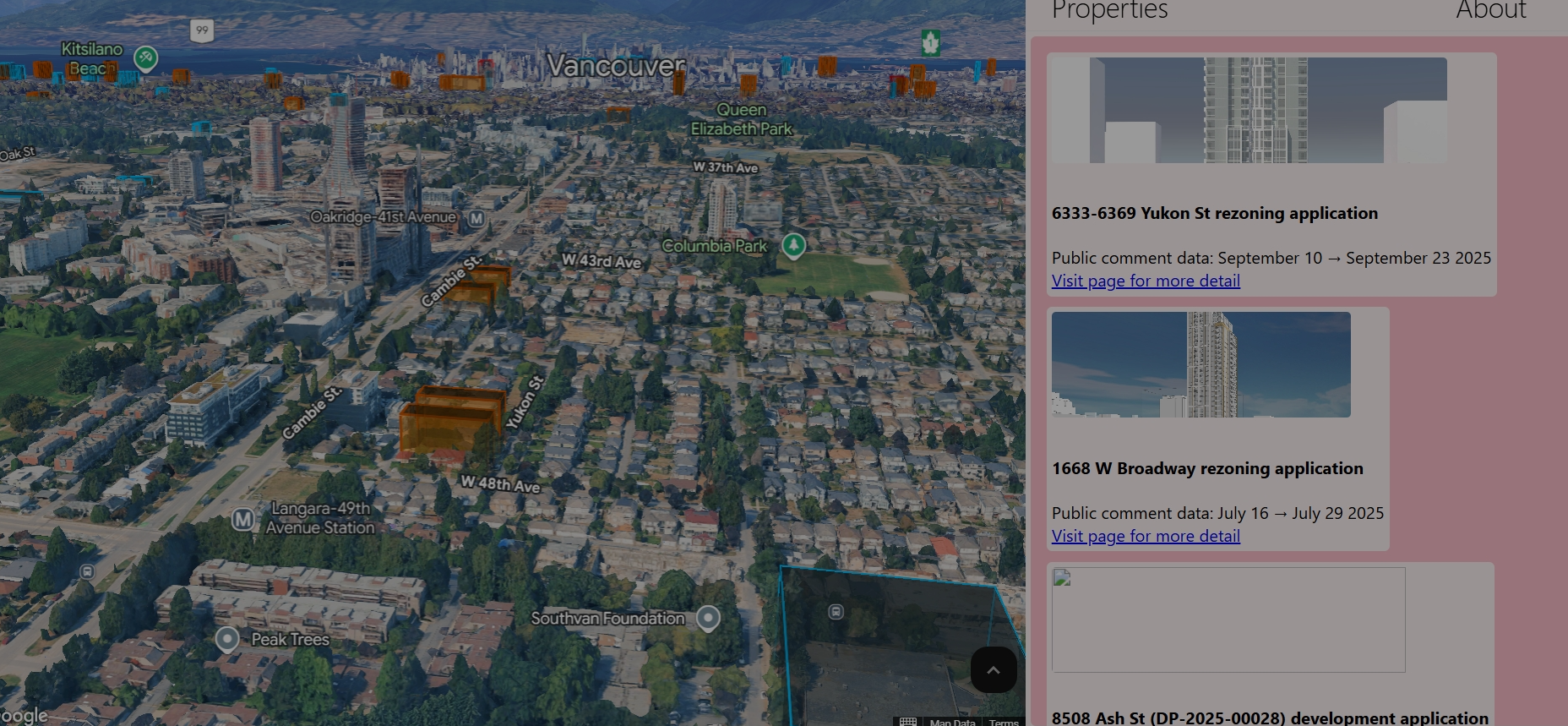
Our website provides the location and property boundaries for each development project within Vancouver.
How we built it
We developed the website by scraping data from the City of Vancouver's ShapeYourCity rezoning and development portal. Additionally, we downloaded property boundary data from OpenData.Vancouver.ca (specifically the Property Parcel Polygon dataset). We then matched the addresses of the rezoning and development projects with their corresponding entries in the property boundary data. This process allowed us to pinpoint the precise latitude and longitude for each project. Utilizing this combined dataset, we built a website that employs the Google Maps 3D API to visually display the boundaries of every project.
Challenges we ran into
One of the primary challenges we faced was deciding between a static and a dynamic website. A static website offered simplicity and direct alignment with our initial goal, while a dynamic website would have allowed for greater scope expansion. Ultimately, we chose the static website because it most directly addressed our immediate objective.
Accomplishments that we're proud of
We are proud to have created a website that provides a valuable service to the general public and directly addresses a pressing social issue.
What we learned
Through this project, we gained significant insights into Vancouver's housing development process and discovered the vast amount of publicly available data. Furthermore, we explored various features of the Google Maps API, realizing the extensive creative possibilities it offers.
What's next for BuildVan
Our next goal for BuildVan is to incorporate 3D model input into the website. This feature is not currently available, primarily because most 3D assets are not publicly accessible or easily modifiable for integration. Additionally, we plan to enhance the project listing display to include sorting, filtering, and searching capabilities for improved user experience.


Log in or sign up for Devpost to join the conversation.