Inspiration
A lot of our inspiration for this project comes from "GeoGuessr", the popular web game that drops users into a Google Street View image and makes them guess their physical location on Earth. We wanted to create a space-themed, educational spin on this concept using real NASA data. By combining historical meteorite landing coordinates with high-resolution satellite imagery, we aimed to gamify planetary science.
What it does
Our Python data pipeline ingests the massive "Meteorite Landings" database by The Meteoritical Society. It parses through 45,000 geological records, filtering for the heaviest, most monumental impact events in history. For the selected meteorites, our script acts as a localized "Lore Engine," automatically generating dynamic statistics like the rock's global size ranking, its class rarity, and running Haversine geospatial math to calculate exactly how many other meteorites fell within a 100-mile radius.
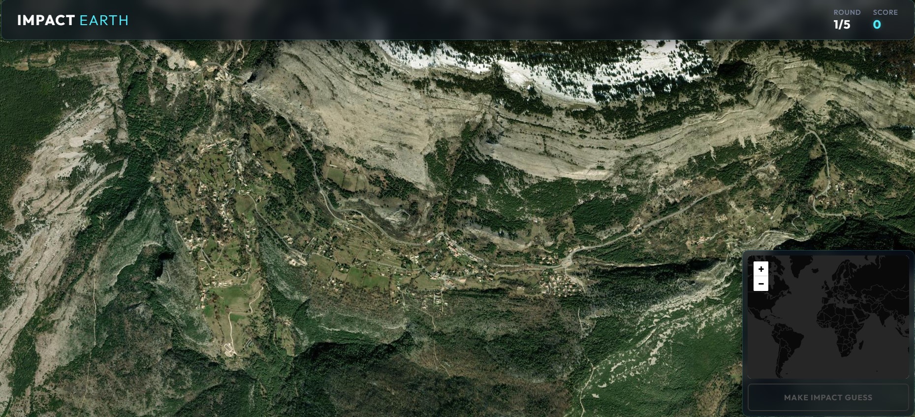
On the frontend, the game drops the player into a gorgeous, zoomed-in ESRI (ArcGIS) satellite view of the impact site. Users must analyze the terrain, biome, and geological features to place a pin on a global mini-map. The closer their guess is to the actual impact coordinates, the higher their score!
Challenges we ran into
Initially, we planned to hook into the Google Street View API to show players the ground-level view of the impact sites. However, we quickly hit a major roadblock: the vast majority of monumental meteorite impacts happened in extremely remote, unmapped rural areas (deserts, deep tundra, etc.) where Google Street View cars have never driven.
Attempting to force Street View resulted in endless blank screens or broken API calls. We had to make a critical pivot and completely rewrite our app to use purely top-down, high-resolution ESRI Satellite imagery instead. This turned out to be a blessing in disguise, as satellite views look significantly more "space accurate" and guarantee 100% coverage of every impact site on Earth!
What we learned
We learned how to design and execute a robust data-filtering pipeline in Python, turning a massive, intimidating CSV dataset into a highly curated JSON payload. We also gained deep experience with frontend geospatial technologies—learning how to implement open-source mapping libraries (Leaflet.js) to render dynamic layers without relying on heavily paywalled APIs, and utilizing complex geospatial math (like the Haversine formula) to calculate real-world spherical rendering and scoring.


Log in or sign up for Devpost to join the conversation.