Inspiration
We wanted to build an app towards the RIT community and after hearing about many crimes occurring in universities, we came up with the idea of creating a safety informational application for our peers and colleagues.
What it does
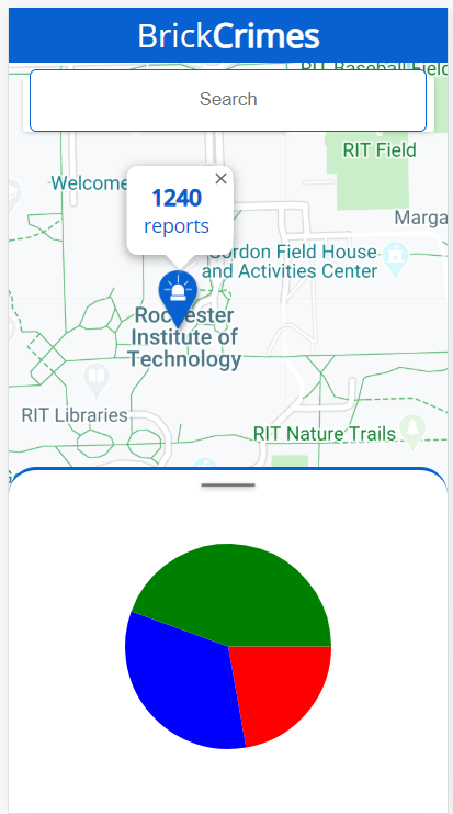
BrickCrimes is a web application that helps its users by spreading information about past public safety reports around campus. It provides the user with a map that identifies the hotspots and relevant statistic of reports in buildings and around other points of interest on campus.
How we built it
Using the Google Maps API and React Native, we built a web application optimized for mobile phones. On the backend, we have a server that processes 26 PDF documents from RIT's Public Safety website and parses the records to glean report details, such as incident type, location of incident, and the time it occurred. The frontend uses this information to map where crimes occur on campus and calculate statistics that would help in visualizing the reports.
Challenges we ran into
We discovered that the PDF documents provided by RIT's Public Safety were subtly inconsistent. Because of this, parsing the relevant fields from the files quickly became a difficult task and took much more of our time than we anticipated.
Accomplishments that we're proud of
After spending many hours battling synchronization issues in JavaScript, PDF parsing issues, and JSON formatting issues, we were finally able to successfully parse the PDF documents in a predictable manner. We're also proud that we managed to produce an application as fleshed out as BrickCrimes is within the time constraints of BrickHack.
What we learned
Throughout this experience, we learned a ton about the Google Maps API, React Native, various npm modules to parse PDF files, and creating visualizations. We also learned how frustrating it was to spend a couple of hours attempting to fix an issue in JavaScript, just for us to learn that we simply needed to convert the an object to a string.
What's next for BrickCrimes
While working on this project, we've thought of a lot of stretch goals for this app. Most importantly, we wanted to add more advanced visualizations on crime reports and to give the user the ability to map out a route on the map to see reports along that path.
Built With
- express.js
- google-cloud
- google-maps
- react
- rit-public-safety-records


Log in or sign up for Devpost to join the conversation.