-
-
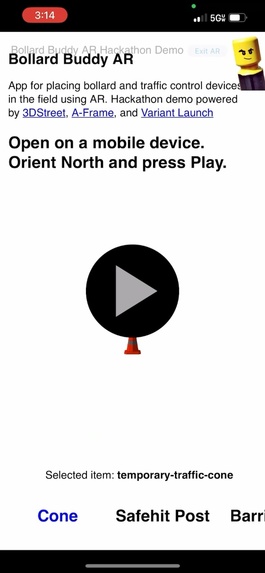
App before entering AR mode
-
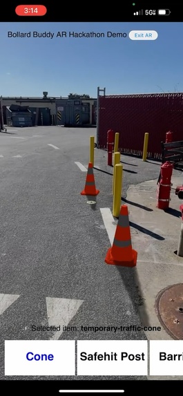
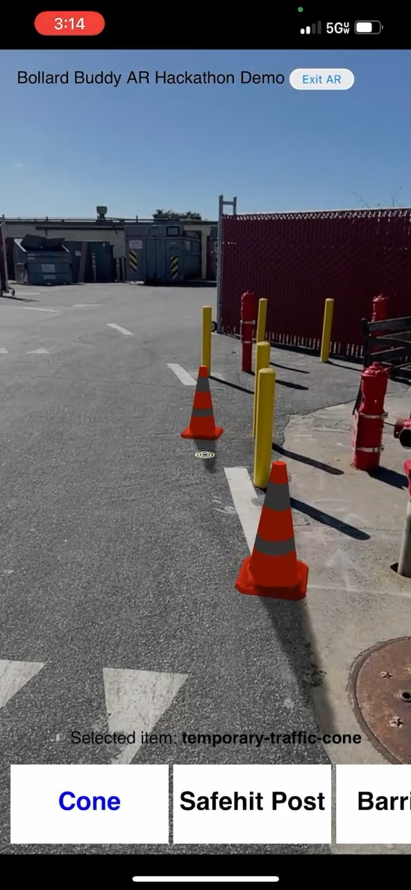
Select and place objects in AR
-
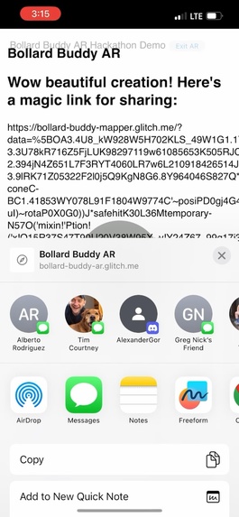
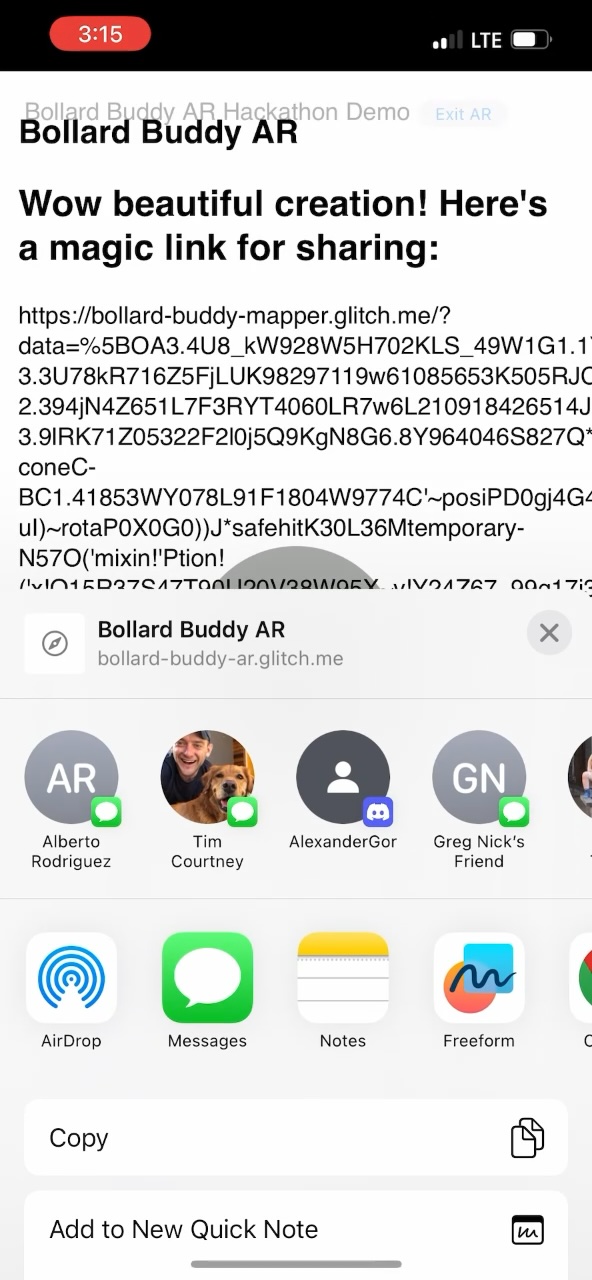
Share the magic link to your creation
-

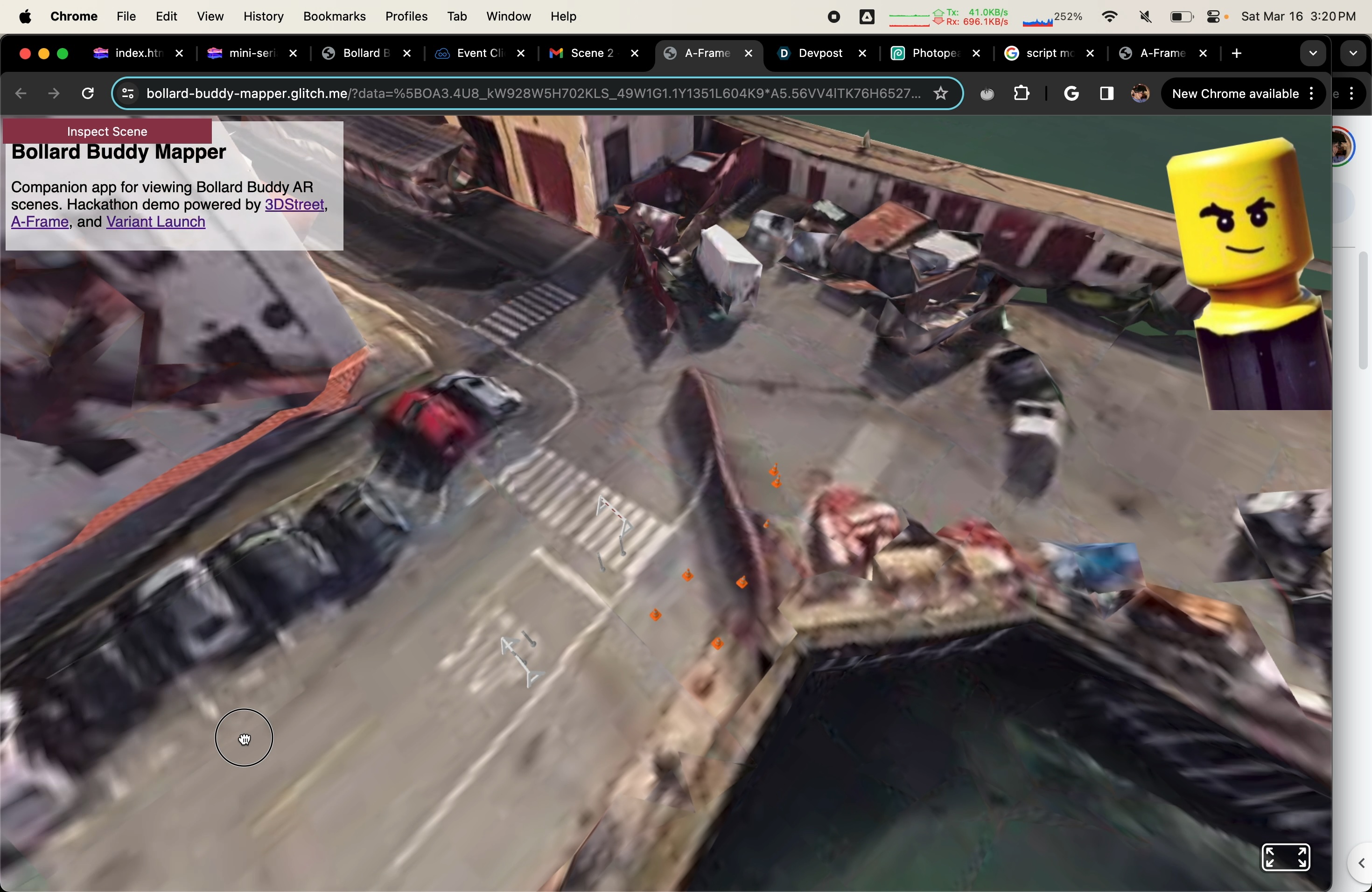
View your creation in google 3d maps
-
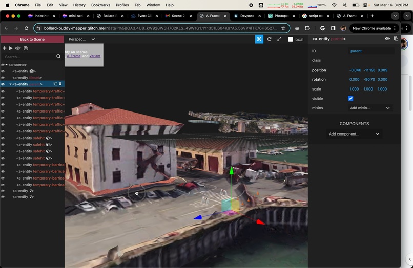
Modify the scene and place it some more


Inspiration
When transportation professionals, event planners and community members plan event or traffic routing changes, they resort to chalk, photoshop, and drawing on paper maps to plan events, traffic routing and more.
What it does
Instead, with BOLLARD BUDDY AR anyone can use any modern mobile device to point and place traffic control devices in the field. Then export and share the magic link with others so they can view your proposed changes.
How we built it
WebXR, A-Frame, three.js, Variant Launch, Google Maps 3D Tiles
Challenges we ran into
Localization (VPS) challenges from limitation of web permissions such as lack of camera access or access to compass relative to magnetic north
Accomplishments that we're proud of
End-to-end mobile AR placement to desktop and VR visualization experience
What we learned
On social media people responded very positively to this concept. Although it is simple, it solves a very real challenge for transportation professionals.
What's next for BOLLARD BUDDY AR
Given the positive community response we plan to integrate some form of this as a new mobile app for 3DStreet.
Built With
- a-frame
- three.js
- variant-launch
- webxr

Log in or sign up for Devpost to join the conversation.