-
-
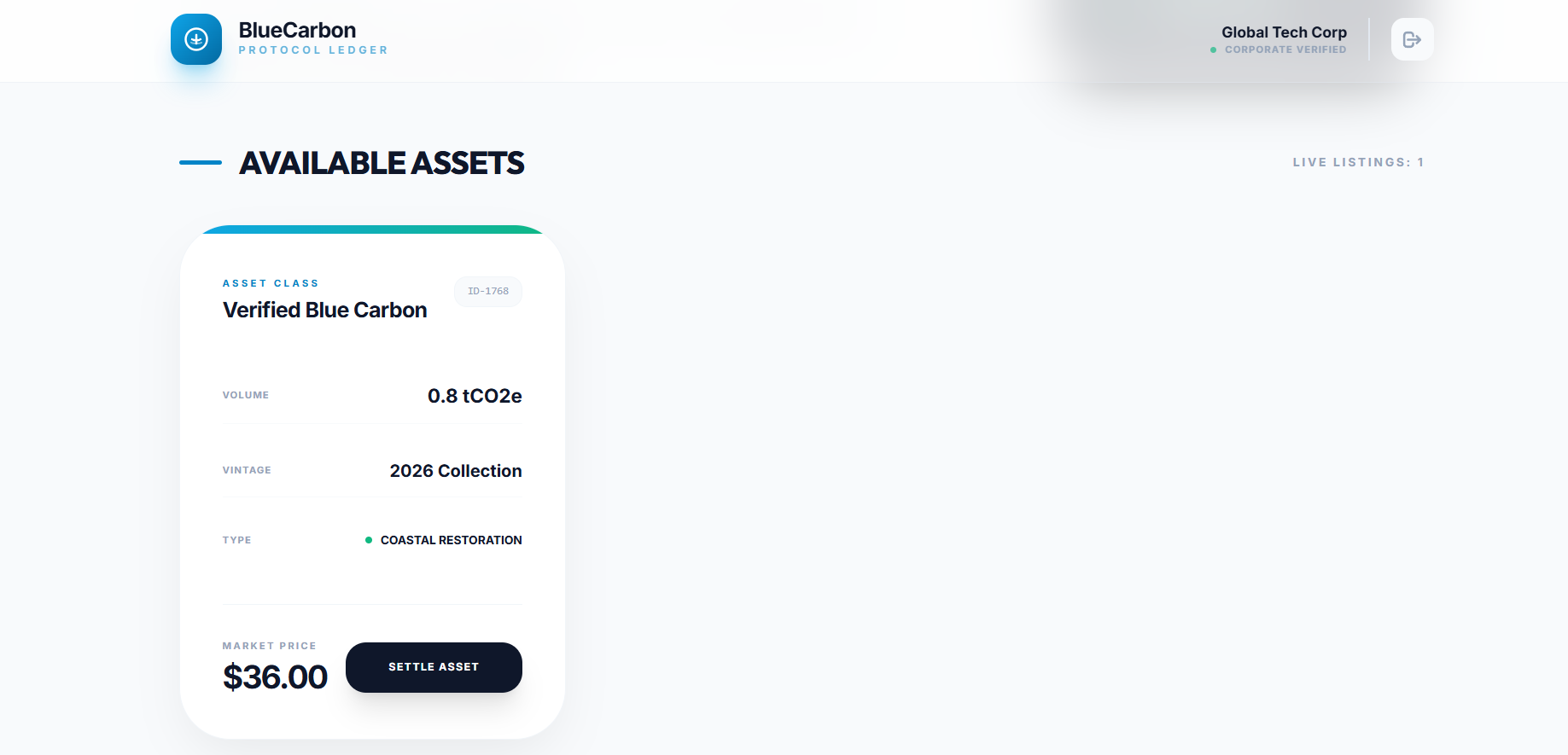
corporate
-
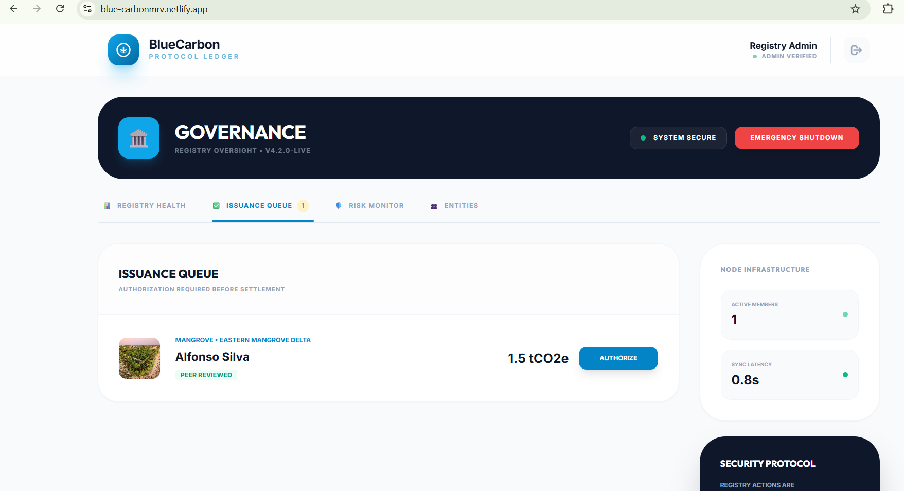
admin
-
roles
-
ngo
-
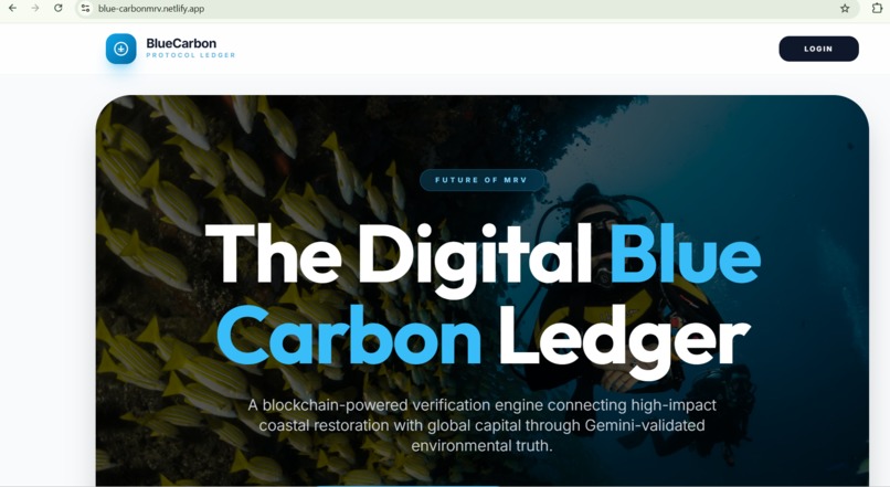
frontpage
-
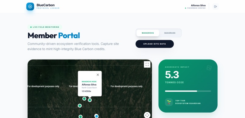
fisherman


.
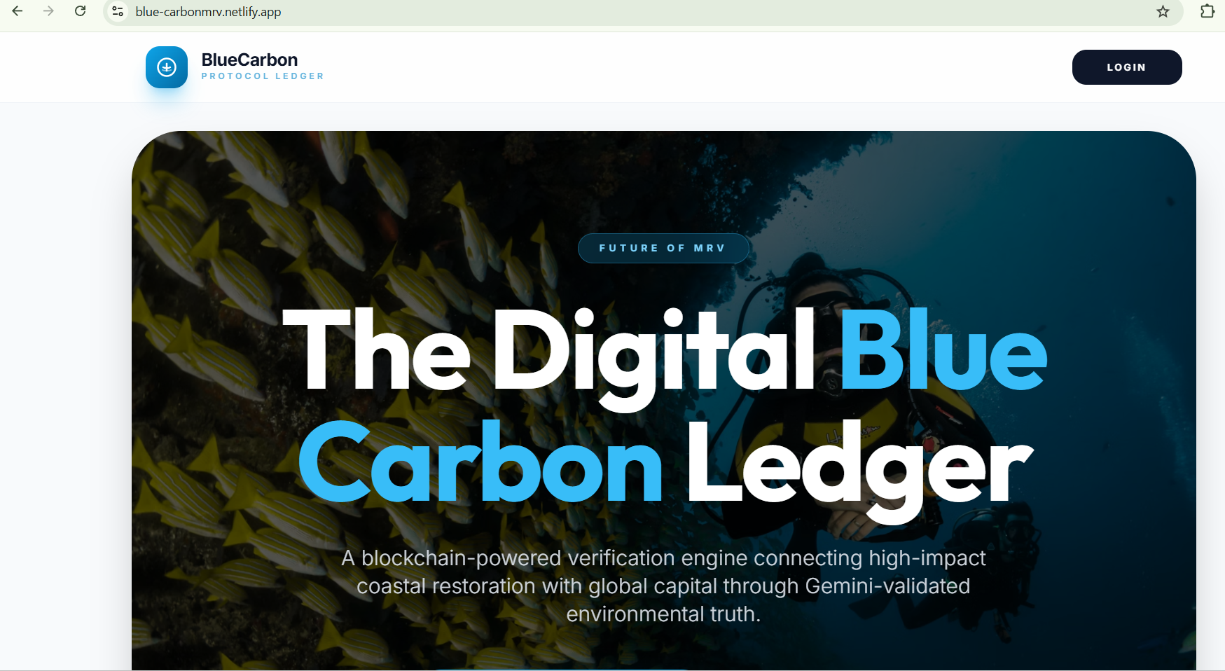
🌿 About the Project – Blue Carbon MRV System
🌱 Inspiration
Coastal ecosystems like mangroves and seagrass capture carbon up to 10×
more efficiently than terrestrial forests.
Yet, despite their importance, communities restoring these ecosystems have no transparent system to prove their work or earn from it. Most fishermen plant mangroves for protection, but their contribution to carbon removal is never recorded, verified, or rewarded.
Our inspiration came from this gap:
How can we use technology to verify real environmental impact and empower the coastal communities who protect these ecosystems?
This question led us to develop a digital MRV (Monitoring, Reporting, Verification) system that uses AI, geo-tagging, and transparent workflows.
🧠 What We Learned
Through this project, we learned:
How blue carbon ecosystems act as natural carbon sinks
The importance of MRV (Monitoring, Reporting, Verification) in climate projects
Building end-to-end full-stack systems (frontend + backend + database)
Using AI models for vegetation detection
Integrating geo-location for field-level verification
Designing role-based dashboards for NGOs, Admins, and Corporates
How carbon credits are estimated and issued
Understanding the challenges behind carbon markets and fraud prevention
We gained both technical knowledge and real environmental understanding.
🏗️ How We Built the Project
We followed a structured workflow:
- Research & Understanding
We first understood how blue carbon credits are generated, restored, measured, and verified. We studied MRV frameworks and simplified them into a digital flow.
- System Architecture Design
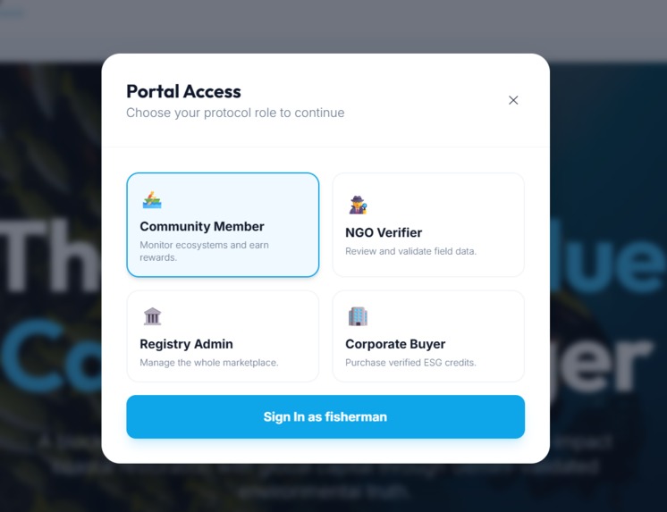
We created a workflow that supports four user roles:
Fisherman
NGO Verifier
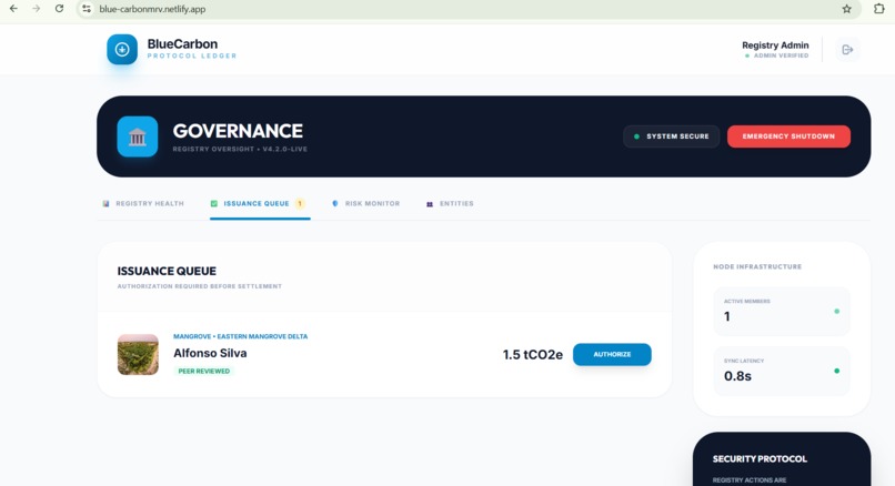
Admin / Government Authority
Corporate Buyer
- Core Components Built
Geo-tagged image upload system
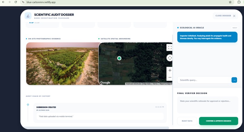
AI verification module using image analysis to detect vegetation
NGO dashboard for human verification & comments
Admin dashboard for final approval & audit logs
Carbon credit simulation module
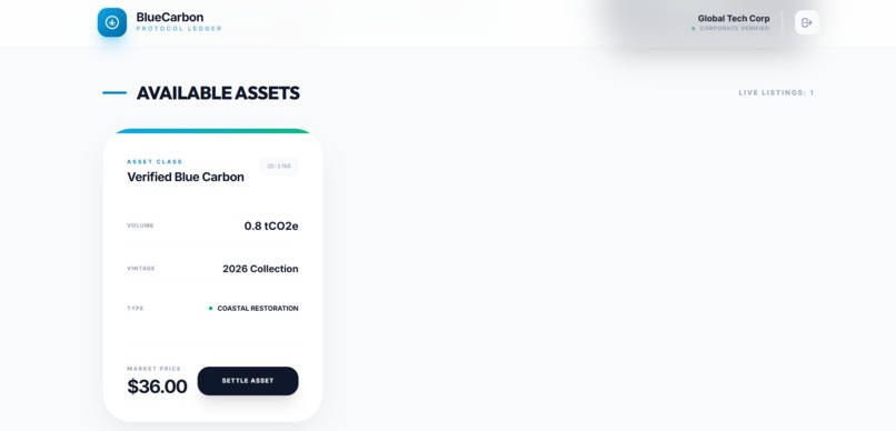
Corporate marketplace for viewing and buying credits
Translation support for multi-language interface
Google Maps integration for precise ecosystem location
- Technology Stack
Frontend: React.js, Typescript , HTML, CSS , JS
Backend: Node.js
Database: PostgreSQL, Supabase
AI: Gemini API
Mapping: Google Maps
🚧 Challenges We Faced
- AI Verification Accuracy
Making AI detect mangrove/seagrass vegetation was challenging because:
Image quality varies
Lighting and angle can affect results
We solved this by:
Preprocessing images
Using confidence thresholds
Allowing NGO overrides
- GPS & Geo-Tag Validation
Ensuring GPS accuracy in low-signal coastal zones was difficult. We added multiple validation layers:
Browser geolocation
Metadata extraction
Map-based NGO review
- Designing Multi-role Workflows
Creating separate dashboards with different permissions required:
Clean API design
Strong authentication
Clear separation of user flows
- Carbon Credit Simulation
Carbon credit calculation is scientifically complex. We built a simplified formula for demonstration:
Credits
𝛼 ⋅ Verified Area Credits=α⋅Verified Area
where 𝛼 α is a constant for MVP demonstration.
- Time Constraints
We prioritized the most impactful features first and built a clean, working MVP.


Log in or sign up for Devpost to join the conversation.