-
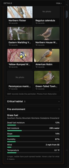
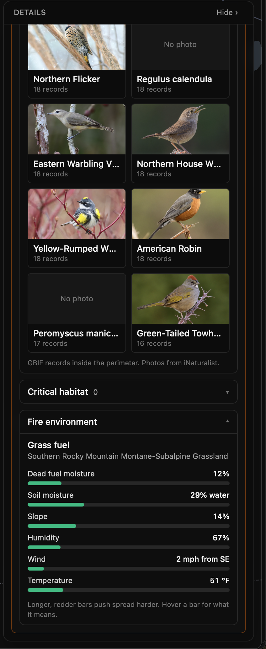
Animal species impacted, and composition of forest fuel.
-
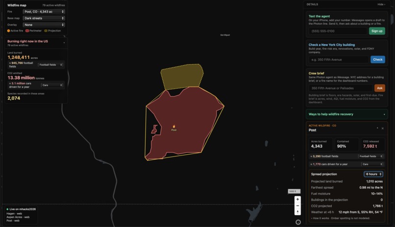
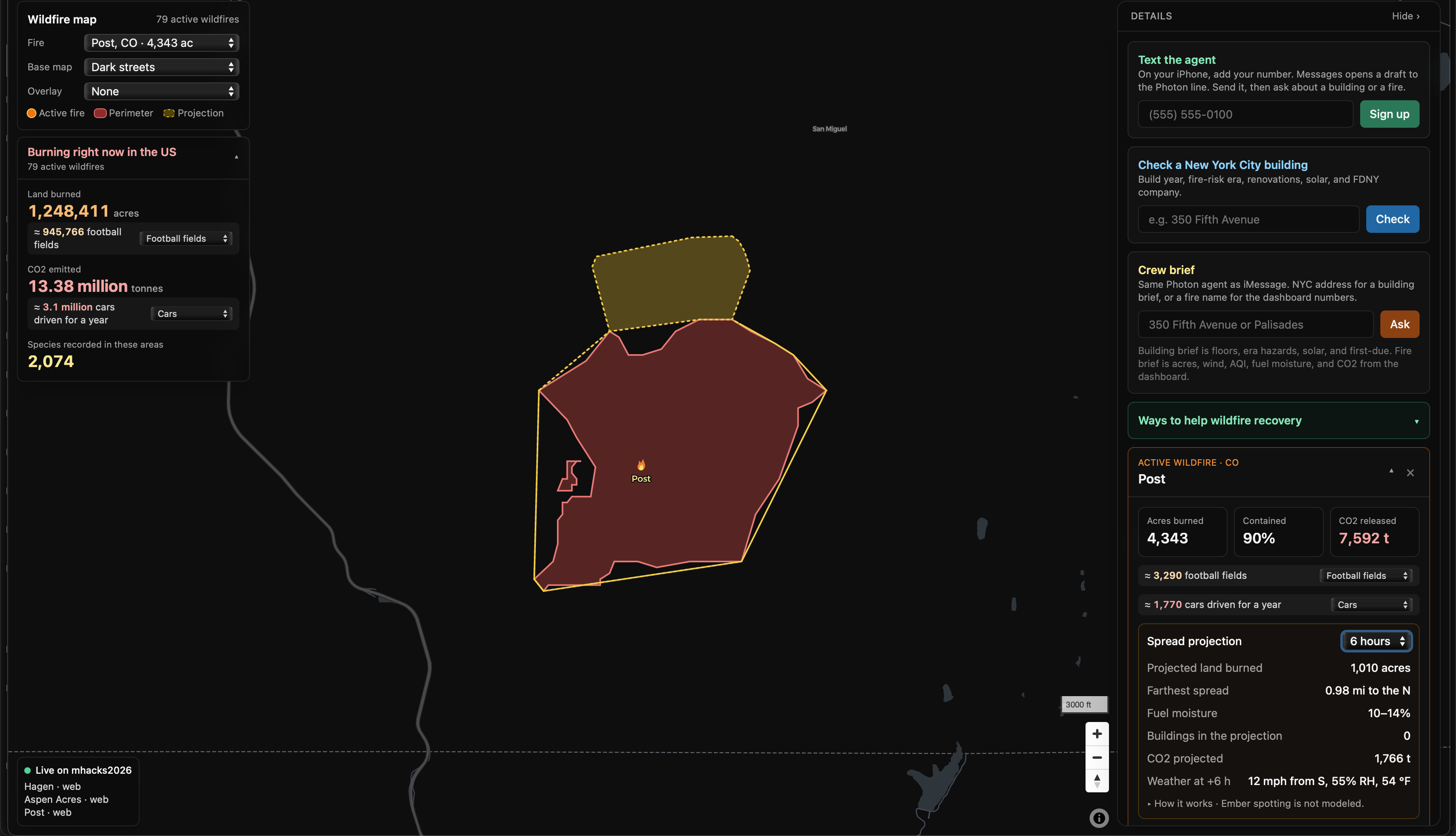
Projected fire spread based on weather conditions and fuel availability.
-
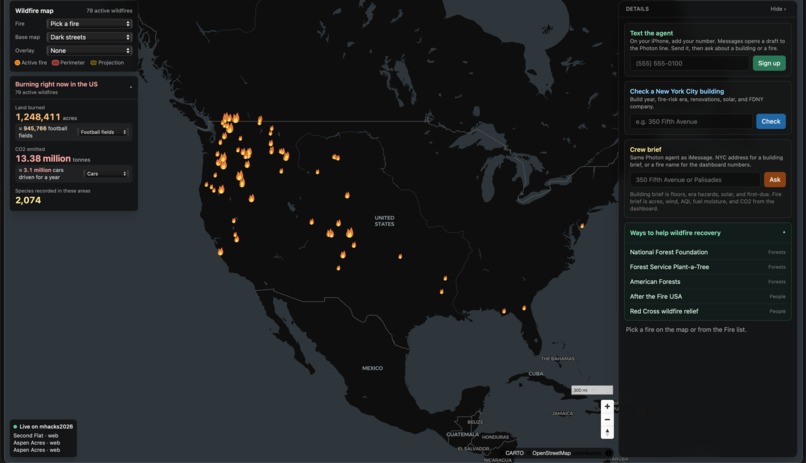
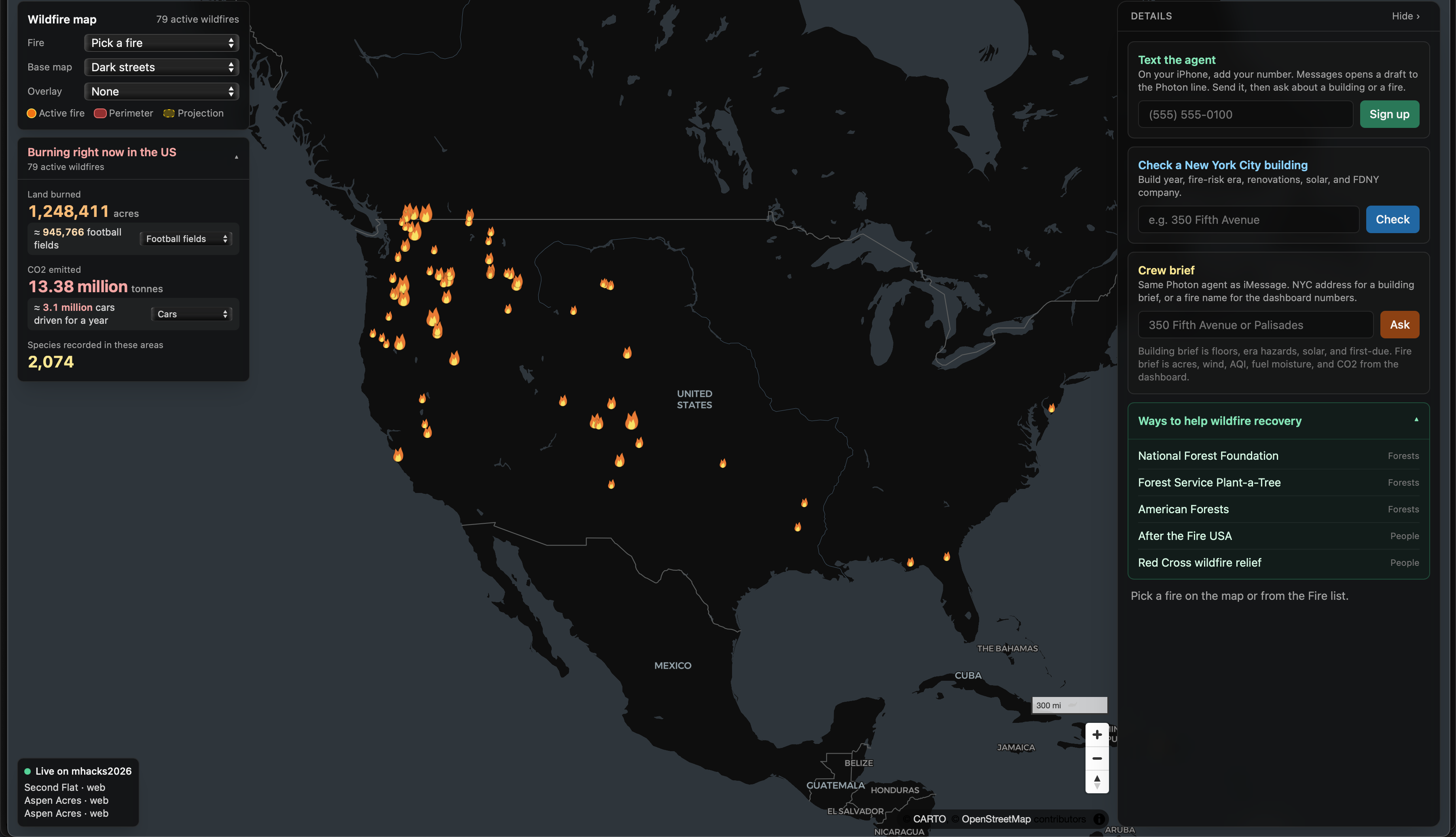
Live map of all major wildfires across the United States.
-
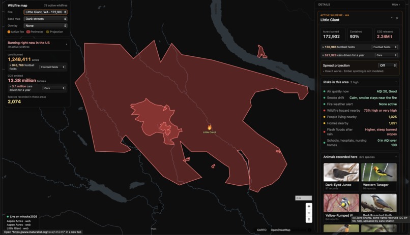
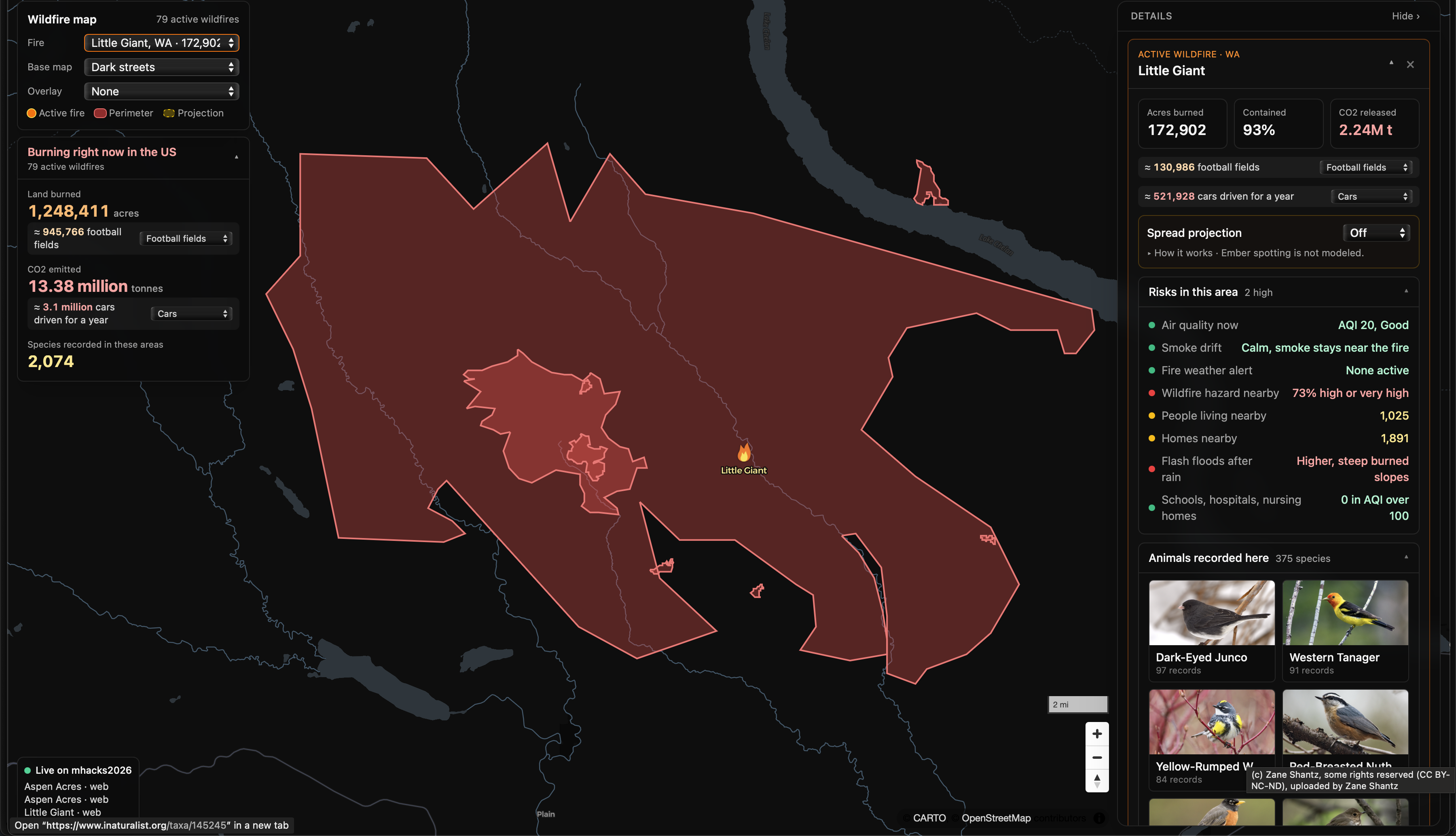
Overview of current wildfire detailing AQI, carbon impact, and acres burned.
-
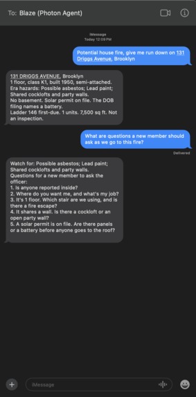
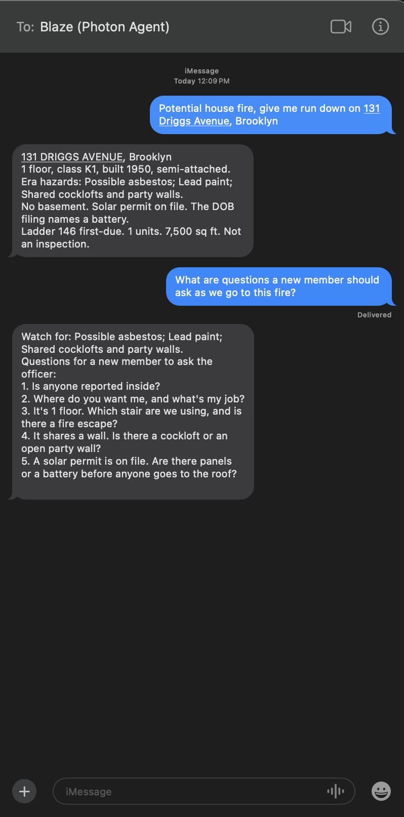
Utilizing Blaze Photon agent to find details about a potential house fire in NYC. Can also be used for any wildfire.
Inspiration
As a volunteer firefighter, often times I would be on the truck not knowing what awaited me. Old homes with asbestos and lead paint, batteries or propane tanks not disclosed, or solar panels on the roof risking collapse. Seconds costs lives in this field, and that precious time is often spent by firefighters figuring out what public records already show. Wildfires have the same problem for everyone else. People hear how many acres burned, but not how much carbon was released, what the air is like for their kids, or what wildlife was in the fire's path. I built Blaze to help with both.
What it does
You can search any address in New York City and get the year the building was built, how many floors it has, the hazards that are common for buildings of that age, whether there is a solar permit on file, and which fire company is first due. The same thing works over iMessage using Photon. Every truck has an iPad at the front of a truck that the officer uses for routing. The officer can text an address or a wildfire name and Blaze uses Photon to send back a short brief and a voice note using Grok Voice API they can play in the truck and relay over the radio. It remembers the call, answers follow up questions, logs when a crew is responding or on scene, and gives newer members questions to ask their officer. It does not give tactics, because that decision belongs to the officer.
The second part is for wildfires, dealing with identifying risk areas before fires break out, information for ongoing fires, and recovery and volunteering resources for the aftermath. Blaze is a live map of every active wildfire in the US. When you click on a fire, it shows the acres burned, containment, wind, humidity, slope and any fire weather alerts, along with a projection of where the fire could spread over the next 1, 2, 3 and 6 hours. It pulls in satellite imagery and heat detections from NASA so you can see the fire from space. It also shows the environmental side, which is the estimated CO2 released, the animals recorded in that area, any critical habitat for endangered species, the air quality for nearby schools, hospitals and nursing homes, and ways to help the area recover.
How we built it
I built the site with Next.js, TypeScript and MapLibre and deployed it on Vercel. The fire perimeters come from the interagency fire center, the satellite imagery and heat detections come from NASA, and the weather and air quality come from Open-Meteo and the National Weather Service. The species data comes from GBIF with photos from iNaturalist, and the habitat data comes from the US Fish and Wildlife Service. For New York City I used the city's own property records and building permit filings. Photon Spectrum connects the agent to iMessage, Grok answers follow up questions using only the facts stored for that call, and the Grok Voice API turns each brief into a voice note. SpacetimeDB is the backend, so every incident, message and crew status shows up live on every open screen. I built everything in Cursor and planned it with Grok Bot. The website and the agent use the same code underneath, so a firefighter gets the same facts over text that you see on the map.
Challenges we ran into
One of the challenges was integrating different apis from different sources into one cohesive map. Each link required its own testing and data validation before being utilized in the map. Another difficult aspect was figuring out how to setup Grok Voice API to integrate with Photon.
Accomplishments that we're proud of
I am passionate about helping climate change both in the classroom and on the field. I am happy that my education and this opportunity at MHacks allowed me to build a tool that can make firefighting more efficient and safer for everyone involved and helps people find resources to help recover from wildfires.
What we learned
I learned that there is a huge amount of useful public data out there, but it is scattered, and most of the work is finding it, checking it and getting it to agree. I learned how a real time backend changes a project, because once everything syncs live the text agent and the website start to feel like one product. I also learned that an AI model is only safe to put in front of first responders if it is limited to the facts you give it and refuses everything else. And I learned that cutting features was some of the best work I did this weekend.
What's next for Blaze
Next I want to bring the building brief to cities beyond New York, starting with the ones that publish their property and permit data. I want to connect it to real dispatch systems so a brief gets sent automatically the moment a call comes in. I also want to add sharper thermal imagery, check the spread projection and carbon estimates against past fires, and build out the recovery side with burn severity and replanting priorities. Most of all I want to put it in front of my old department and see what they think.
Built With
- javascript
- photon
- react
- spacetimedb
- typescript


Log in or sign up for Devpost to join the conversation.