What is your project called?
Patrol Planner
What is your chosen problem statement?
For this hackathon, we chose Theme 3: Safeguarding Public Security, and Subtheme 1: Strengthening Domestic Security
How does your hack answer the problem statement?
Our hack, Patrol Planner, directly addresses the problem statement by integrating crime hotspot analysis with patrol route optimization. By allowing law enforcement agencies to easily gain optimized patrol routes in terms of splitting a patrol area up into subsections and getting an optimal route within each subsection, we aim to reduce emergency response times and enhance the overall efficiency of patrols.
How did you build your hack?
In coming up with our hack, we realised that we could split the given problem into two main prongs. First, the need to transform data on crime into geospatial hotspot data. Second, the need to use that data to generate optimal routes.
First, let's look at how we transformed crime data into hotspots. Kernel Density Estimation (KDE) was applied on the geolocations of crimes, weighted by their severity, on a scale of 1-10 and time occurred, with crimes that tend to occur closer to the current time of patrol being weighted higher. This allowed us to have a heatmap that highlighted regions with higher crime intensity which formed the backbone of the second prong of our hack
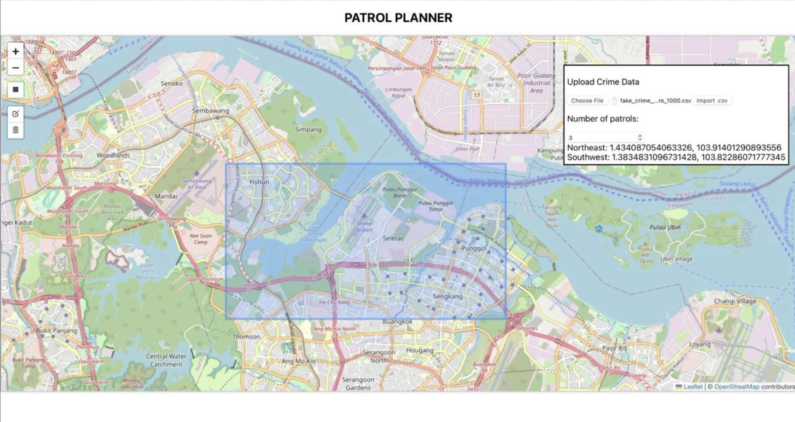
A key component of our hack that sets us apart from the rest was the splitting of the patrol area into multiple sub-sections. Through research, we found out that patrols were conducted with multiple vehicles at once, instead of just one. On top of this, required patrol numbers can change according to manpower needs or special circumstances. Hence, instead of jumping into providing the optimal route for a patrol area, we added an extra layer of functionality, the optimal splitting of a patrol area into subsections to reduce emergency response times.
By using weighted K-means clustering to segment crime data into high-risk areas based on the heatmap, we were able to suggest an optimal patrol allocation. Each cluster represents a patrol zone with significant crime activity, ensuring that patrols are not spread too thinly across low-risk areas. This balance maximizes the impact of available resources and ensures improved safety. Additionally, since this ensures that patrol areas are compact and centered around high-risk spots, travel time between incidents is reduced, leading to faster emergency response times and more effective patrolling.
Lastly, within each identified patrol section, we identified all high-intensity points that exceeded a certain threshold. Then we created a loop route connecting all the high-intensity points, ensuring all of them are visited. This means that our route would prioritize high-risk areas and create an optimized patrol route that maximizes response efficiency to emergencies.
Built With
- flask
- geopandas
- leaflet.js
- matplotlib
- networkx
- osmnx
- react
- scikit-learn


Log in or sign up for Devpost to join the conversation.