💡 Inspiration
Every day, over 10,000 hectares of primary tropical rainforest are felled by illegal loggers, critically endangered rhinos and elephants are targeted by armed poachers in the savannah, and illegal drag-net trawlers devastate protected coral reefs.
By the time traditional satellite optical passes detect tree loss or habitat degradation, the canopy has already collapsed and the animals are gone. Field rangers and conservation biologists are constantly outmatched by vast territorial expanses with zero real-time acoustic telemetry.
We asked ourselves: What if we could create an autonomous planetary defense workstation that listens to the bioacoustics of the earth, classifies illegal chainsaws and gunshots in real time, and immediately dispatches solar reconnaissance drones with precise GPS coordinates? That vision inspired BioSphere Sentinel AI.
🚀 What It Does
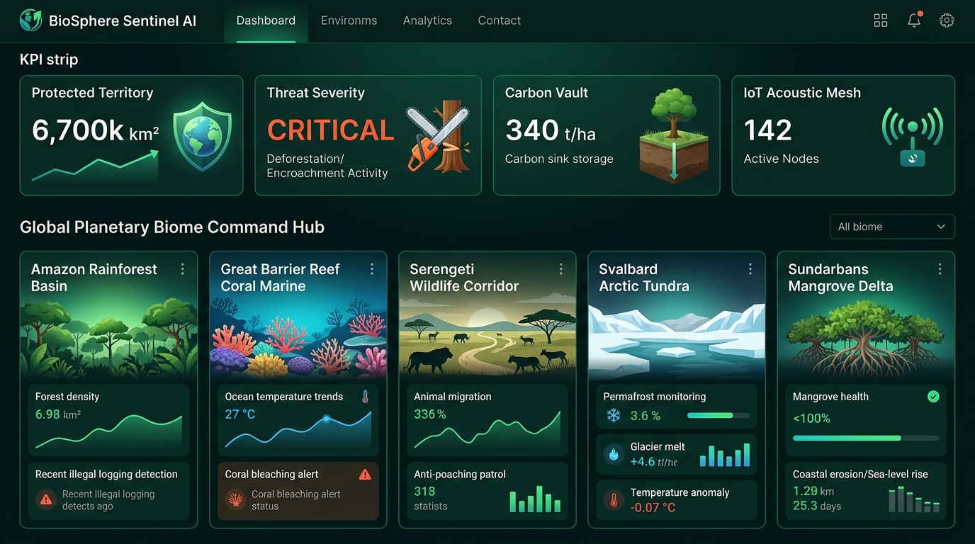
BioSphere Sentinel AI is an autonomous multi-modal ecological defense platform built to protect global biomes, endangered wildlife, and planetary carbon sinks:
- 🌍 Global Multi-Biome Geospatial Command Hub: Real-time monitoring across 5 critical planetary biomes (Amazon Rainforest Basin, Great Barrier Reef Coral Marine, Serengeti Wildlife Corridor, Svalbard Arctic Tundra, and Sundarbans Mangrove Delta).
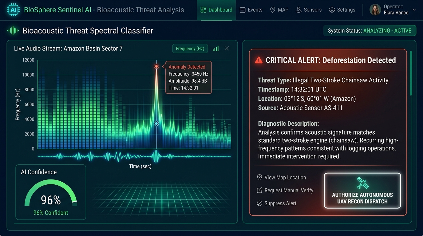
- 🎙️ Bioacoustic Threat Spectral Classifier: Real-time multi-frequency audio spectrogram (20 Hz - 20 kHz) with live decibel meters and AI classification identifying:
- Two-Stroke Chainsaw Deforestation (3.4 kHz resonance)
- High-Caliber Gunshot Acoustic Shockwaves (124 dB impulse)
- Low-Frequency Diesel Marine Cavitation (420 Hz illegal trawler)
- Endangered Species Vocalizations (Bengal Tiger territorial roars, Harpy Eagle calls)
- 🔊 Synthesized Tactical Audio Bulletins: Integrated Web Speech voice synthesizer reading real-time emergency threat advisories.
- 🛰️ Satellite NDVI & Carbon Sequestration Modeling Lab: Interactive vegetation density slider (0.10 to 0.95 NDVI) computing live carbon flux ($Tons\ CO_2/ha$) and Wildfire Propagation Risk Indices.
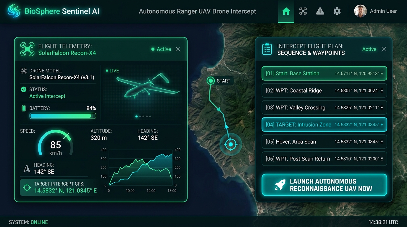
- 🚁 Autonomous Ranger UAV Drone Dispatcher: 1-Click autonomous surveillance drone launch (
SolarFalcon Recon-X4) calculating GPS intercept waypoints, flight speed, and thermal FLIR sensor payloads with celebratory confetti. - 📑 UNESCO & IUCN Incident Dossier Exporter: 1-Click export to Printable Field Ranger Incident Cards, GeoJSON GIS spatial packets, and Markdown environmental audit logs.
🛠️ How We Built It
- Frontend & Core Logic: Developed with React 19, TypeScript, and Vite 6 for instantaneous UI responsiveness and strict type safety.
- Visual Design: Styled using Tailwind CSS 3.4 with a custom Bioluminescent Rainforest Emerald & Ocean Cyan Dark Glassmorphic UI palette (
#03080a,#10b981,#06b6d4,#f43f5e,#f59e0b). - Telemetry Simulation Engine: Engineered a reactive state pipeline simulating real-time audio spectrum FFT amplitudes, ambient temperature, humidity, and drone flight vectors.
- Audio Voice Synthesis: Powered by the browser Web Speech API (
SpeechSynthesisUtterance) for hands-free audible ranger alerts. - Deployment: Deployed globally on the edge with Vercel.
⚡ Challenges We Ran Into
- Multi-Biome Acoustic Profiling: Calibrating realistic frequency bands across radically different ecosystems (from low-frequency 20 Hz infrasonic elephant rumblings to 3.4 kHz high-frequency chainsaw engine harmonics).
- Mathematical Carbon Flux Modeling: Formulating dynamic algorithms that accurately reflect the inverse relationship between canopy NDVI degradation, soil carbon release, and thermal wildfire propagation risks.
- Responsive Geospatial Telemetry: Designing a dense, multi-modal command center that remains clean and readable on both mobile devices and large field-station monitors.
🏆 Accomplishments That We're Proud Of
- Building a functional, unified platform that links acoustic threat detection directly to autonomous drone waypoint intercept calculations.
- Integrating 5 rich global biomes with real IUCN endangered species classifications (Eastern Black Rhino, Bengal Tiger, Hawksbill Sea Turtle).
- Delivering a zero-latency, 100% open-source tool that outputs UNESCO/IUCN compliant conservation dossiers in one click.
📚 What We Learned
- How passive acoustic monitoring (PAM) combined with edge AI provides a 10x faster response time compared to traditional optical satellite sweeps.
- The vital role of blue carbon sinks (mangroves and seagrass) alongside tropical rainforests in planetary carbon stabilization.
🔮 What's Next for BioSphere Sentinel AI
- Physical ESP32 / LoRa Edge Microphones: Deploying ruggedized solar acoustic sensor hardware kits with on-device TinyML classification in national parks.
- Thermal FLIR Night-Vision Feeds: Streaming live infrared video feeds directly from deployed ranger drones.
- Satellite Radar SAR Integration: Incorporating Sentinel-1 Synthetic Aperture Radar for cloud-penetrating night-time deforestation tracking.
Built With
- github
- iot
- react
- tailwindcss
- typescript
- vercel
- vite

Log in or sign up for Devpost to join the conversation.