-
-
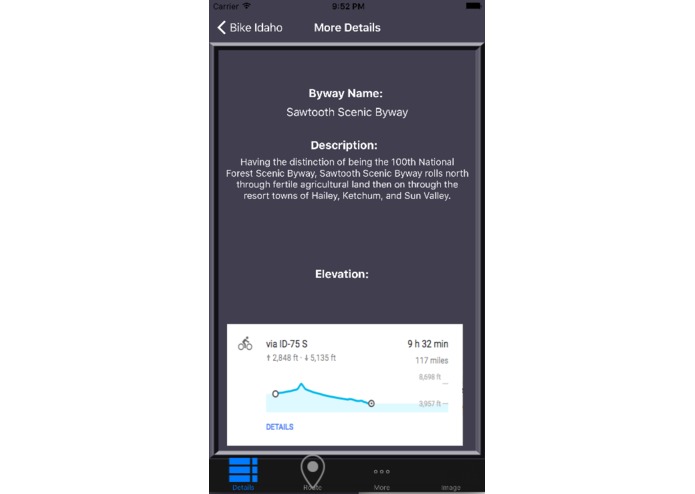
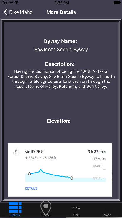
Details about Byway
-
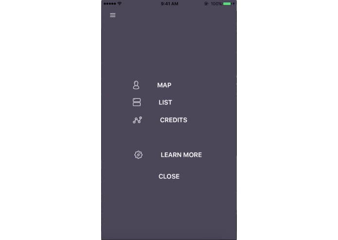
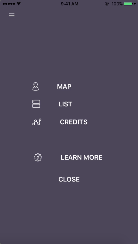
Bike Idaho Menu
-
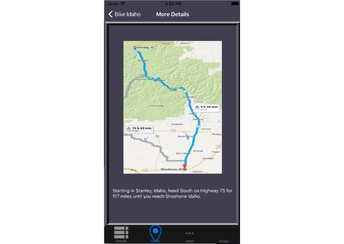
Tab showing Route and Directions for Byway
-
Initial Screen for choosing view
-
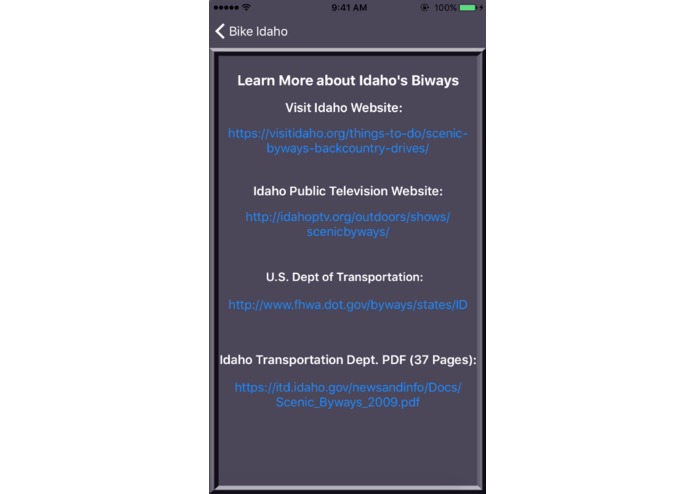
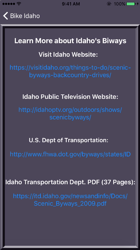
More information about Idaho Byways
-
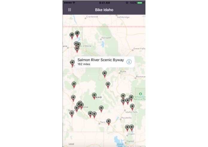
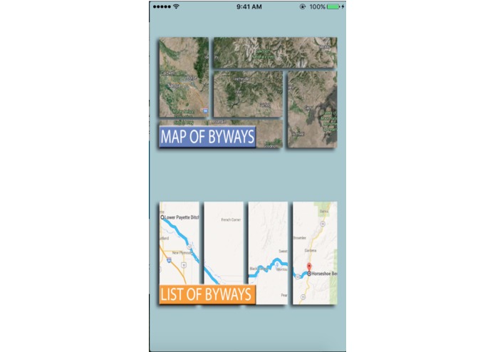
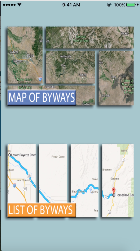
Map View of Byways
-
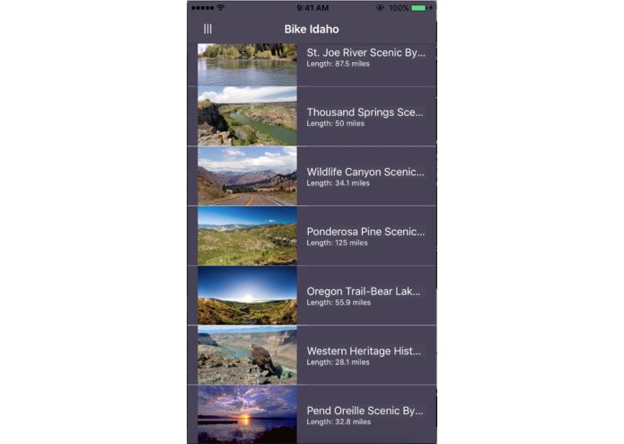
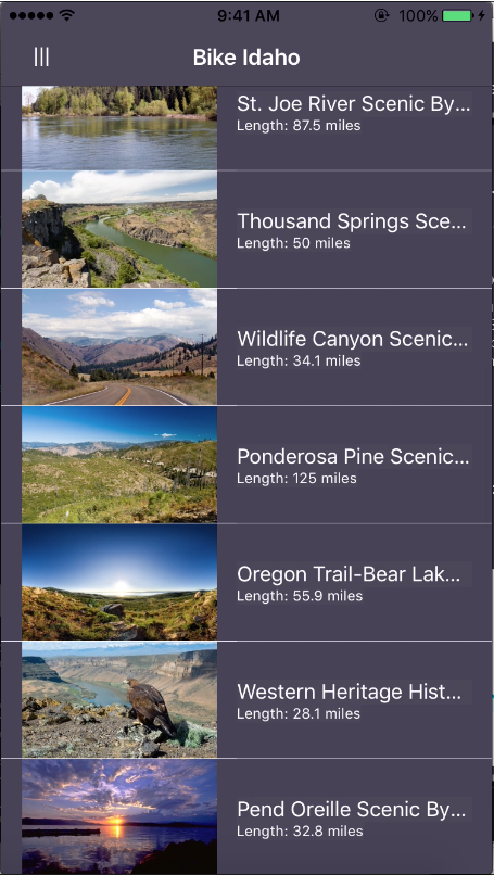
List View of Byways
-
Splash Screen and iOS app icon for Bike Idaho


Inspiration
The inspiration for why I chose this app was that I have recently acquired an appreciation for the great outdoors of Idaho. I took a Geoscience course at Boise State in the Fall of 2015, and it really opened my eyes to the beauty that surrounds us. I have lived in Idaho for 22 years, and took for granted all of the history and amazing landmarks that are in Idaho. Building this app made me want to go out and travel some of these byways this Summer and hopefully the users of this app will acquire the same desire as well.
What it does
Bike Idaho displays the 32 Scenic Byways that are scattered throughout Idaho. Users of the app can view these byways either as pins on a map of the State of Idaho, or in a list with an accompanying picture. You can choose to view more information about each byway, to which the user will be presented with details about the byway, elevation graphs, a picture of the byway route, directions and additional websites/youtube videos if they wish to learn more.
How I built it
I developed Bike Idaho using XCode on a Macbook Pro. All of the information about the different byways were stored in a JSON file.
Challenges I ran into
The main challenge I had was creating an overlay of each byway and incorporating it onto a map. If this were to be accomplished, a bicyclist could follow the byway and view their location on their phone. I instead had to include snapshots of each byway, but this is a feature that I think would boost the appeal of this app to bicyclists.
Accomplishments that I'm proud of
The implementation of the menu (https://github.com/Yalantis/GuillotineMenu) with the views which took a while, as well as the custom pins for the map and overall layout of the app.
What I learned
There are many amazing byways throughout Idaho, and not all of them are up north in the mountains. Several of them are relatively close to Boise, and would make for the perfect weekend adventure.
What's next for Bike Idaho
-Implementation of a byway overlay on the maps so that users can view the route in real time (as well as their current location). -A weather option for each location so users can plan accordingly. -Integrate a Speedometer and current elevation alongside the route so that a bicyclist can have statistics available. -Fitness feature building off of the elevation, speed and distance.


Log in or sign up for Devpost to join the conversation.