-
-
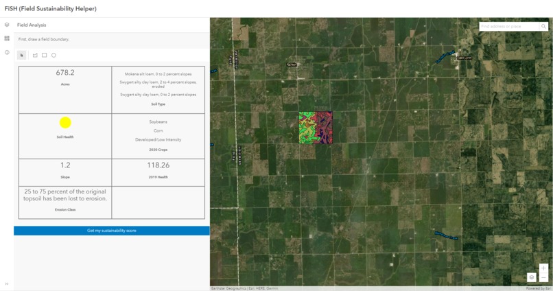
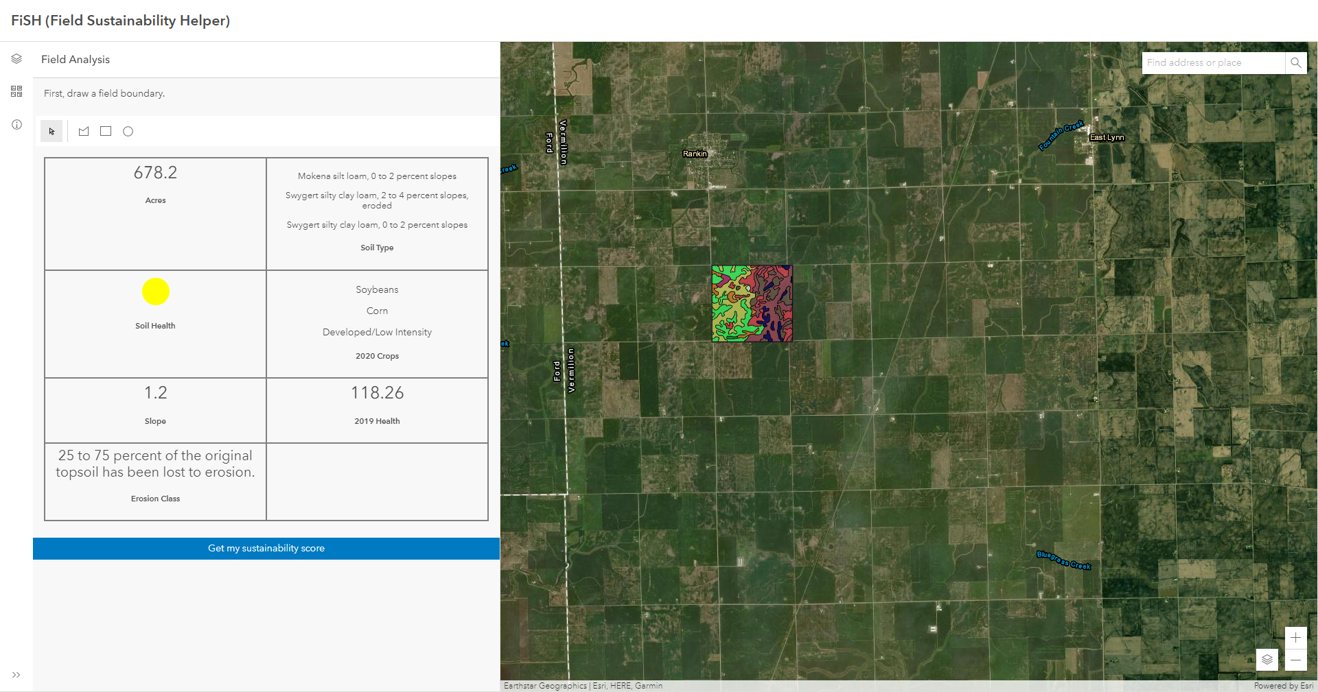
Field information
-
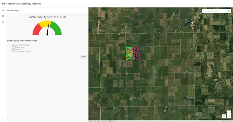
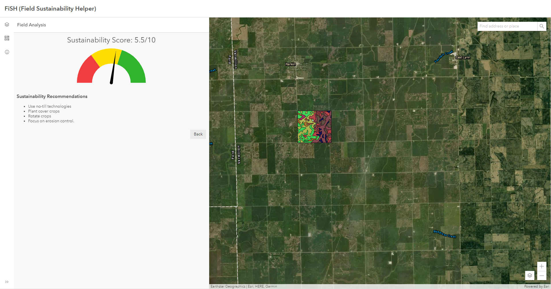
Sustainability recommendation
With increasing focus on sustainable agriculture, incentivized farming practices, and increased carbon credit potential, the time is now to unlock the power of the necessary rich datasets within the ArcGIS Ecosystem and empower today’s sustainability consultants with an easy-to-use decision support tool. FiSH (the Field Sustainability Helper) will enable consultants and farmers alike to use the Living Atlas, accessed through the ArcGIS Platform, to make educated, sustainable decisions for the future.
To view the application, go to: https://esrips.github.io/field-sustainability-helper
Code: https://github.com/EsriPS/field-sustainability-helper
What it does
Field Sustainability Helper allows an agronomist or field consultant to quickly draw a field, get information about the field, answer a few questions about farming practices, and then get a sustainability score and recommendations on what to do in the future to attain higher levels of sustainability.
How we built it
Field Sustainability Helper is a dynamic web application built on the latest web technologies: the ArcGIS API for JavaScript, Esri Calcite Components, and ReactJS. It uses the API Key pattern from ArcGIS Platform to access premium Living Atlas layers and geocoding services.
What we learned
We learned a lot about Esri image services, the ArcGIS API for JavaScript, and working together as a team.
What's next for Field Sustainability Helper (FiSH)
This app has a lot of potential - we want to add the ability to save field boundaries so the user can come back in the future to analyze sustainability over time and edit existing fields. We'd also like to add the ability to generate reports. We can also continue to improve the sustainability analysis (and allow the grower to customize the analysis to fit their situation) and show the user field health imagery over time (for example, 5-year health).
Category: Sustainability
Built With
- arcgisapiforjavascript
- esri
- javascript
- livingatlas
- react


Log in or sign up for Devpost to join the conversation.