About the Project: Prowl
Our Inspiration
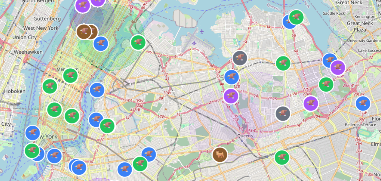
The project was born from a simple observation: urban wildlife activity is happening all around us in cities like New York, yet it remains largely hidden in plain sight. While over 10,000 wildlife observations are logged in NYC every single week, the data is scattered across multiple disconnected platforms. We were inspired to bridge this gap between urban communities and their local ecosystems by creating a unified view of the wildlife sharing our "concrete jungles".
How We Built It
Prowl is designed as the first passive, real-time intelligence platform for urban wildlife. Rather than relying on manual reporting, we built an automated engine that scrapes and aggregates data from dozens of secure public resources. Our technical architecture focuses on Data Fusion from six primary categories:
- Visual Data: We ingest live CCTV footage and community photo contributions.
- Field Reports: We integrate park ranger reports and public safety records.
- Research & Crowdsourcing: Our system pulls from open-source research, wildlife audio recorders, and crowd-sourced APIs.
- Social & Digital Trends: We monitor social media and various user reports for real-time sightings. Technical Implementation
To process this massive influx of information, we implemented several confidence-weighting frameworks. A core component of our service is the use of Computer Vision to automatically identify species in camera feeds. We then apply Statistical Modeling to turn raw sightings into intelligence. Using spatial clustering algorithms, we group probabilistic animal hotspots. For example, we use Haversine calculations to determine distances between points on the Earth's surface:
$$d = 2r \arcsin\left(\sqrt{\sin^2\left(\frac{\phi_2 - \phi_1}{2}\right) + \cos(\phi_1) \cos(\phi_2) \sin^2\left(\frac{\lambda_2 - \lambda_1}{2}\right)}\right)$$
We utilize clustering methods like K-Means and DBSCAN to identify patterns in the data. To ensure the map remains "living" and accurate, our data decays stochastically over time, prioritizing the most recent and relevant sightings.
Challenges Faced
One of our greatest hurdles was the manual nature of traditional tracking, which requires constant human intervention. Building a system that replaces this with a passive intelligence model meant solving the problem of data silos—where different organizations have information but do not share it. We also had to ensure that our ingestion engine could handle "massive amounts of information every minute" while maintaining data security and reliability.
What We Learned
Through this project, we learned that the data to understand urban ecosystems already exists; it is simply locked away in disparate formats. By centralizing this information into a real-time interactive map, we can transform how city dwellers interact with the nature around them, moving from a disconnected community to one that is actively aware of its non-human residents.
Built With
- fastapi
- git
- python
- pytorch
- react
- typescript
- vite
- yolo26


Log in or sign up for Devpost to join the conversation.