Inspiration
I am a museum curator and digital artist. I have created a monthly series of free public history walks based on Adobe Aero and galleries of archival photographs around civil rights history placed using Google Geospatial Creator onto the exact site where the photographs were taken. This walking series, called Drift the Map, has attracted audiences of over a hundred people in Atlanta, Georgia over five monthly walks, has been written up in local press, and has led to sponsorships by multiple local museums and nonprofits. The walks are co-facilitated with my 16-year old daughter, also an artist, who collaborates with me in advance using Adobe Aero, Google Earth Studio, and Cesium Ion to research and place these photographs from newspaper archives into the walking environment. These walks fuse archival research with urban exploring to encourage an engagement with Atlanta’s layered history. Additional context is provided through Cesium Ion Stories viewed on participants’ phones to explore historic maps georeferenced over current Google Earth Photorealistic 3D Tiles. The events are marketed in advance with orbiting views created in Google Earth Studio.(https://www.instagram.com/p/CxdUfsWuD12/).
What it does
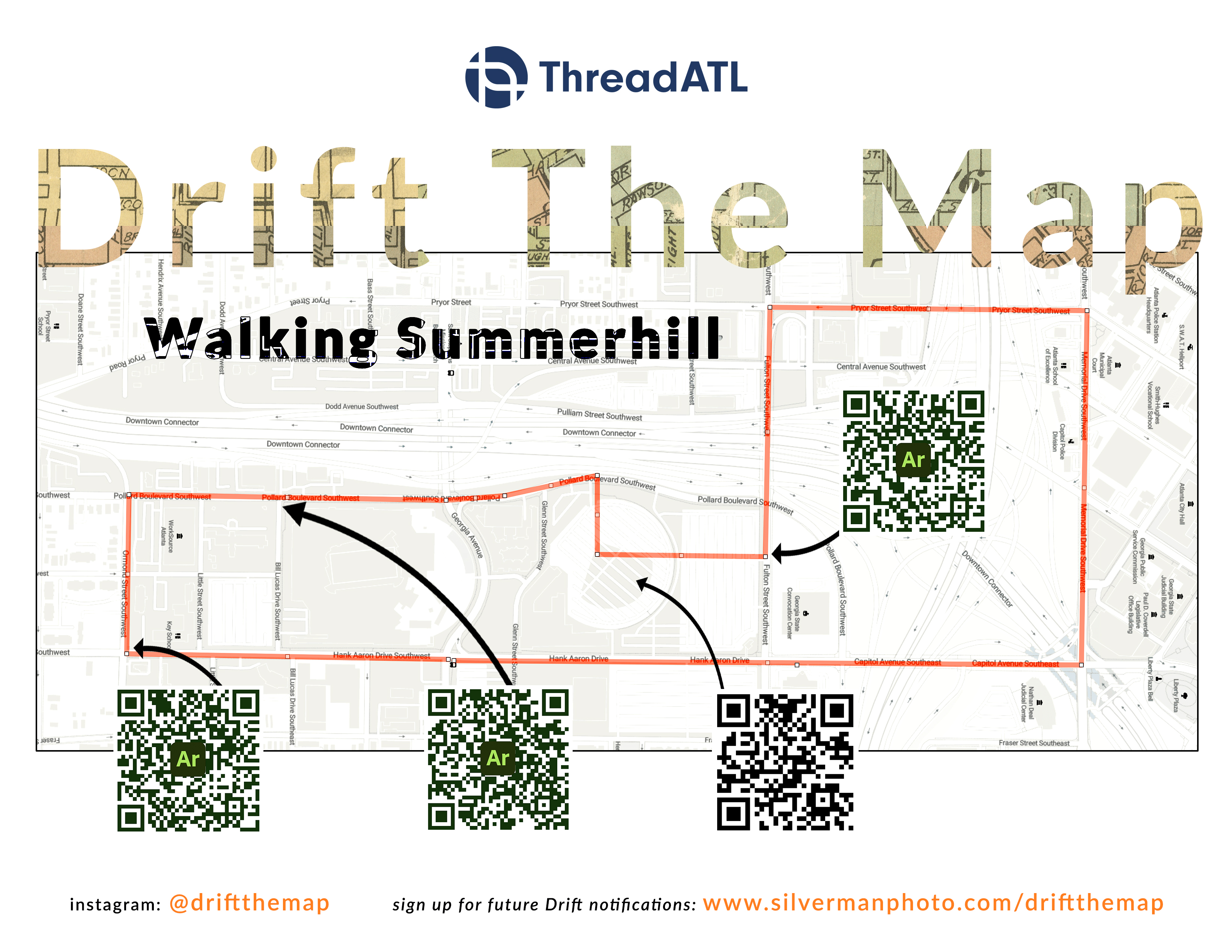
When the walking tour arrives at an A/R activated site, the group is invited to scan a sign with QR codes and then a guest historian or community stakeholder is invited to give context for the exhibition. Recent experiences included the Student Nonviolent Coordinating Committee's 1966 march which was sparked by the shooting by the police of an unarmed Black man at the height of civil rights tensions in the American South. Newspaper photos of the protest show the Mayor of Atlanta on a police car with a bullhorn, and crowds of protestors being dispersed by tear gas. The day ended with civil rights activist and Black Panther Stokely Carmichael arrested for his role in organizing the protest. The community called it The Summerhill Rebellion, but the local press named it "The Summerhill Riot." Participants in the A/R experience were both astonished by the fact that this incident has largely been forgotten by Atlanta residents and how powerful the experience was of encountering historic photographs of a civil rights scene of thousands of protestors on the exact site over half a century later, now a quiet neighborhood facing a new set of concerns over gentrification, homelessness, and affordability.
A previous walk, co-sponsored by the Atlanta Freedom Park Conservancy, recreated the 1988 moment of civil disobedience when protestors fighting the demolition of a historic neighborhood for a highway being built through the center of Atlanta chained themselves to bulldozers to stop the road being built. The moment led to a court victory and the stopping of the construction of the highway. I used Adobe Aero to reconstruct the scene of protesters surrounding bulldozers and construction equipment. Some of those same activists from 1988 were on the walk with us that day and remarked how the A/R experience instantly transported them back to that pivotal moment in city history.
How we built it
We are historians and artists, not coders. These A/R-powered history tours were made possible by access to the no-code Adobe Aero beta desktop app powered by Google Geospatial Creator. Additional context is given through an interactive Cesium Ion Story created using a 1921 map of Atlanta georeferenced over current Google Earth Photorealistic 3D Tiles. That story is viewable here: Cesium Ion Story: Atlanta Map Overlay: 1921 and 2023
Adobe Aero served as the primary tool for integrating archival photographs into the physical world, placing them precisely at the historical locations. QR code signs placed at A/R-activated sites enable participants to access the augmented experiences. We engaged guest historians and community stakeholders to provide contextual insights.
The ease of use of these tools allowed us to spend our planning time on archival and primary source research, not coding.
Challenges we ran into
The Adobe Aero app is still in beta and the phone app is not quite ready for prime time yet. Multiple participants did not have smartphones with current versions of iOS capable of playing the experience. Sometimes A/R tracking is lost and the app has to be restarted to continue to view the experience. Good humor by the facilitators and a friendly crowd allowed the experimental nature of these tools to become part of the experience and not a problem for enjoyment of the experience.
Accomplishments that we're proud of
This technology, even in its infancy, has already been career-changing for me. I used this technology demo of Geospatial Creator tools and complex Google Earth Studio animations to define a new job for myself as Curator of Digital Art for the Breman Museum, which has hired me to use these and similar 3D-enabled tools to invent a “museum of the future” built around this technology. As Geospatial Creator grows and evolves, I am excited to create metaverse immersive experiences of digital scenes of our historical past blending with the analog present.
I am also excited that participants in these walks have included high-profile guests who were moved by the power of these tools. These participants have included the CEO of the Jimmy Carter Presidential Center, the CEO of the National Center for Civil and Human Rights, professors and students from local colleges, and dozens of neighborhood activists and historians who are all new to A/R tools being used for historic preservation and scholarship.
What we learned
As no-code Geospatial and immersive creation tools mature, it becomes doubly important to create deeply researched content using archives, museums, and interviews with community stakeholders, culture-bearers, and historians. It doesn’t matter how immersive the technology is if the content is not educational and entertaining. On the other hand, great content can overcome limitations of technology that is maturing rapidly and not yet glitch-free or fully immersive.
What's next for Drift the Map:
This series has a growing audience and network that includes partnerships with the Museum of Design Atlanta and ThreadATL, a nonprofit advocating for walkability and smart urbanism. As this audience grows, I will use the fast-improving Geospatial Creator tools to create ever more immersive experiences of the civil rights past to inform the dialog around justice in the present. Future plans involve continuing these monthly tours with an expanding roster of stakeholders, growing our social media presence to expand the monthly audience, and incorporating new tools like Google 3D Tiles in Blender to create even more immersive metaverse experiences, and continuing to innovate in historical preservation through augmented reality.

Log in or sign up for Devpost to join the conversation.