Inspiration
Earth’s orbit is becoming increasingly crowded with satellites and space debris. With more companies and countries launching satellites every year, the risk of collisions in space is growing. A single collision could damage critical infrastructure such as communication, navigation, and weather satellites.
Organizations like NASA and European Space Agency have raised concerns about orbital congestion and the increasing amount of debris in space. However, many current monitoring systems are complex and difficult to visualize quickly.
This inspired us to create ASTRAGUARD, a platform that makes orbital traffic easier to understand through AI-powered prediction and 3D visualization.
What it does
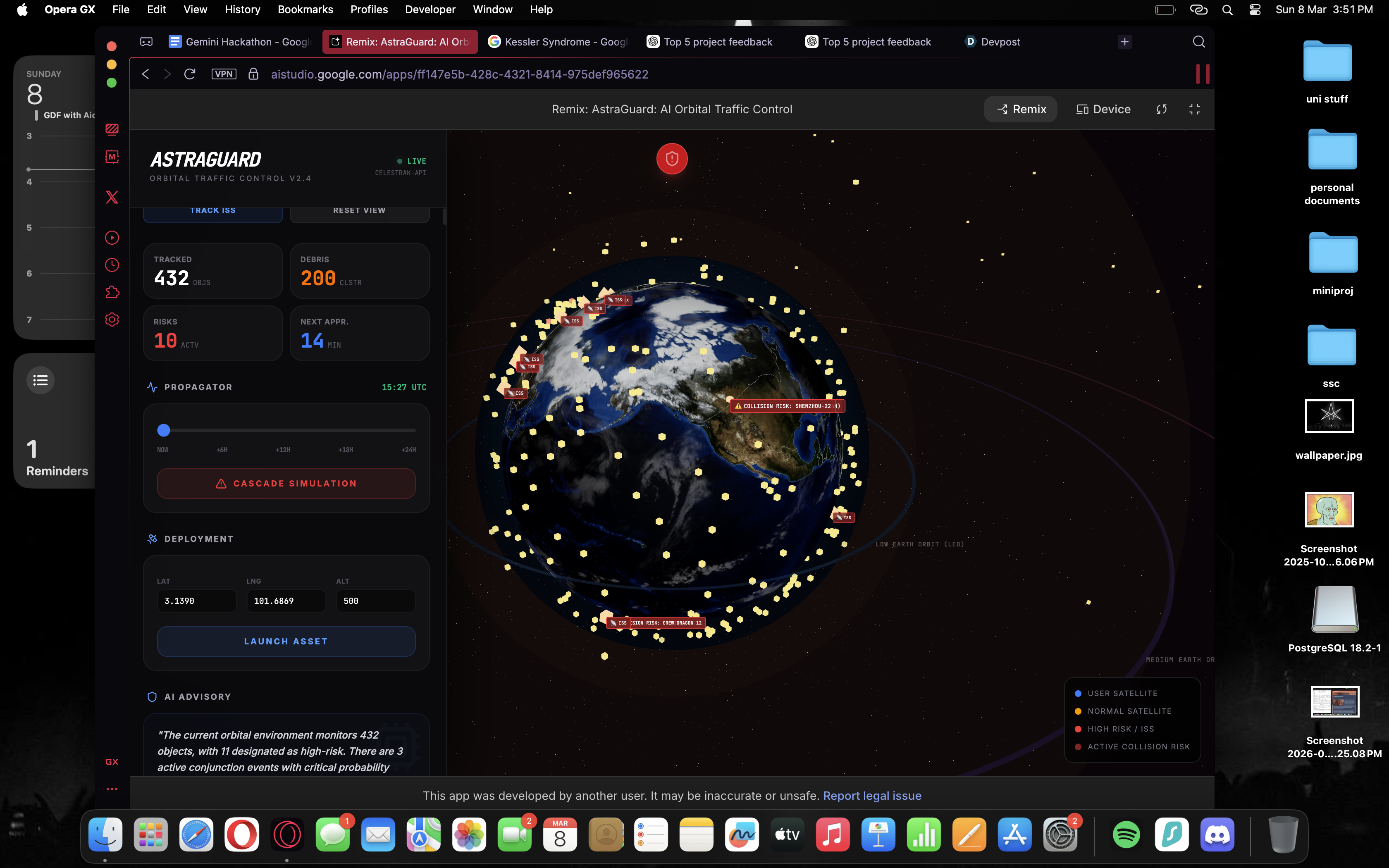
ASTRAGUARD is an AI-powered 3D platform that visualizes satellites and space debris orbiting Earth and predicts potential collision risks.
The platform allows users to: View satellites and debris moving around Earth in a 3D environment Identify high‑risk orbital zones Detect possible satellite collision risks Receive alerts and suggested actions to avoid collisions The system uses real satellite data from CelesTrak to track objects currently orbiting Earth.
How we built it
We built ASTRAGUARD by combining real satellite data, AI analysis, and 3D visualization. First, we obtained real satellite orbital data from CelesTrak. This data allows us to track the positions of satellites around Earth. Next, we developed a 3D visualization environment that displays satellites and debris moving around the planet in real time. Finally, we implemented an AI-based system that analyzes satellite paths and identifies situations where objects may come dangerously close to each other. When a potential risk is detected, the system highlights it and alerts the user.
Challenges we ran into
One of the biggest challenges was working with real satellite data, as the data sometimes failed to load or required careful formatting before it could be used. Another challenge was managing large numbers of satellites in the visualization while keeping the system smooth and responsive. We also needed to design a way to identify potential collision risks clearly so that users could quickly understand the situation.
Accomplishments that we're proud of
We are proud that we successfully built a platform that: Visualizes satellites and debris in an interactive 3D environment Integrates real satellite tracking data Demonstrates AI-powered collision risk detection Makes complex orbital data easy to understand Most importantly, we created a system that helps improve space situational awareness.
What we learned
Through this project, we learned about: Satellite orbits and space traffic How real satellite data is used for tracking Building interactive 3D visualizations Using AI to analyze and predict potential risks We also learned how challenging it can be to transform complex scientific data into something simple and intuitive.
What's next for ASTRAGUARD
In the future, we want to improve ASTRAGUARD by: Adding more advanced AI collision prediction Including more satellite tracking data sources Improving real-time monitoring capabilities Developing a dashboard for global space traffic awareness
Our long‑term goal is to help make space safer and easier to understand as the number of satellites continues to grow. 🌍🛰️


Log in or sign up for Devpost to join the conversation.