-
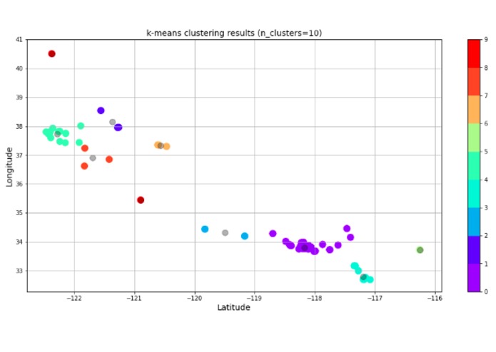
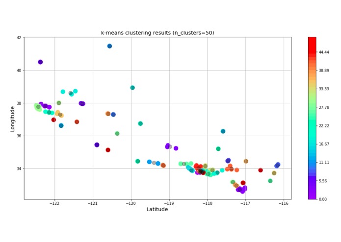
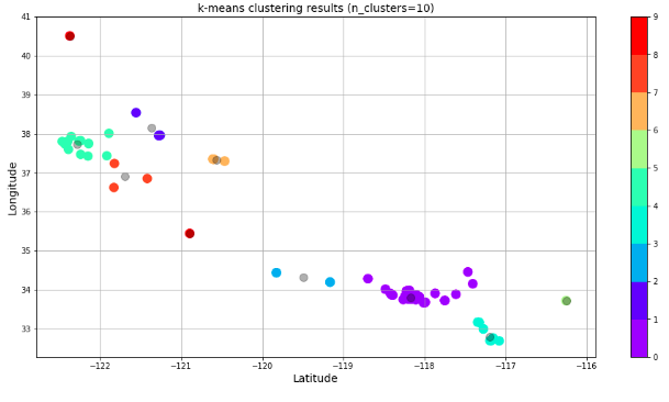
Training the AI
-
Logo
-
Optimized AI


Inspiration
Questions: How do we use AI to see where problems appear How do we deal with biased AI?
What it does
Intakes local data to automatically detect and predict hazard points
How I built it
Data was sourced as csv file from Long Beach city open data. The data pipeline was built using pandas, machine learning models developed using scikitlearn and tensorflow. Outputs were fed into a web-app built using react.
Challenges I ran into
Dealing with different data schemas and standardizing them so that Artemis can read them in.
Accomplishments that I'm proud of
Completion of full end to end data pipeline with map visualization to see exactly how Artemis thinks
What I learned
What's next for Artemis
Generalized interface to intake any geolocation data to grow ever smarter.

Log in or sign up for Devpost to join the conversation.