Inspiration
Illegal deforestation and wildfires are devastating our planet’s lungs — our forests — yet current monitoring methods are slow, expensive, and reactive. We wanted to create an affordable, autonomous system that empowers conservation teams to detect threats in real time and take action before irreversible damage occurs.
What it does
Aerial Ace is a low-cost, AI-powered drone that autonomously:
Detects deforestation activity such as illegal logging and tree removal
Identifies early signs of forest fires, including smoke and heat
Sends real-time alerts with visual evidence and location data
Maps deforestation and fire zones on an interactive dashboard
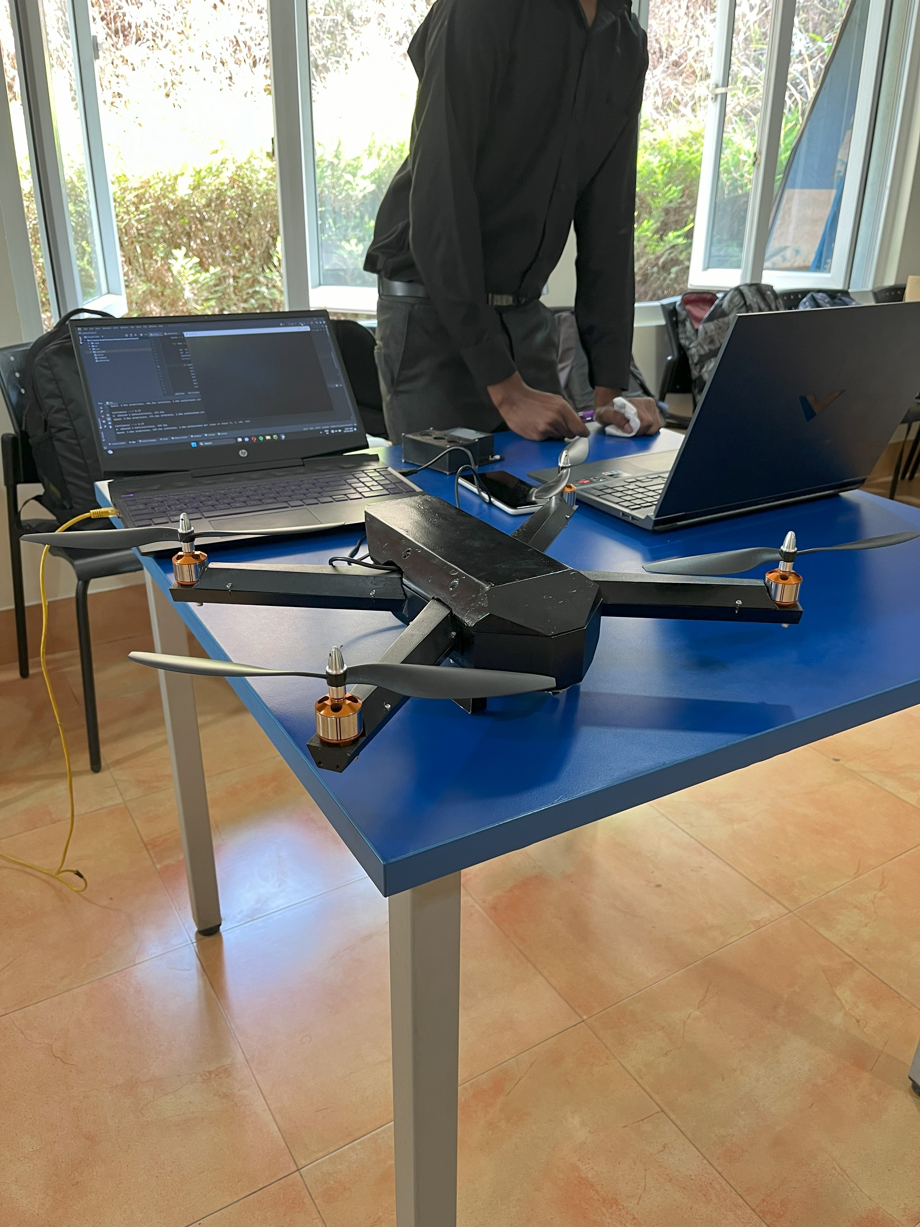
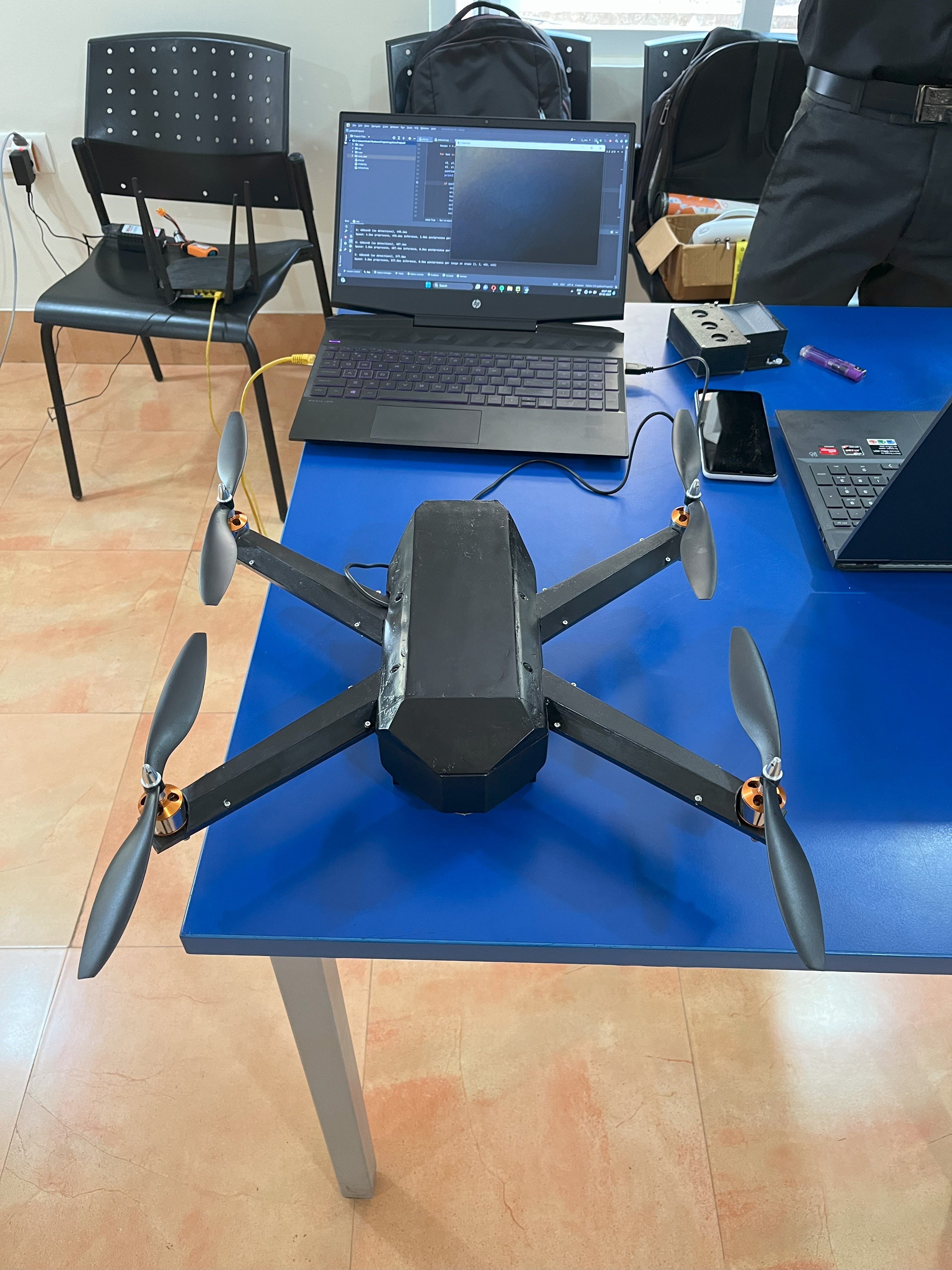
How we built it
We focused on using cost-effective components to make the system scalable:
ESP32-CAM module captures live video during flight
A YOLOv8 model trained on a custom dataset processes the footage in real time to detect deforestation and fire-related anomalies
Arduino Nano running MultiWii is used as the drone’s flight controller for stable autonomous navigation
Data and alerts are sent to a lightweight FastAPI backend, which powers a live dashboard built with Angular and Mapbox
The system can run offline for remote areas and sync data once reconnected
Challenges we ran into Integrating the ESP32-CAM with the YOLOv8 pipeline in real time while maintaining frame consistency
Running a flight-stable drone with limited computational resources and low-cost hardware
Designing a lightweight detection pipeline for limited connectivity or offline use
Training the model to differentiate between deforestation indicators and natural changes like fallen trees due to storms
Aligning flight path, GPS tracking, and detection zones with a clean UI in the dashboard
Accomplishments that we're proud of Built a fully working drone prototype using affordable components
Successfully ran YOLOv8 inference on real-time aerial video for deforestation detection
Detected simulated forest fire and logging scenarios during field tests
Created a clean and intuitive alert dashboard with real-time updates
Designed the system to work offline, syncing data when reconnected — essential for remote forest regions
What we learned
How to process and analyze drone video feeds on constrained hardware like the ESP32
Optimizing object detection models for environmental applications
Managing real-time communication between flight systems, AI, and backend APIs
The importance of balancing cost, power, and performance in field-deployable systems
Dealing with real-world constraints like signal dropout, battery life, and weather variability
What's next for Aerial Ace
Integrate thermal imaging to enhance wildfire detection capabilities
Develop multi-drone coordination for wider coverage of large forest areas
Add NDVI and vegetation health analysis using multispectral data
Partner with forest departments, NGOs, and climate initiatives for pilot programs
Build a mobile companion app for rangers and volunteers to report incidents and receive alerts
Explore solar-powered landing and recharge pads for continuous autonomous patrols

Log in or sign up for Devpost to join the conversation.