-
-
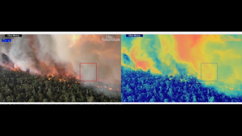
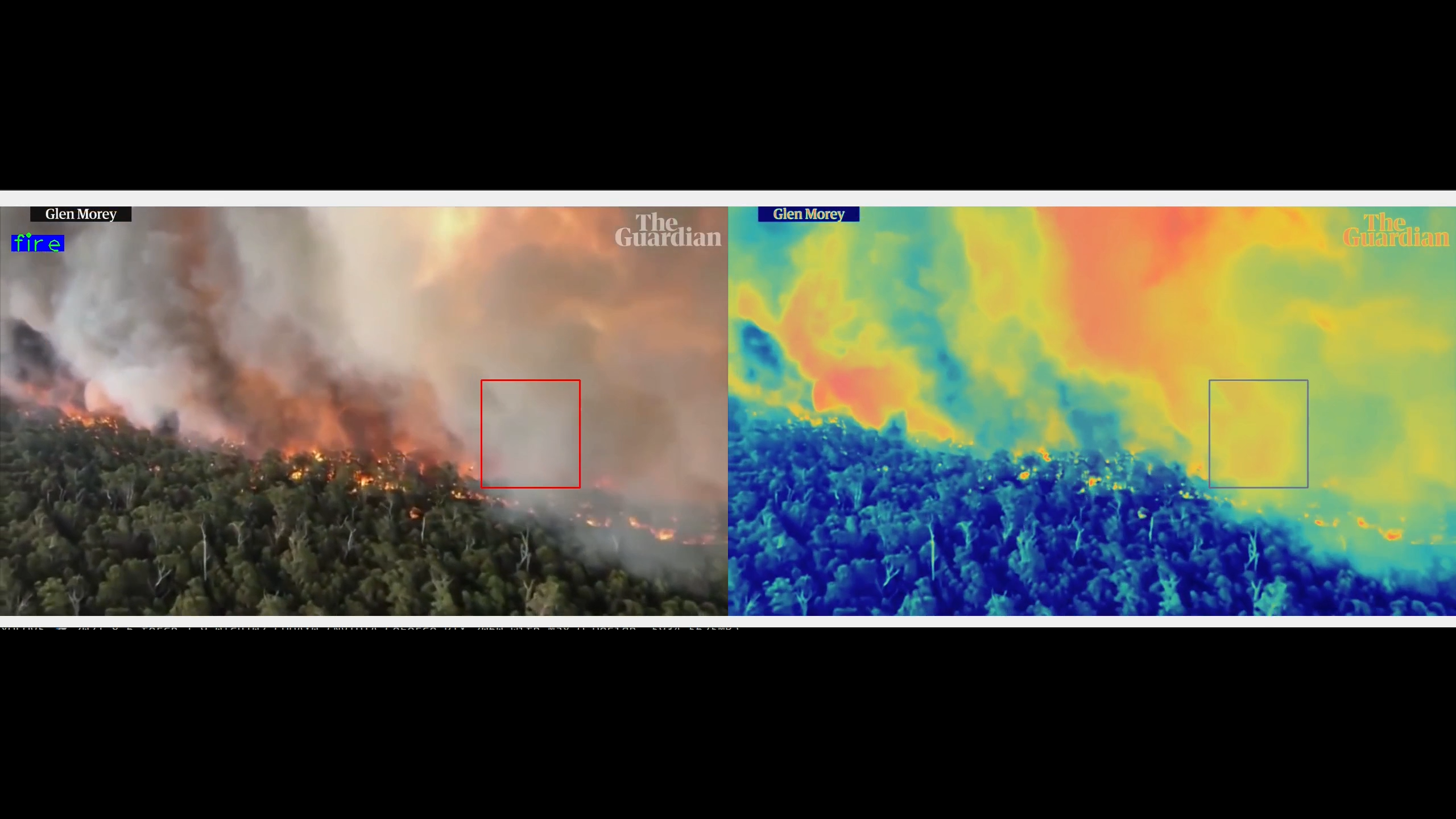
Wildfire
-

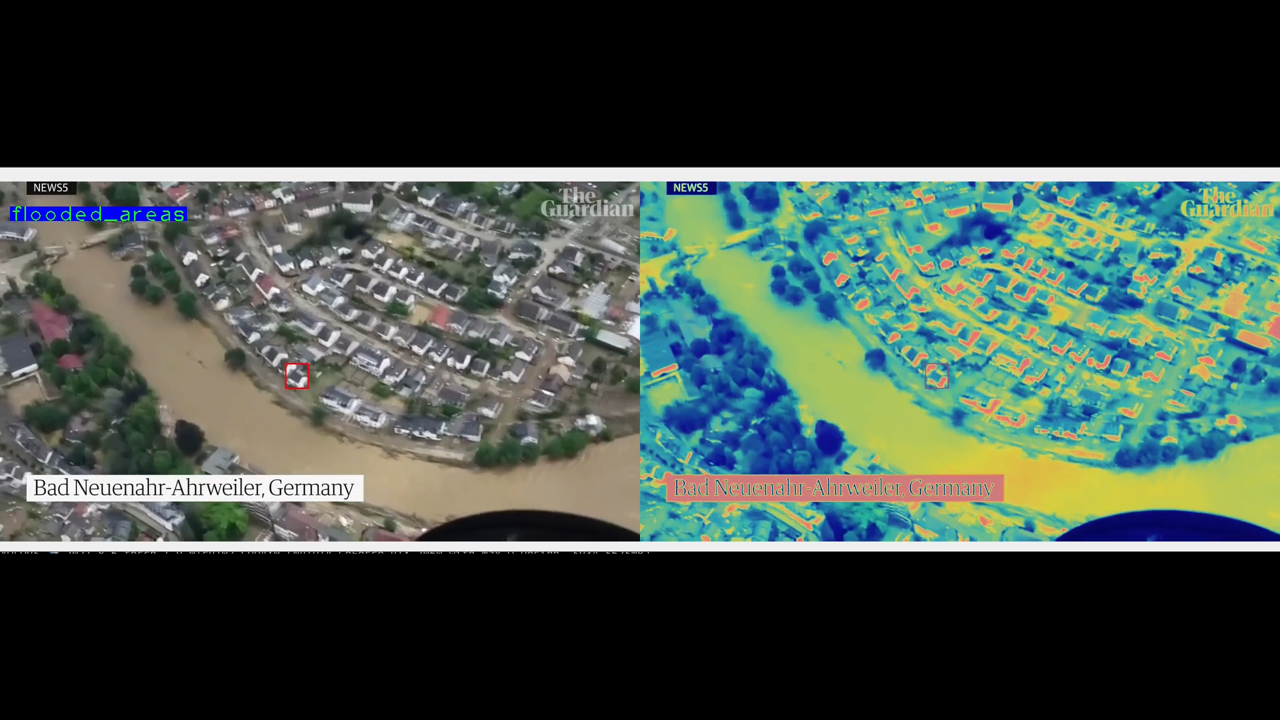
Flood
-
Setting up disaster in the cafeteria HAHA

Inspiration
Every year we see heartbreaking news about thousands of lives getting devastated with different natural calamities like flood, wildfires e.t.c.

This incurs too much loss and the geographical data of the affected areas are never observed in the right way. This is something we wanted to fix, to replace the traditional way of surveying the areas and using the data to predict the next possible disaster.
What it does
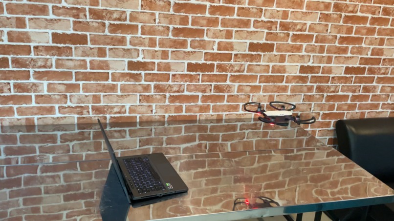
Argus stealthily flies over the affected areas without the need of a human control, it generates very critical data based on the locality density, possible population density and monocular depth data.
The data then is sent to the dashboard for visualisations and to get the nearest safest place to move to.
How we built it
- We started with collecting data from different aerial footages to train our Deep Learning model to classify between flood, wildfires, normal scenarios.
- We then piped the stream from drone to the model to get the classification results on the feed.
- The stream then goes into heatmap generation which gets the data from the monocular depth estimation data as well as the colormap we generated out of our classification model.
- All the metadata is then pushed to the dashboard.


Log in or sign up for Devpost to join the conversation.