-
-
Farm Assist Logo
-
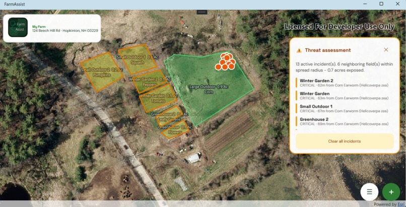
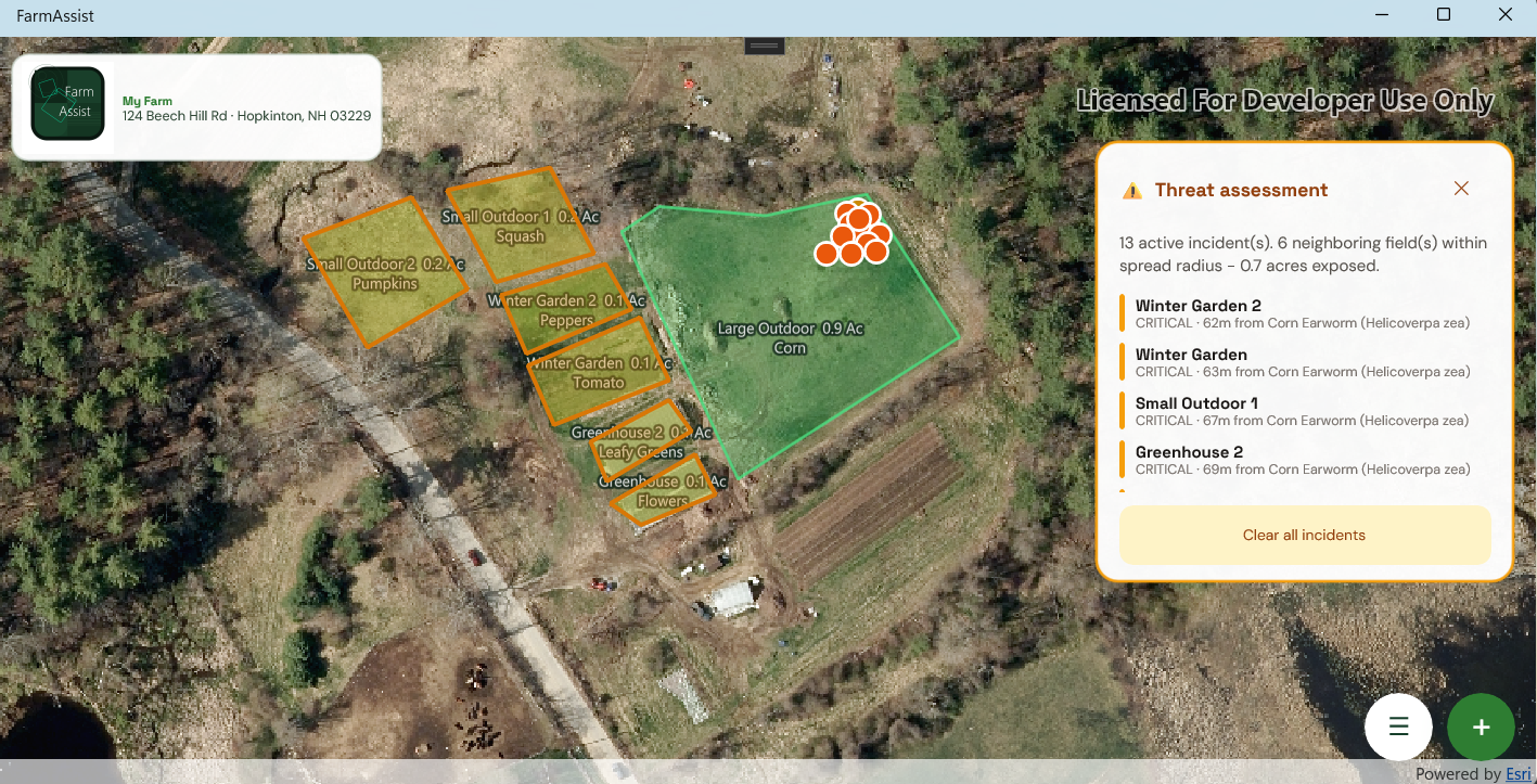
Main Screen Desktop Version
-
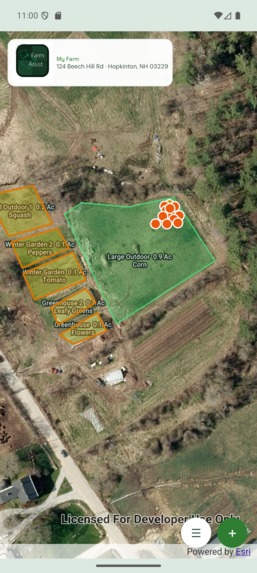
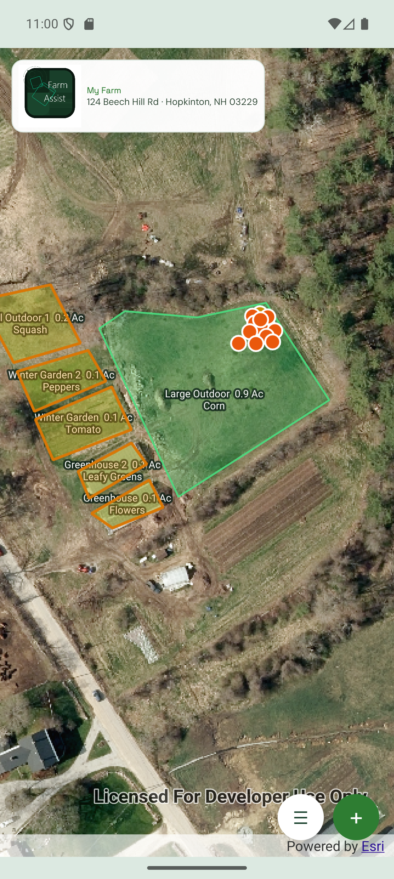
Mobile Version
-
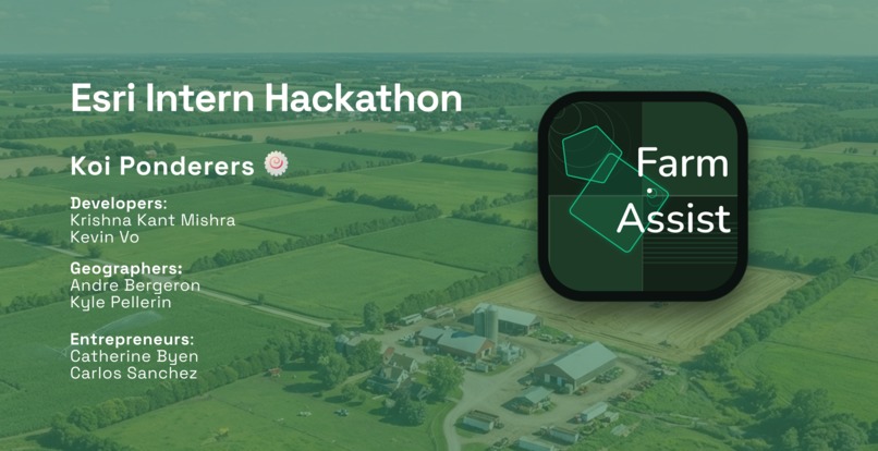
Slide 1
-
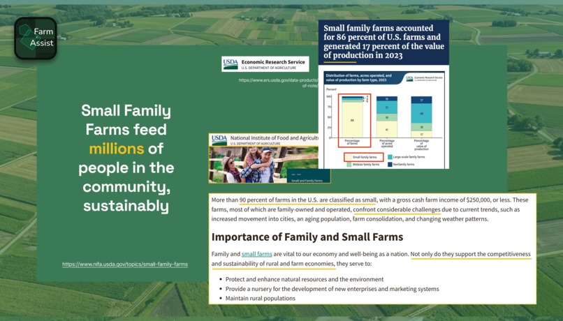
Slide 2 - importance of small family farms
-
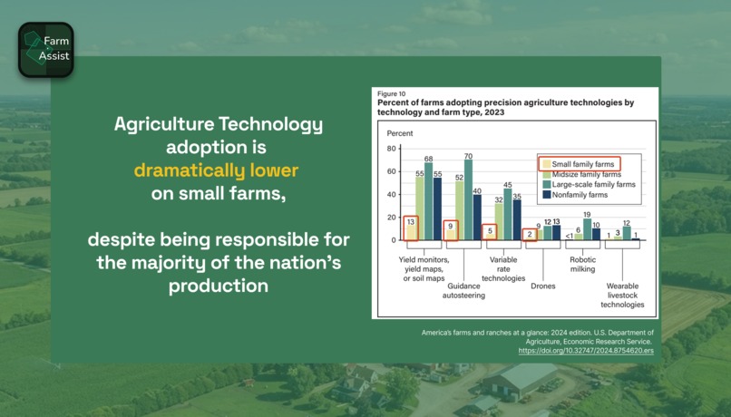
Slide 3 - challenges of small family farms
-
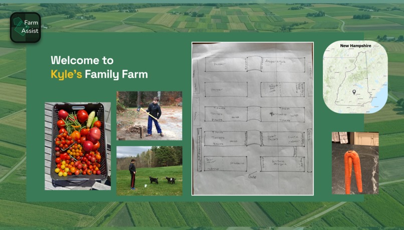
Slide 4 - Kyle's Family Farm
-
Slide 5 - Farm Assist
-
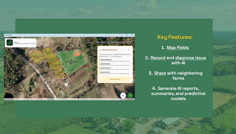
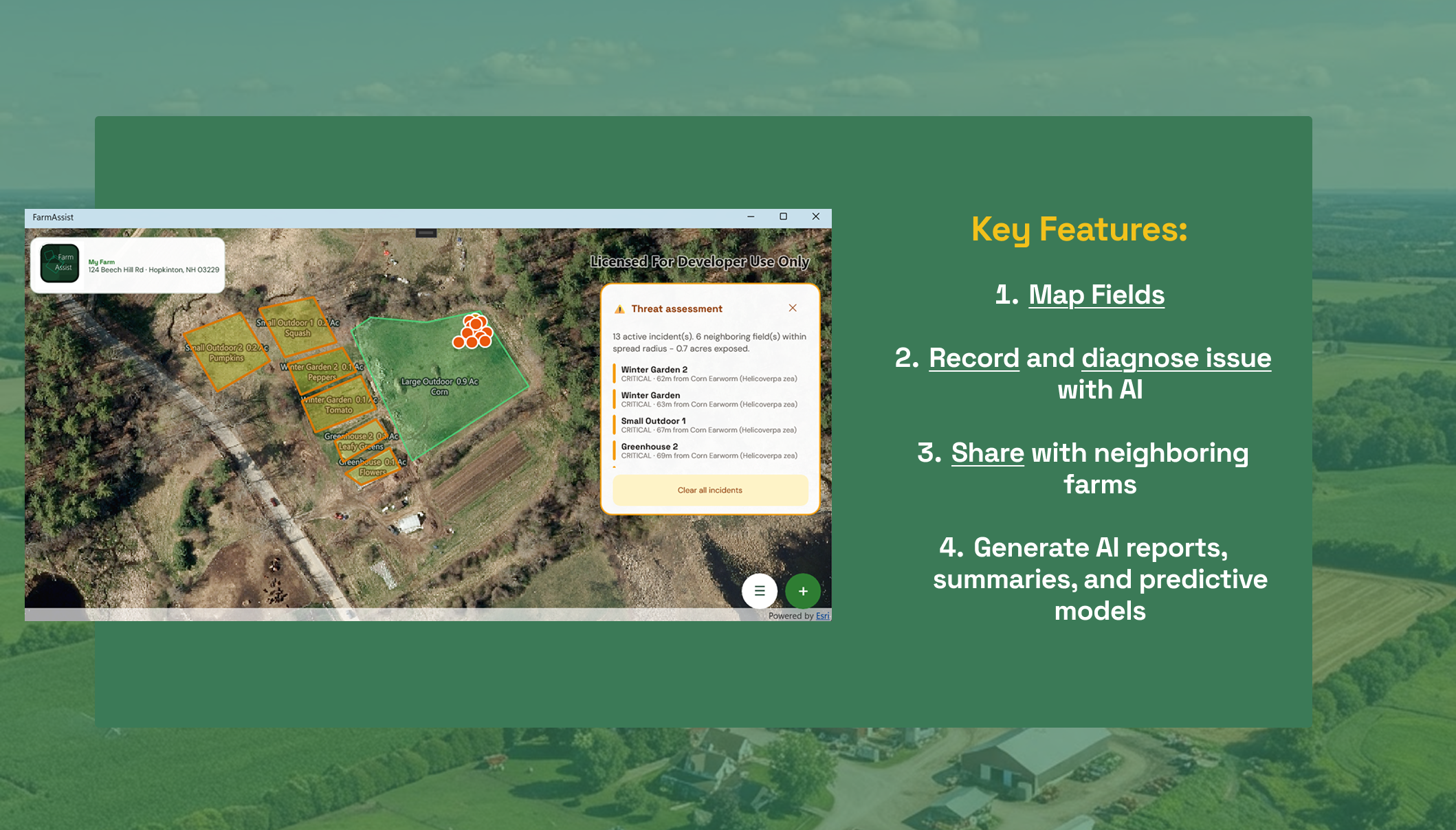
Slide 6 - Features
Inspiration
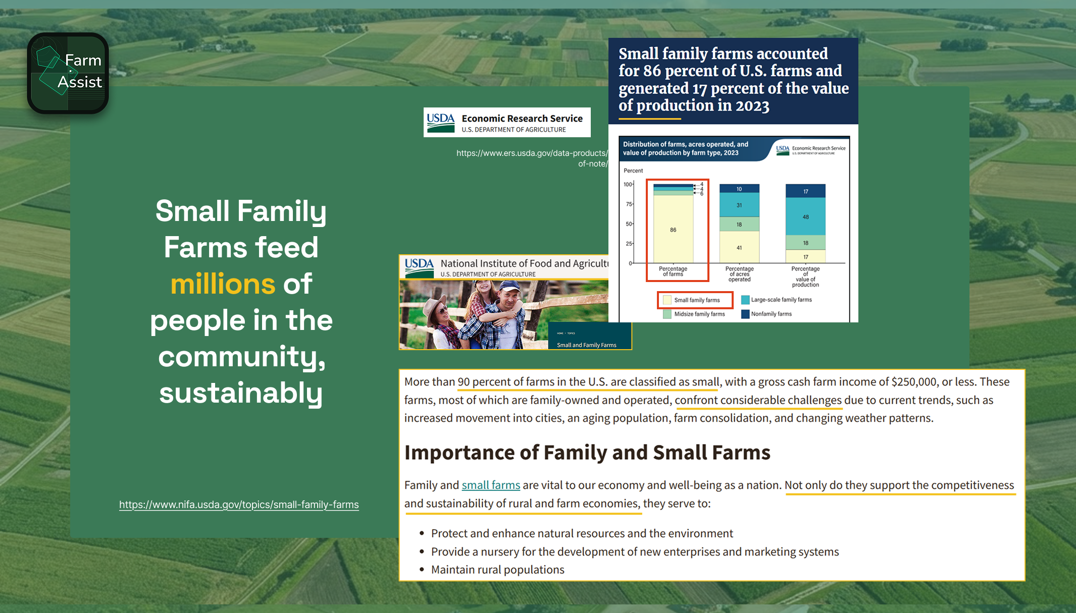
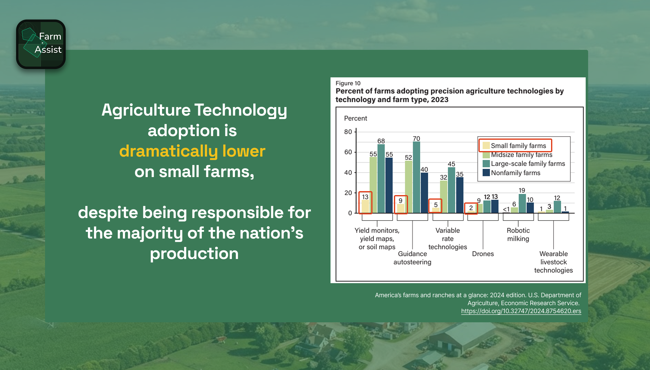
The inspiration behind our hackathon project has been that every major agricultural disaster begins with small signals that go unnoticed. Small local farms are responsible for feeding millions of people in the U.S., one pest outbreak, weather shift, disease, or drought event can destroy months of work before even realizing what is happening. Now more than ever farmers have access to more data with the technology that is available. Farmers should not find the disaster after it happens, but they should know before it starts. With FarmAssist we hope to address this issue by making a GIS powered assistant for small farm management.
What it does
With the help of GIS, FarmAssist helps farmers map, detect, monitor, and respond to crop issues before it happens.
Farm Mapping: Satellite imagery you can draw boundaries of your farm and add names for specific crop.
Community reporting: report pest outbreaks when you find them, model potential pest outbreaks, view reports from nearby farms, track outbreaks while they spread.
Early warning alerts: send out notifications when risks are detected, provide severity levels (low, medium, high), and explain what caused it along with recommended next steps.
AI FarmAssist: generate AI reports, diagnosis, summaries, and predictive models
How we built it
Open AI ArcGIS Maps SDK for .NET .NET MAUI
Challenges we ran into
One of our biggest challenges was learning how to combine UI/UX design with ArcGIS SDKs to build a user-friendly app that could also be deployed reliably. Only one of our team members had prior experience using .NET for app development, so we faced several challenges collaborating between multiple computers and bringing the interface to life the way we originally envisioned.
Accomplishments that we're proud of
Our team is especially proud of the story our app tells and the potential impact it can have on smallholder farmers. By building this app, we are helping farmers use early warning systems to stay informed about nearby risks and monitor pest and disease outbreaks that can affect entire communities. We are also proud of the app’s geospatial capabilities and its potential to provide robust, long-term support for safer, more adaptable farming.
What we learned
We learned a great deal about ArcGIS SDKs, UI/UX mobile development, and how to implement a full project using .NET with ArcGIS SDKs. Teamwork was essential throughout the process and played a major role in turning our idea into a working solution. We also gained experience in geospatial analysis, parcel management, and user-centered design—especially designing for farmers who may not use technology in their daily routines.
What's next for FarmAssist
In addition to the app’s current capabilities, we envision FarmAssist growing into a comprehensive farm management platform. One key next step is enabling offline mapping, so farmers can map boundaries and log incidents without connectivity, then sync data once they are back online. We already calculate which fields fall within an outbreak’s spread radius. The next feature we want to add is time-based spread tracking: because each incident is timestamped and geolocated, the app can estimate real spread velocity when the same pest appears in one field on Monday and a neighboring field on Friday.


Log in or sign up for Devpost to join the conversation.