Inspiration
Land development in India is difficult long before construction begins. A citizen may own a property and still be unable to locate it on a Development Plan. The plan may exist only as a scanned sheet, without geographic reference, written for officials and practitioners rather than for the person whose land it governs.
The rules are spread across planning regulations, land records, valuation standards, local authority practices and government portals. Each system uses its own language and identifiers. Rural land is recorded differently from urban land. A survey number, CTS number, Property Card, 7/12 extract, zoning line and ASR rate may all describe different aspects of the same property, but they rarely meet in one understandable place.
This creates a genuine disadvantage for ordinary people. They often depend on intermediaries simply to understand what information exists, where to find it and what it means. It also harms honest professionals. Architects, valuers and lawyers spend a large part of their time collecting documents, repeating data entry and navigating administrative procedures. That is time they could have spent on design, judgment, verification and better service to their clients.
We are architects. We live inside these systems. ARC GENESIS began with a simple question: what if an Indian land workflow could be as easy to start as a conversation, but as inspectable as a professional file?
What it does
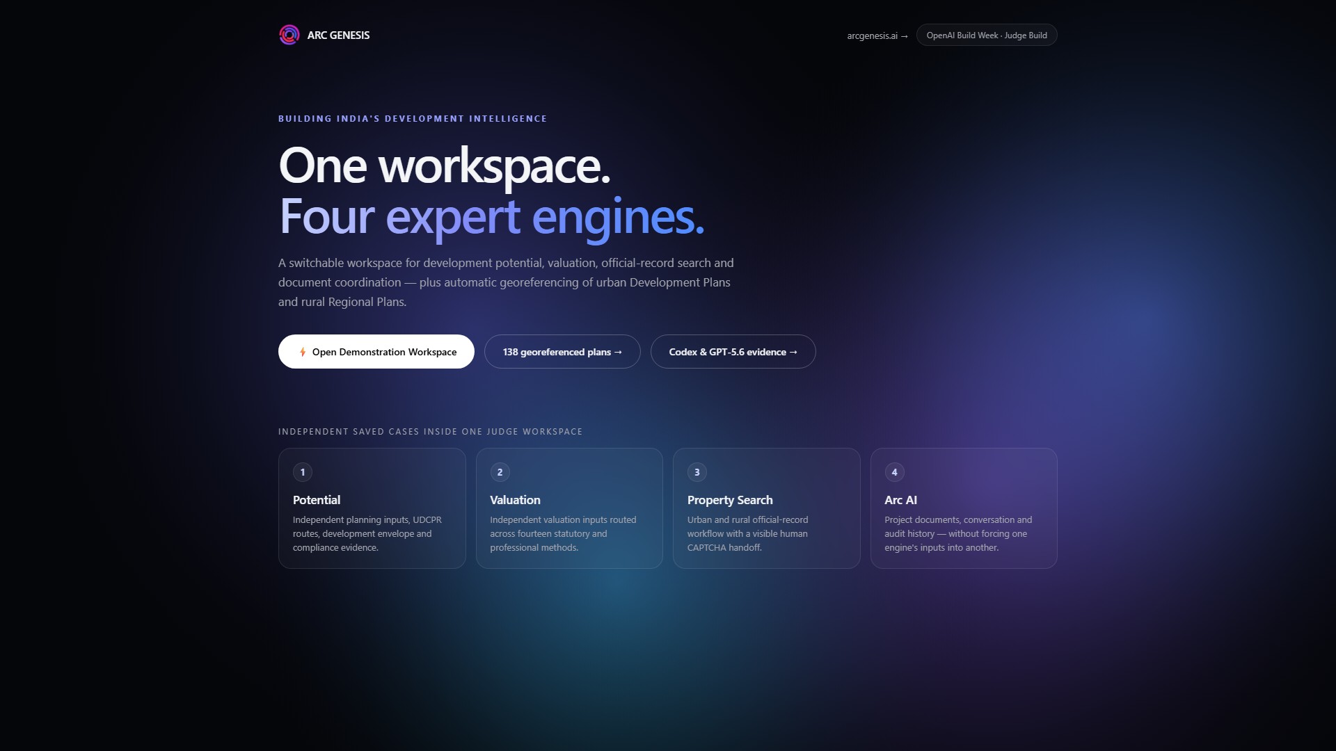
ARC GENESIS is one conversational workspace over four engines, joined by a single project spine.
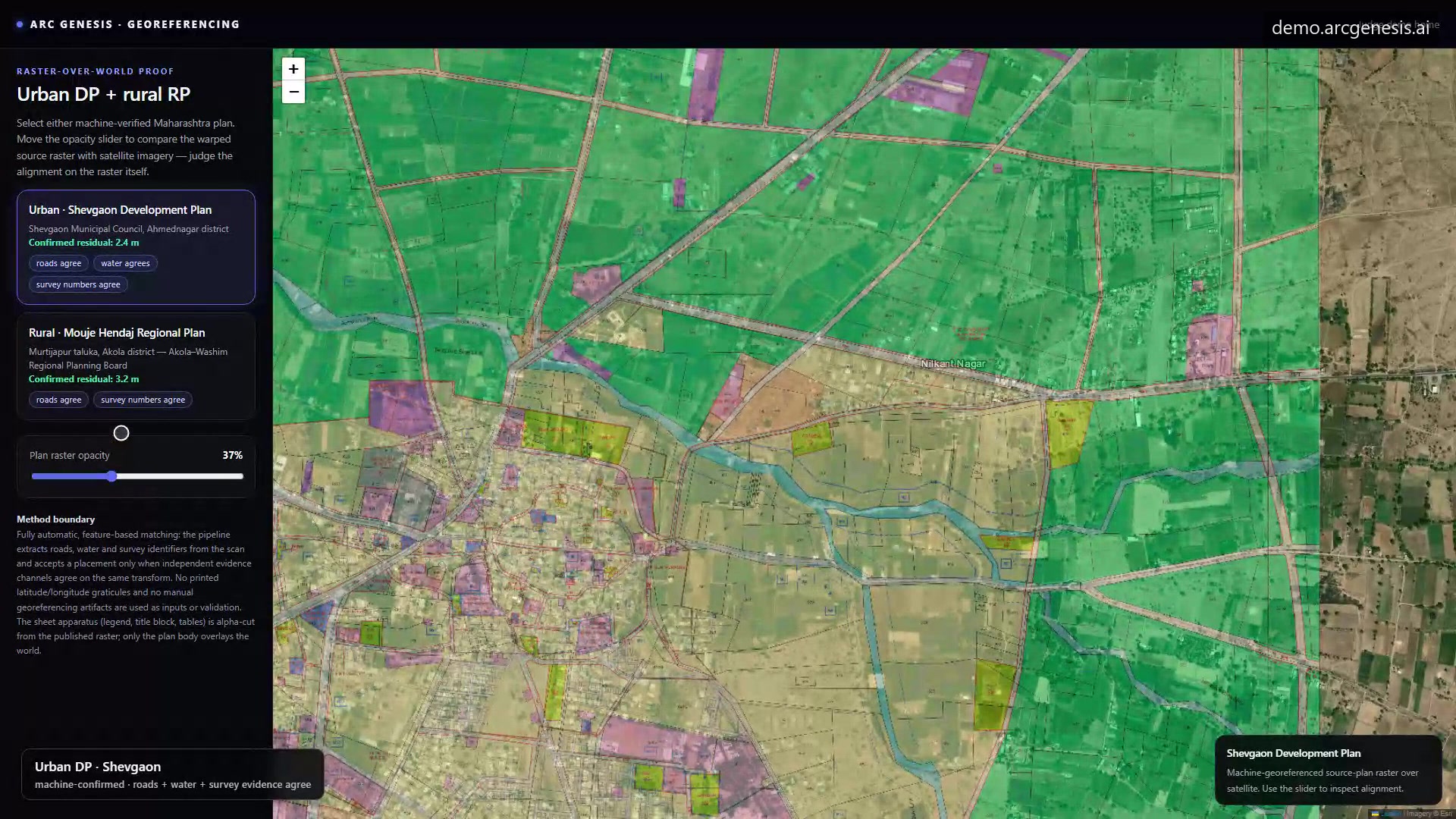
Georeferencing reads scanned Development and Regional Plans and places them on the real world automatically. A placement is accepted only when independent evidence channels agree: roads, water, railway lines, survey references. 138 plans across 21 districts are placed and open for inspection, each one viewable as the original planning raster over satellite imagery with an opacity slider.
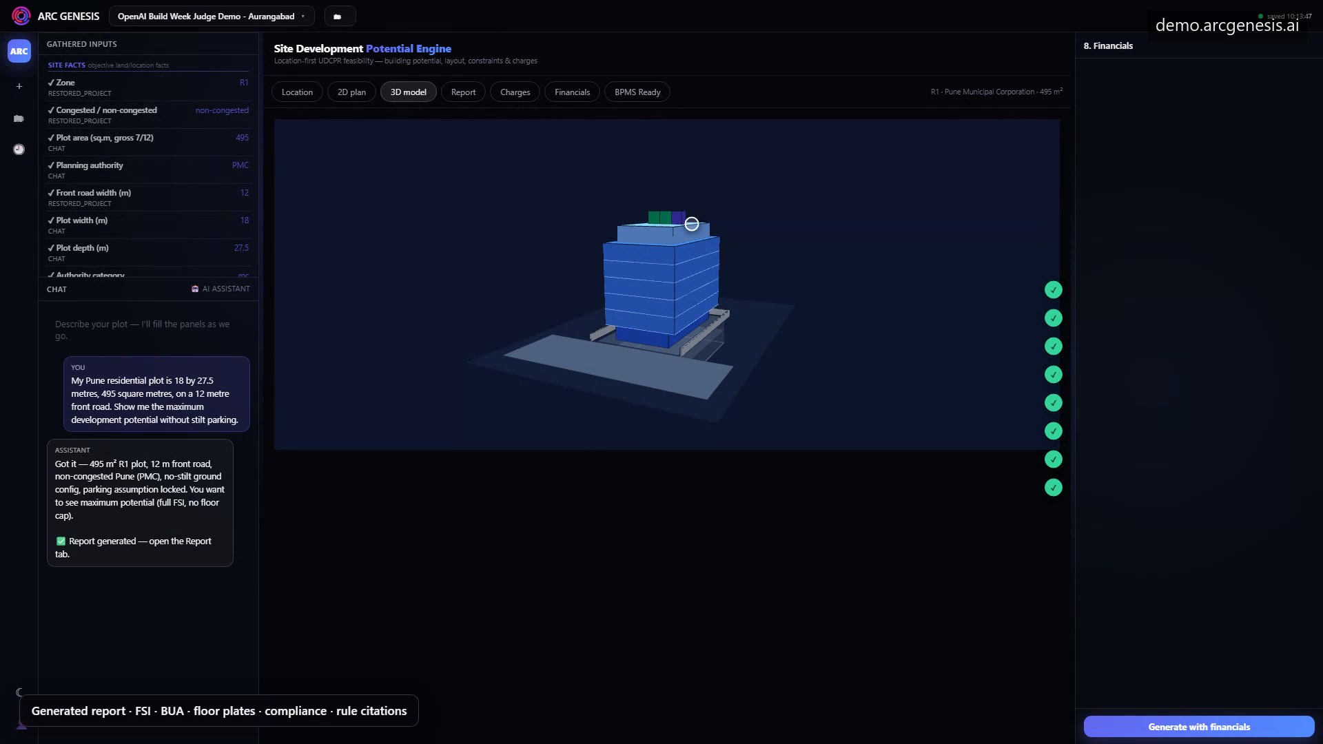
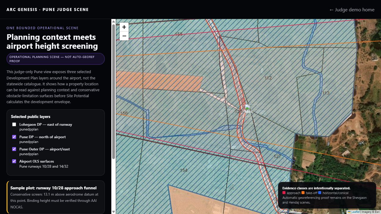
Site Potential lets a person describe a plot in ordinary language. The deterministic UDCPR engine locates it on the Development Plan, reads the zone, and calculates permissible built-up area, setbacks, floorplates and the number of floors needed to consume the full potential. The number of floors is counted to consume the maximum permissible built-up area. Every number traces to a rule.
The engine can also answer a different design question. If a user wants to restrict the building to a particular number of floors, it can recompute what that choice means for consumed and unconsumed development potential. This does not replace the maximum-potential calculation. It gives the user a way to compare the legal maximum with a preferred development form.
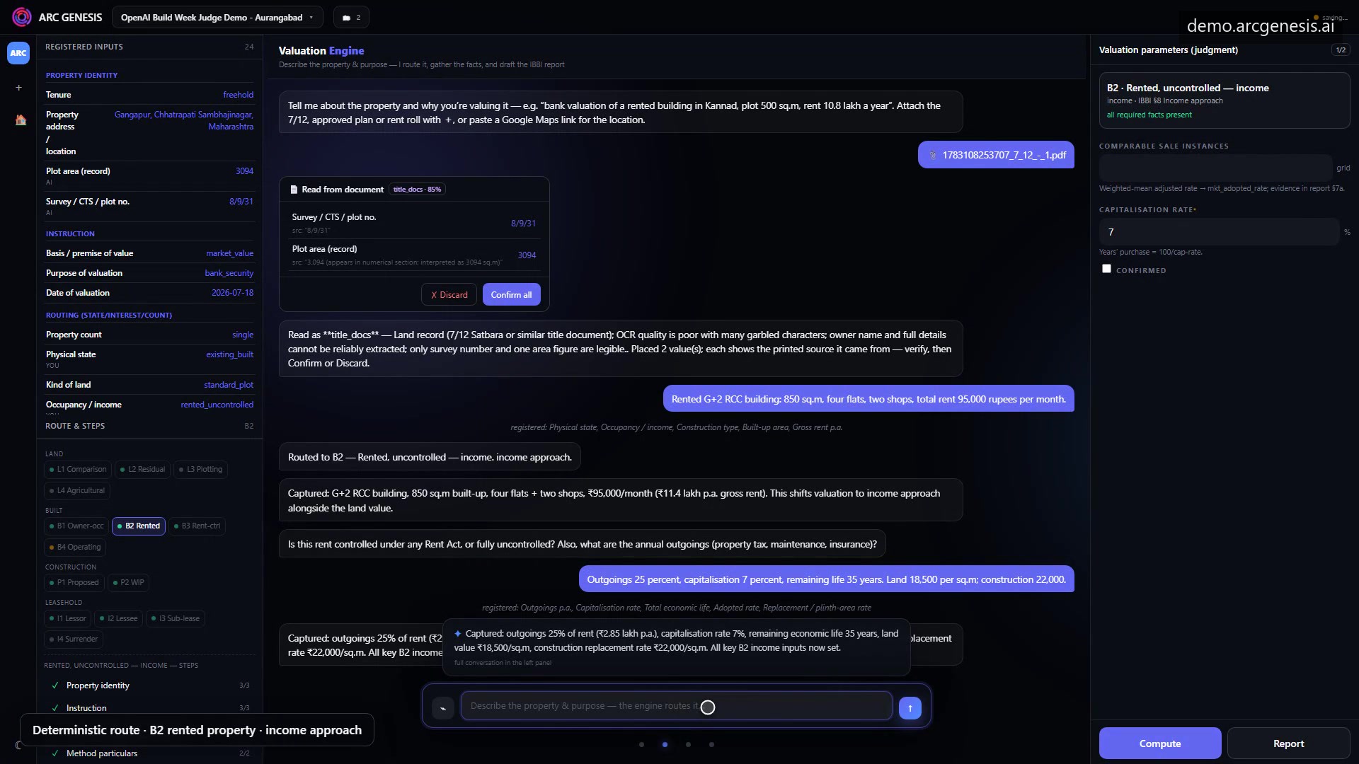
Valuation routes a case to the appropriate method from its IBBI syllabus‑mapped coverage (10 implemented, 3 partial) and produces the full computation: rates, assumptions, method and result, as an inspectable draft that a registered valuer verifies and signs.
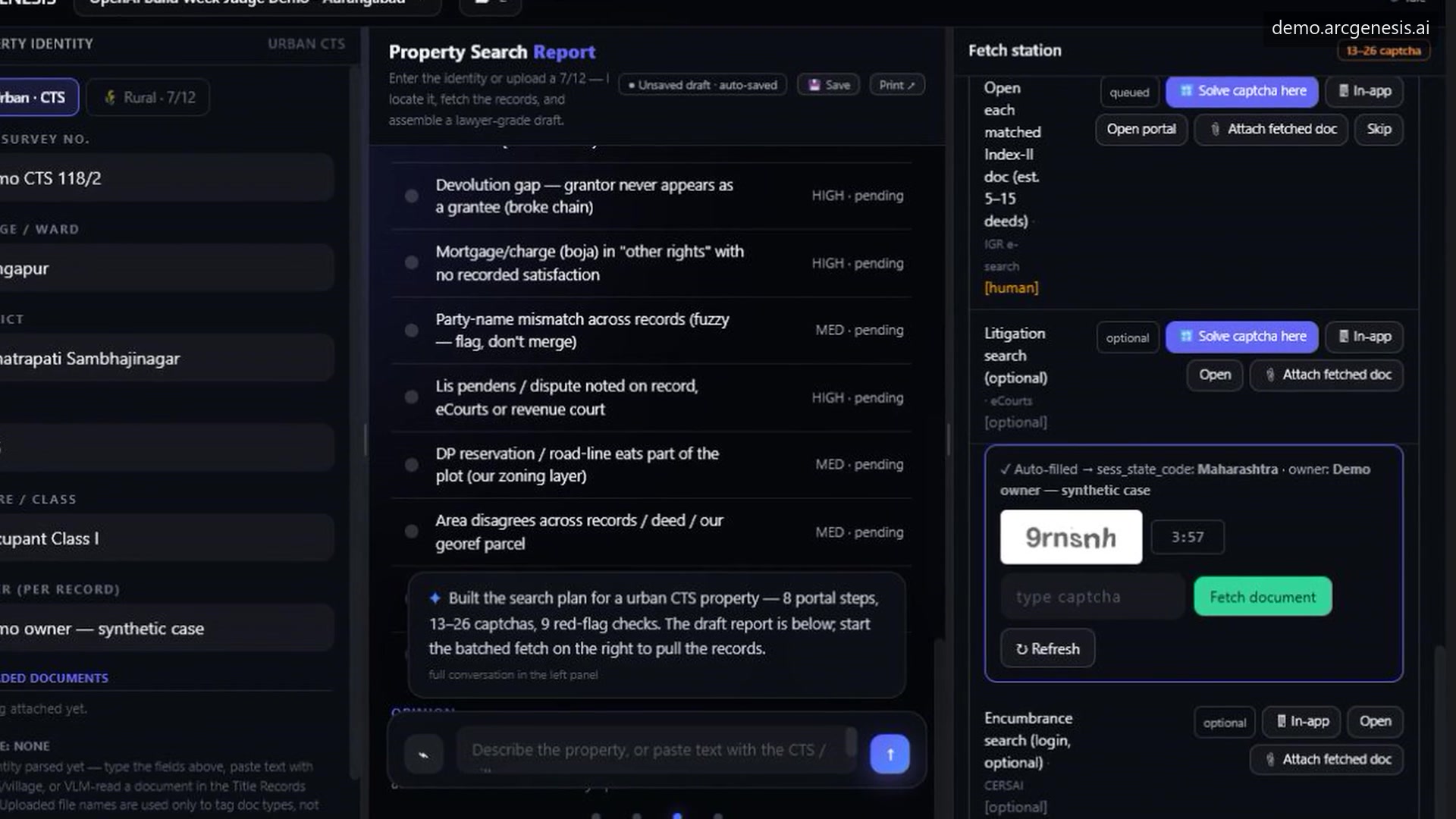
Property Search prepares the search across rural 7/12 and urban Property Card systems, carries the property identity through the process and brings the user to the correct government checkpoint. The human completes that step.
Arc AI carries the conversation and documents, and reads shared project state through tools. At runtime it runs on OpenAI GPT-5.6. It gathers facts and explains results, and it hands every calculation to the engine that owns it.
How we built it
The technical challenge was not simply to place an AI chatbot over these processes. Land decisions have legal and financial consequences. A language model may help a person describe a property, read a document or understand the next step, but it should not quietly become the planning authority, registered valuer or title lawyer.
We therefore had to separate conversation from authority. The conversational layer gathers facts and makes the workflow approachable. Deterministic engines perform the planning calculations, valuation mathematics and structured checks. Every important output must remain inspectable, and uncertainty must remain visible.
Government portals created another boundary. CAPTCHAs, OTPs and paid records are not technical inconveniences to be bypassed. They represent deliberate human or institutional checkpoints. ARC GENESIS prepares the search and brings the user to the checkpoint, but the human completes it.
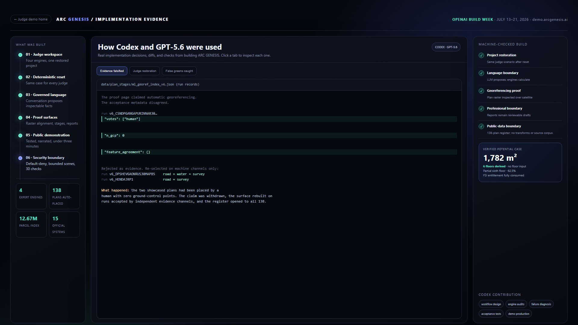
The project was built from scratch in about two months by a small team pairing two coding agents, Codex with GPT-5.6 and Claude Code, with the architects supplying the domain rules, source records, professional judgment and the acceptance standard. During Build Week, Codex designed workflows, audited the engines, diagnosed failures to the actual offending object, hardened the public judge boundary, wrote the acceptance tests and helped produce the judge demonstration itself. At runtime, the shipped product runs Arc AI and its vision path on GPT-5.6, with automatic fallbacks so the demo never goes dark.
Challenges we ran into
Georeferencing presented a real difficulty. Indian planning maps do not follow one consistent visual language. Roads may be drawn as black boundaries on one plan, grey ribbons on another and red proposed lines on a third. Old plans may no longer agree with modern road networks. Dense cities can produce statistically convincing but geographically incorrect matches. We learned that one matching method cannot be trusted everywhere. A placement should be accepted only when independent evidence such as roads, water, railway lines and survey references agrees.
That rule was tested against our own work. Late in the build, our acceptance metadata showed that two plans on our proof page had been placed by a human, with zero ground control points. We withdrew the claim, rebuilt the proof on machine-confirmed runs only, and opened the full register of 138 plans so anyone can check us.
Keeping the language model out of the mathematics took discipline. Every time the assistant seemed capable of answering directly, we reminded ourselves that a citizen acting on a wrong number loses real money. The boundary held.
And we have not solved every land process in India. Our strongest current evidence and operational coverage are in Maharashtra. Some records remain offline, some planning data is incomplete and every professional report still requires verification and responsibility from the qualified person who signs it.
Accomplishments that we're proud of
Our achievement is to make a fragmented process substantially more understandable, efficient and auditable without pretending that professional or legal responsibility has disappeared.
Concretely: 138 Development and Regional Plans placed automatically across 21 districts, with the best residual at 2.4 metres, every placement inspectable. A Site Potential engine that derives the floors instead of asking for them. A valuation whose entire computation is visible. A property search that respects the checkpoints the state built. And one workspace where a single real parcel travels through all of it, behind a public judge demo that anyone can reset and test.
We are also proud of what we withdrew. The honest register matters more to us than the impressive claim it replaced.
What we learned
We learned that the greatest problem is not always the absence of information. Often the information already exists, but it is fragmented across maps, regulations, records and portals that were never designed to work together.
We also learned that simplicity for the user requires considerable complexity behind the interface. A person should be able to describe a plot in ordinary language. Behind that conversation, however, the system must distinguish supplied facts from assumptions, identify the correct planning route, calculate permissible built-up area, derive a suitable floorplate and determine how many floors are needed to consume that potential.
We learned that transparency is more valuable than a confident answer. A valuation becomes credible when the method, rates, assumptions and computation are visible. A property search becomes useful when it shows which records have been obtained, which checks remain pending and where human verification is required. A georeference becomes defensible when the original planning raster can be inspected over satellite imagery and the evidence supporting the placement is disclosed.
Most importantly, we learned that AI is most useful here when it reduces the distance between a person and a difficult system. It can help citizens express what they need, help professionals organise evidence and help both understand the consequences of the available information. The final authority must still remain with the applicable regulation, government record and responsible professional.
What's next for ARC GENESIS — India's Land Intelligence Workspace
ARC GENESIS does not promise to remove Indian bureaucracy with one interface. It offers a practical beginning: bring the scattered information together, explain it in ordinary language, calculate through inspectable rules, preserve human checkpoints and return valuable time to citizens and professionals.
Two research fronts remain. Georeferencing every planning map in India, so that no citizen has to guess where a planning line falls on their land. And encoding the building regulations of every Indian jurisdiction into deterministic engines that anyone can query. The goal has not changed. A citizen should be able to understand their own land.
Built With
- claude
- codex
- gpt-5.6
- leaflet.js
- node.js
- openai-api
- php
- postgresql
- python
- pytorch

Log in or sign up for Devpost to join the conversation.