-
-
-

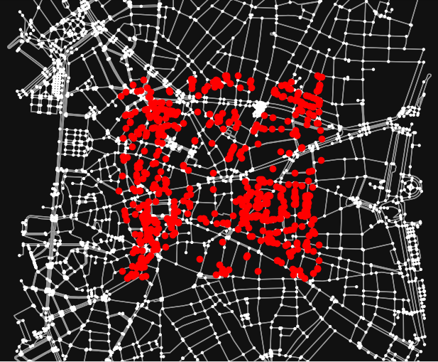
Map Data (Madrid Spain)
-
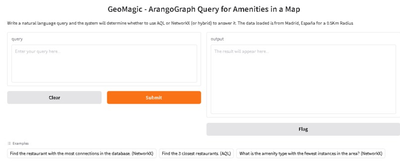
User Interface
-
-
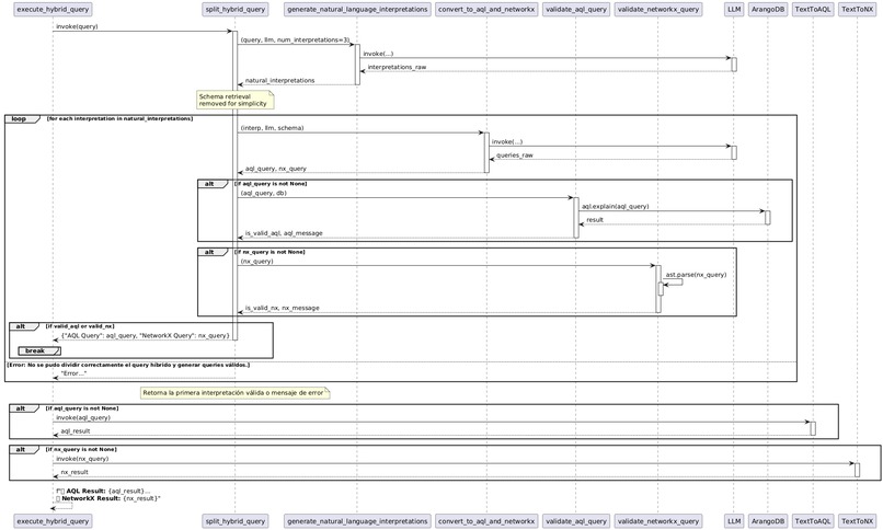
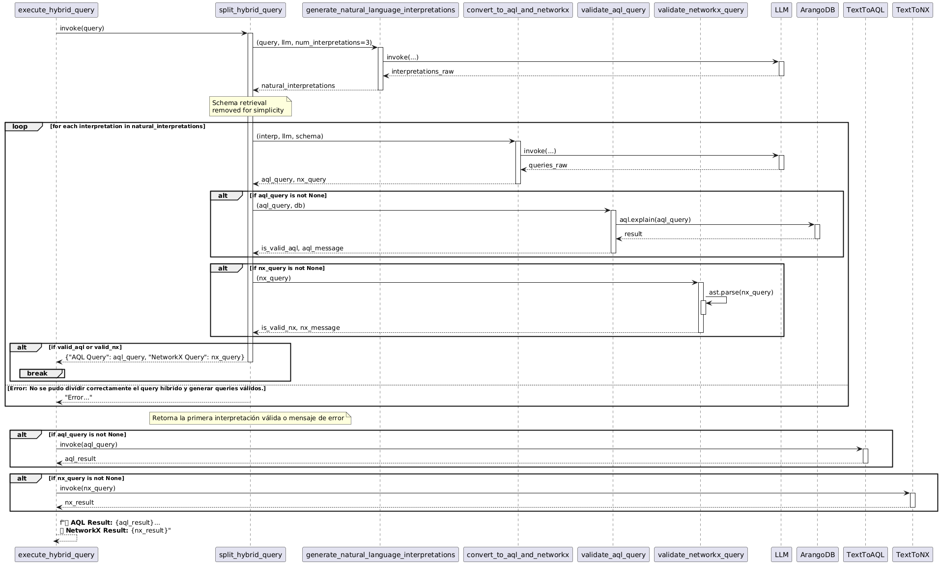
Secuence Diagram For Hybrid Query Tool


Inspiration
While researching into the potential of AI agents for a local institution here in the Dominican Republic, I received a DevPost email about this hackathon. The timing was perfect! The challenge aligned directly with my research, and honestly, the chance to upgrade my computer with a prize didn't hurt. 😉 It felt like the ideal opportunity to test my ideas in a real-world setting, and I was genuinely excited to see what I could build in this focused and competitive environment.
What it does
This tool transforms map data into actionable insights by analyzing business density and proximity. It goes beyond simple navigation, uncovering patterns that reveal underserved areas and prime locations for new ventures. Essentially, it turns location data into a catalyst for opportunity
How we built it
Building this project involved overcoming several key challenges. First, we had to find effective ways to extract and process relevant data from map sources. Second, we needed to design AI agents that could accurately interpret and respond to user queries. To address these challenges, we conducted thorough research, experimented with various libraries and techniques, and iteratively refined our prompts and workflows. We also spent significant time testing and validating our solution to ensure it met our performance and accuracy goals.
Challenges we ran into
Key challenges included developing accurate query routing, ensuring LLM-generated query syntax was correct, and guaranteeing repeatable and valid results. We overcame these obstacles through robust classification, retry mechanisms, and rigorous data validation.
Accomplishments that we're proud of
First, i'm really proud of the intelligent query routing system, that sends the user question to the correct query engine(AQL, NetworkX, Hybrid). Also, the successful implementation of the Hybrid tool, which splits and recombines results from the AQL and NetX parts and to see the idea came to life by getting the data os OSMX, put it in a Arango Graph Database and use it for a very practical purpose with great potential.
What we learned
Learned a lot About Langchain, Prompts, Knowledge Graphs and NetworkX. I didn't know that multimodal databases exist until i test ArangoDb. Very Cool!
What's next for ArangoGraph Geo X-ray
Looking ahead, ArangoGraph Geo X-ray will expand its capabilities to provide even more precise and user-driven insights. We will introduce custom dataset integration (from any location), enabling users to analyze their own specific data. We will also refine the query classifier to improve its accuracy, and implement interactive feedback loops to ensure the system evolves with user needs. A comprehensive logging system will be integrated to capture user interactions and provide data for continuous system improvement.
Built With
- arangodb
- langchain
- openai
- python


Log in or sign up for Devpost to join the conversation.