-
-
-
Dashboard
-
Dashboard & Risk Analysis
-
Inspection Priority
-
SHAP Explanation
-
Dhaka Observatory
-
Bangladesh Demo
-
Cross-Region Evaluation
-
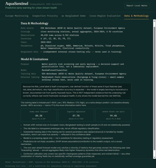
Data & Methodology
-
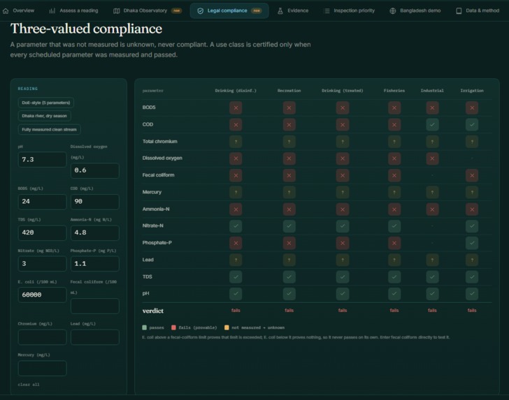
Legal Compliance
-
Report
-
-
Inspiration
Bangladesh is a river-rich country in South Asia, yet many of its rivers face serious pollution and declining water quality. For me, this is more than a dataset or a hackathon problem-I grew up in a country where communities depend on these rivers every day.
That led me to the One Health perspective behind AquaSentinel: polluted water does not affect people alone. It also threatens fish, aquatic ecosystems, livelihoods, and the communities that depend on them.
The Buriganga and Turag, two rivers flowing through Dhaka and declared Ecologically Critical Areas in 2009, kept coming back to me. Years later, extremely low dissolved-oxygen levels can still occur during certain periods. That raised a bigger question: is the river getting worse, what might be driving the change, and where should limited monitoring resources be focused?
A simple hackathon project could answer “safe or unsafe?” But Bangladesh does not need AI to tell us that some rivers are polluted. The harder problem is turning scattered water-quality data into trends, predictions, and actionable monitoring priorities.
That question became AquaSentinel. The system starts with European water-quality data, then tests its assumptions against Bangladesh's own river records. That cross-region comparison is not a side experiment-it is central to the project.
What it does
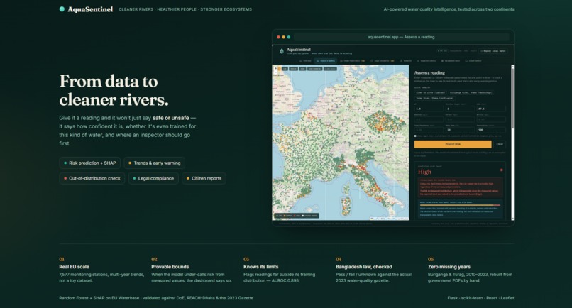
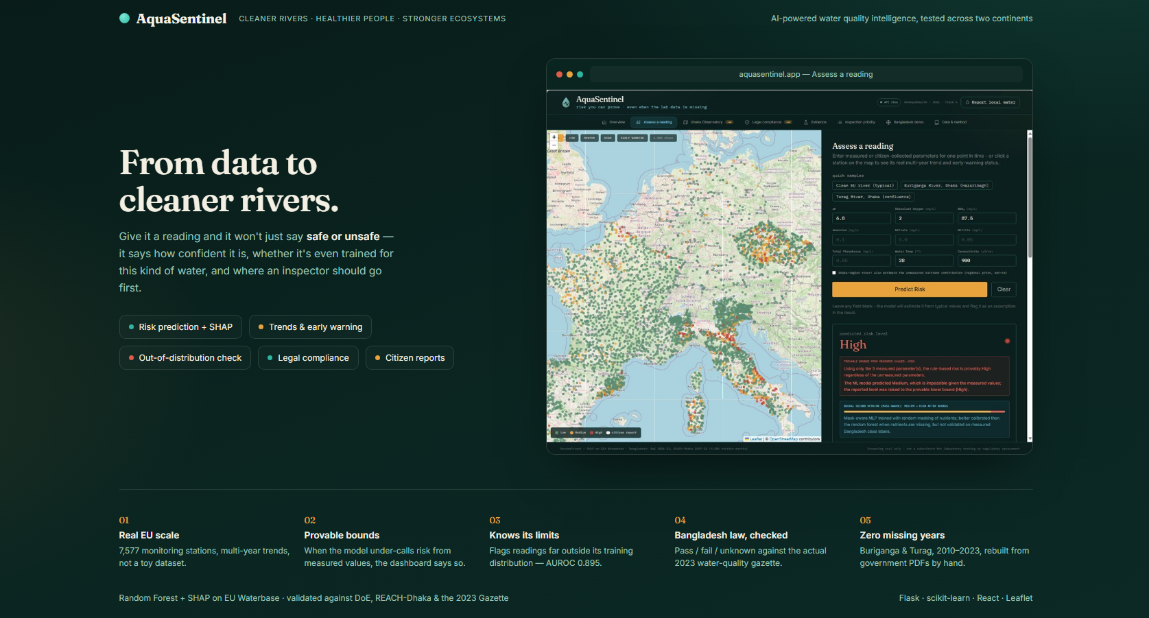
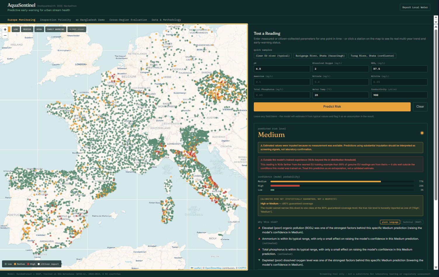
In one sentence: give it a water reading, and it doesn't just say "safe" or "unsafe" - it tells you how confident it is, whether it's even trained for this kind of water, and where an inspector should go first.
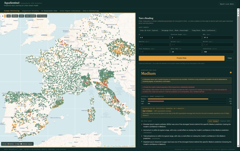
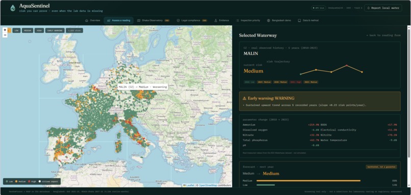
- Predicts Low/Medium/High risk and explains why in plain language (SHAP), not just a label.
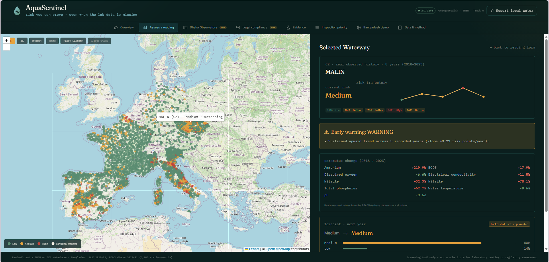
- Tracks real multi-year trends across 7,577 European monitoring stations, flags
NORMAL → WATCH → WARNING → CRITICALwith specific reasons attached. - Forecasts next year's risk, backtested only on years the model never saw.
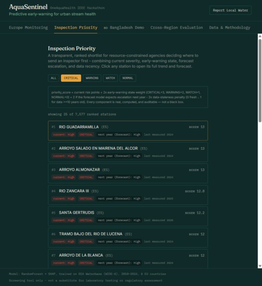
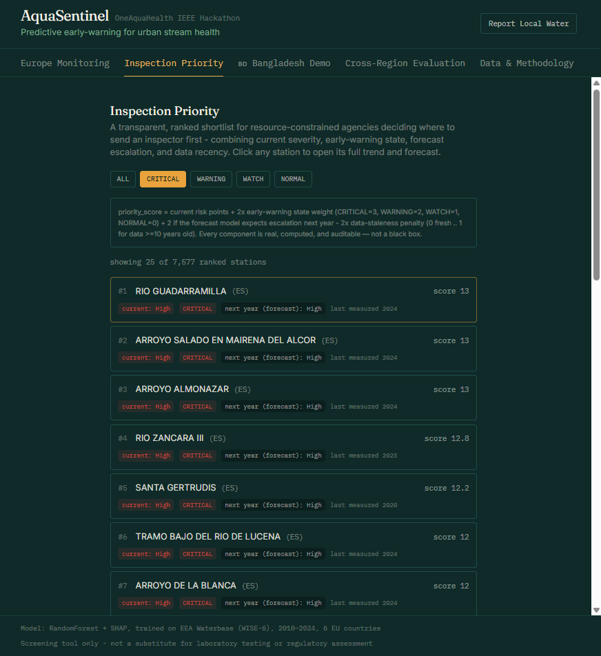
- Ranks stations by inspection priority - a list of 200 alerts isn't the same as "go here first."
- Knows when it's out of its depth (out-of-distribution check) and gives a statistically backed confidence range instead of a fake-precise number.
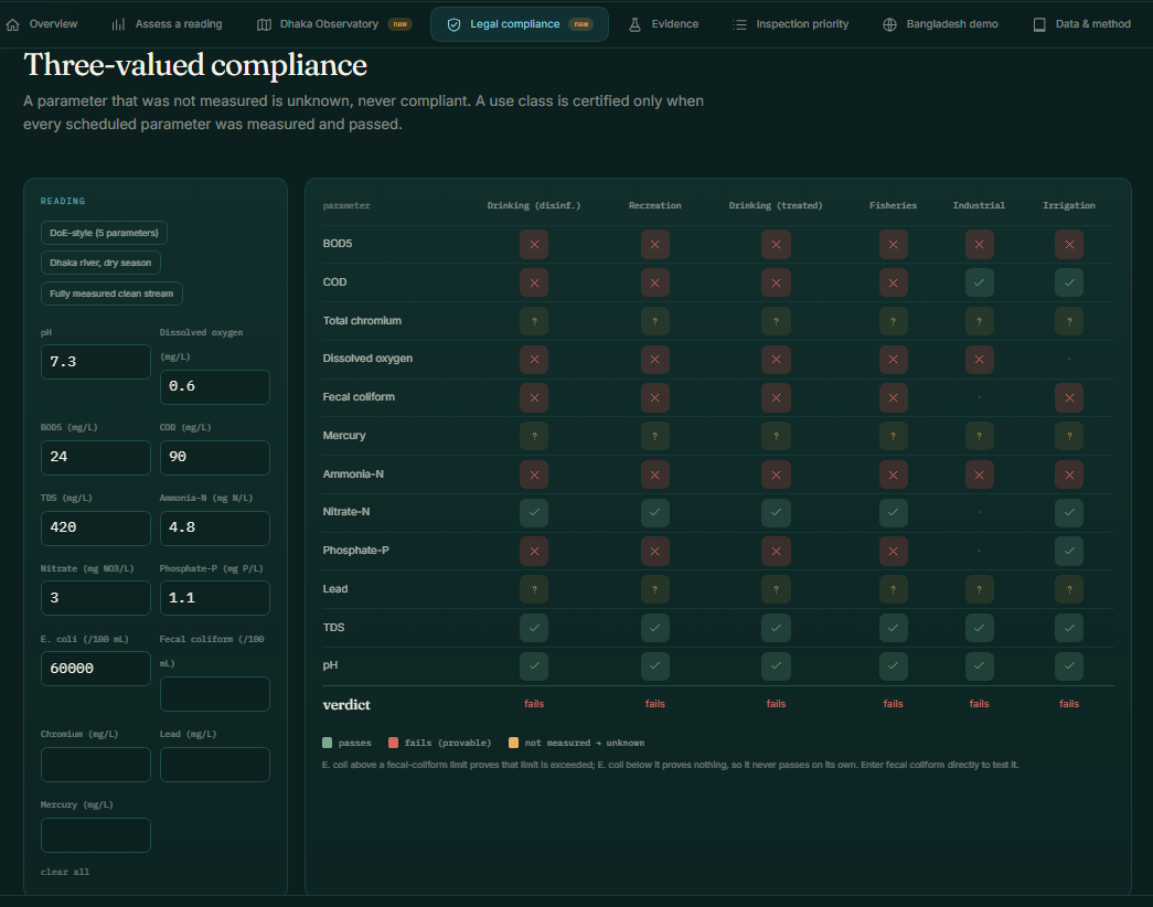
- Checks a reading against Bangladesh's actual 2023 water law, pass/fail/unknown - never silently assumes compliance when a parameter wasn't measured.
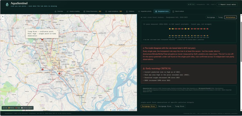
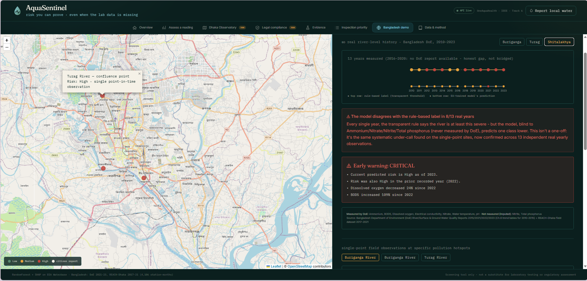
- Runs on real Buriganga, Turag and Shitalakhya data - 41 river-years, 2010–2023, zero missing years for Buriganga/Turag.
- Lets nearby residents report what they see (foam, smell, visible pollution) - built to be compatible with a citizen-science pipeline, not a lab result.
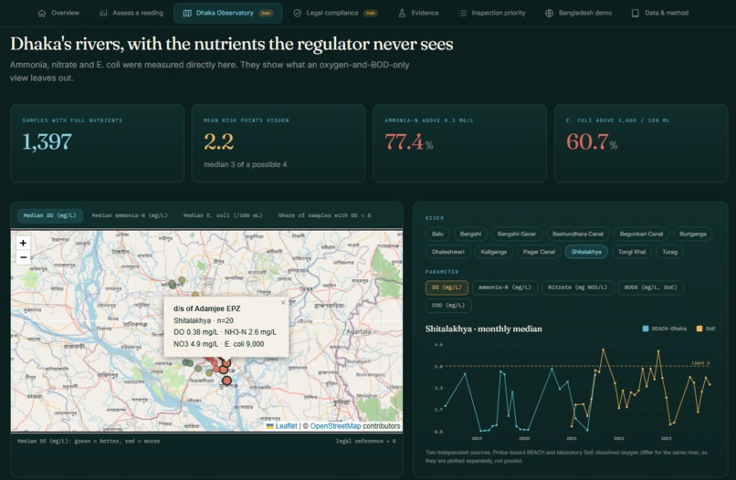
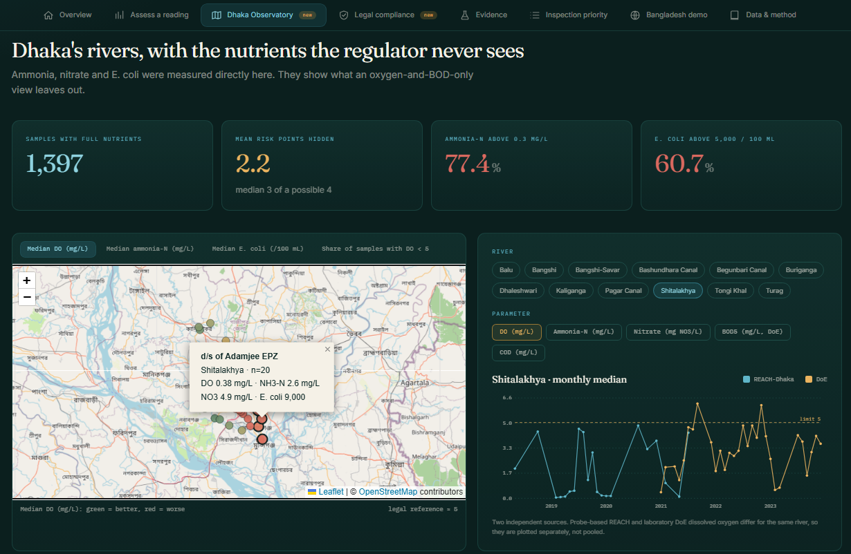
- Interface: one dashboard, eight focused tabs - assess a reading, browse the live Dhaka map, check legal compliance, see the evidence behind every number - built to be understandable by a non-technical environmental officer, not just a data scientist.
How we built it
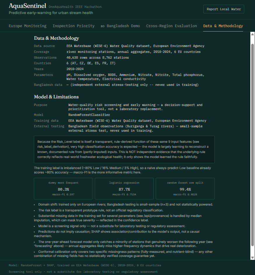
It grew one question at a time. Random Forest on the EU's Waterbase dataset (~40,000 station-year records, 6 countries) + SHAP for explanations. Then: does a station's situation change over time? → a real multi-year early-warning system. Then: can we predict where it's headed? → a one-year-ahead forecaster, tested only on transitions it never saw during training.
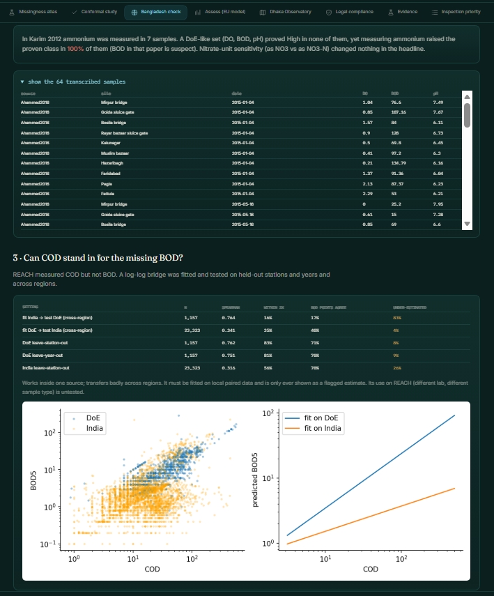
Then we ran it on Bangladesh data - and that's where the project actually changed direction (see below). We merged three independent Bangladesh sources into one evaluation dataset: DoE's own government reports (2010–2023), a University of Oxford field-monitoring campaign (REACH-Dhaka, 2017–2021, GPS-located), and the 2023 Bangladesh Gazette for the current water law. We added a mask-aware neural network as a second opinion, and a regional model that estimates likely nutrient levels when they weren't directly measured.
Stack: Flask, scikit-learn and SHAP on the backend, React, Leaflet and Tailwind on the front. Everything traces back to one Jupyter notebook we treat as ground truth - if a number's on the dashboard, it came from a notebook cell, not from us typing something that sounded right.
Challenges we ran into
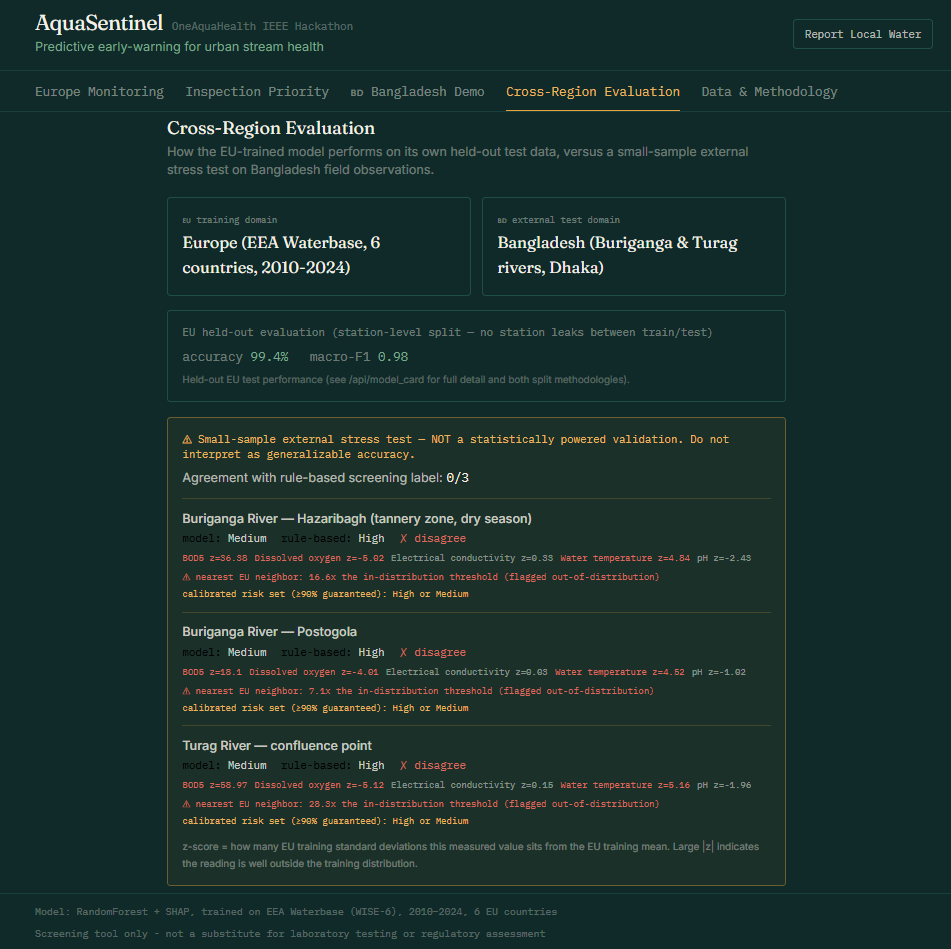
The real challenge wasn't a bug - it was our model being consistently wrong on Bangladesh data, and figuring out whether that was real or noise.
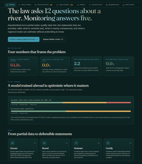
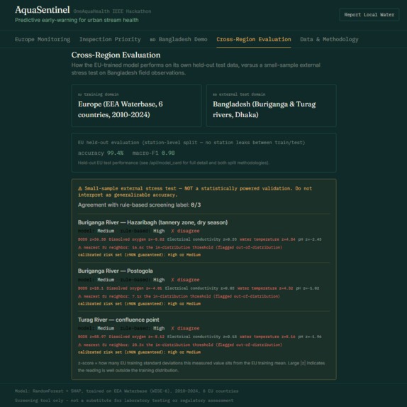
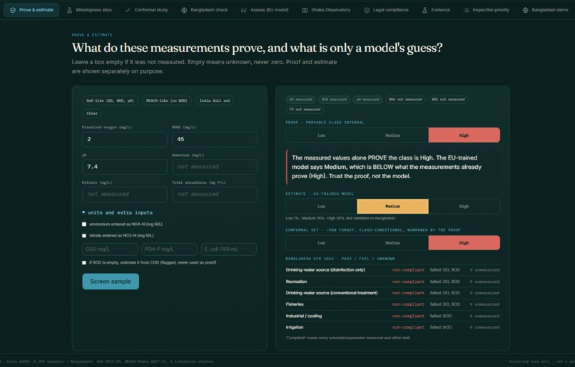
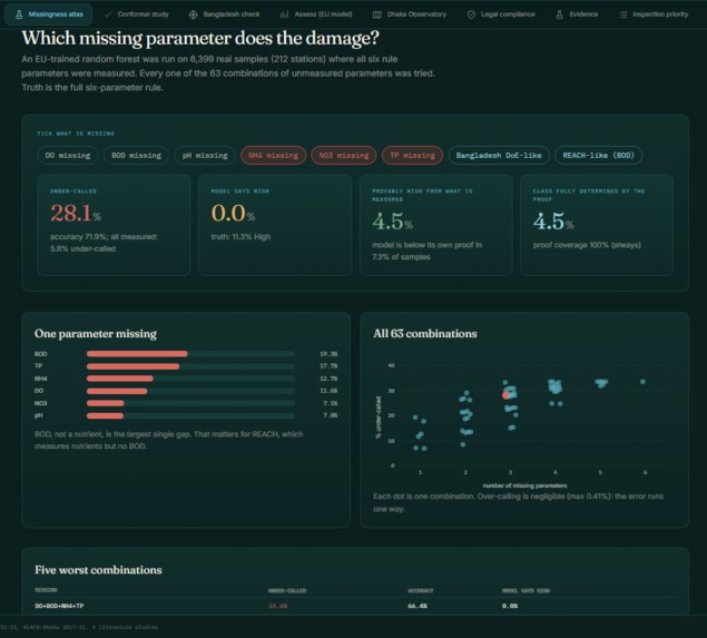
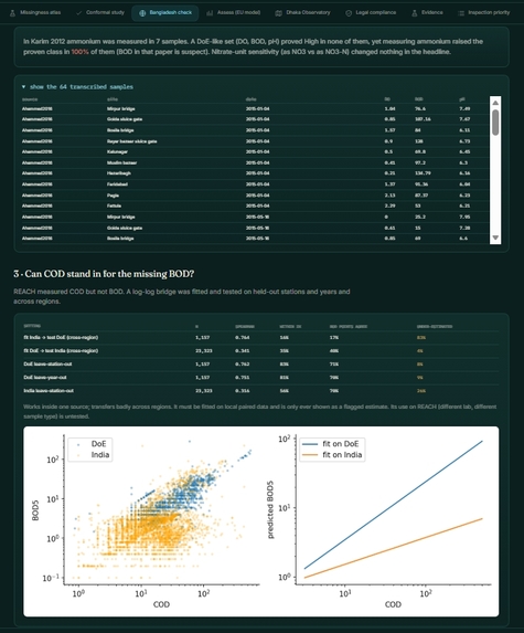
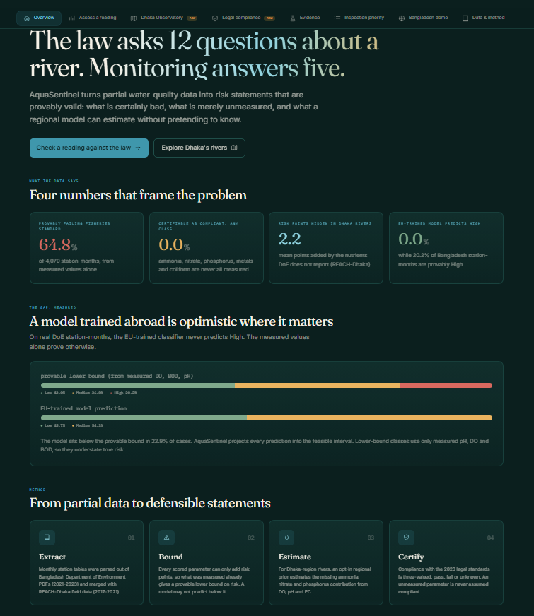
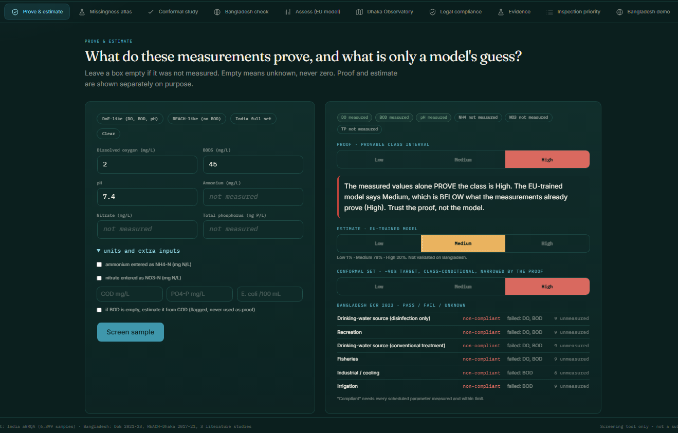
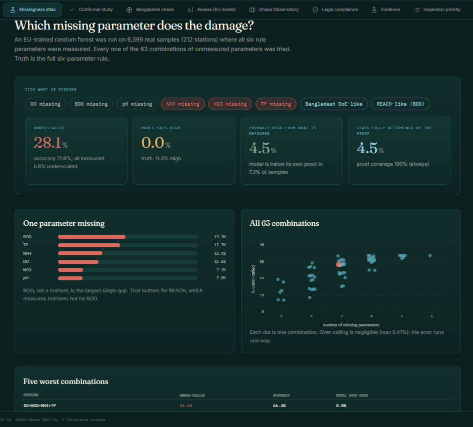
Across dozens of real Bangladesh river-years, the model kept predicting Medium while a plain threshold rule said High most of the time. Digging in: Bangladesh's monitoring program doesn't measure some of the nine parameters we trained on in most years - and those parameters can only push risk up, never down. So missing them makes the model structurally too optimistic. Not random - systematic, and explainable once we saw it.
Standard uncertainty tools didn't catch this either. Conformal prediction is supposed to give a statistically guaranteed confidence level - it still silently failed, claiming 90% while actually landing around 84%. We had to calibrate separately by which measurements are actually available.
Sourcing was its own fight. Our first Bangladesh data was three single-point readings with fuzzy "compiled from published studies" sourcing. We weren't comfortable standing behind that, so we pulled real numbers, table by table, out of seven Bangladesh government PDF reports (2010-2023) - including one that exists only as a scanned image with no text layer, where we had to read the trend tables directly off the page - plus the Oxford field dataset and the water-law gazette.
And yes, a completely mundane bug: our basemap provider quietly started requiring a paid API key and served "API KEY REQUIRED" watermark tiles instead of a map. Took an embarrassingly long time to notice.
Accomplishments that we're proud of
Naive uncertainty calibration breaks quietly under a real missingness gap; calibrating for the actual missing pattern fixes it - statistically confirmed (p < 10⁻⁶), never made things worse.
We pushed this further than a two-scenario demo. On a 2,070-station-month, 28-river evaluation, we compute a mathematically guaranteed lower bound on risk from only the measured parameters - since unmeasured parameters can only add risk points, never remove them. The model violates that guaranteed floor in roughly 1 in 4 cases, and our out-of-distribution flag predicts exactly those violations at AUROC 0.895.
We found Bangladesh's own current water-quality law (2023) already sets thresholds close to what we'd built from EU regulation - so we built a full pass/fail/unknown compliance checker directly against it.
And we closed a real data gap ourselves rather than just disclosing it: one government report existed only as a scanned image; we read its 2016 trend tables directly off the page. Buriganga and Turag now have zero missing years, 2010–2023.
It's a real, working app - eight tabs, a tested API, a notebook that reproduces every number on the dashboard - not a slide deck describing what we'd build with more time.
What we learned
Being accurate isn't the same as being trustworthy, especially across regions. A model that's 99% accurate at home can quietly mislead somewhere else - and the failure is often systematic enough to find and fix, if you bother to look.
The data you need usually already exists - sitting in a government PDF (sometimes a scanned one) nobody's turned into a dataset yet. Bangladesh alone has 405 named rivers; the environment agency's own lab network actively samples only about 8% of them. That gap is the whole reason a prioritization tool like this matters - and it's a monitoring-resource problem shared by many countries in the Global South, not just Bangladesh.
And being upfront about what our system doesn't do well made the parts we are confident about land harder, not softer.
What's next for AquaSentinel
- Get the parameters still genuinely unmeasured everywhere we've looked (Nitrite, Total phosphorus) for Bangladesh, to see whether the under-prediction actually closes once the data exists.
- Independently re-verify the gazette-read legal thresholds with Bangladesh's Department of Environment before treating them as a citable legal reference.
- Teach the early-warning system to tell "been bad for years" apart from "just started getting bad" - right now both look identical to it.
- Connect directly with OneAquaHealth's own Citizen Science App and Resilience Map, so the inspection-priority layer and citizen reports plug into the wider ecosystem instead of standing alone.
- Test whether the missingness-aware calibration fix generalizes outside Bangladesh - a fair question for any monitoring-scarce country in this hackathon's audience.
- Write this up properly for peer review - limitations and all.
Built With
- artificial-intelligence
- bangladesh-doe
- css3
- deep-learning
- flask-api
- forecasting
- html5
- javascript
- machine-learning
- react
- shap-explainability
- tailwindcss
- urban-stream-health
- water-quality


Log in or sign up for Devpost to join the conversation.