-
-
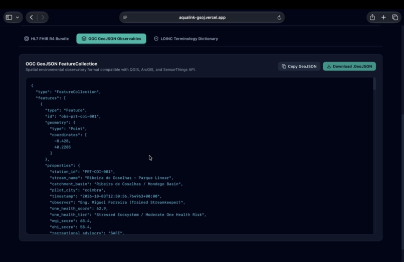
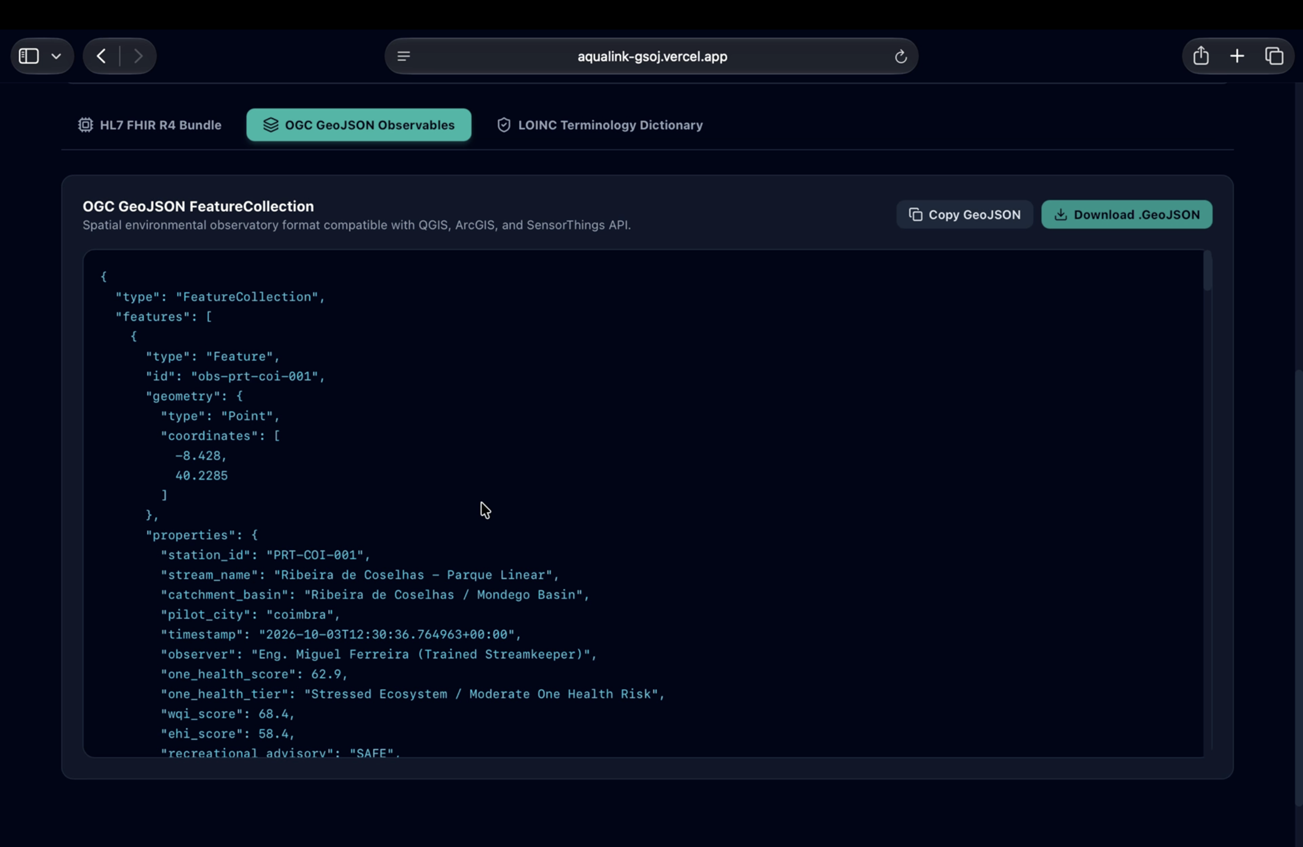
OGC GeoJSON FeatureCollection view providing native spatial data interoperability for GIS platforms and remote sensing workflows.
-
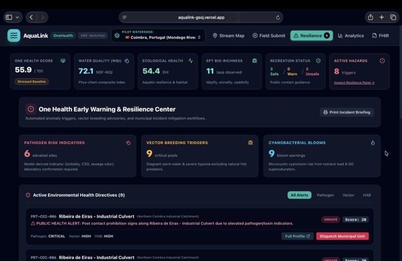
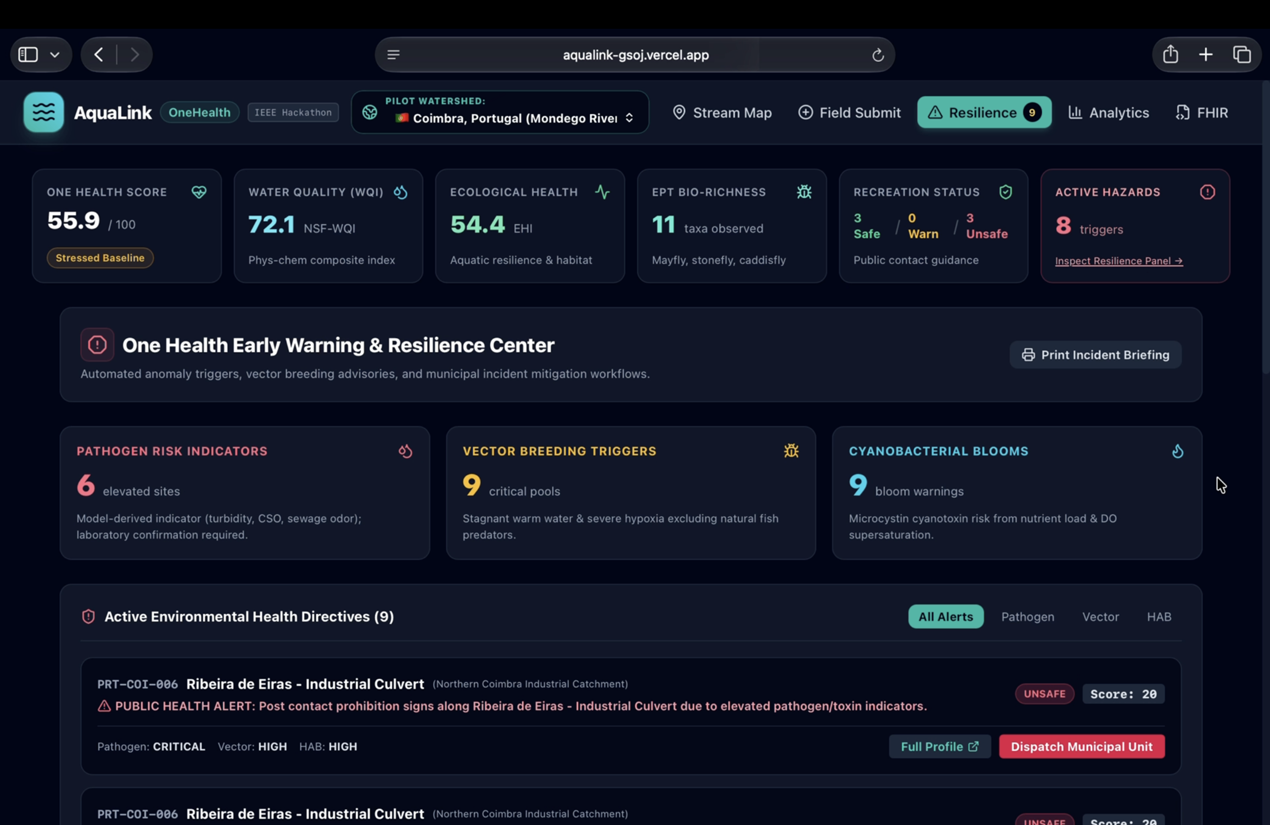
One Health Resilience Center surfacing pathogen indicators, vector-breeding triggers, and one-click municipal intervention dispatches
-
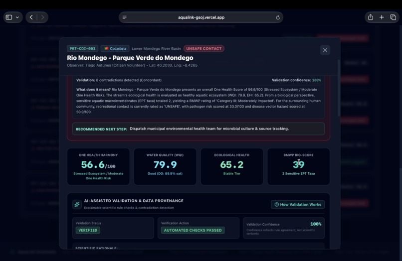
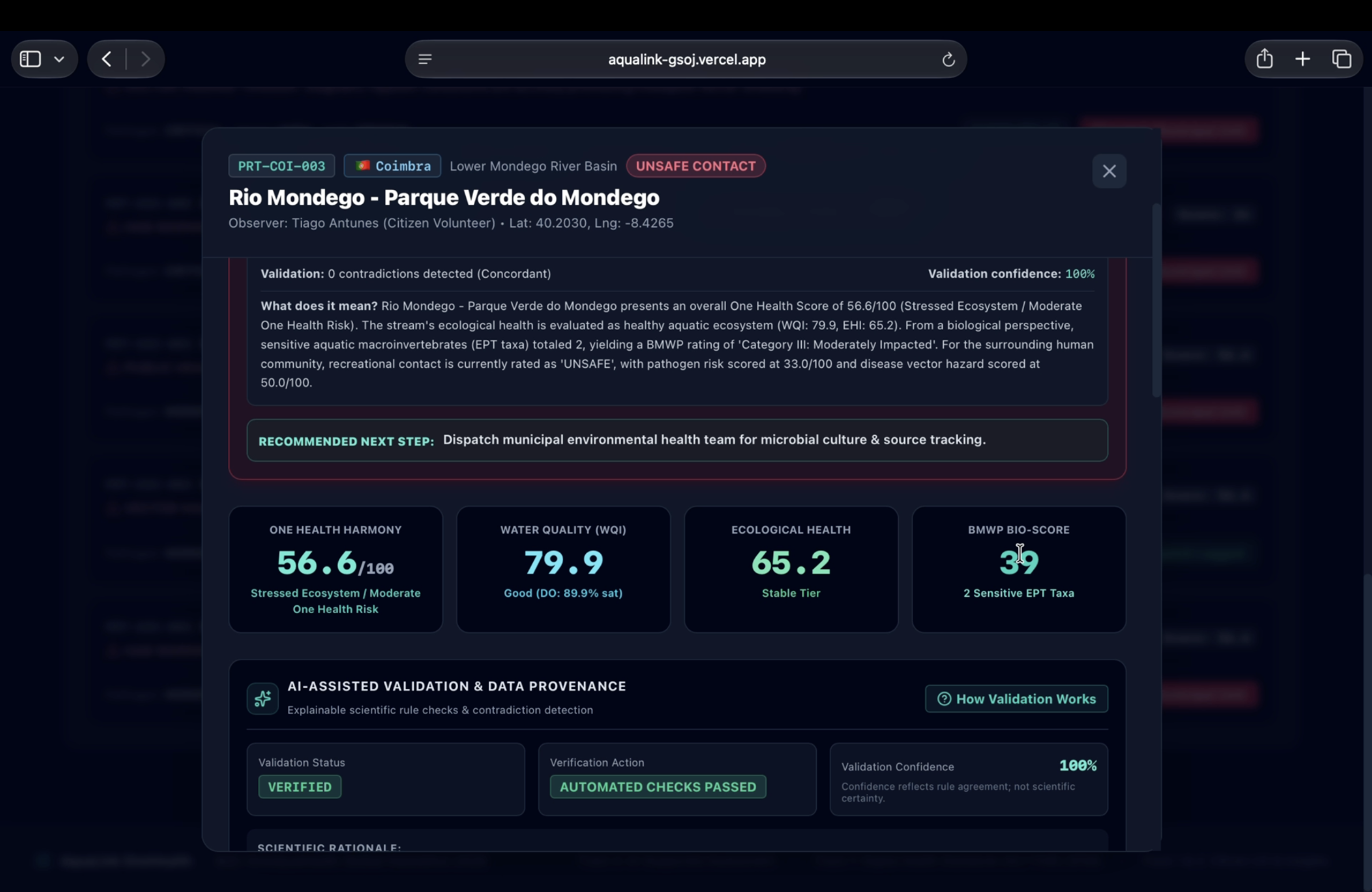
Station profile modal breaking down One Health harmony, WQI, BMWP bio-scores, and automated municipal next-step intervention guidance.
-
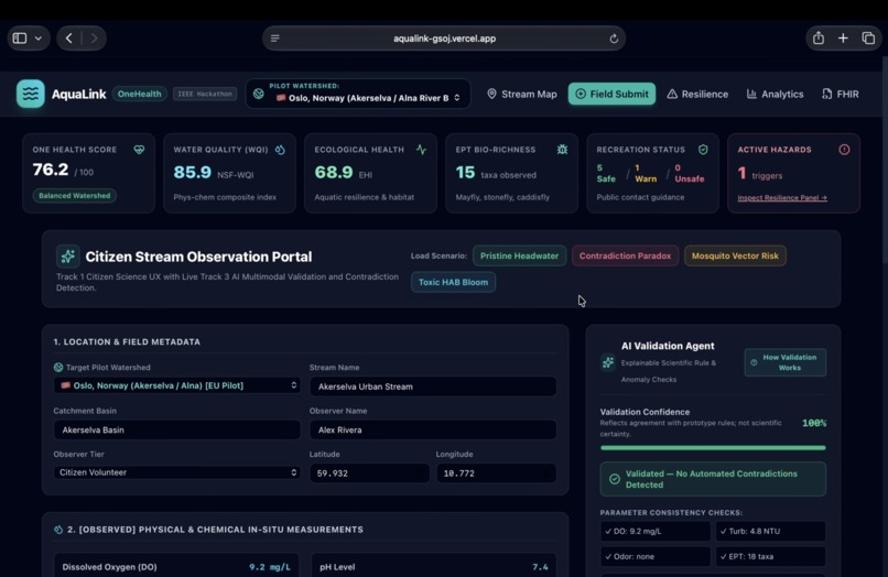
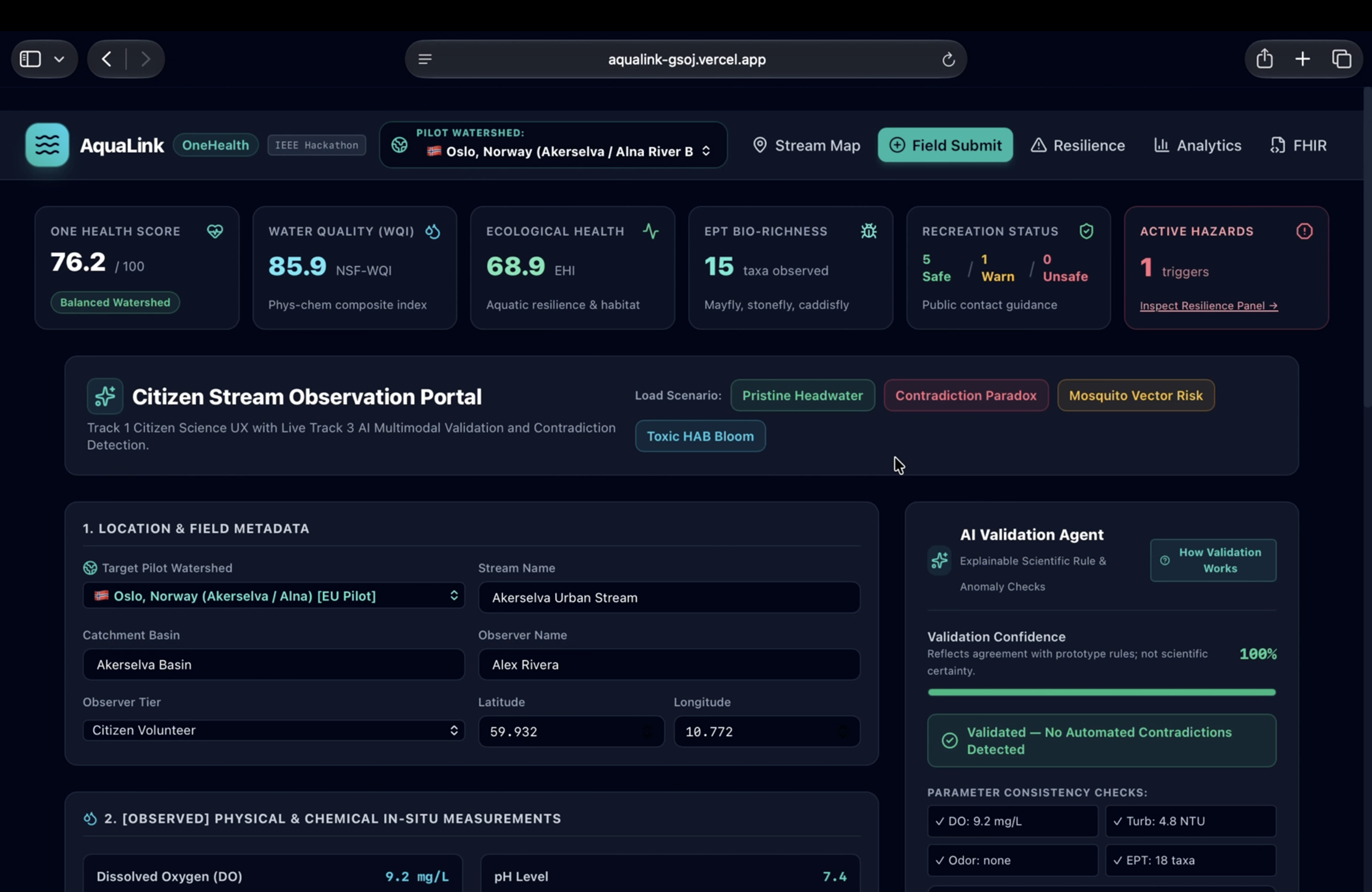
Citizen observation portal featuring real-time AI validation and contradiction checks across in-situ probe readings and bio-indicators.
-
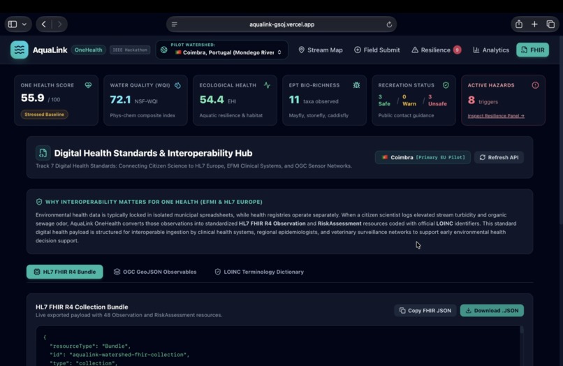
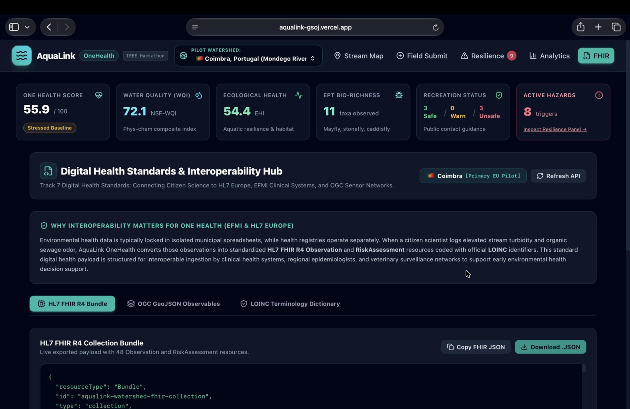
Digital Health Interoperability Hub exporting live stream data as an HL7 FHIR R4 Collection Bundle coded with official LOINC standards
-
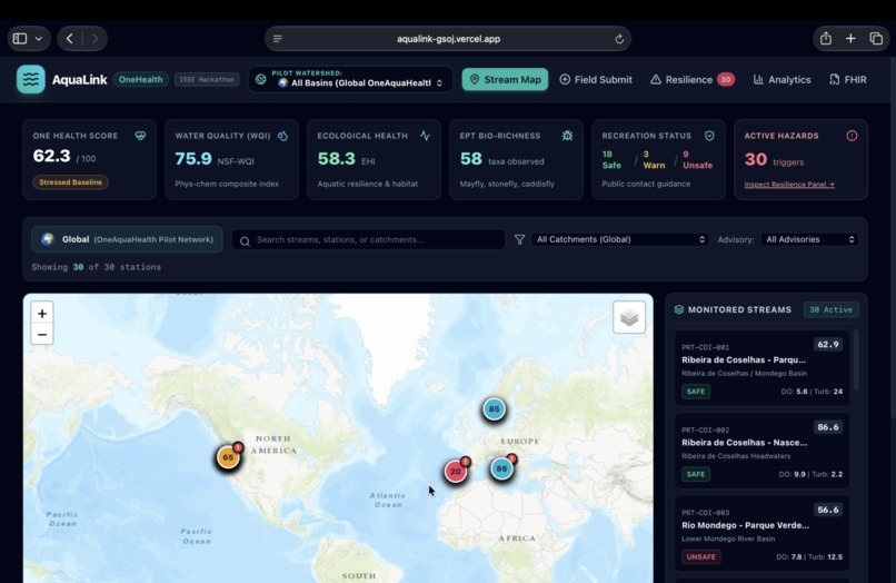
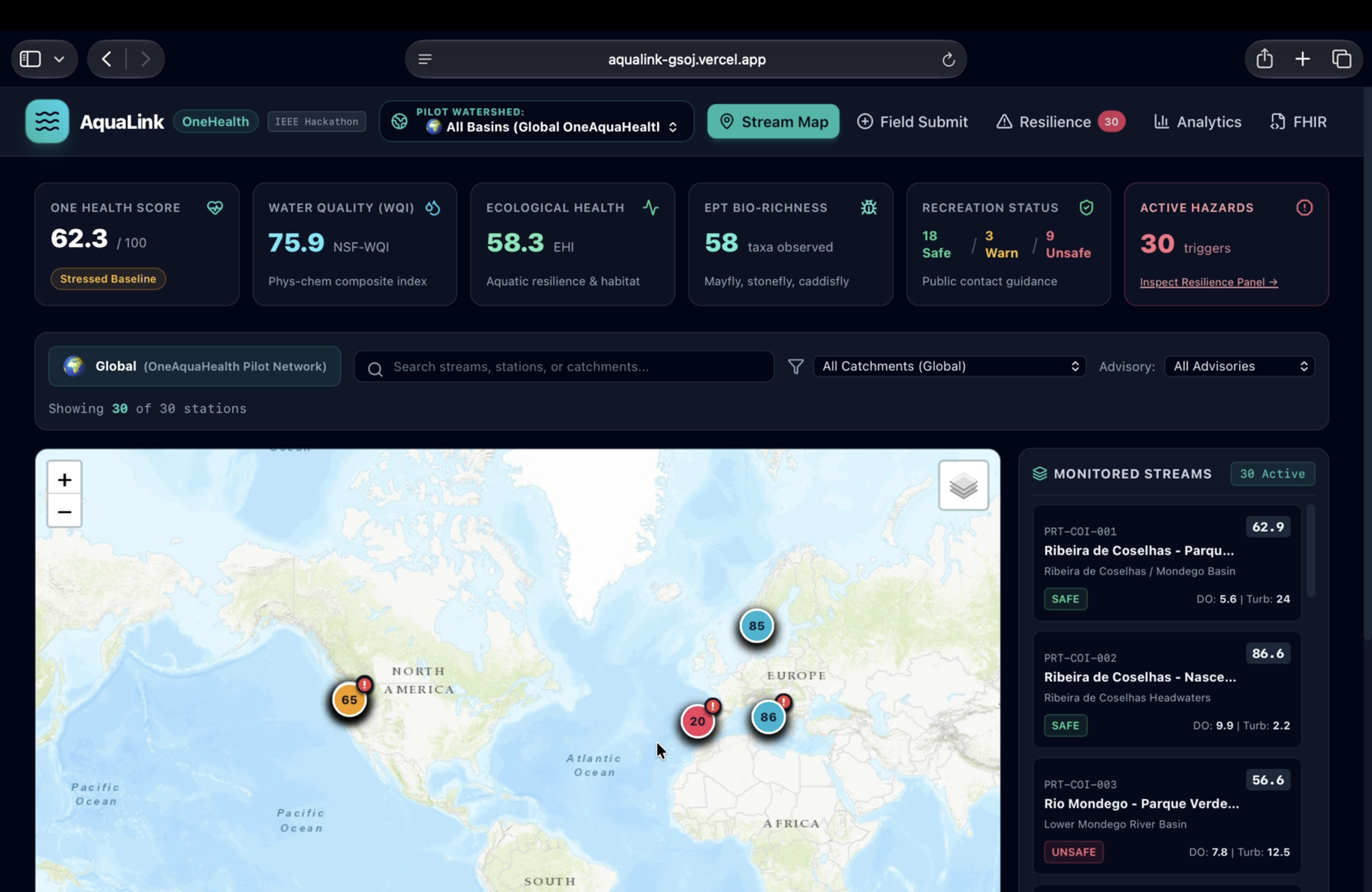
Live pilot watershed map showing real-time One Health scores, WQI, EPT bio-richness, and public contact advisories across active stations.
Inspiration
AquaLink was inspired by a simple problem: people can observe changes in urban streams, but those observations do not always become useful information for environmental or public-health decision making.
Citizen observations can be valuable, but they may contain contradictions or incomplete information. At the same time, water quality, ecological health, biodiversity, and public-health risks are often considered separately.
We wanted to build a system that connects these pieces into one One Health workflow.
What We Built
AquaLink turns citizen stream observations into validated ecosystem-health signals, public-health risk indicators, and actionable early warnings.
The platform includes:
- 🧑🤝🧑 Citizen Science — guided stream observation and field submission
- 🤖 AI-Assisted Validation — detects contradictions and explains why an observation is flagged
- 🌊 Water & Ecological Assessment — WQI, ecological health, and EPT bio-richness indicators
- ⚠️ One Health Risk Indicators — recreation, pathogen, vector, and environmental hazard signals
- 🚨 Early Warning & Resilience — translates validated signals into actionable response information
- 🗺️ Geospatial Monitoring — interactive stream and watershed mapping
- 🔄 Interoperability — HL7 FHIR R4 and OGC GeoJSON support
One of our key demonstrations is the Contradiction Paradox scenario. It combines observations that do not agree with each other, allowing AquaLink to detect the inconsistency, explain the reason, and flag the case for human review rather than automatically declaring the citizen observation false.
This human-in-the-loop approach reflects our belief that AI should support scientific assessment, not replace human judgment.
How We Built It
AquaLink uses a React + TypeScript + Tailwind CSS frontend and a FastAPI backend.
The backend provides the API, validation logic, environmental calculations, One Health indicators, early-warning logic, and interoperability endpoints. The frontend provides the citizen submission workflow, interactive dashboard, maps, resilience interface, and FHIR/GeoJSON views.
We developed the system locally and then deployed the frontend and backend separately on Vercel, creating a publicly accessible working prototype.
The project also incorporates environmental assessment approaches including WQI, BMWP, Hilsenhoff Biotic Index (FBI), dissolved oxygen calculations, and One Health composite indicators.
What We Learned
Our biggest lesson was that building an AI-assisted environmental system is not just about producing a prediction.
The system needs to explain why something was flagged and communicate uncertainty clearly.
We learned that citizen science becomes more useful when observations can be checked for contradictions while still keeping humans involved in important decisions.
We also learned the importance of interoperability. Environmental monitoring should not exist in isolation, so using standards such as HL7 FHIR R4 and OGC GeoJSON can help connect environmental observations with digital-health and geospatial workflows.
Challenges We Faced
One of our main challenges was designing validation that could identify meaningful contradictions without automatically rejecting citizen observations.
We addressed this by using explainable validation rules and human-review flags.
Another challenge was combining different dimensions of stream health. Water chemistry, ecological indicators, biodiversity observations, recreation guidance, and environmental hazards each tell a different part of the story.
We therefore designed AquaLink to show these signals individually while also providing a broader One Health view.
Finally, deploying the complete application required connecting a React frontend to a separate FastAPI backend while keeping both local development and production deployment working correctly.
The Vision
AquaLink is built around a simple progression:
Observe → Validate → Understand → Act
Our vision is to help communities and environmental and public-health teams move from:
Seeing a problem in the water
Understanding what it means and what should happen next.
AquaLink aims to make citizen observations more useful, environmental intelligence more actionable, and urban freshwater monitoring more connected to One Health.
Built With
- fastapi
- hl7-fhir-r4
- ogc-geojson
- pydantic
- python
- react
- rest-api
- tailwind-css
- typescript
- vite

