-
-
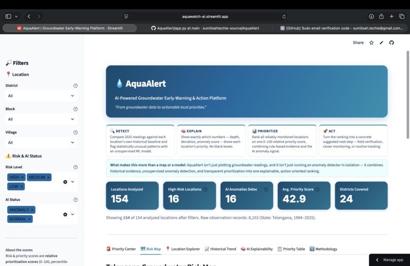
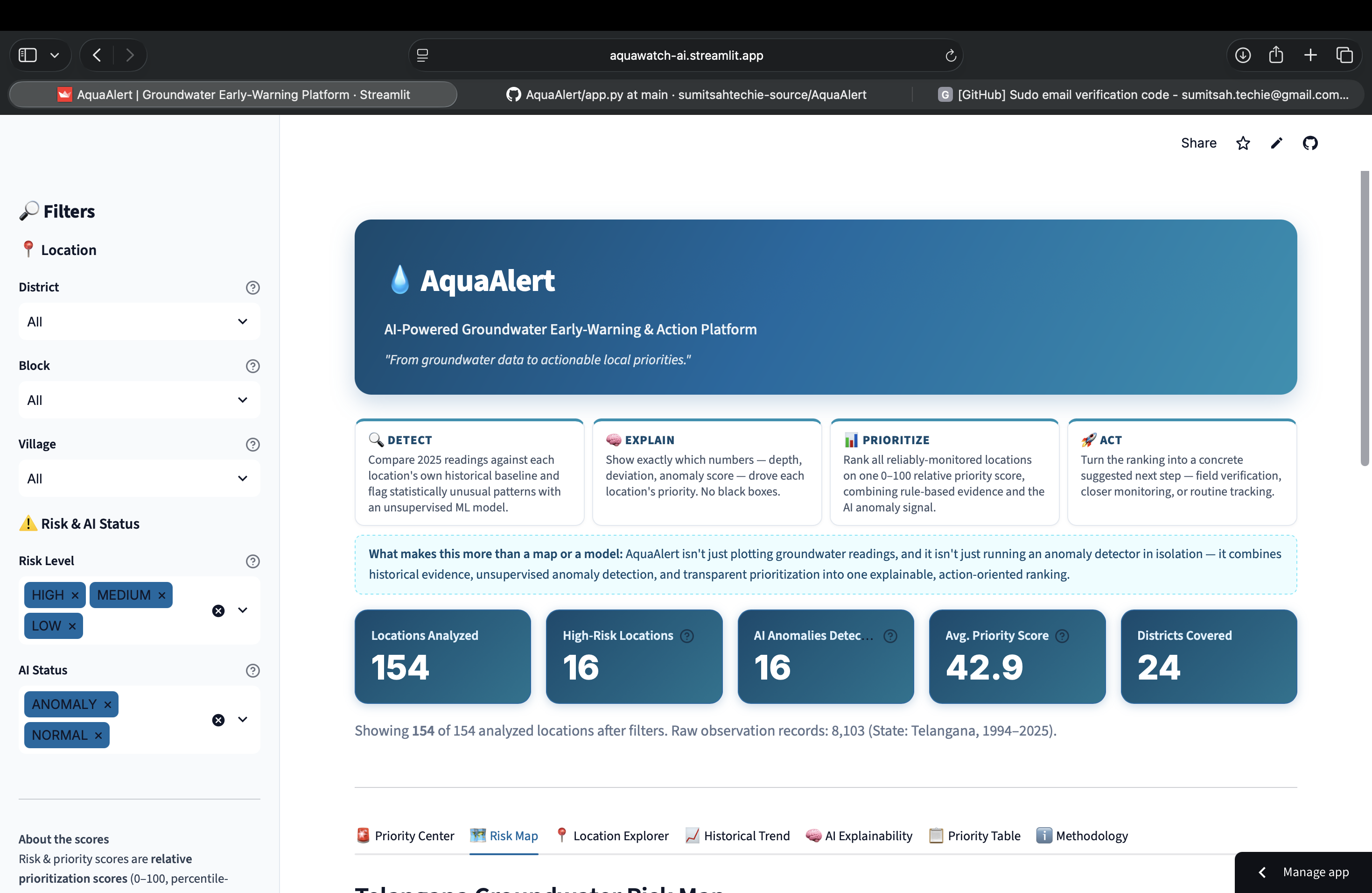
Main dashboard showing groundwater priorities, key risk metrics, AI anomalies, and the DETECT → EXPLAIN → PRIORITIZE → ACT workflow.
-
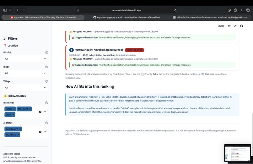
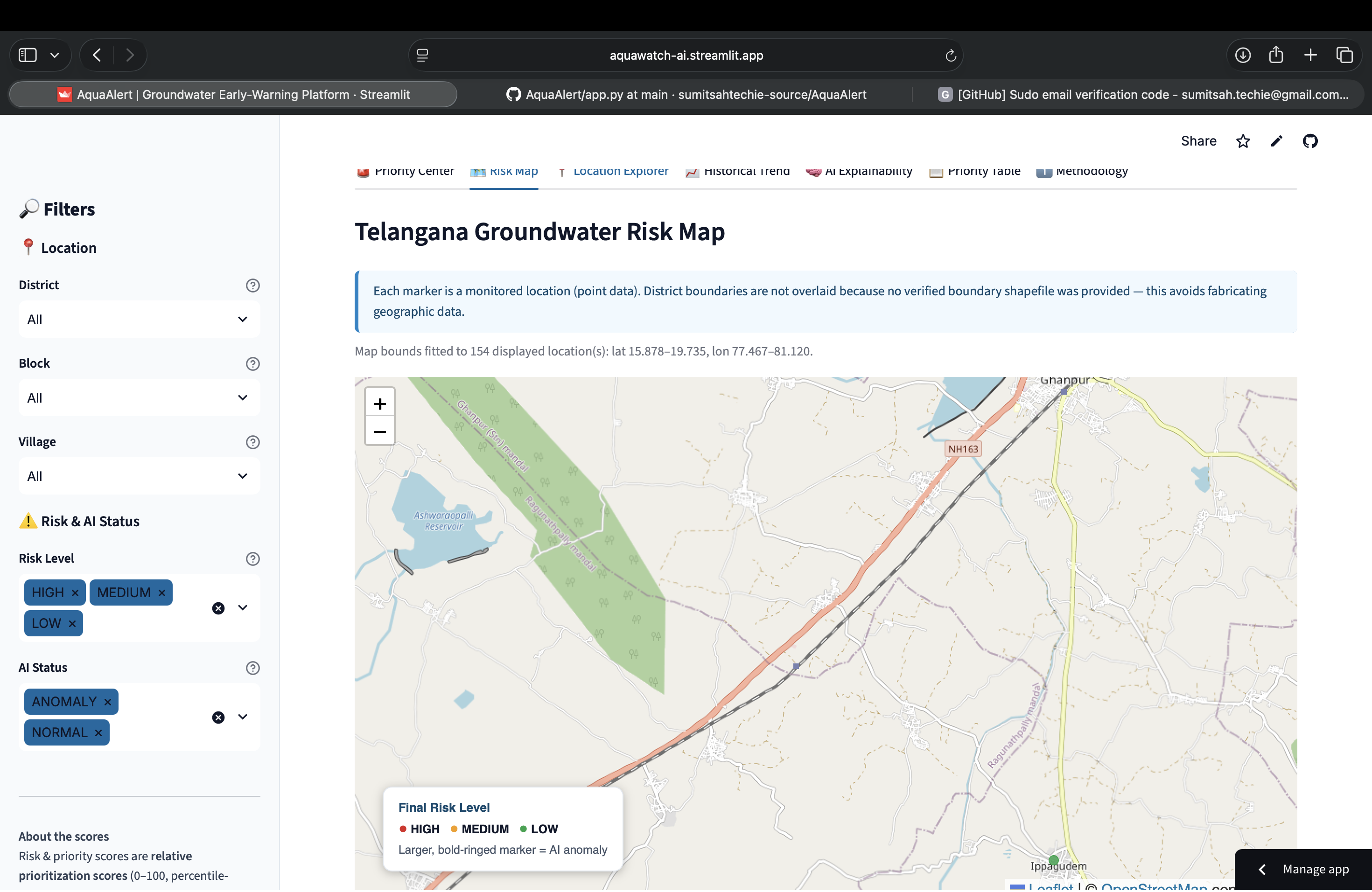
Interactive Telangana groundwater risk map showing monitored locations by priority level and AI anomaly status.
-
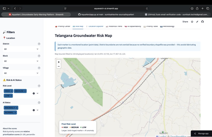
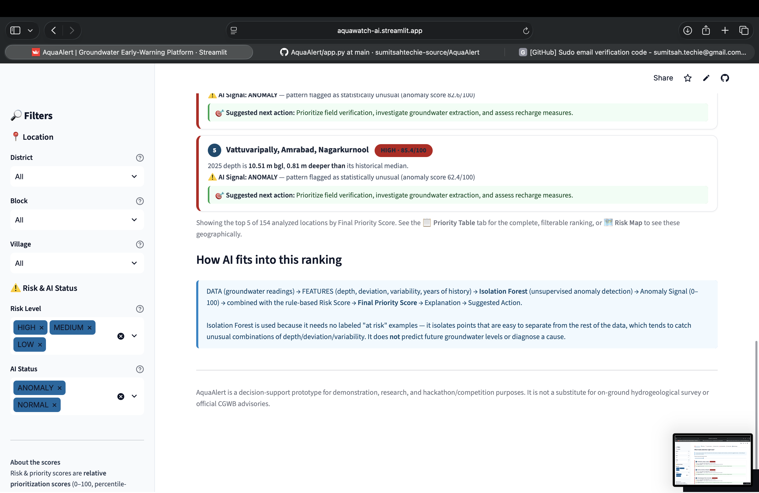
Detailed view of a prioritized location with groundwater depth, historical median, deviation, risk score, and AI anomaly score.
-
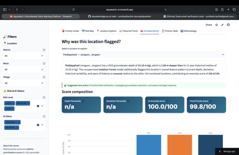
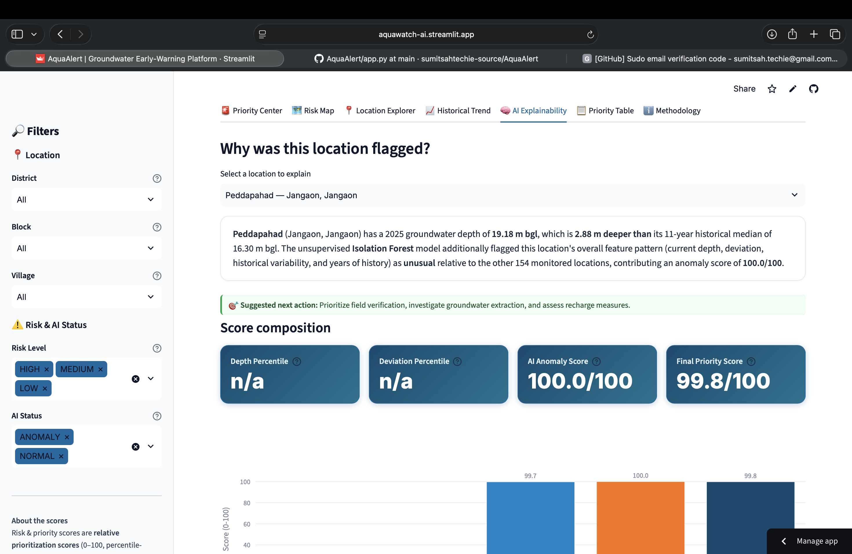
AI explainability view showing why a location was flagged and how rule-based risk and AI anomaly signals form the final priority score.
-
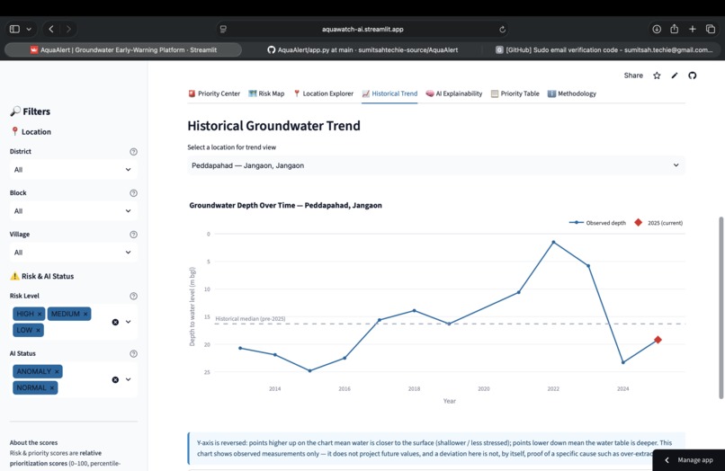
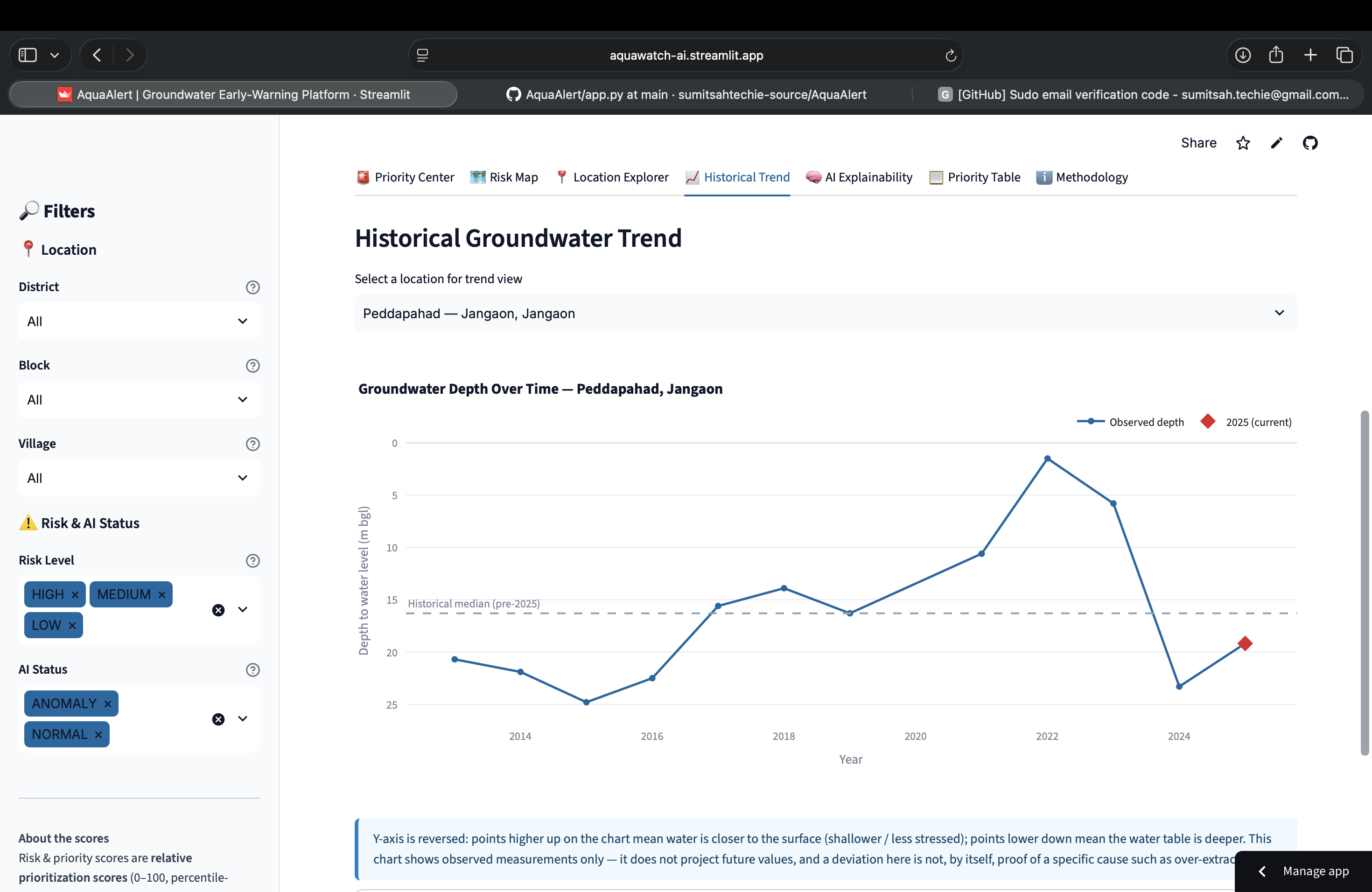
Historical groundwater trend showing observed depth over time, historical median, and the current 2025 measurement.
Inspiration
Groundwater is an important source of water for communities, agriculture, and ecosystems. However, large groundwater datasets are difficult to interpret at the local level. We wanted to build a simple system that could help users identify which locations deserve attention first instead of looking through thousands of raw observations.
This idea led us to AquaAlert, an AI-powered groundwater early-warning and action platform focused on Telangana.
What it does
AquaAlert converts historical groundwater observations into an understandable location-level priority system.
The platform follows four steps:
DETECT → EXPLAIN → PRIORITIZE → ACT
It analyzes historical groundwater-level observations and 2025 measurements to identify locations with higher relative priority.
Users can explore:
Groundwater priority rankings
AI-detected anomalies
Interactive groundwater risk maps
Location-level groundwater information
Historical groundwater trends
Explainable risk scores
Suggested actions for prioritized locations
How we built it
We used Python and Pandas to clean and analyze groundwater observations from the Central Ground Water Board.
The final analysis covers groundwater observations from 1994 to 2025. We filtered the dataset to locations with sufficient historical observations and a 2025 observation, resulting in 154 reliable locations.
A rule-based risk score was created using current groundwater depth and historical deviation.
We then used an Isolation Forest machine learning model for unsupervised anomaly detection.
The final priority score combines the rule-based risk signal with the AI anomaly signal.
The application was built using Streamlit, Plotly, and Folium with an interactive OpenStreetMap-based map.
Challenges we ran into
One of the main challenges was converting a large historical groundwater dataset into reliable location-level information.
The data contained observations across many years and locations, so we needed to clean the data, handle uneven historical coverage, and make sure that only locations with sufficient historical information were used for the main prioritization pipeline.
Another challenge was making the AI results understandable. Instead of showing only an anomaly score, AquaAlert explains the factors behind a location's priority and presents the information in a simple interface.
Accomplishments that we're proud of
We built a complete working platform that connects data analysis, machine learning, explainability, visualization, and recommended actions in one application.
AquaAlert analyzes 154 reliable groundwater locations across 24 districts and provides an interactive way to explore their relative priority.
We are especially proud of the DETECT → EXPLAIN → PRIORITIZE → ACT workflow because it turns complex groundwater data into information that is easier to understand and act upon.
What we learned
We learned that building an AI system is not only about training a machine learning model. Data quality, feature selection, explainability, visualization, and communicating limitations are equally important.
We also learned the importance of being scientifically careful with environmental data. AquaAlert uses relative priority scores and anomaly signals as indicators for further investigation rather than claiming that a location has proven groundwater depletion or predicting future groundwater levels.
What's next for AquaAlert — Groundwater Early-Warning AI
Future versions could include more frequent groundwater monitoring data, additional environmental and climate variables, stronger spatial analysis, automated alerts, and validation with domain experts.
The long-term goal is to make AquaAlert a practical decision-support platform that can help communities and monitoring teams identify groundwater locations that deserve closer attention.
Built With
- artificial-intelligence
- data-science
- data-visualization
- enviromental-monitoring
- folium
- groundwater
- machine-learning
- pandas
- plotly
- python
- scikit-learn
- streamlit
- sustainability

Log in or sign up for Devpost to join the conversation.