-

-
-
-
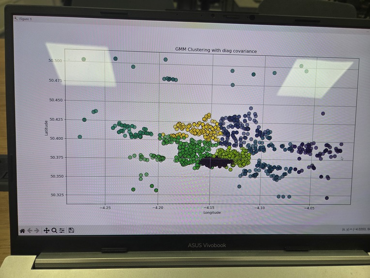
Demonstration of GMM clustering

Inspiration
Lauren mentioned the crime API in a Big Data Analytics and I thought it would be applicable to be used to improve security in a city
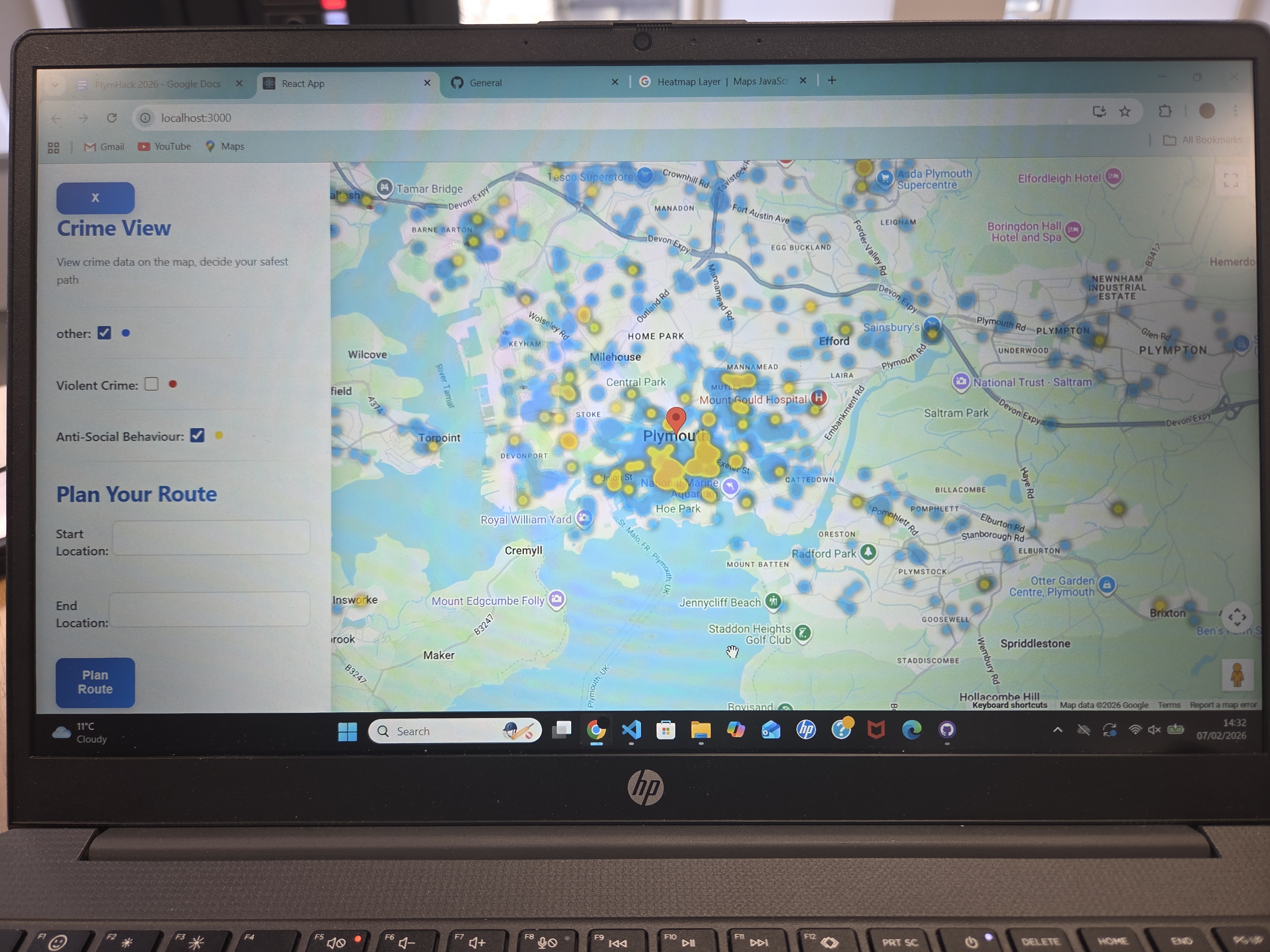
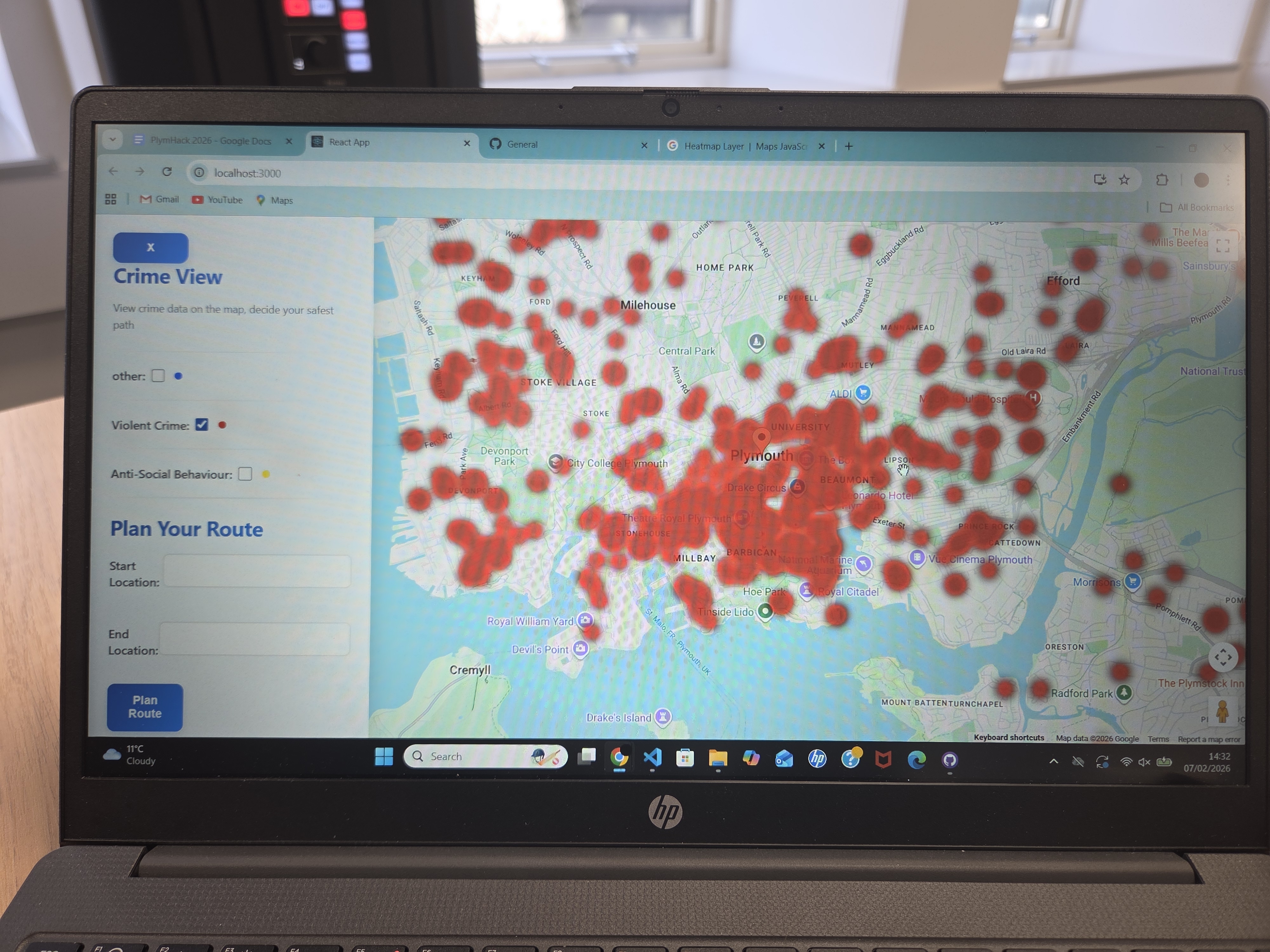
What it does
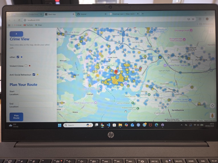
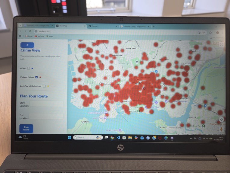
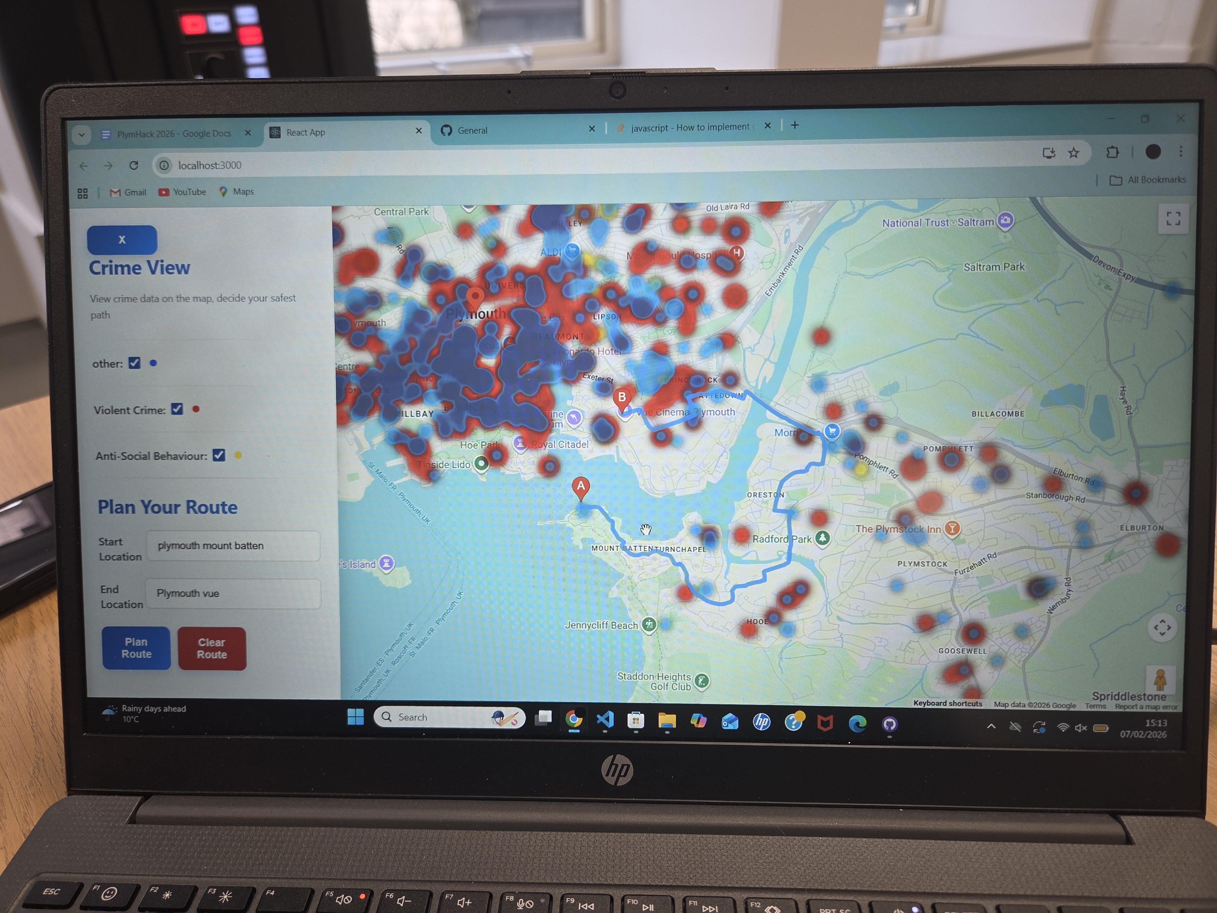
Initially, the Dataset from the crime API is cleaned and only convicted crimes from the past year are used on the application to ensure an up to date heatmap. These points are then exported to a react frontend that displays a map of Plymouth with the associated heatmap over the top.
The frontend was built using the Google maps api to display an interactable map of Plymouth. Users could toggle check boxes to filter for different crime heat maps. A navigation feature was added but unfortunately was not fully functional as it does not provide low risk paths.
How we built it
The task was split into the react portion as well as the python portion. The python section uses pandas to manage the dataset as well as scikit to display a visual clustering of the data.
Challenges we ran into
The main challenge we had was time constraints as we have had to finish the hackathon quite early. as a result, our end product isn't as polished as we would like it to be
Accomplishments that we're proud of
We are proud that we have managed to create a minimum viable product in the short amount of time we had available.
What we learned
We have learned how to integrate python in the pipeline and have further expanded our react and python skills.
What's next for Anti Crime Navigator
An option to select an option from multiple routes based on perceived route safety and route distance/time taken.

Log in or sign up for Devpost to join the conversation.