-
-
-
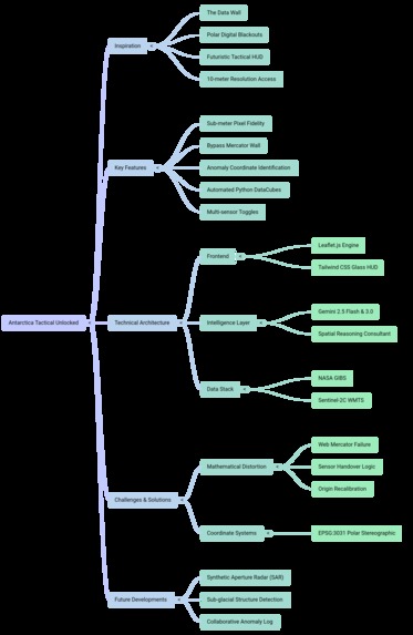
Mind Map
-
-

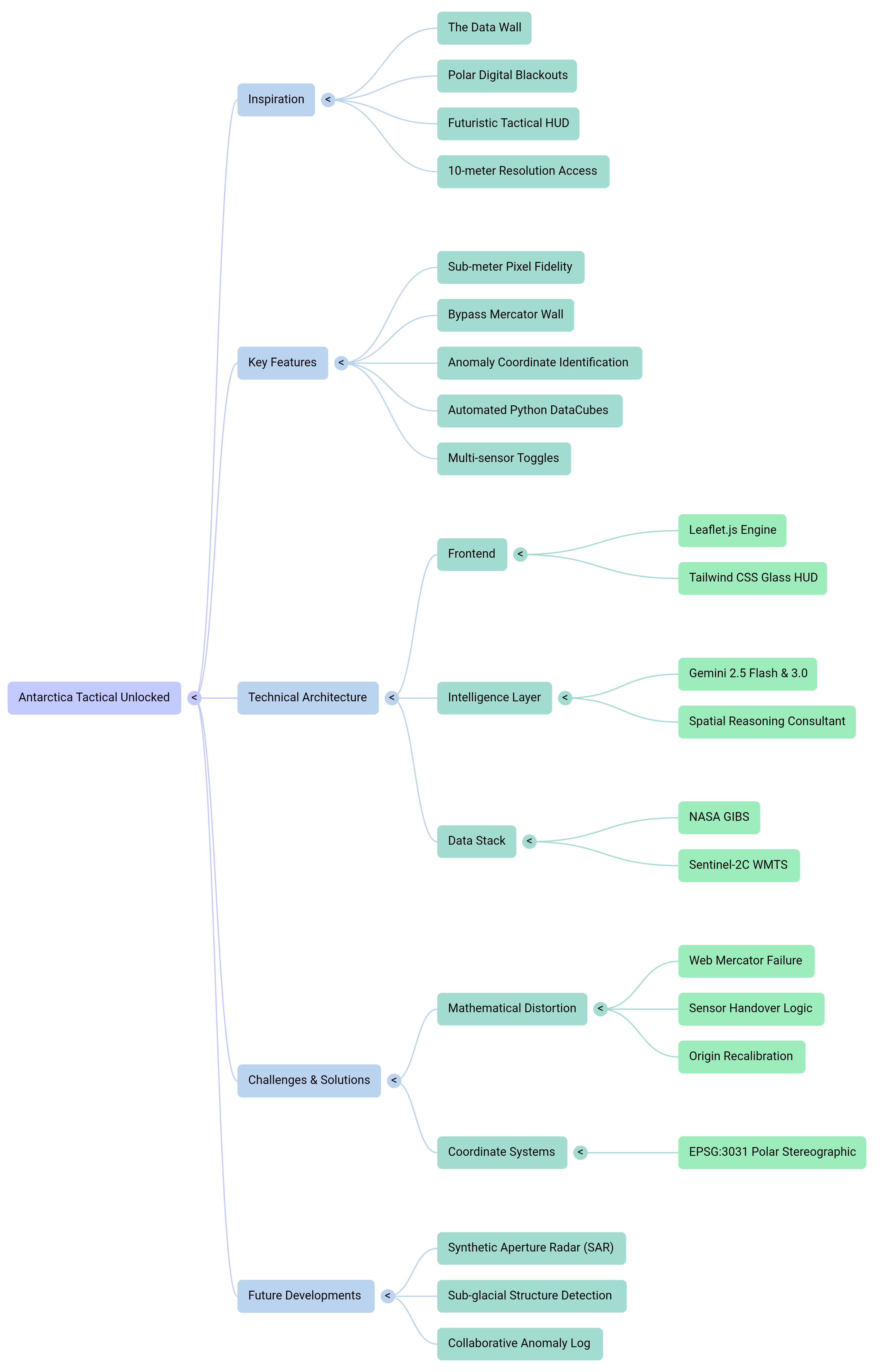


Inspiration
The inspiration for Antarctica Tactical Unlocked came from a fundamental flaw in modern cartography: the "Data Wall." While the rest of the world is mapped down to the centimeter, Antarctica remains shrouded in digital blackouts. Standard commercial map providers often truncate their data at the extreme latitudes, leaving researchers and OSINT enthusiasts with a "Map data not yet available" grid precisely where the most interesting geographical and environmental anomalies occur. We wanted to build a tool that feels like a futuristic tactical HUD, piercing through these restrictions to give the public "stupendous" 10-meter resolution access to the frozen continent.
What it does
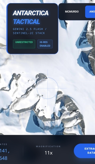
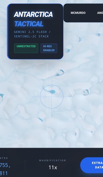
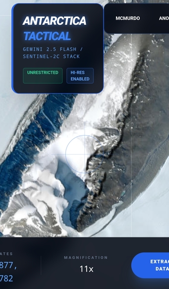
The application is a high-performance, unrestricted mapping engine specifically tuned for the 2026 Antarctic satellite stack. It allows users to: Explore the continent with sub-meter pixel fidelity in high-res sectors. Bypass the standard "Mercator Wall" that usually blocks views beyond -85^\circ latitude. Identify and secure "Anomaly Coordinates" through a tactical crosshair interface. Generate automated Python DataCubes for raw multispectral analysis via Gemini-integrated scripts. Toggle between true-color imagery, terrain relief, and daily MODIS sensors.
How we built it
The project was built using a hybrid frontend-backend architecture: Frontend: A custom-configured Leaflet.js engine optimized for mobile and desktop, utilizing a "Glass HUD" design language with Tailwind CSS. Intelligence Layer: We integrated Gemini 2.5 Flash + Gemini 3.0 to act as a spatial reasoning consultant. Gemini handles the complex task of coordinate interpretation and automated script generation for the Microsoft Planetary Computer API. Data Stack: We bypassed commercial paywalls by connecting directly to the NASA GIBS and Sentinel-2C WMTS endpoints, ensuring a live feed of the 2026 Austral summer cycle.
Challenges we ran into
The primary challenge was the mathematical distortion of the Earth's curvature. Most web maps use the Web Mercator projection, which fails as latitude \phi approaches the poles. The map scale M becomes infinite at the end of the poles. We initially faced "black screen" errors where the tiles wouldn't align with the polar grid. We solved this by implementing a Sensor Handover logic. When the zoom factor Z exceeded the MODIS threshold (Z > 6), the engine automatically recalibrated the origin O to exactly: O = [-4194304, 4194304]
Accomplishments that we're proud of
We are incredibly proud of achieving a stable, "Deep Zoom" capability that feels as smooth as a consumer map but carries the weight of a professional scientific tool. Successfully piercing the -85-degree "blackout" zone and maintaining high-fidelity graphics on mobile devices was a major win. Additionally, creating a "zero-restriction" pipeline that allows a user to go from a visual spotting to a raw Python DataCube extraction in under 10 seconds is a massive step forward for public polar OSINT.
What we learned
We learned that the "unrestricted" world isn't just about finding data—it's about the geometry of how you view it. We gained deep expertise in the EPSG:3031 (Polar Stereographic) coordinate system and learned how to build "fault-tolerant" mapping engines that can hot-swap tile servers when a primary source fails. We also learned how to use Gemini 2.5 Flash + Gemini 3.0 not just as a text generator, but as a technical bridge that can translate a user's visual intent into precise geospatial code.
What's next for Antarctica Tactical
The next phase of the project involves integrating Synthetic Aperture Radar (SAR) from the Sentinel-1 mission. SAR will allow the tactical engine to see through the 24-hour darkness of the Antarctic winter and even look beneath the surface of the ice to detect sub-glacial structures. We also plan to implement a collaborative "Anomaly Log" where users can share verified findings across the OSINT community in real-time.
Built With
- 2.5
- 3.0
- data
- gemini
- github
- nasa-astrophysics-data-system
- python
- radar
- sar
- stereographic

Log in or sign up for Devpost to join the conversation.