Inspiration
What it does
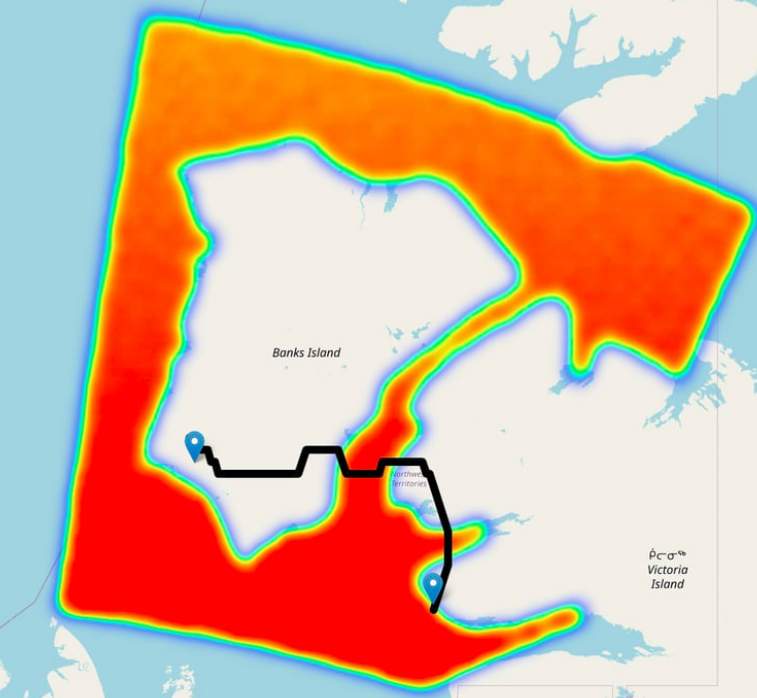
an AI-based polar navigation platform that provided optimal routing for land vehicles in arctic regions, influenced by climate change.
Did you know Arctic communities have to cross frozen lakes and ice roads for both personal and commercial needs? With the increasing temperatures due to climate change, these routes are becoming more and more dangerous.
How we built it
A data platform that uses machine learning; Satellite data for real-time ice trail safety predictions (using Copernicus) and navigation (using Galileo) “At first it was all market research. There wasn’t any advantage in building solutions without fully understanding the problem faced in the region. So, we all did independent research and shared our findings in Discord.
Over time, some problems gained our interest more than others - at this point, we began considering solutions.
We had maybe 2 or 3 meetings where we began pitching potential ideas, and through our discussions (and advice from the experts), we slowly eliminated ideas until we arrived at the one we were most confident in.”
What's next for An AI, Satellite-based Navigation Platform
THE HACK AI intelligence item and administration applications are turning out to be progressively famous. The interest is additionally higher than any time in recent memory.
Clearly, we realize that satellite route isn't effectively available and replicable.
Yet, your emphasis ought to be on the computer based intelligence part, and how this German group figured out how to use the force of man-made reasoning to foster an undertaking that focuses on wellbeing and unwavering quality.
And keeping in mind that their objective might have been simply to plan the specialized side of the innovation, they actually figured out how to model a versatile application, characterize income models and detail a future guide of tasks.
Built With
- imagingsensor
- java
- machine-learning


Log in or sign up for Devpost to join the conversation.