Inspiration
The Amazon rainforest holds secrets of ancient civilizations, hidden beneath its dense canopy for centuries. Inspired by recent discoveries of pre-Columbian geoglyphs, engineered soil (terra preta), and advanced settlement planning, I aimed to build a tool that combines satellite imagery and AI to help archaeologists, researchers, and curious explorers identify areas of potential historical significance. I was driven by the question: What if the legends of cities like El Dorado weren’t myths—but forgotten truths waiting to be uncovered from space?
What it does
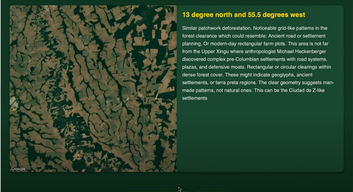
Amazon Explorer is an AI-powered visual analysis platform that scans satellite imagery to highlight regions with patterns or features that may indicate human activity—such as circular clearings, road systems, soil anomalies, and other geo-structural clues. It also let's you to discover places in the Amazon.
It generates:
AI-driven interpretations of satellite images. Hypotheses about what these patterns may represent (e.g., geoglyphs, ancient agricultural grids, etc.). How we built it Satellite Imagery: I sourced images from the Google Map Platform's Static API. AI Interpretation: I used Google Gemini to analyze satellite data, detect unusual patterns, and generate historical hypotheses. Interface: Built a simple web-based dashboard for viewing AI-generated insights.
Challenges we ran into:
- Cloud Obstruction: Many Amazon images had heavy cloud cover, making analysis difficult.
- False Positives: Distinguishing ancient earthworks from modern deforestation or logging roads required refined logic and multiple validation layers.
- Data Volume: Processing large multi-band satellite images was computationally intensive.
- Historical Ambiguity: Training the AI to understand what a “lost civilization site” might look like from space required carefully curated prompts and examples.
Accomplishments that we're proud of
- We successfully identified multiple regions that visually align with known geoglyphs and pre-Columbian settlement zones.
- We created a working AI model that can describe satellite imagery in archaeological terms.
- We built a tool that could potentially assist real-world researchers in narrowing down areas for field study.
What we learned
- How to effectively reveal hidden features in dense forests.
- How Gemini can be guided to interpret remote sensing data meaningfully.
- That the combination of AI + Earth observation is a powerful approach to uncovering human history.
What's next for Amazon Explorer
- Automated Scanning: Build a pipeline that continuously scans new tiles of the Map Platform's Map tiles API over the Amazon and flags anomalies.
- Expansion: Apply this model to other underexplored areas like the Congo Basin or Southeast Asia.

Log in or sign up for Devpost to join the conversation.