
Inspiration
We envision a sustainable future and believe that everyone can contribute to better societal change by minimizing their environmental impacts and partnering with communities. Esri's overarching value and technology really showed us what's possible through improved analysis, integration with GIS, and mapping; thus, we were inspired to prioritize what's essential for our future.
What it does
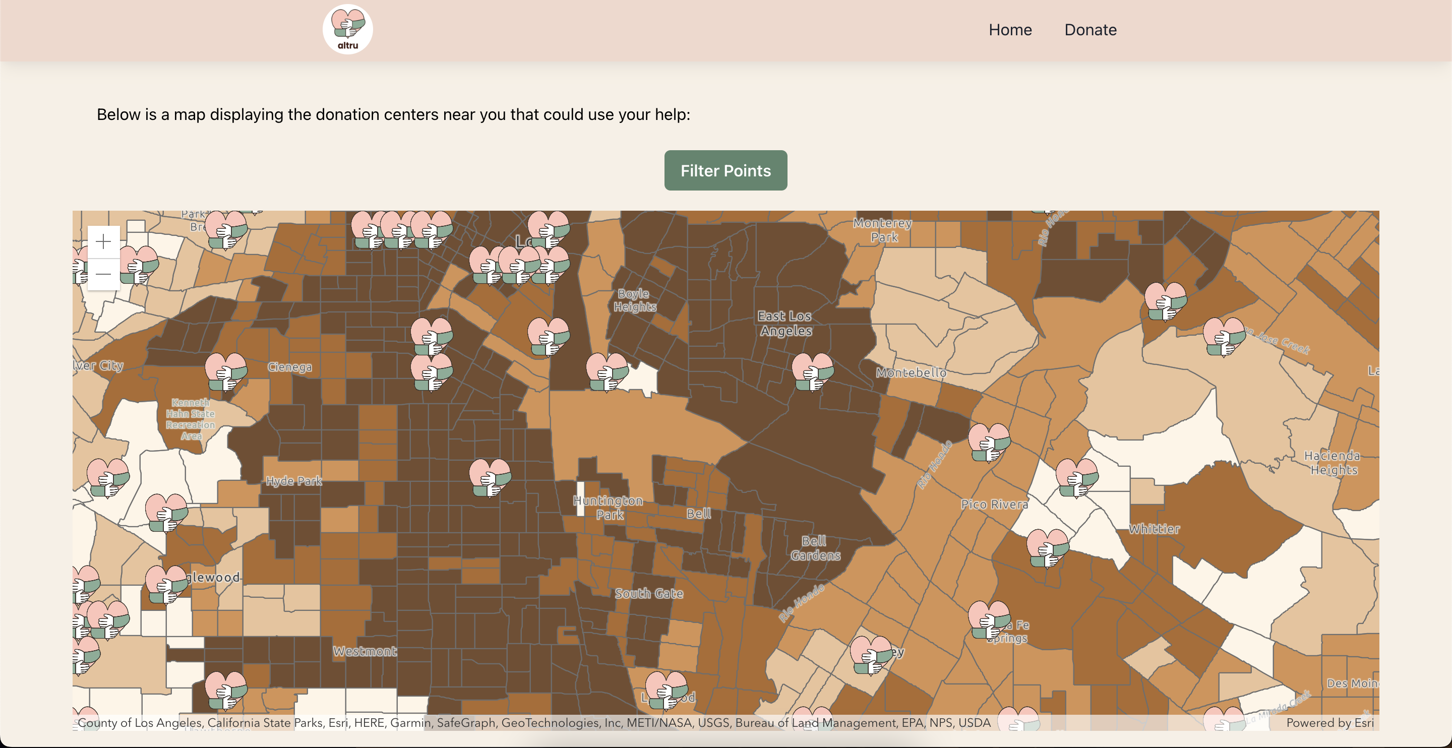
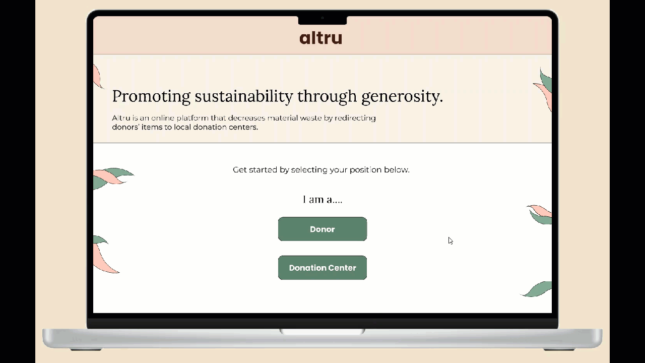
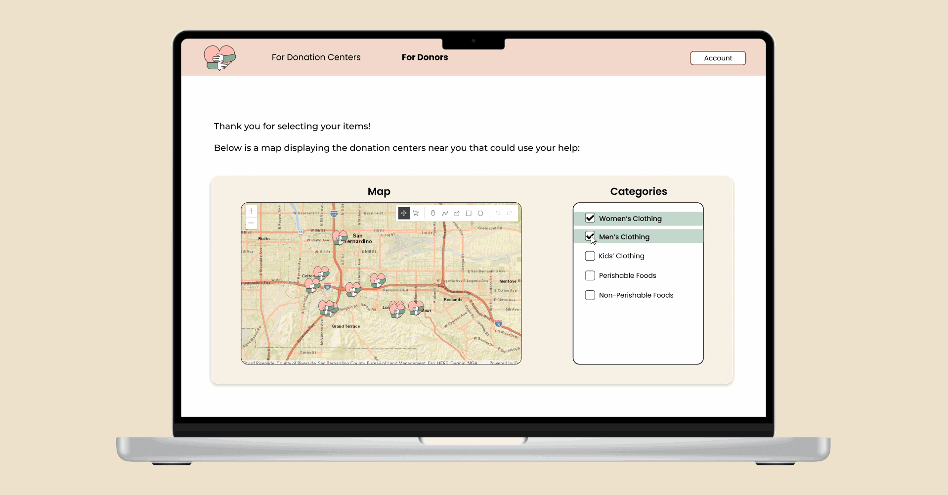
Altru decreases material waste in the environment by redirecting unneeded items to those in need through nearby donation centers. We connect donors to donation centers through easy matching. A donation center can register on the app and request categories of donations they seek. On the other hand, a donor can input items they have to donate. The app will match the donor to the closest donation center that requests that item. It also displays a map to donors that visualizes the surrounding donation centers in need of their items. The app also includes a drop-off scheduler and direction routing.
How we built it
We chose to build a web app with ReactJS Framework so that it'll be accessible via both mobile and desktop devices. We used ArcGIS JavaScript APIs and the esri-loader module to build the web app. We have integrated the index maps that we have built into the web app using the WebMap and Graphics Layer APIs. Then, we plotted the data that we had on the donation center onto the map. We have provided filters to help the donors narrow down their search for donation centers. After selecting a donation center, the donor can schedule a drop-off. We used youcanbook.me to enable the drop-off scheduler. We have seen one of the best lazy loading practices put into use. The esri-loader module loads the required map components and graphics whenever the web app requires it. It decreases the load on the browser and the data consumed significantly.
Challenges we ran into
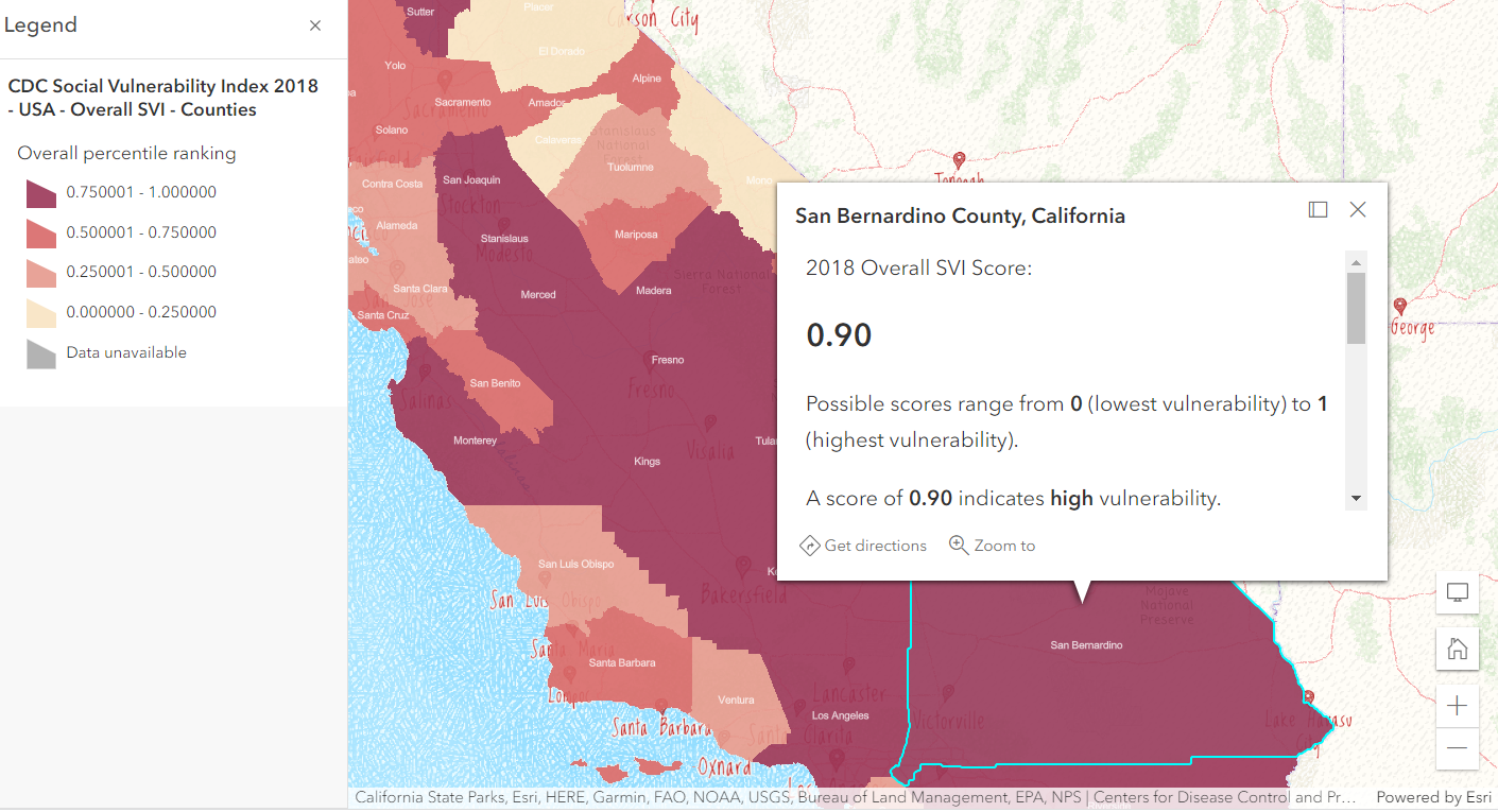
We initially planned to integrate our ArcGIS Online indexed-need maps into the app, but ran into some issues with ArcGIS Pro to ArcGIS Online layer transition. We could not export the layers from ArcGIS Pro into ArcGIS Online as web layers. Due to the time constraint of the hackathon, we ended up using the index maps in our project introduction to communicate the importance of helping those in need.
Accomplishments that we're proud of
We created a fully functional website that is responsive in both desktop and mobile browsers. This site is also interactive and allows the user to select their desired donation categories and adjust the map output based on their desired categories.
What we learned
We learned that exporting layers from ArcGIS Pro is not always straightforward. We went through a long debugging process to figure out how to integrate the multi-layered webmap into our site. Ultimately, we integrated a webmap into the site, even though it was not the full webmap we had hoped for, but we learned how to improvise and implement an innovative plan that allowed our site to function smoothly.
What's next for Altru
In the future, we want to fully integrate the interactove index maps into the app. Donors would be able to input the items they want to donate, then Altru would output the indexed-need map of the surrounding population based on their calculated need. This would help the user visualize the populations they could potentially aid with their donations. We also want to add more specific item categories to the app.


Log in or sign up for Devpost to join the conversation.