Inspiration
I created this website to merge my love for geography with my newfound web development skills. It's a dynamic showcase for my interactive mapping projects, educational games, and conservation insights—all designed to make geography engaging and accessible. As my first self-coded project, it represents both my technical growth and passion for sharing knowledge. I'm constantly improving it, adding features, and inviting collaboration from fellow enthusiasts. This platform proves that with curiosity and effort, anyone can turn ideas into digital reality while building community around shared interests.
What it does
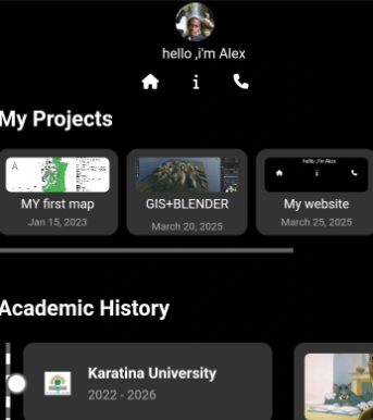
This website serves as an interactive portfolio featuring three core elements: (1) geological maps of Kenya with layered data visualization, (2) educational games to make geography fun, and (3) tutorials sharing my technical process. Designed with HTML, CSS, and JavaScript, it prioritizes user-friendly navigation and responsive design, while laying the foundation for future dynamic features like user-submitted content or AR integrations.
How we built it
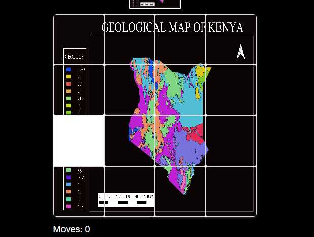
I developed this site from scratch using vanilla HTML/CSS for structure and styling, then added interactivity with JavaScript. Key steps included wireframing the layout in Figma, optimizing QGIS map exports for web display, and rigorously testing mobile responsiveness. Challenges like implementing the game’s scoring system taught me problem-solving
Challenges we ran into
Balancing design aesthetics with functionality was tricky for example, ensuring the geological maps remained detailed yet fast-loading. I overcame this by compressing raster images and using SVG for vector layers. Another hurdle was making the geography game intuitive for all ages; iterative user testing with students helped refine its difficulty levels and feedback system.
Accomplishments that we're proud of
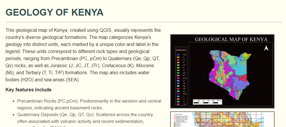
My QGIS geological mapping project and interactive geography game gained recognition from the GIS Club, which loved how my game, inspired by my childhood, brought innovation to geospatial education. They’ve embraced my game for their workshops and invited me to speak at their GIS meetings. This support from the GIS community inspires me to keep creating tools that connect geography’s theory and practice.
What we learned
This project strengthened my QGIS mapping expertise, inspired by my childhood love for geography, and showed me the joy of creating engaging educational tools. I learned to blend creativity with technical precision,like designing an interactive game that simplifies complex geological data while keeping it accurate.
What's next for Alex's portfolio
Inspired by my childhood passion for geography, I’m eager to deepen my Blender skills to craft dynamic 3D visualizations for live maps, blending my QGIS expertise with immersive designs. I also plan to expand my interactive geography game with new features and integrate my geological research into engaging educational tools. These steps will fuel my growth in geospatial innovation.


Log in or sign up for Devpost to join the conversation.