Inspiration
We wanted to find a way to check how dangerous certain places are in the world before we visit them. We thought that it would be nice to have an expanded feature of Waze that shows crashes and police presence but instead for crime
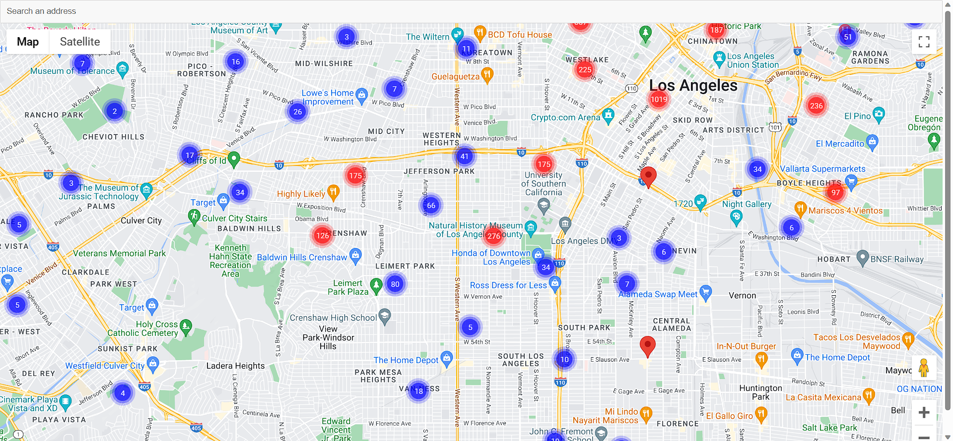
What it does
Shows clusters of crimes committed from 2020 to 2023 in Lost Angeles. It allows you to see how dangerous certain places are and what kinds of crimes have been committed in the area
How we built it
We built it through React and the google maps API platform. We got the data from https://data.lacity.org/Public-Safety/Crime-Data-from-2020-to-Present/2nrs-mtv8 and used the crime committed, lattitude, and longitude to create the markers on the map
Challenges we ran into
It was very challenging to actually show the google map in a next.js application so we had to pivot to a react application by Leigh Halliday to get it working. We later had to deal with time constraints since we were behind with adding all the features
Accomplishments that we're proud of
We were able to display all crimes in Los Angeles
What we learned
How to use Google maps API
What's next for AlertMe
We'll develop the application to increase its functionalities and maybe make it mobile friendly
Built With
- google-maps
- places
- react


Log in or sign up for Devpost to join the conversation.