Inspiration
Deliver a real time hydrology data to the public with GIS layers on top of base maps.
What it does
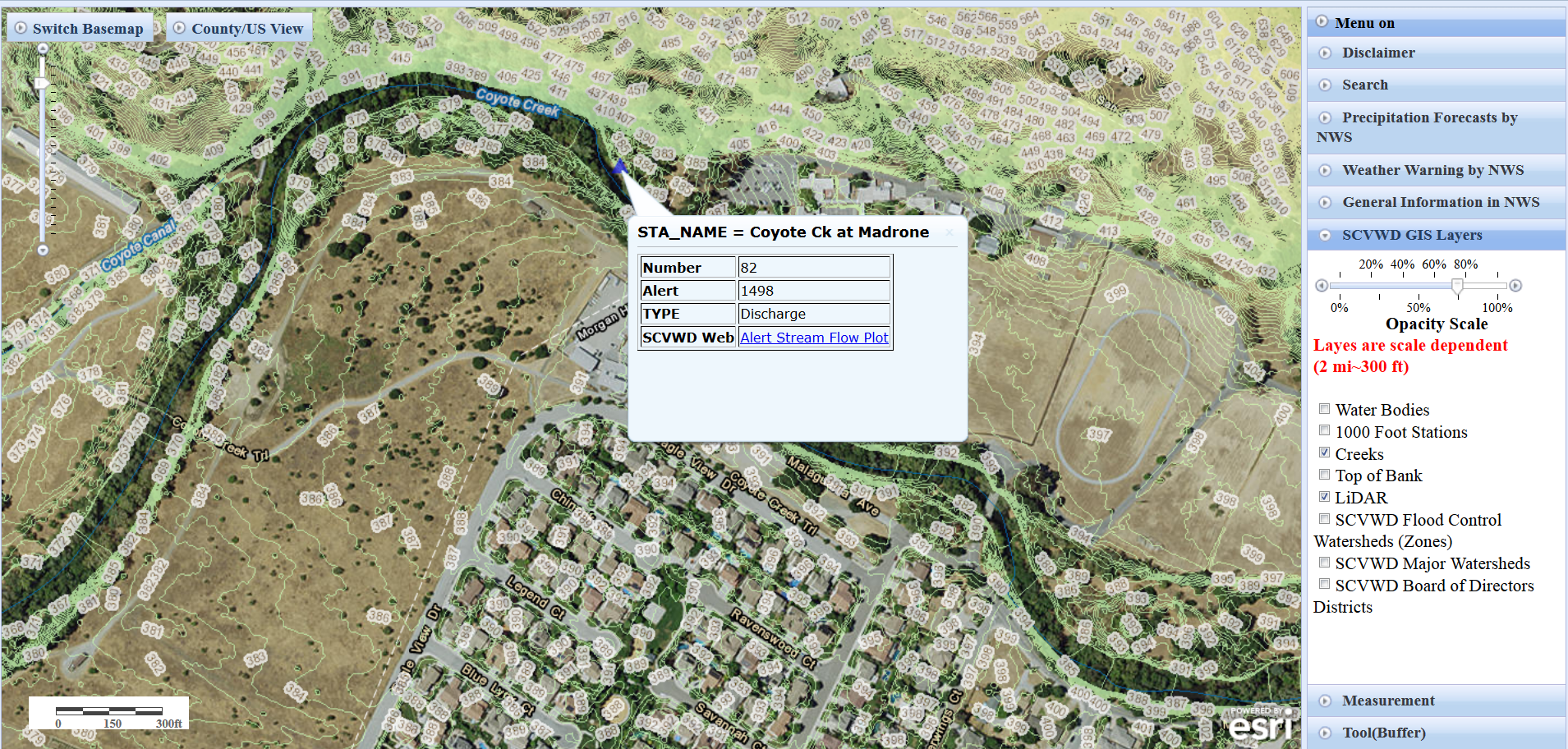
It is a part of flood warning web page to the public in the county. This web page give a real time hydrology data to aware of a potential flood event in the Santa Clara County. It gives following information. real time hydrology data; rainfall, stream flows and current reservoir status NOAA's forecasted rainfall data District GIS layers including Lidar contour lines
## How I built it Esri javascript
Challenges I ran into
Reprojection in the web environment
Accomplishments that I'm proud of
Build a WebGIS application to help public.
What I learned
JavaScript and how to design a WebGIS application.
What's next for alert webpage: GIS online version(GIS layers & Plot)
Mobile version

Log in or sign up for Devpost to join the conversation.