-
-
SMS
-
Playbook
-
Risks Mapping
-
Readiness
Inspiration
Across the IGAD region of East Africa, climate forecasting has advanced significantly—meteorological agencies can predict droughts and floods weeks in advance. Yet, catastrophic losses persist because of the Early Warning to Early Action Gap.
Warnings typically arrive as dense, probabilistic PDFs, forcing humanitarian actors to manually translate climate indicators into operational decisions under severe time constraints. We were inspired to build AINA (Anticipatory Intelligence Network for Action) to bridge this final mile: an intelligence layer that transforms complex hazard data into explainable, localized, and actor-specific workflows before a disaster strikes.
What it does
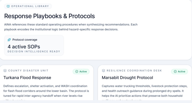
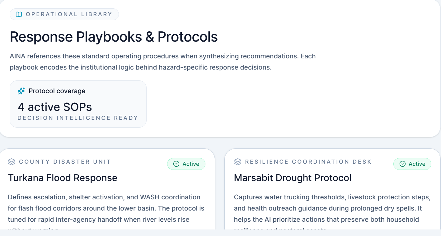
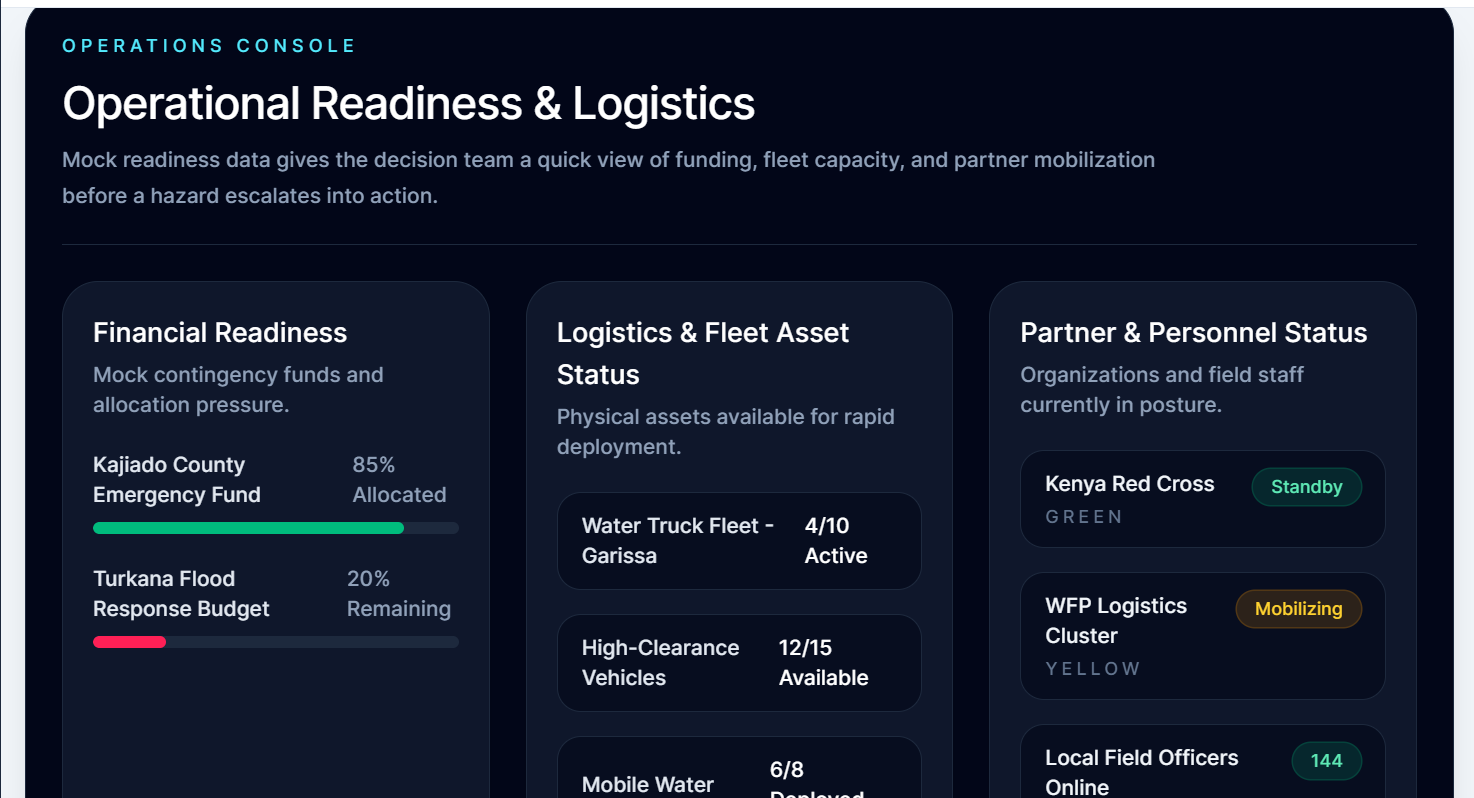
AINA is a Decision Intelligence Operating System. It doesn't just build another weather dashboard; it sits above the forecasts and before the action.
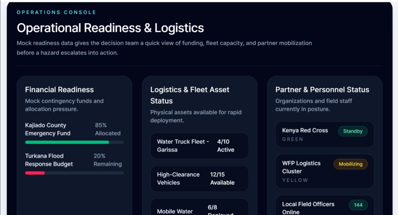
AI-Driven Anticipatory Action: AINA ingests spatial risk signals, exposure scores, and asset metadata, processing them through a DeepSeek LLM to generate ranked, actor-specific recommendations (e.g., directing a County Committee to release specific funds).
Multi-Role & Localization: Humanitarian response requires a chain of command. AINA adapts its UI based on the user's role (National Director vs. Field Officer) and features instant Swahili localization to ensure actionable guidance reaches the last mile without translation barriers.
Simulation Mode: We engineered a dedicated rehearsal environment allowing decision-makers to safely inject hypothetical hazard data to stress-test their operational readiness.
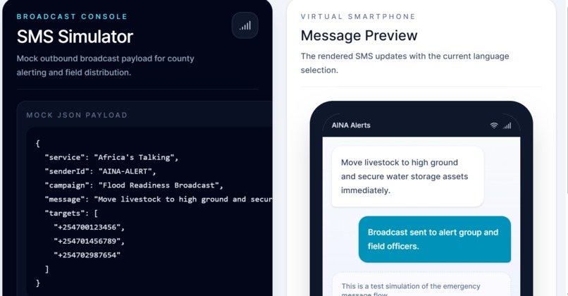
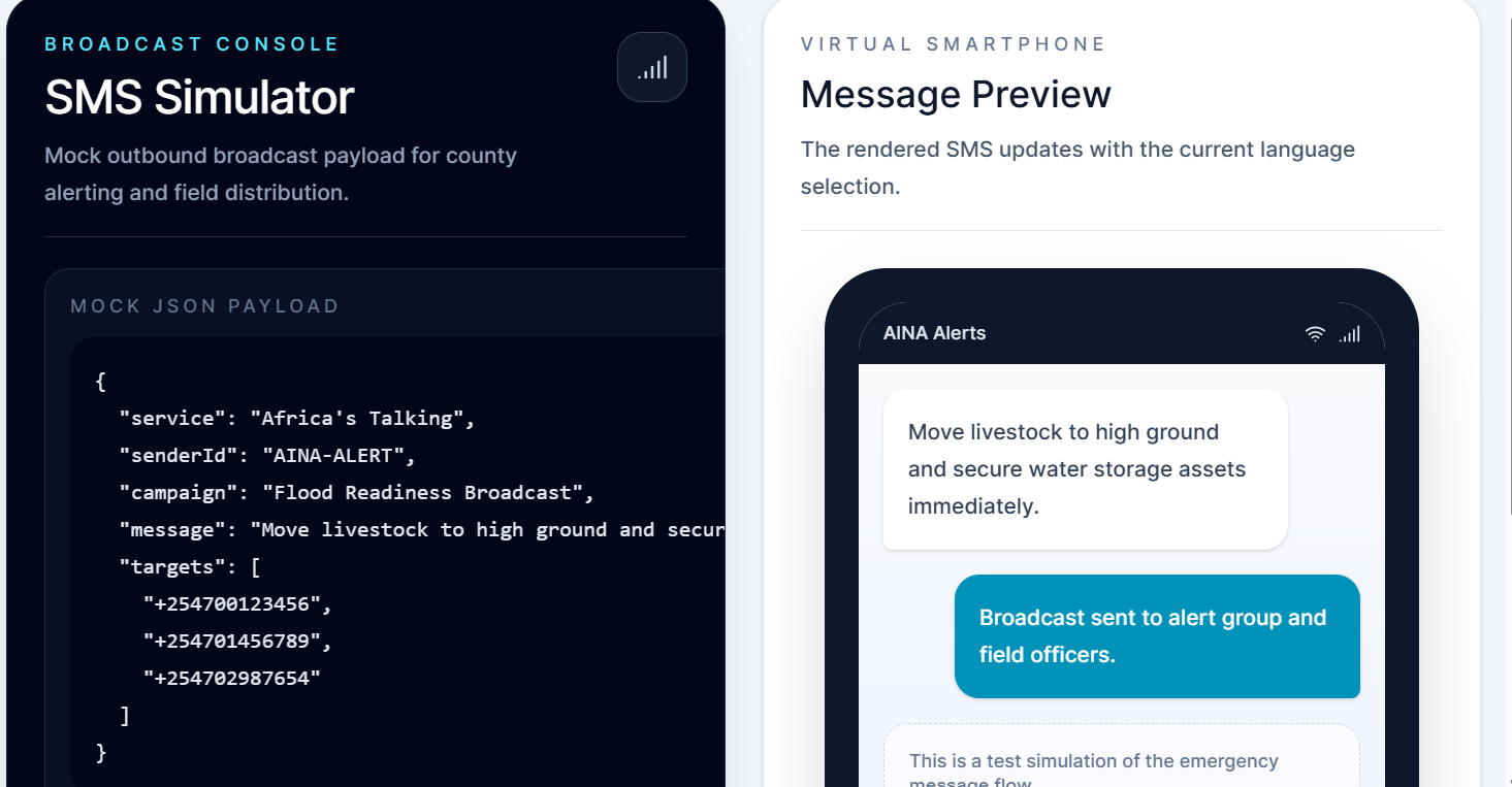
SMS Broadcast Simulator: AINA doesn't just display data on a web app; it generates Africa's Talking API payloads to distribute targeted SMS alerts directly to field officers' feature phones.
How we built it
We engineered AINA for speed, modularity, and accessibility in low-bandwidth environments:
Frontend: A blazing-fast React 18 and TypeScript application built with Vite and Tailwind CSS v4.
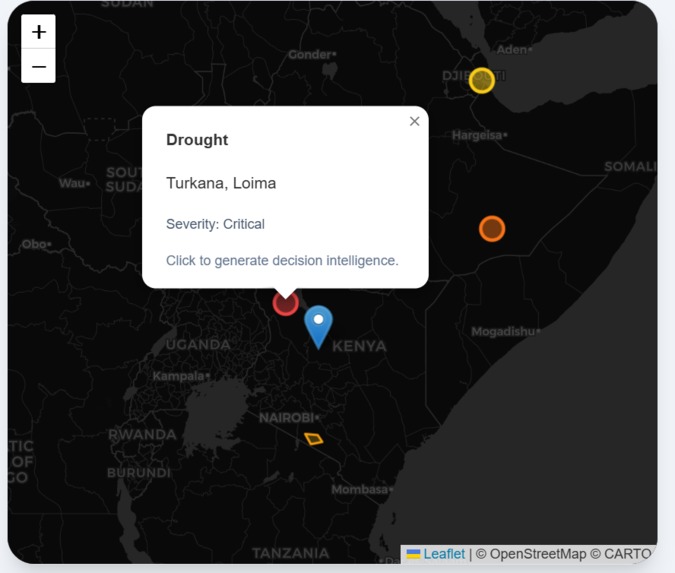
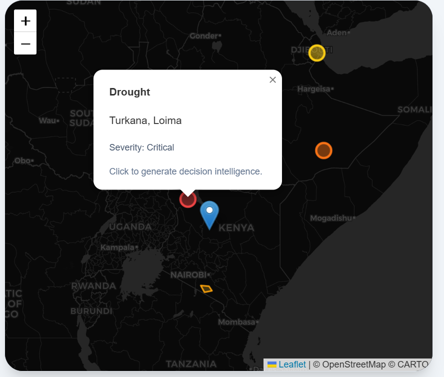
Geospatial Layer: Interactive maps powered by React-Leaflet to render spatial boundary overlays and critical asset markers.
AI Decision Core: We integrated the Featherless AI API to execute DeepSeek-V4 models. We utilized strict system prompts and client-side markdown parsing to enforce deterministic, highly structured JSON outputs for recommendation generation.
State Management: Built a robust, custom React Context architecture to seamlessly handle multi-role data, language switching, and LLM loading states across the entire application.
Challenges we ran into
Bridging GIS Data & LLM Context: Scientific spatial datasets store raw geometries, while LLMs reason over semantic context. Structuring dynamic spatial metrics (like asset counts and named facilities) into clean prompt payloads without exceeding context windows required intense prompt engineering.
Deterministic Output Constraints: Forcing LLMs to strictly return actionable JSON without injecting conversational markdown wrappers caused multiple application crashes. We solved this by building robust, client-side Regex sanitization to strip formatting before parsing the AI's response.
API Latency: Large language models take time to generate complex operational logic. We implemented a local caching architecture within our Simulation Mode to store and instantly retrieve AI responses, ensuring lightning-fast scenario rehearsals.
Accomplishments that we're proud of
We successfully closed the loop between spatial GIS data and actionable AI reasoning in a matter of days. We are particularly proud of our Last-Mile Focus. By implementing Swahili localization and the SMS Broadcasting Simulator, we ensured that AINA isn't just a tool for analysts in capital cities, but a lifeline for the people actually executing the response on the ground.
What we learned
Human-in-the-Loop Governance: AI in high-stakes humanitarian contexts must suggest, not replace, human accountability.
Resilient Architecture: Decoupling our data pipelines and building a mock JSON dataset layer early in the sprint proved essential, allowing our frontend UI and LLM integration to proceed rapidly even when backend components bottlenecked.
What's next for AINA
Our immediate next step is transitioning from a hackathon MVP to a Pilot County deployment, putting the system in the hands of an actual county disaster management committee using live ICPAC forecast data.
Long-term, we envision AINA growing into a Regional Federation aligned with IGAD's mandate. Because the core AI engine is domain-agnostic, we plan to expand beyond droughts and floods to support anticipatory action for food security, public health, and climate adaptation across Africa.
Built With
- fastapi
- featherless
- postgresql
- python
- react
- tailwindcss
- typescript


Log in or sign up for Devpost to join the conversation.