-
-
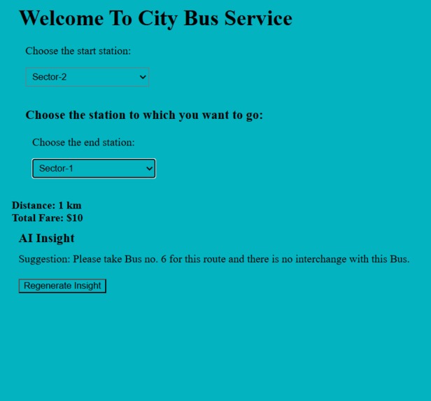
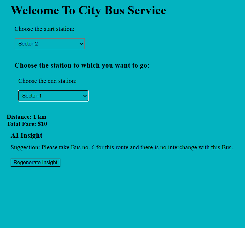
AI insights help to smartly commute plan
-
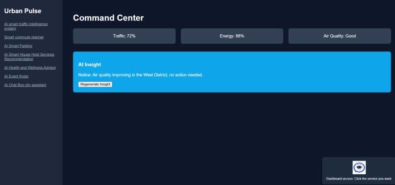
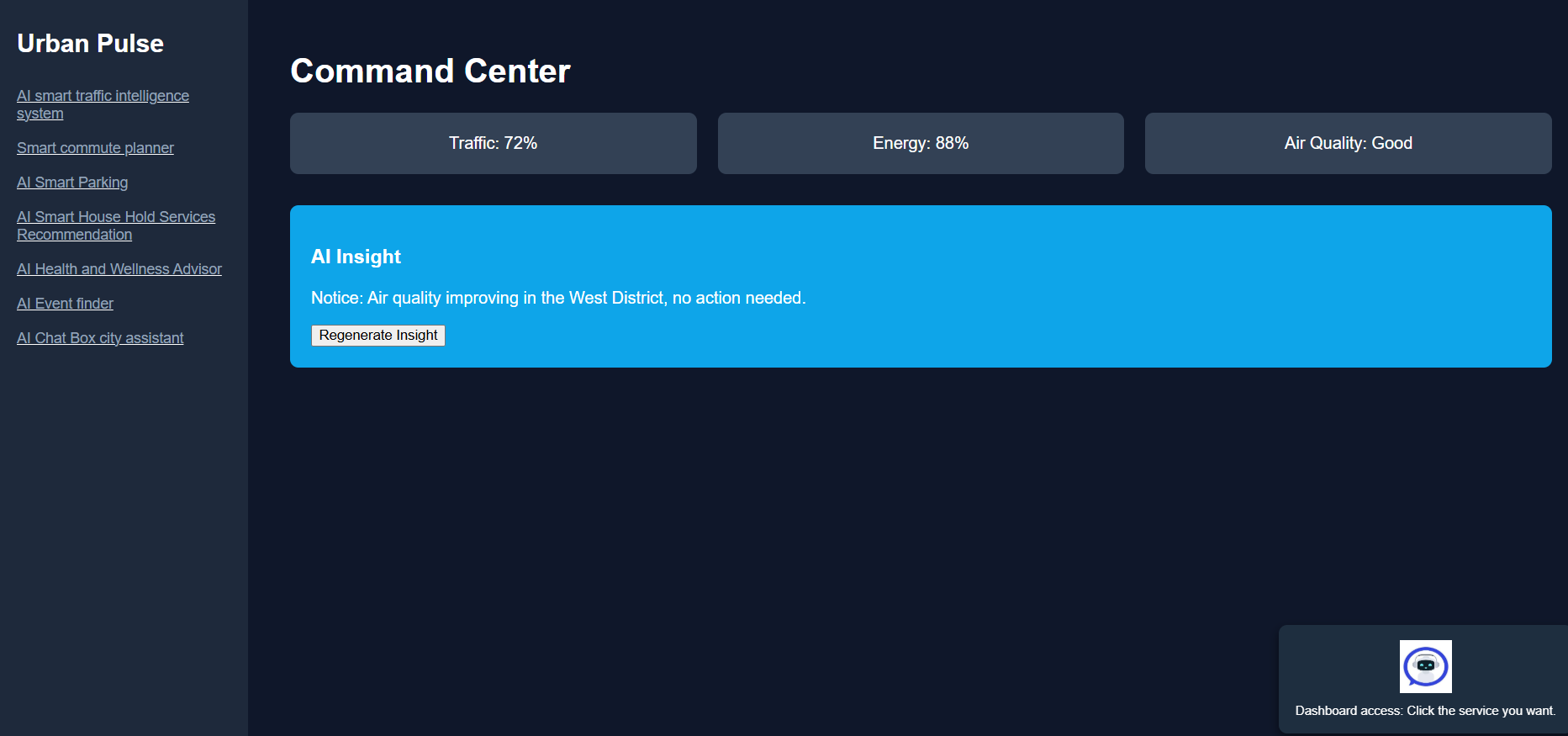
This is the dashboard for access various things
-
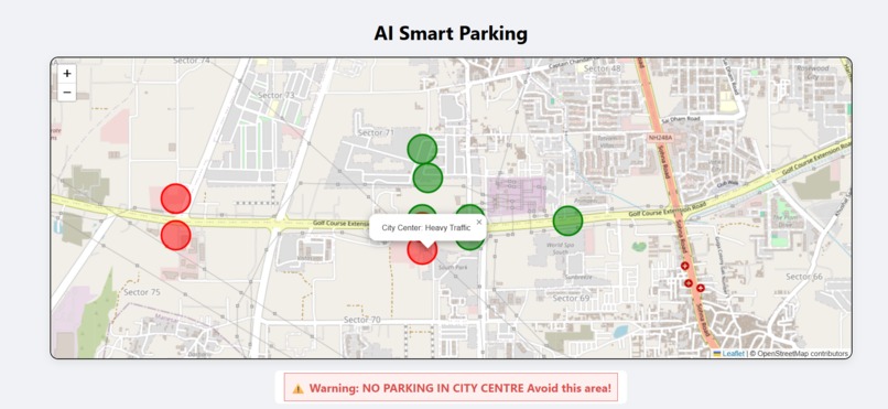
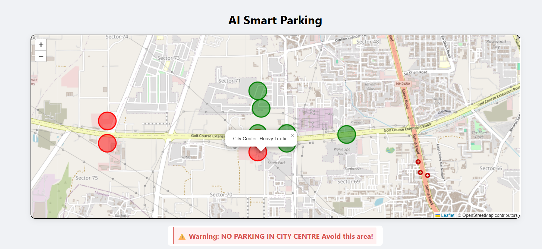
AI smart parking helps you to find the area to park..
-
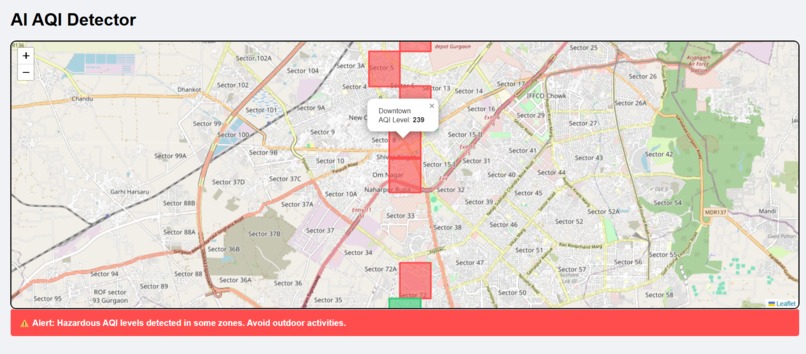
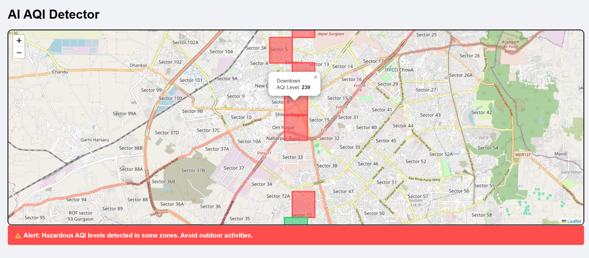
AI helps to find the aqi by area
-
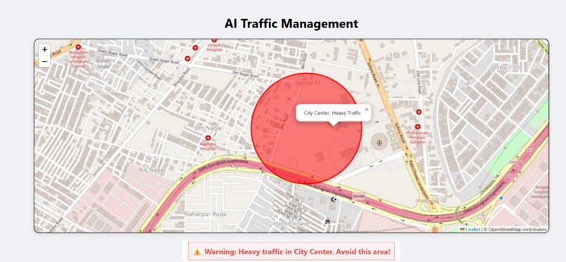
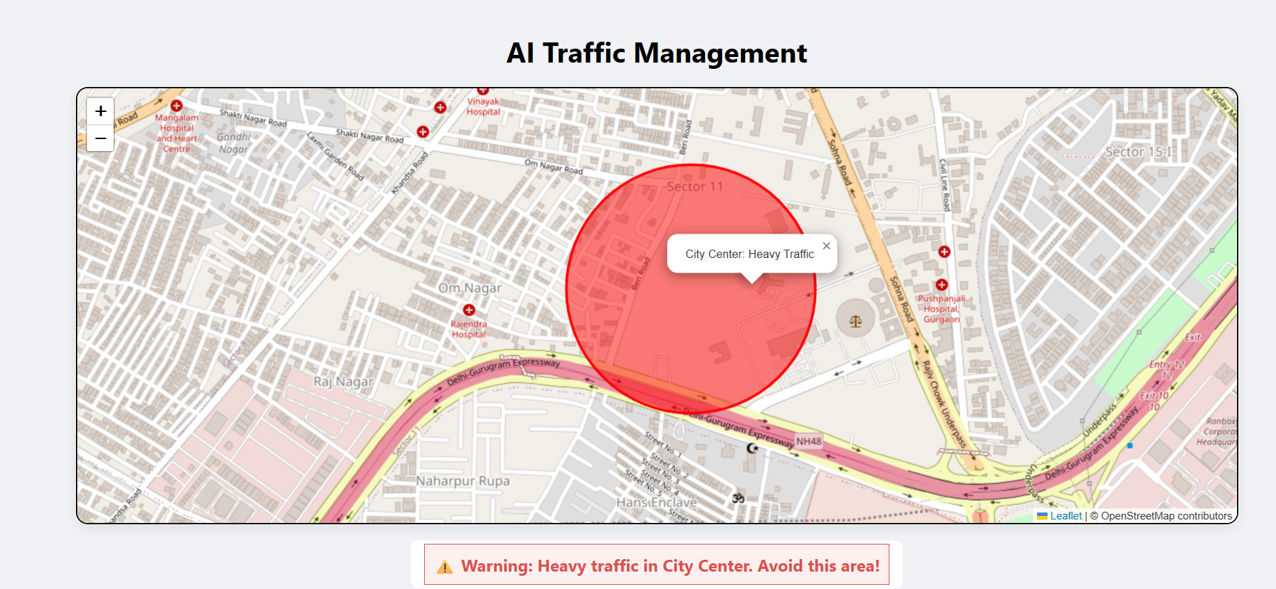
AI smart traffic management helps you to find the area where is less traffic and also find the best route
Inspiration
Most smart city projects focus on expensive hardware sensors that are hard to maintain in the Indian climate. Our inspiration was to prove that we can solve urban problems by simply connecting the dots between existing data silos—like Google Maps traffic data, government AQI stations, and public event listings—into one unified, AI-powered "Brain."
What it does
Vayu-Sutra is a digital urban OS that works by aggregating and analyzing live data streams:
Virtual Traffic Monitor: Instead of physical cameras, it uses Google Maps APIs and TomTom Data to analyze congestion patterns and suggest alternative "low-stress" routes.
AQI Forecaster: Pulls live data from CPCB (Central Pollution Control Board) stations and uses machine learning to predict pollution levels for the next 24 hours based on wind and traffic.
City Event & Safety Hub: Aggregates public data for local events (festivals, protests, rallies) and warns users about potential crowd-related delays.
Service Tracker: Uses open GTFS (General Transit Feed Specification) data to provide real-time tracking for city buses and metro systems.
How we built it
Data Aggregation: We used official Government of India APIs (data.gov.in).
AI & Logic: Built a predictive model using Random Forest and LSTM (Long Short-Term Memory) networks to forecast AQI and traffic bottlenecks based on historical trends.
Backend: A Node.js server acts as the middleware, cleaning and "normalizing" data from different sources so they can work together.
Frontend: A React-based Dashboard for officials and a PWA (Progressive Web App) for citizens that works offline and sends push notifications.
Challenges we ran into
Data Fragmentation: Different cities provide data in different formats (some in JSON, others in old CSVs or even PDFs). We had to build custom "Data Cleaners" for each source.
API Limits: Free-tier APIs for maps and traffic have strict limits, so we had to optimize our calls and implement heavy caching to keep the app fast.
Real-time Lag: Ensuring the "Event Finder" was actually up-to-date with last-minute changes (like a sudden road closure) required building a community-reporting feature.
Accomplishments that we're proud of
Zero Hardware Cost: We proved that a city can become "smart" without spending crores on new sensors—just by using the data that already exists.
High Prediction Accuracy: Our AI reached 90%+ accuracy in predicting AQI spikes 6 hours in advance, allowing for better travel planning.
Inclusive Design: Made the platform accessible via a simple web link, so users don't need a high-end smartphone to access city updates.
What we learned
We learned that the biggest hurdle in India isn't a lack of technology, but the "data gap." We realized that by centralizing data, we can empower citizens to make better choices—like choosing a cleaner route for their morning walk or avoiding a traffic jam before they even leave home.
What's next:
Crowdsourced Reporting: Adding a "Citizen Journalist" module where users can upload photos of potholes or broken lights to alert authorities.
Hyper-local Weather: Integrating satellite data from ISRO for more accurate monsoon and flood warnings.
Expansion: Scaling the software to support 100+ Indian cities by simply plugging in their local transit and pollution feeds.
Built With
- api
- css3
- html5
- javascript
- maps


Log in or sign up for Devpost to join the conversation.