-
-
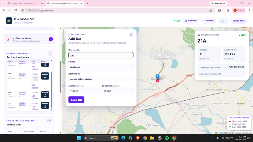
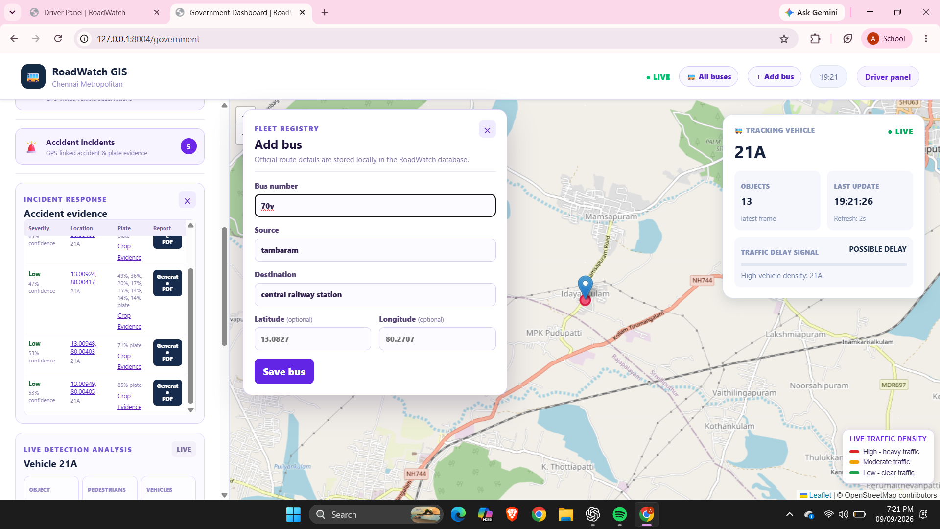
bus from and to
-
-
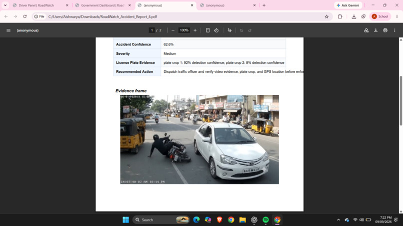
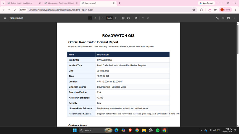
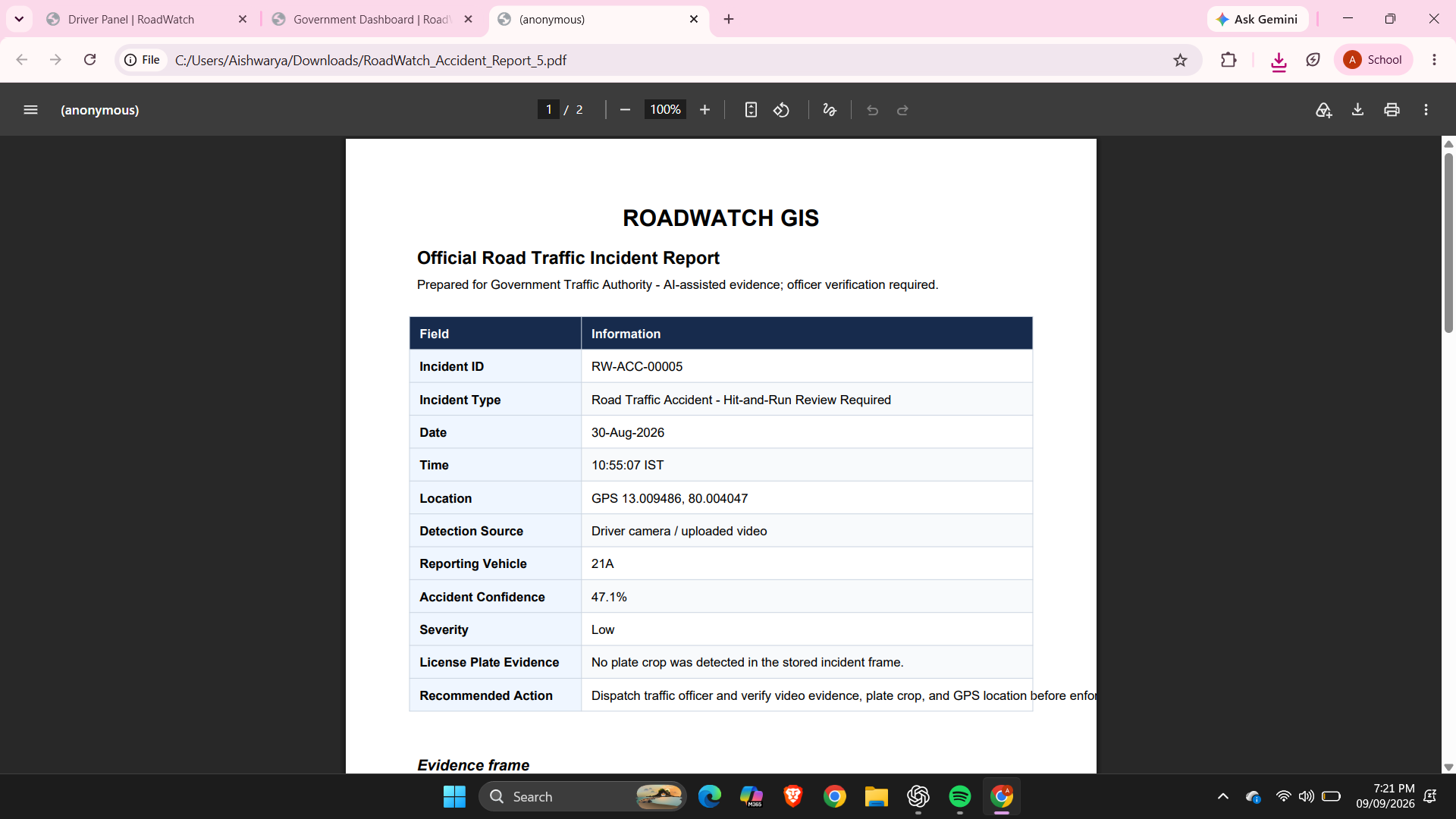
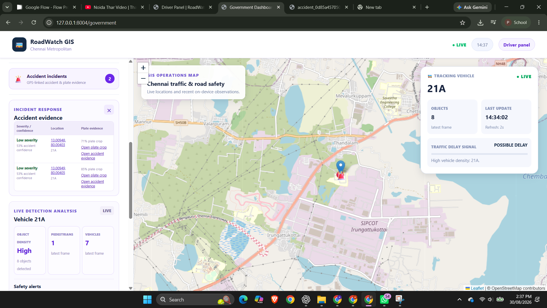
accident report generation
-
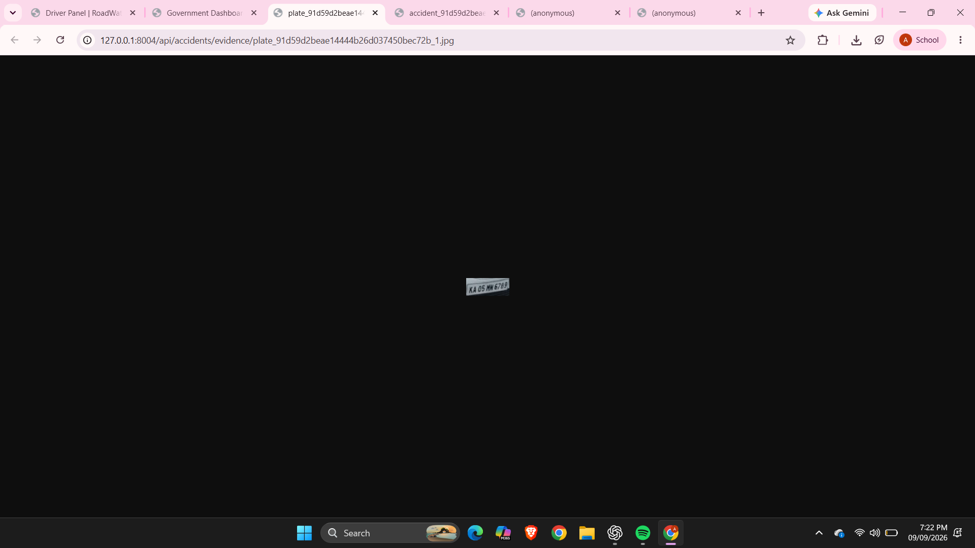
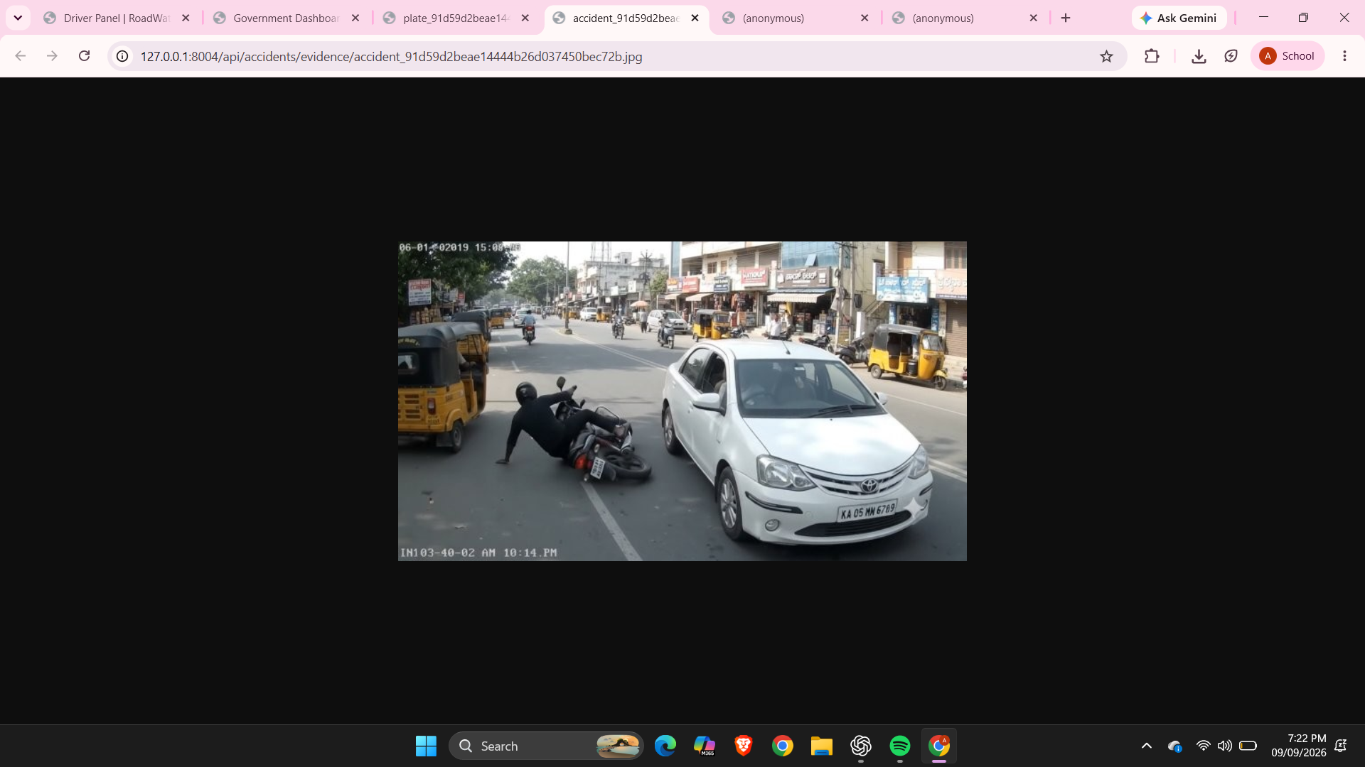
offended vehicle linsense plate capture
-
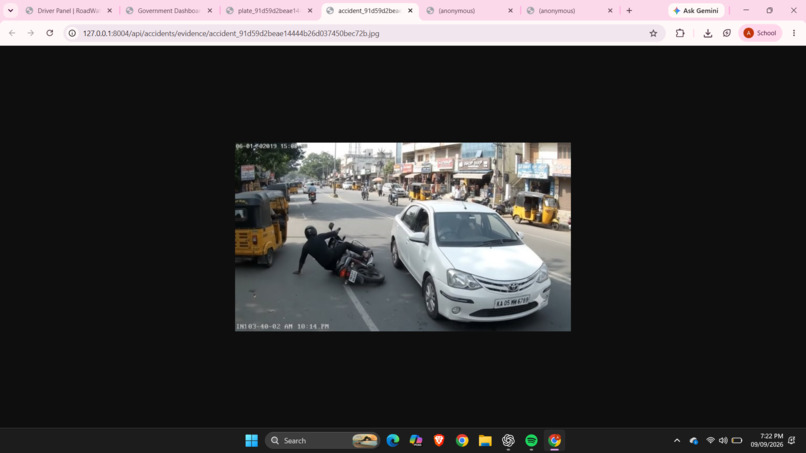
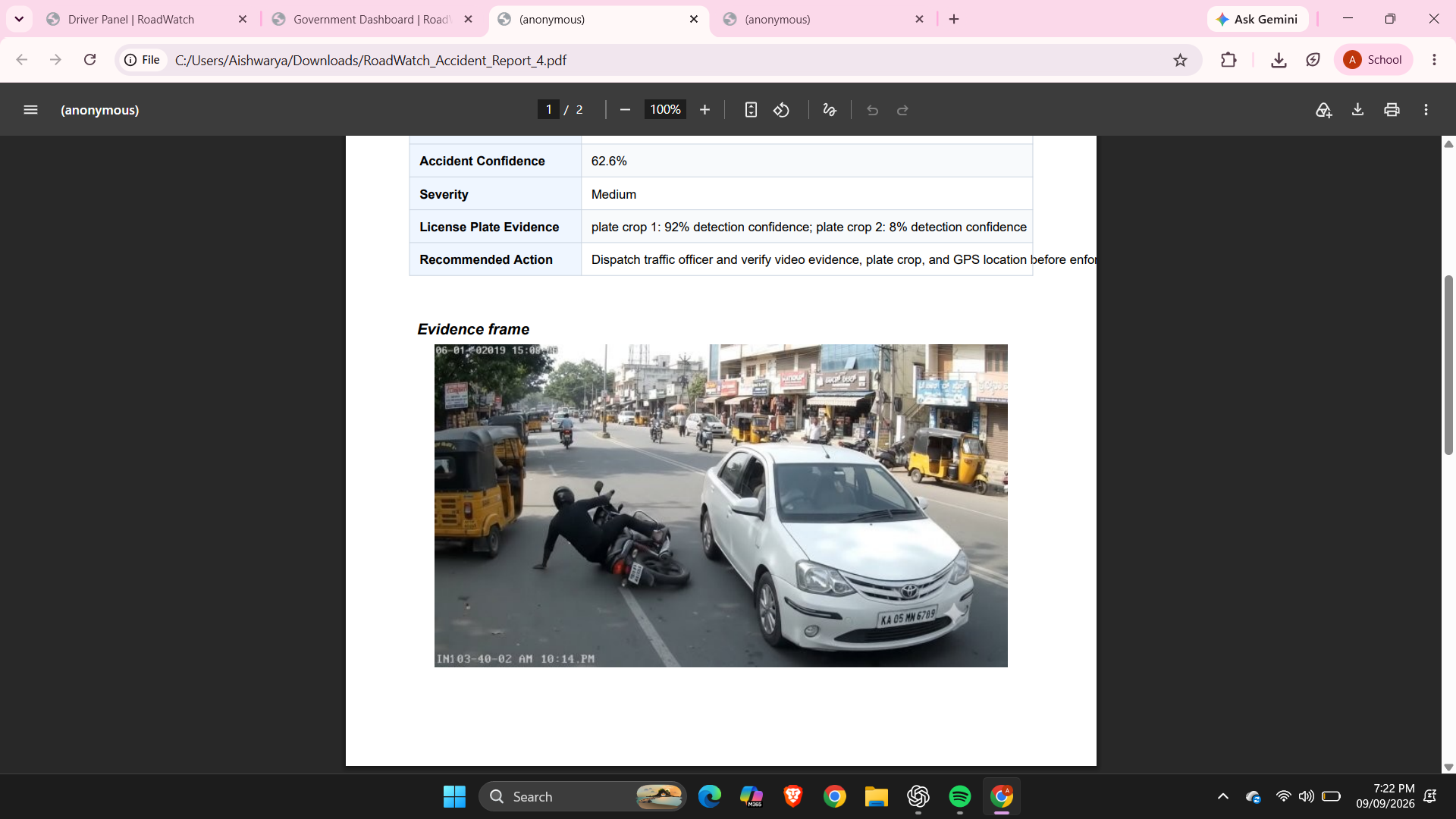
accident capture
-
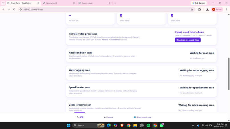
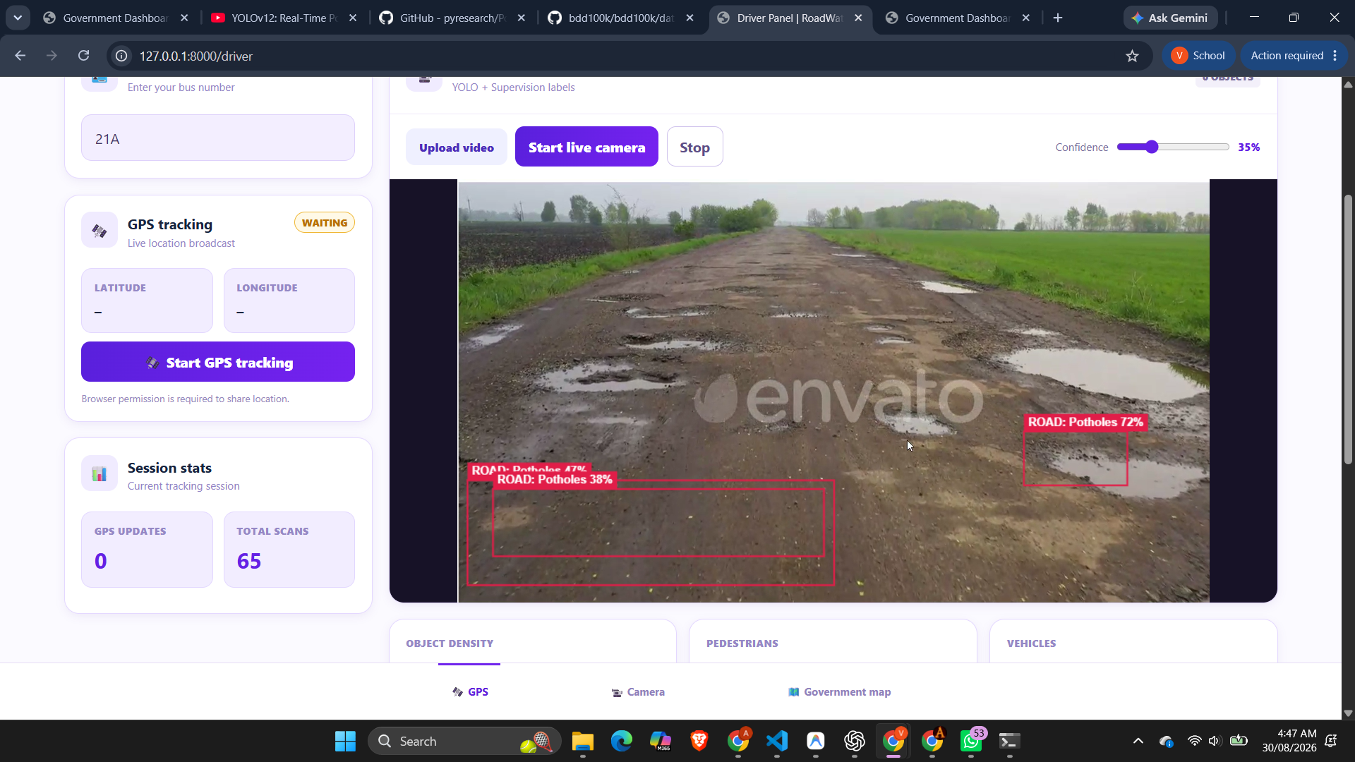
detection analysis
-
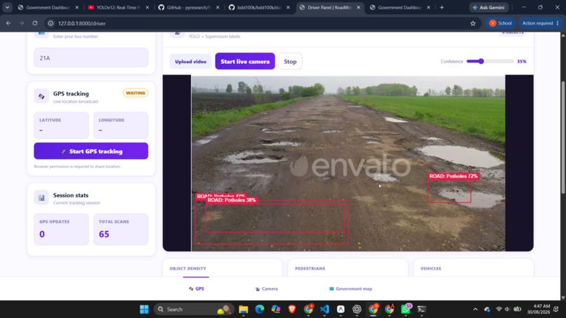
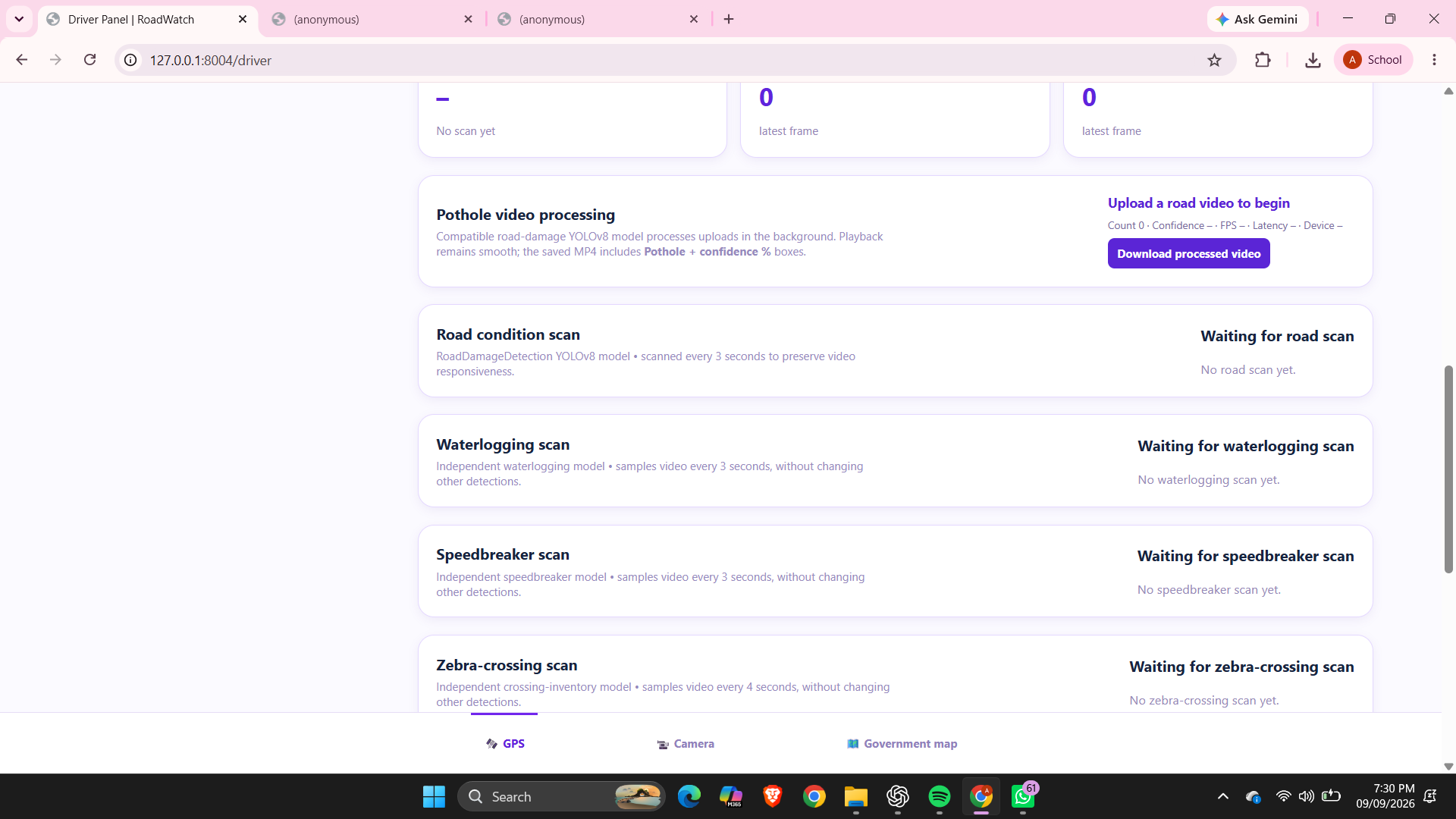
potholes detecion
-
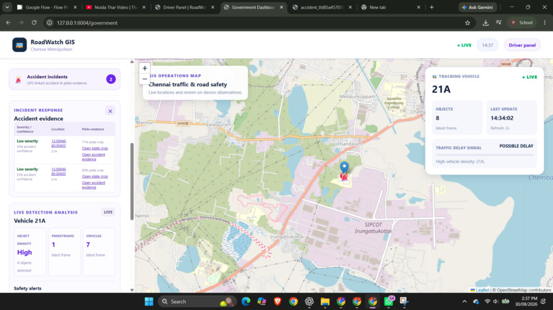
Main Government dashboard
Inspiration
Despite massive investments in smart city infrastructure, urban civic maintenance remains dangerously reactive. Cities rely on static CCTV networks with massive blind spots, manual surveys that take months, and citizen grievance apps that flood departments with duplicate complaints. The "aha" moment for our team came when we realized the solution is already driving right past us: public transport buses. Every day, buses traverse almost every major arterial road and residential street, and they are already equipped with multi-angle cameras. However, these cameras act as passive "black boxes," recording footage that is overwritten unless a major crash occurs. We were inspired to give these existing cameras a brain, transforming passive transit fleets into a proactive, city-wide digital nervous system.
What it does
MovIqSense is an Edge-AI and GIS-integrated urban intelligence platform that turns public buses into mobile sensing units. As the bus drives its daily route, our onboard AI continuously scans the road. It detects infrastructure hazards (potholes, waterlogging, missing dividers), estimates traffic density, flags unsafe pedestrian conditions near school zones, and captures evidence of hit-and-runs (including automated license plate extraction).
Instead of spamming authorities with raw data, the system uses Multi-Bus Collaborative Verification. If multiple buses independently detect the same pothole, the system automatically clusters these observations, boosts the confidence score, and filters out false alarms. The dashboard then ranks every defect using a dynamic priority engine based on severity, traffic density, and safety exposure, telling municipal teams exactly where to send their repair crews first.
How we built it
We engineered a decoupled, edge-to-cloud architecture designed for the chaotic reality of Indian traffic:
- Edge Vision Pipeline: We deployed a custom, shared-backbone YOLOv8 model to concurrently detect both road defects and traffic dynamics. We integrated ByteTrack and Kalman Filtering to track vehicle trajectories and maintain object identities even during temporary occlusions.
- Inverted Telemetry: To avoid choking cellular networks with heavy video streaming, we process everything on the edge. The bus transmits only a lightweight structured JSON payload (GPS coordinates, defect class, confidence) and a single cropped keyframe for evidence.
- Cloud & Spatial Core: The backend is powered by FastAPI and PostgreSQL with PostGIS. This spatial database enables our collaborative geo-clustering, map-matching incoming pings to existing hazard records within a 5-meter radius.
- Command Dashboard: We built the frontend using React, Leaflet, and Mapbox, creating a Live City Map that displays heatmaps, hazard alerts, and an automated incident PDF generator for traffic police.
Challenges we ran into
- Bandwidth Bottlenecks: Streaming video from hundreds of moving buses over 4G is financially and technically impossible. We overcame this by inventing our "Inverted Telemetry" approach, reducing data payload by over 99% by sending only JSON metadata and keyframes.
- Network Dead Zones: Buses constantly drive through tunnels or rural stretches where cellular connection drops. We built an offline-tolerant local SQLite Write-Ahead Logging (WAL) buffer. If the network drops, data queues locally on the bus and automatically syncs to the cloud the millisecond the connection returns.
- False Positives & Sensor Noise: A shadow can look like a pothole, and camera vibration can warp bounding boxes. We mitigated this by requiring temporal verification (a defect must persist across multiple consecutive frames) and spatial deduplication (waiting for a second bus to verify the first bus's detection).
Accomplishments that we're proud of
- Date-Fixed Autonomous Verification: We built a closed-loop system for contractor accountability. If a city engineer assigns a pothole repair deadline of October 1st, the system waits. On October 2nd, the next bus that drives over those coordinates automatically scans the road to verify if the asphalt is smooth or if the pothole persists, effectively auditing the repair without a human inspector.
- Cracking the Edge Efficiency: Successfully running a multi-tasking vision model (hazards, traffic, ANPR, and tracking) on a single edge pipeline without thermal throttling or frame-rate collapse.
- Privacy-by-Design: Implementing automated facial and license plate blurring at the edge before any data reaches the cloud, ensuring civilian privacy while still providing actionable data to the government.
What we learned
We learned the immense difference between a controlled AI lab environment and the unpredictable edge. We had to rethink our entire approach to data ingestion when dealing with moving sensors, realizing that geospatial clustering (PostGIS) and offline buffering were just as important as the accuracy of our YOLO model. We also learned how to translate raw AI outputs into actionable municipal workflows—because 10,000 red dots on a map cause operational paralysis, but a prioritized, auto-verifying queue drives real action.
What's next for AI-Powered Mobile Urban Intelligence Platform
- Hardware Hardening & Pilot: Transitioning from our hackathon prototype to a real-world pilot on 50 municipal buses using NVIDIA Jetson Orin Nano modules.
- Multi-Agency ERP Integration: Establishing direct API pipelines with the State Police Integrated Command Centers and municipal contractor billing systems to fully automate SLA penalty enforcement.
- V2X (Vehicle-to-Everything) Scaling: Eventually opening up our aggregated, real-time hazard telemetry to private navigation systems and autonomous vehicles, creating a safer driving environment for the entire city.
Built With
- anpr
- bytetrack
- dl
- fastapi
- gis-cloud
- gps-explorer
- heap
- json
- ml
- model
- postgresql
- python
- queue
- sqlite
- yolo


Log in or sign up for Devpost to join the conversation.