Inspiration
Crime patterns are not random—they often depend on where and when previous incidents have occurred. We wanted to explore whether AI could help identify these patterns and assist police departments in making better decisions. Instead of only visualizing past crime data, our goal was to build a system that could predict potential crime hotspots, support patrol planning, and also allow citizens to report local issues that may affect public safety.
What it does
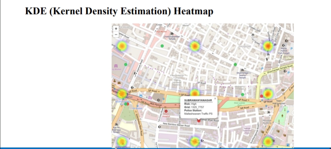
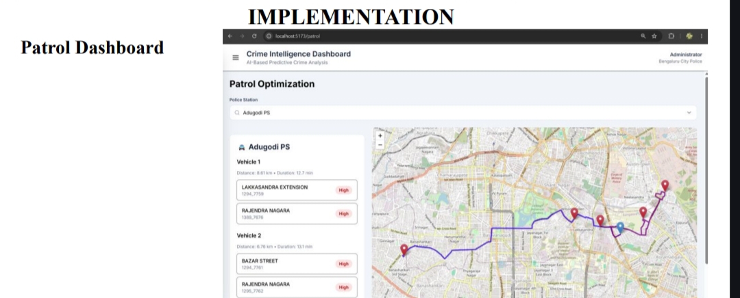
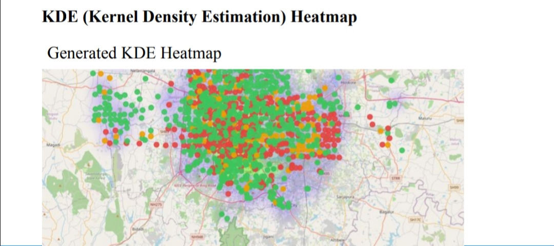
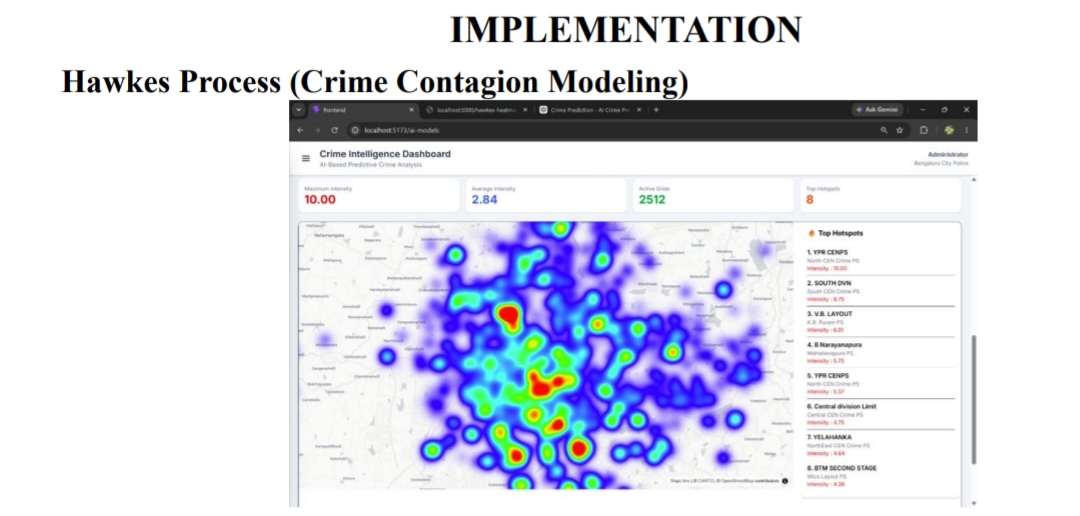
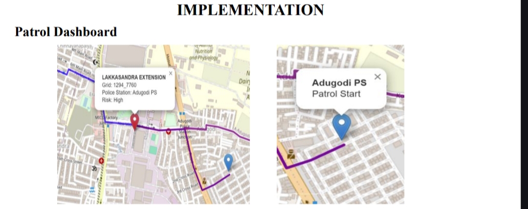
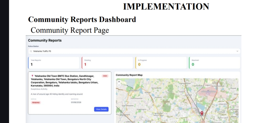
Our project is an AI-powered web application that analyzes historical crime records to identify high-risk areas across Bengaluru. We used LSTM to learn temporal crime trends, GCN to capture spatial relationships between neighboring regions, and a Hawkes Process to model crime contagion effects. The outputs are combined to classify each grid as low, medium, or high risk. The application visualizes these predictions through interactive hotspot maps and KDE heatmaps. It also includes a patrol optimization module that recommends efficient patrol routes based on predicted hotspots and police station jurisdiction. In addition, a community safety module allows citizens to submit reports, which are automatically assigned to the nearest police station and tracked through different resolution stages.
How we built it
We built the backend using Flask and Python, while the frontend was developed using React. Crime data was preprocessed into spatial grids before training the prediction models. We used TensorFlow/Keras for the LSTM model, PyTorch Geometric for the GCN model, and implemented the Hawkes Process for estimating crime intensity. The frontend uses Leaflet and Deck.gl to display maps, hotspot layers, and patrol routes. Community reports are stored in a PostgreSQL database and managed through REST APIs.
Challenges we ran into
One of the biggest challenges was finding a suitable crime dataset with accurate geographic information. Many location records were incomplete or inconsistent, so we spent considerable time cleaning the data and mapping crimes to grid cells. Integrating multiple prediction models into a single risk score while maintaining consistent outputs was another challenge. We also had to handle routing, map visualization, and backend–frontend integration, ensuring that all modules worked together smoothly.
Accomplishments that we're proud of
We are proud of successfully integrating multiple AI techniques into a single working platform instead of building them as separate models. Our system combines LSTM for temporal analysis, GCN for spatial learning, and the Hawkes Process for crime contagion analysis to generate unified crime risk predictions. Another achievement was building a complete end-to-end application rather than just training machine learning models. We developed an interactive dashboard for crime hotspot visualization, a patrol optimization module that generates efficient patrol routes, and a community safety portal where citizens can report incidents and police can track their resolution. We also overcame challenges related to data preprocessing, spatial grid mapping, and integrating the backend and frontend into a functional web application.
What we learned
This project helped us understand how machine learning models can complement each other in solving real-world problems. We gained practical experience in data preprocessing, spatial analysis, REST API development, React-based visualization, and integrating multiple AI models into a complete application. Beyond the technical aspects, we also learned the importance of designing systems that are practical, scalable, and useful for end users such as police departments and citizens.
What's next for AI-Powered Crime Intelligence & Hotspot Detection
We plan to enhance the system by incorporating real-time data such as traffic conditions, weather information, and public events to improve prediction accuracy and patrol planning. Future versions will include role-based authentication for police personnel, live incident monitoring, mobile support for field officers, and automatic notifications for newly reported incidents. We also aim to improve the patrol optimization module by incorporating dynamic route planning based on changing traffic conditions and emergency priorities. In the long term, we envision extending the platform to support multiple cities, enabling law enforcement agencies to make faster, data-driven decisions for smarter and safer communities.
Built With
- axios
- css
- data
- deck.gl
- flask
- geometric
- git
- github
- html
- javascript
- keras
- leaflet.js
- learning
- machine
- numpy
- pandas
- python
- react
- scikit-learn
- sql
- tensorflow
- visualization
- vite


Log in or sign up for Devpost to join the conversation.