-
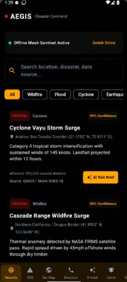
Screen short of UI of app
-
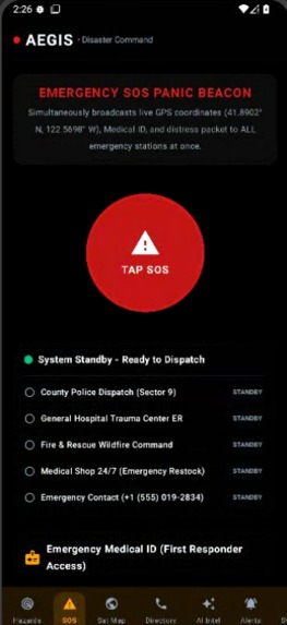
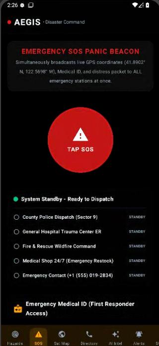
sos window of app
-
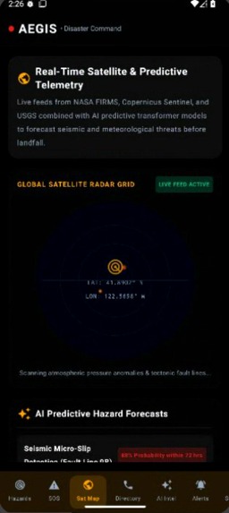
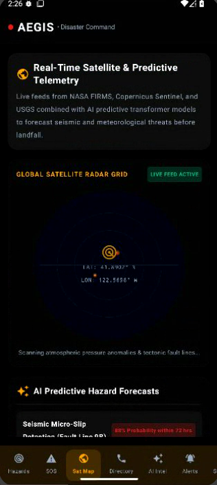
satellite map system window
-
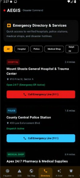
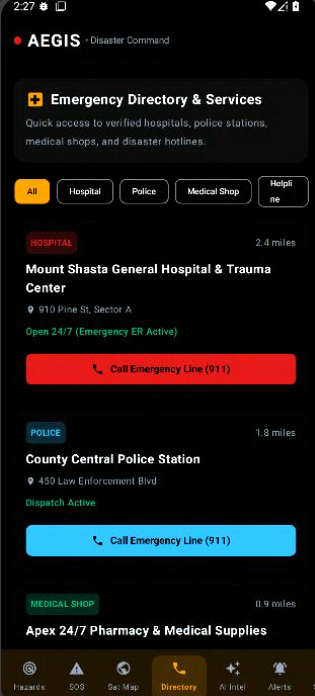
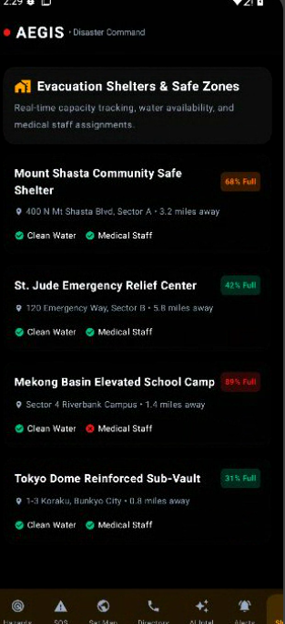
emergency system window
-
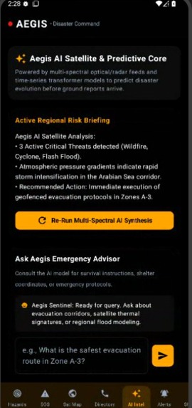
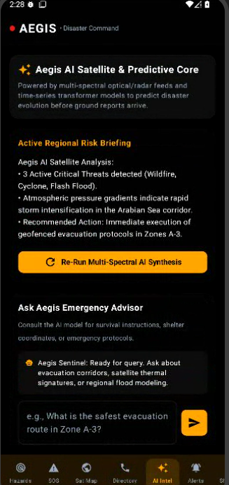
ai assistant system window
-
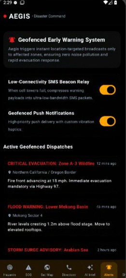
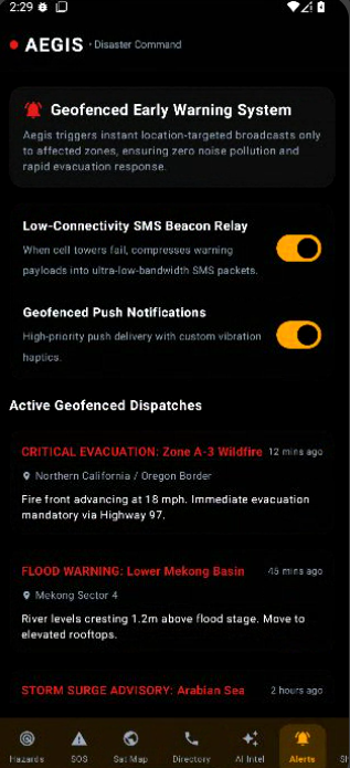
early warning system window
-
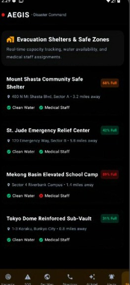
Tips area system window
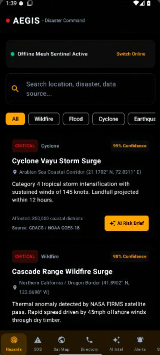
Aegis — AI Disaster Detection & Early Warning System
"By the time you see the wave, it's too late to run. We wanted to build the five minutes back."
Inspiration
Every major natural disaster in recent memory shares one tragic thread: the technology to predict it already existed, but the warning never reached the people who needed it in time. Satellites orbiting the earth capture flood plains rising, wildfires igniting, and cyclones forming hours or even days before the news does. That data sits in research archives, government dashboards, and scientific papers — miles away from the family in a flood-prone valley or the driver of an ambulance trying to find the fastest route into a collapsing zone.
We kept asking the same question: what if the gap between "the satellite knows" and "the person on the ground knows" could be closed to seconds instead of hours? That question became Aegis — an AI system that watches the planet in real time and turns raw satellite signals into a warning a person can act on before disaster strikes, not after.
What it does
Aegis is an end-to-end pipeline that detects, predicts, and communicates natural disasters as they form:
- Detects and predicts across disaster types — floods, wildfires, cyclones/hurricanes, earthquakes-adjacent ground deformation, landslides, and droughts — by continuously ingesting satellite imagery and atmospheric data rather than waiting on manual reports.
- Sends real-time, location-specific alerts — the moment a risk crosses a danger threshold in a given area, Aegis pushes alerts only to the users inside (or about to enter) that geofenced zone, with a plain-language description of the threat, its expected timeline, and recommended action.
- Directs emergency response in real time — Aegis doesn't stop at the public. It simultaneously flags high-need locations to emergency vehicles and dispatch centers, so ambulances, fire crews, and rescue teams are routed to where help is actually required as the situation evolves, not after a call comes in.
The result is a single AI layer sitting between the sky and the street: watching, forecasting, and routing help — continuously, automatically, and before the worst happens.
How we built it
We split the system into three tightly connected layers:
1. Sensing layer. We pull continuous feeds from open satellite and atmospheric sources — including optical and radar imagery, thermal anomaly data for fire detection, sea-surface and pressure data for storm formation, and soil-moisture/elevation data for flood and landslide risk. Because different disasters move at different speeds, this layer normalizes everything into a common time-series and spatial-grid format so one model architecture can reason across all of them.
2. Prediction layer. This is where the AI does the heavy lifting. Convolutional models scan imagery for early visual signatures — a smoke plume, a swelling riverbank, a spinning cloud mass — while time-series forecasting models (LSTM/temporal transformer style) project how a detected anomaly is likely to evolve over the next hours to days. The two outputs are fused into a single risk score per geographic cell, updated continuously as new satellite passes come in.
3. Response layer. Once a cell crosses a risk threshold, the system triggers two parallel actions: a geofenced push/SMS alert to every user inside that cell (built for low-bandwidth delivery, since disaster zones often lose reliable connectivity first), and a dispatch signal to a live map used by emergency services, ranking locations by urgency so responders aren't guessing where to go first.
We built the alerting and mapping layers to be connectivity-resilient — short SMS-based alerts as a fallback whenever push notifications can't get through — because a warning that arrives after the network goes down helps no one.
Challenges we ran into
- False alarms vs. missed disasters. Tuning the risk threshold was the hardest problem in the project. Too sensitive, and we train users to ignore alerts (the "boy who cried wolf" trap). Too conservative, and we miss the early window that makes the whole system worth building. We had to treat this as a continuously tunable parameter per disaster type rather than a single global setting.
- Satellite data is not real-time by default. Many satellite passes revisit the same location only every few hours, which is a problem for fast-forming disasters like flash floods. We had to design around gaps in coverage by blending satellite data with whatever near-real-time atmospheric and ground signals were available, rather than relying on imagery alone.
- Alerting the right people without spamming everyone. Precise geofencing at scale — especially for people who are moving, like drivers or commuters — was harder than static-address alerting and needed careful handling of location updates without becoming invasive.
- Designing for the worst-case network. The people who most need a disaster alert are often the people about to lose cell towers and power. We had to design delivery as degrade-gracefully rather than assume a stable connection.
Accomplishments that we're proud of
- A single unified pipeline that reasons across multiple disaster types instead of building a separate silo for each one.
- A response layer that closes the loop — Aegis doesn't just warn the public, it actively shortens emergency response time by directing help to where it's needed.
- An alerting design built around the reality of disaster zones (unreliable connectivity, moving populations) rather than assuming ideal conditions.
What we learned
The hardest part of a disaster warning system was never the detection — it was earning trust fast enough that people act on a warning within minutes of receiving it. We learned that prediction accuracy is necessary but not sufficient: delivery speed, clarity of the message, and reliability under network stress matter just as much as the AI model underneath. We also learned to respect how differently each disaster type behaves — a wildfire and a flood do not unfold on the same timescale, and treating them identically would have weakened the whole system.
What's next for Aegis
- Expanding disaster coverage to include drought and heatwave prediction using longer-horizon time-series models.
- Partnering with local emergency services and telecom providers to enable direct cell-broadcast alerts, removing dependence on app installs entirely.
- Building a feedback loop where on-the-ground reports from users and responders retrain the model, improving accuracy region by region over time.
- Multilingual, low-literacy-friendly alert formats (icons, audio alerts) so warnings are accessible regardless of language or literacy level.

Log in or sign up for Devpost to join the conversation.