Inspiration In the critical first hours of a disaster—whether it is a flash flood, an earthquake, or an industrial crisis—seconds save lives. We noticed that emergency command centers are often overwhelmed by a flood of raw data. Aerial drone photos and satellite imagery stream in, but managers lack the tools to instantly understand what they are looking at. Instead of data helping them, it creates a bottleneck of confusion. Decisions about where to deploy medical teams or search and rescue units are often left to guesswork or unverified radio updates. We were inspired to create AegisResponse v2.0 to act as a digital co-pilot that cuts through this chaos, turning raw photos and field data into an exact rescue plan in seconds.
What it does AegisResponse v2.0 is an intelligent disaster management system that connects front-line data straight to optimized emergency fleet distribution.
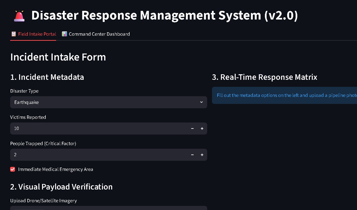
When a field worker uploads a drone photo and enters basic numbers (like the number of people trapped), the system acts as a triple-threat brain:
Scans the Photo: It immediately rates the structural damage as Low, Moderate, or Severe, and highlights the specific problem areas (like debris or water) on the image so humans can see its reasoning.
Calculates the Fleet Response: It instantly determines exactly how many Search and Rescue (SAR) technicians, medical responders, and fire trucks are needed.
Mobilizes the Community: It reads through a local database of volunteers, analyzes their written biographies, and instantly ranks and matches the best individuals (like a heavy machinery specialist) to fill the gaps in the current crisis.
How we built it We constructed the platform as a modular chain using three specialized Artificial Intelligence components and wrapped them inside a simple, interactive web dashboard:
The Vision Layer: We used a pre-trained deep learning image model called EfficientNet-B3 and fine-tuned it on aerial disaster photos. To ensure safety, we added an uncertainty checker. The model uses an entropy math calculation to determine its own confidence: Uncertainty Score = - Sum of [ Probability * Log2(Probability) ] If the model gets confused by an image, it automatically raises its hand and flags the photo for a human to review.
The Allocation Layer: We used a machine learning model called a LightGBM Multi-Output Regressor to predict the perfect rescue fleet. To keep the AI completely safe under extreme conditions, we added hardcoded safety rules that override the model if things look critical. For instance, if more than 4 people are trapped, the software overrides any lower AI estimate and automatically enforces a maximum deployment floor using the formula: 1.5 * Trapped Individuals + 2.
The Natural Language Layer: To match volunteers, we used a text-processing technique called TF-IDF Vectorization paired with Cosine Similarity. It mathematical compares what the disaster needs against what the volunteers can do, producing a clean ranking of local talent.
The Interface: We built the front-end using Streamlit, splitting the app into an intuitive Field Intake Portal for uploading data, and a bird's-eye view Command Center Dashboard for city leaders to track the active fleet.
Challenges we ran into Unbalanced Data: Most disaster datasets are flooded with photos showing "no damage" or "low damage," meaning our AI originally struggled to spot real, extreme destruction. We overcame this by manually applying heavy image distortions (like severe crops, color shifts, and rotations) to the rare damage photos, training the model to recognize worst-case scenarios instantly.
The "Black Box" Problem: Emergency responders are rightfully hesitant to trust a computer program that tells them where to send ambulances without explaining why. We fixed this by ensuring our AI is completely transparent: it visually highlights the exact pixels that caused its damage assessment and relies on strict, logical fallback safety bounds so it never behaves unpredictably.
Accomplishments that we're proud of We are incredibly proud to have created a unified, multi-model AI pipeline that runs entirely in real-time. Getting a computer vision model, a resource allocation model, and a natural language text-matching model to work together in harmony—without slowing down the user experience—was a major milestone. We succeeded in building an application where an emergency worker can input data and receive a tailored, cross-referenced rescue strategy in less than a second.
What we learned Building this project taught us that great AI impact doesn't come from using the biggest or most complex individual model. It comes from multi-model harmony and defensive software design. We learned that when building applications for high-stakes environments like crisis response, you must pair machine learning with clear human safety nets. Merging data predictions with logical rules creates a trustworthy system that empowers human commanders rather than replacing them.
What's next for AI based Disaster Response Management Moving forward, we want to expand AegisResponse v2.0 into an offline-first mobile application. During severe disasters, cellular towers and internet grids are often completely wiped out. The future of AI in disaster management relies on Edge Computing—shrinking these advanced deep learning models so they can run locally on an iPad or a rugged field laptop without needing an active internet connection, keeping rescue operations fully active anywhere on earth.
Colab: https://colab.research.google.com/drive/1G4inm8PVAYwU89_W_HmFe0Jyd8WNMdGv?usp=sharing
Slides: https://docs.google.com/presentation/d/1xjr1zG61bRSeXJA8sCKylwLLxt7aQDHxcOrFR0ygmEM/edit?usp=sharing
Built With
- and-custom-feature-maps)-core-gui-framework:-streamlit-(creating-the-multi-tab-interactive-field-intake-portal-and-command-center-dashboard)-image-processing:-pillow-(pil)-(ingesting
- and-verifying-remote-imagery-payloads-safely)-development-environments:-google-colab-(gpu-accelerated-training-environment-using-a-tesla-t4-runtime)
- cosine-similarity-calculations
- data-manipulation)-deep-learning-frameworks:-pytorch
- data-splitting-metrics)-data-science-stack:-numpy
- google-colab
- image-tensor-transformations)-machine-learning-libraries:-lightgbm-(multi-output-regression-engine)
- joblib
- lightgbm
- local-dataframe-management
- model-development
- numpy
- opening
- pandas
- pandas-(fast-array-manipulations
- pillow
- python
- pytorch
- scikit-learn
- scikit-learn-(tf-idf-vectorization
- session-log-caching)-serialization-utilities:-joblib-(saving-and-restoring-trained-ml-models
- streamlit
- tokenizers
- torchvision-(efficientnet-b3-model-architecture

Log in or sign up for Devpost to join the conversation.