-
-

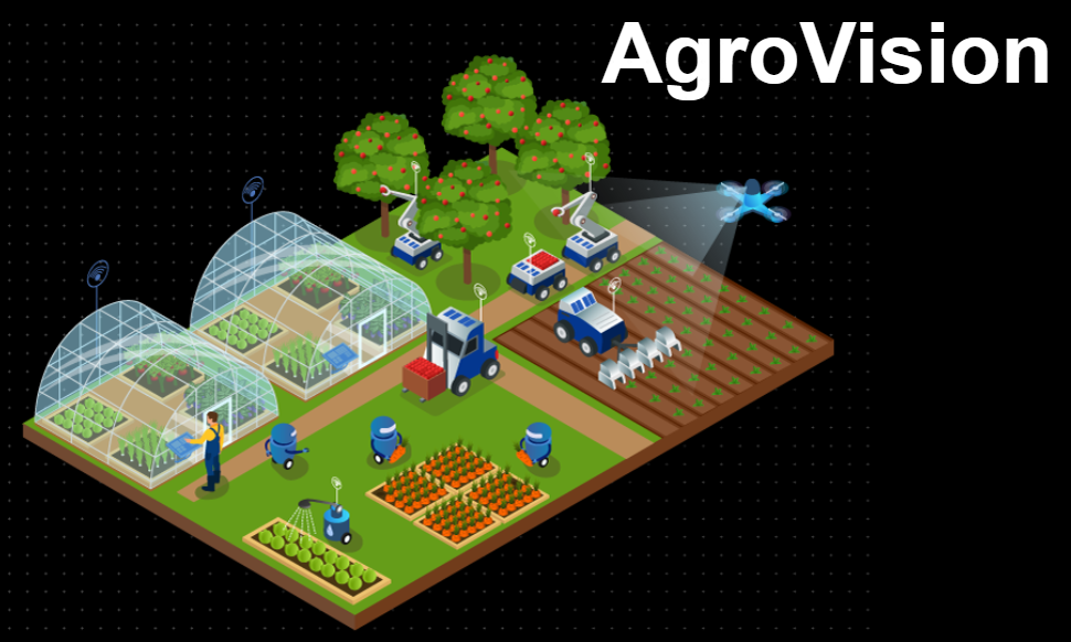
Logo
-
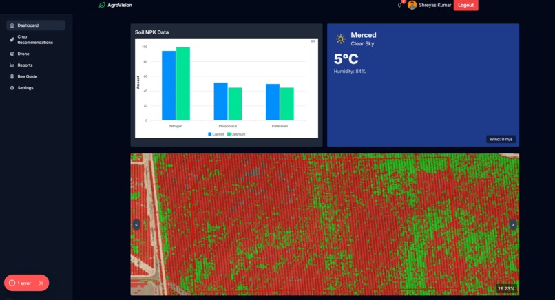
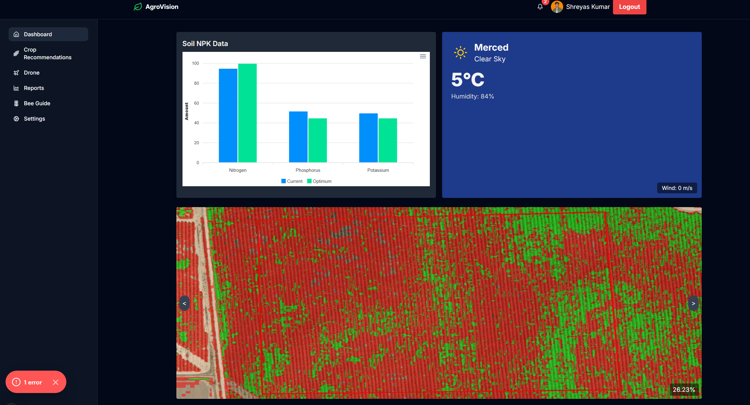
Aerial Farm Data
-
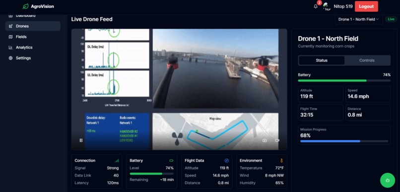
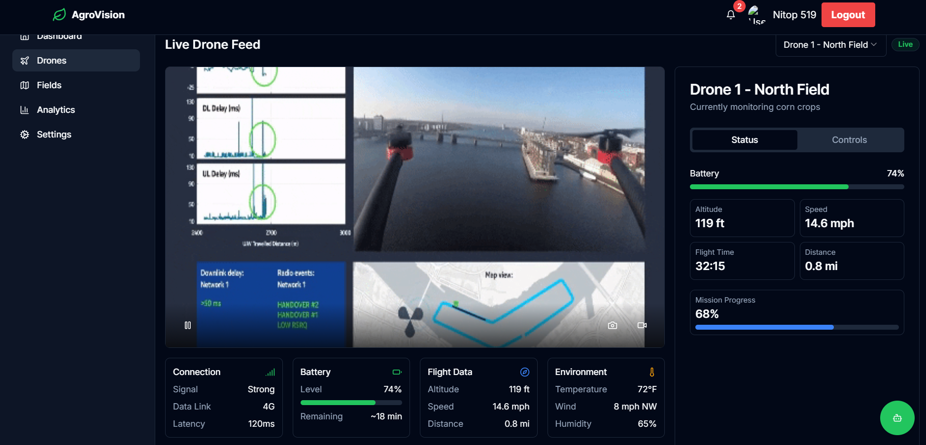
Drone Management
-
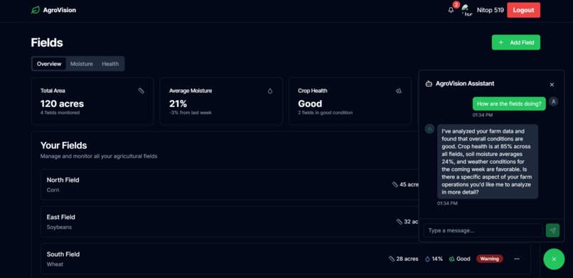
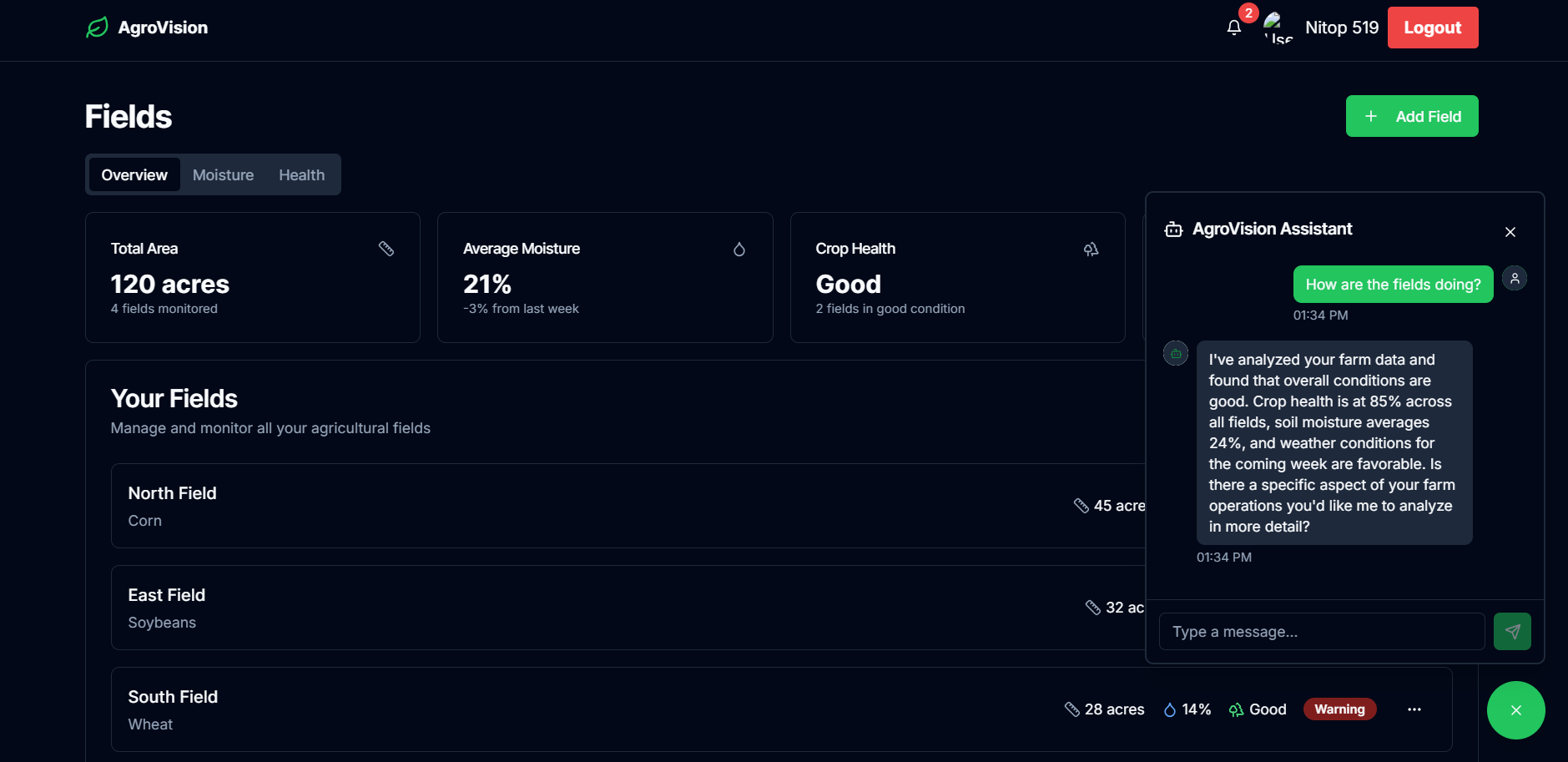
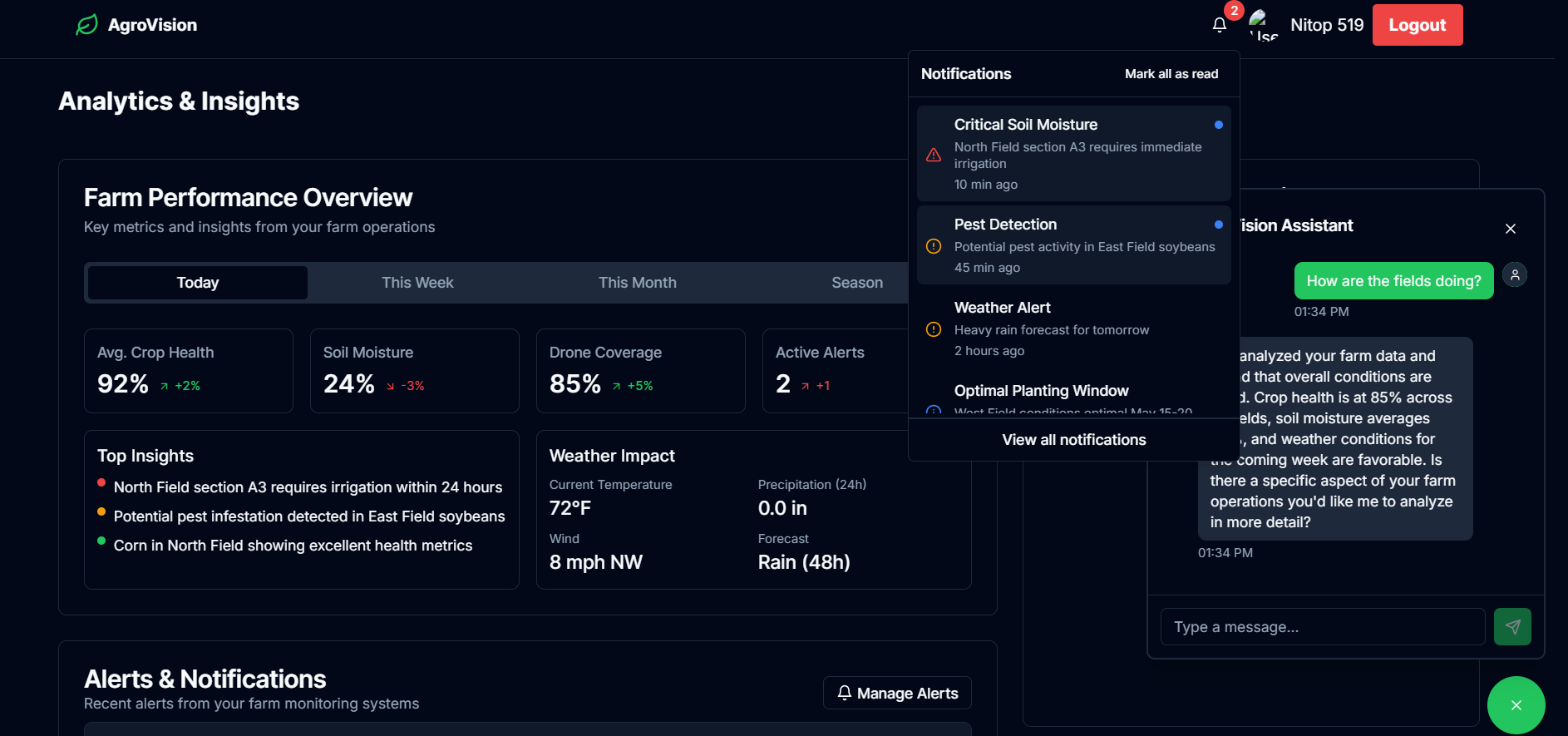
Field Data and Chatbot
-
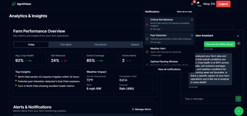
Alerts and Insights
-

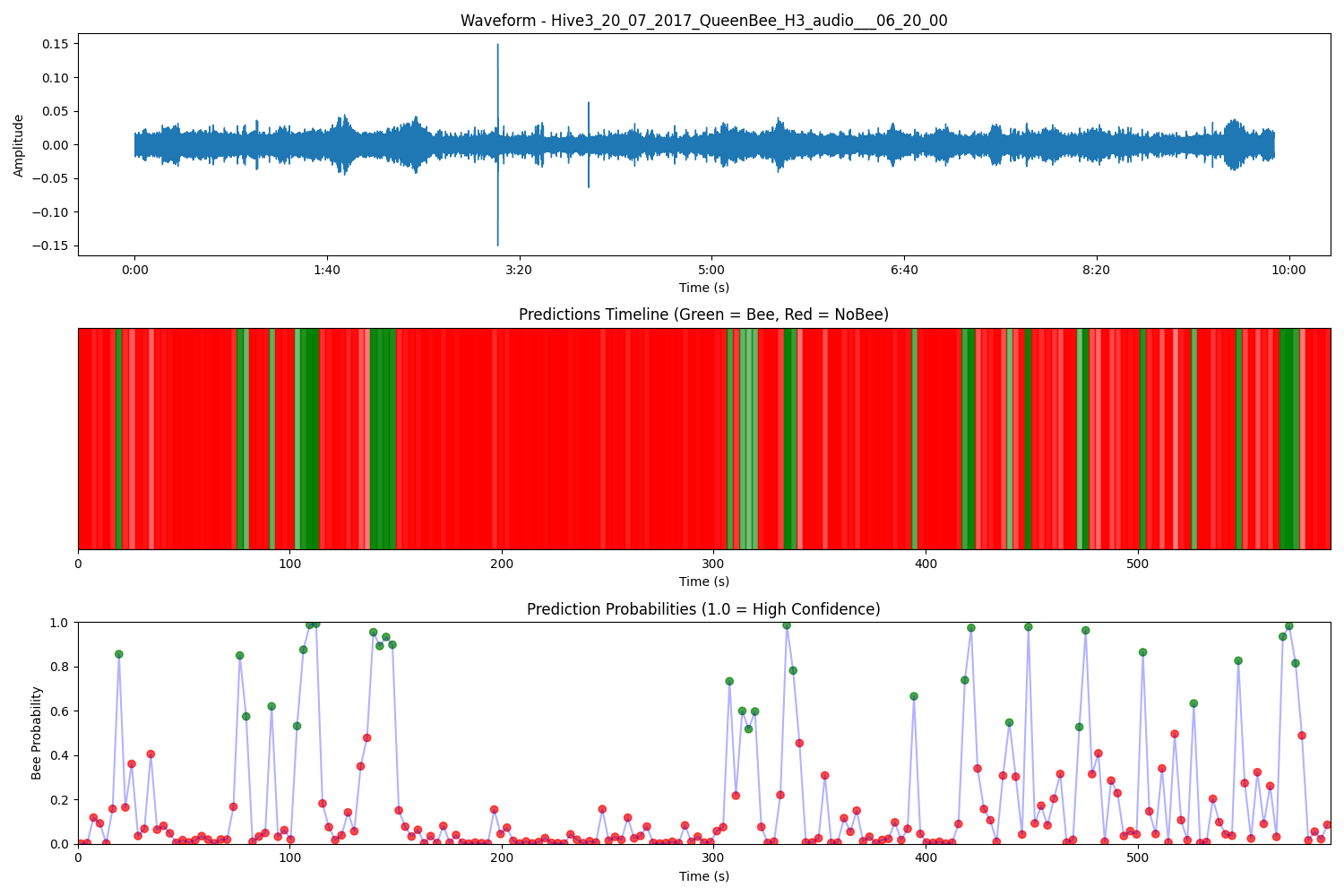
BeeHive Deep Learning Model
AgroVision: AI-Powered Smart Farming Solution 🌱🚜
Overview
AgroVision is a web-based precision agriculture platform that helps farmers monitor and manage farmland using satellite imagery, AI-driven analytics, and remote sensing. By leveraging satellite data, machine learning models, and AI-powered insights, AgroVision provides real-time farm analytics, crop health monitoring, and predictive insights to empower farmers with data-driven decision-making for improved productivity and sustainability.
Key Features
✅ Satellite & AI-Powered Monitoring – Uses satellite imagery and machine learning to analyze soil moisture, crop health, and nutrient levels.
✅ Interactive Dashboard – Displays real-time farm data, weather updates (via OpenWeather API), and AI-driven insights in an easy-to-use interface.
✅ AI-Powered Chatbot – Provides personalized farming advice using Gemini AI, assisting with crop management and problem-solving.
✅ Crop Health & Soil Analysis – Uses AI-based image processing to assess vegetation health, detect diseases, and monitor soil conditions.
✅ Livestock Monitoring – Tracks animal health and movement using AI-powered analysis of satellite and thermal imagery.
✅ Smart Farming Insights – AI-generated recommendations for irrigation, fertilization, and pest control, optimizing farm efficiency and sustainability.
Inspiration
Farmers face increasing challenges due to climate change, soil degradation, pest outbreaks, and water scarcity. Traditional farming methods rely on manual inspections and guesswork, leading to inefficiencies and resource wastage. Inspired by the power of AI, remote sensing, and data-driven decision-making, we built AgroVision to bridge the gap between traditional farming and modern precision agriculture. Our goal is to provide farmers with real-time insights using AI and satellite data, helping them optimize crop and livestock management for a more sustainable and productive future.
What it does
AgroVision is an AI-powered agricultural monitoring platform that provides real-time data analysis on crop health, soil conditions, pest infestations, and livestock well-being. By leveraging satellite imagery and AI models, the system offers insights such as NDVI-based vegetation health, soil moisture levels, pest and disease detection, yield predictions, and climate risk assessments. The interactive dashboard enables farmers to optimize resource usage, improve yields, and minimize environmental impact by making data-driven decisions.
How we built it
Due to hardware constraints, we couldn't integrate real-time drones or IoT sensors, so we adapted by using satellite imagery and machine learning models to generate insights. AgroVision was developed using:
- Frontend: Next.js (React), Tailwind CSS
- Backend: FastAPI (Python)
- Database: MongoDB
- Chatbot: Letta API
- AI Models: Gemini AI for predictive analysis
- Cloud & Containers: Docker, Docker Compose
- Task Processing: Celery
The backend processes satellite imagery and agricultural data using AI-driven analysis via Gemini AI and serves insights through FastAPI. The frontend, built with Next.js (React) and Tailwind CSS, provides an intuitive dashboard for users. MongoDB is used to store processed insights, and Celery handles task processing efficiently. The AI-powered chatbot, integrated via Letta API, allows farmers to receive real-time recommendations. To ensure scalability and smooth deployment, the system is containerized using Docker and Docker Compose.
Challenges we ran into
One of the biggest challenges was finding reliable agricultural datasets and satellite imagery that could substitute for real-time drone or sensor data. Training ML models without access to ground truth sensor data was another hurdle, requiring us to rely on historical data and public datasets for validation. Ensuring accuracy in crop health and pest detection models without direct on-field calibration was also a challenge, and integrating multiple ML models into a seamless workflow required extensive optimization.
Accomplishments that we're proud of
Despite hardware limitations, we successfully built an end-to-end AI-powered agricultural analysis system that provides real-time insights from satellite imagery without requiring on-site sensors or drones. Our machine learning models effectively detect crop stress, analyze soil conditions, and predict agricultural risks, offering valuable insights to farmers. Additionally, we developed a functional and interactive dashboard that transforms raw data into actionable intelligence for smarter farming.
What we learned
Through this project, we gained experience in satellite imagery analysis, AI-driven crop health assessment, and real-time data visualization. We learned how to train ML models for precision agriculture using limited datasets and optimize workflows for integrating multiple AI-driven insights into a single platform. Additionally, we realized the potential of low-cost, AI-powered farming solutions that provide valuable insights without requiring expensive hardware, making precision agriculture more accessible and scalable.
What’s next for AgroVision
Looking ahead, we aim to enhance AgroVision with real-time satellite streaming, advanced AI models for disease detection and weather prediction, and deeper integration with live climate data. Future improvements may include automated farm management recommendations, farmer-specific alerts for pest outbreaks and soil imbalances, and machine learning models that improve over time with more data. Additionally, once access to drones and IoT sensors becomes available, we plan to enhance AgroVision with real-time data collection, precision farming capabilities, and on-the-ground validation. Our long-term goal is to make AI-driven precision agriculture more accessible, efficient, and sustainable, helping farmers maximize productivity while minimizing environmental impact.


Log in or sign up for Devpost to join the conversation.