-
-
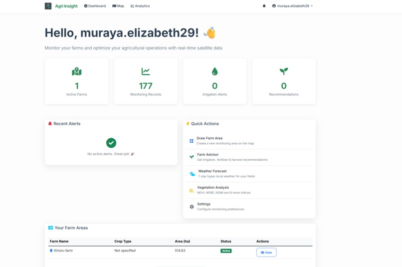
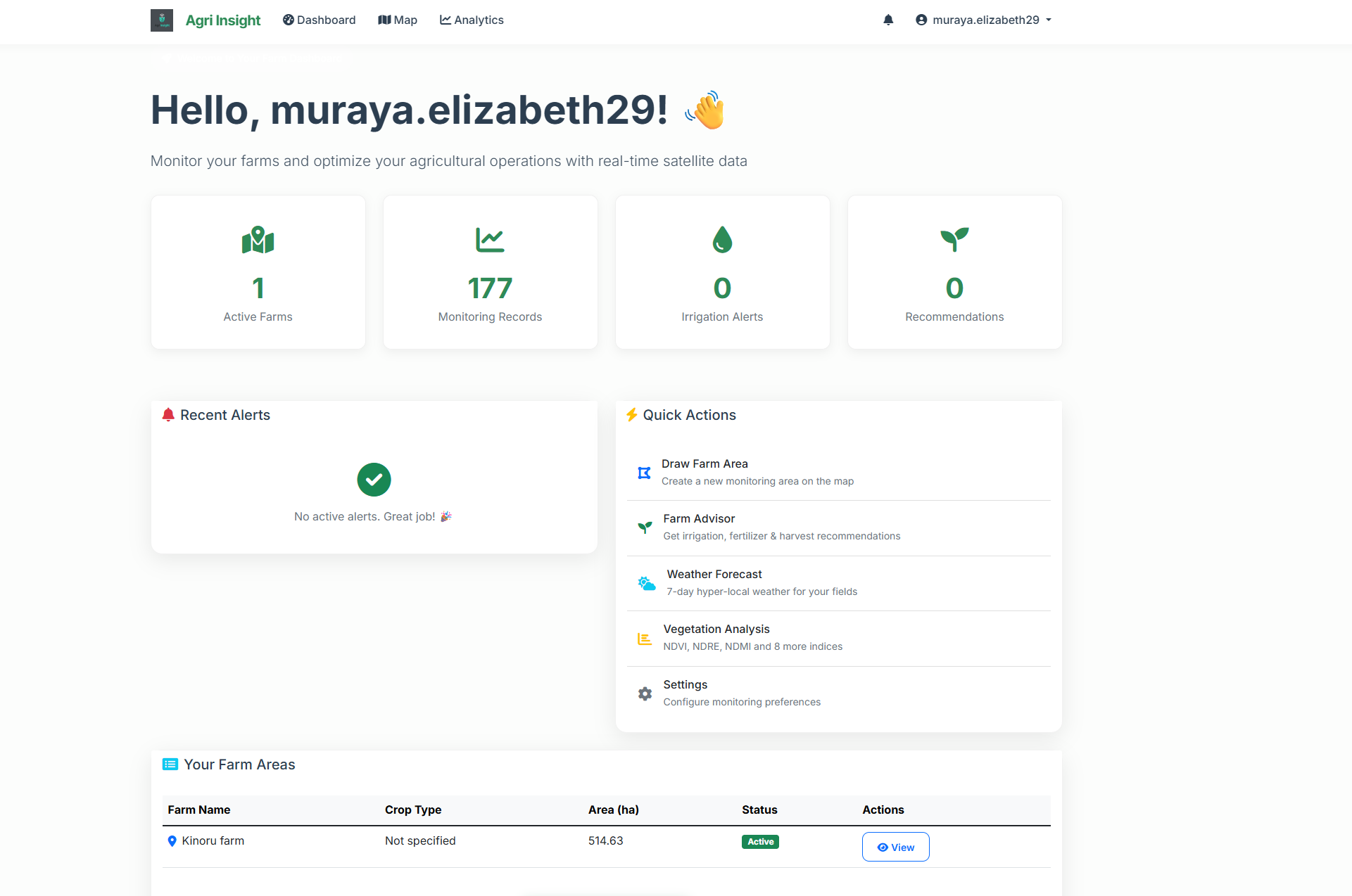
personalised dashboard
-
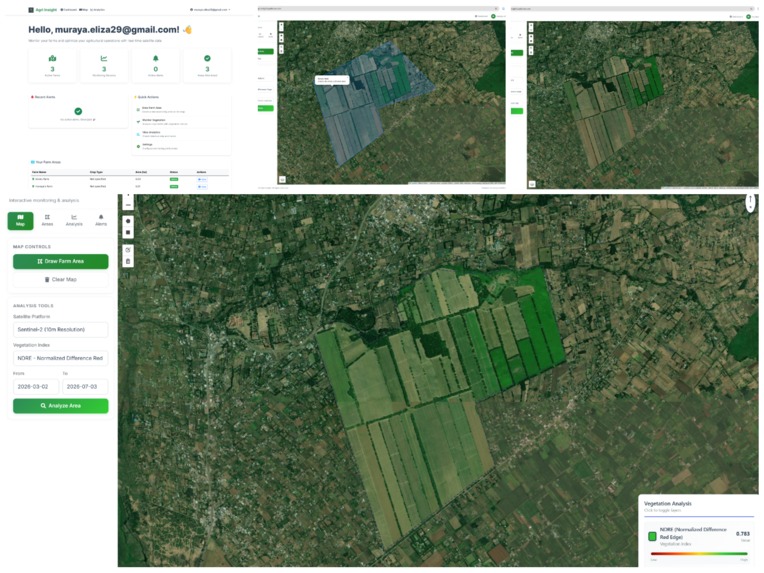
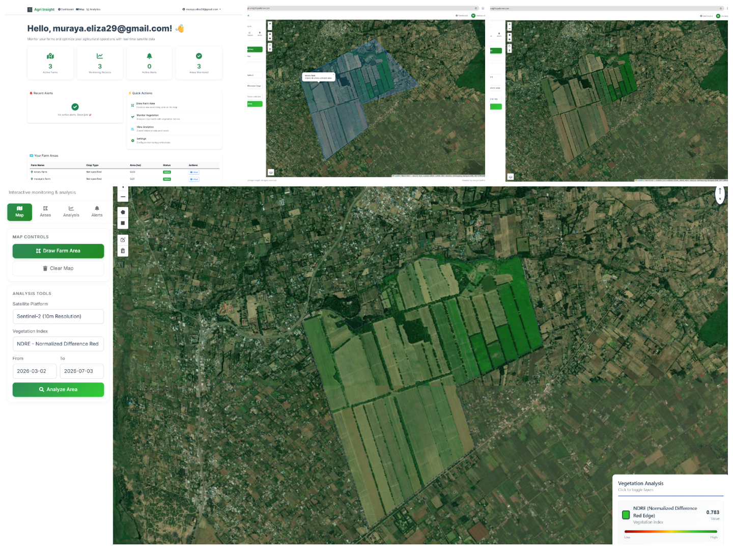
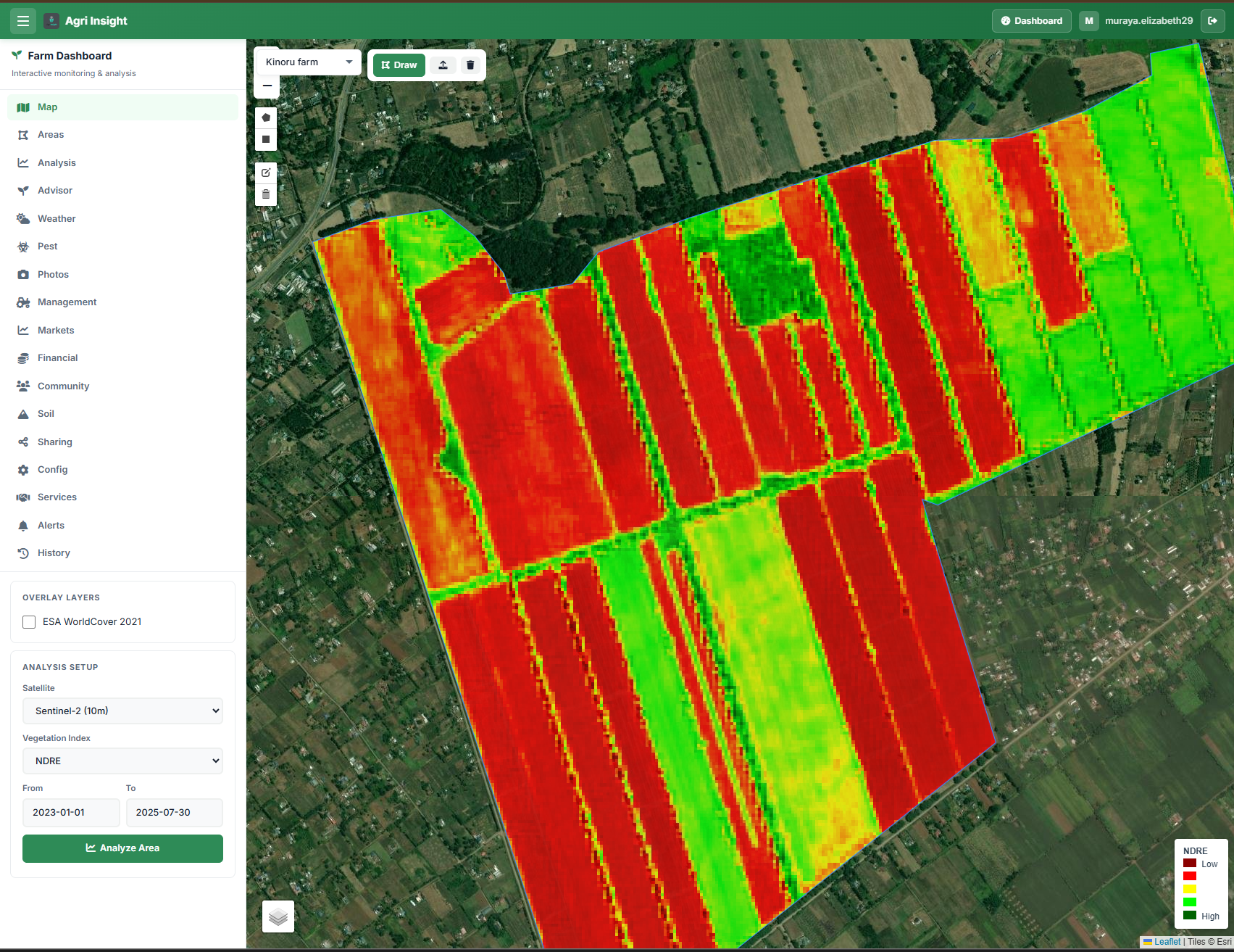
The map interface of the Agriinsights Farm level selection
-
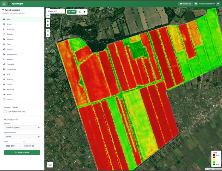
The map interface of the Agriinsights analysis
-
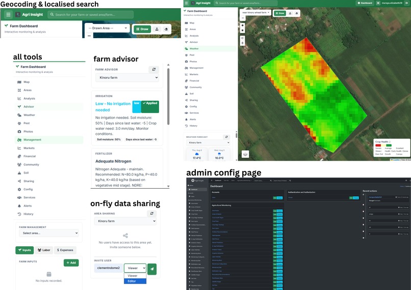
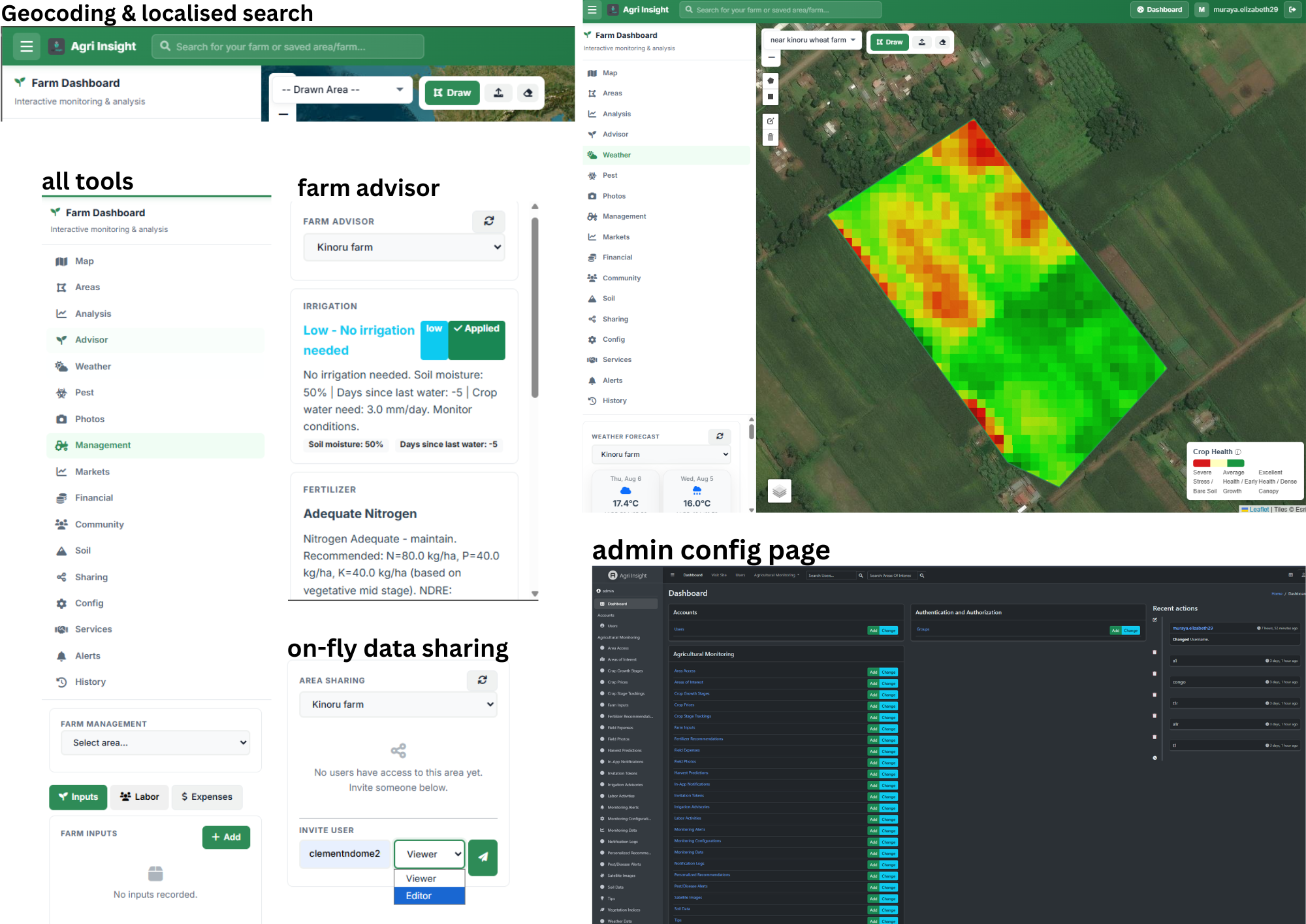
Different tools and pages
-
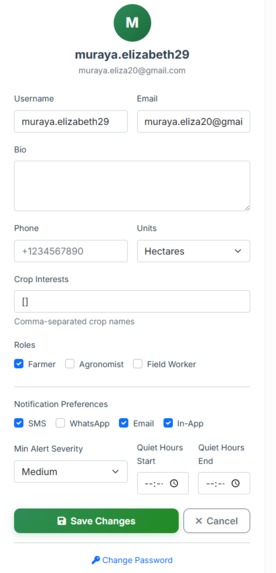
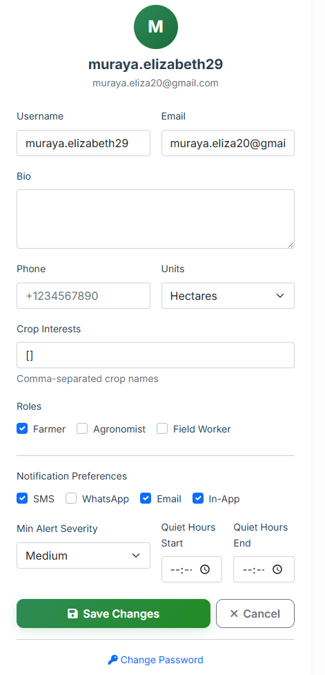
Personalised user profile
-
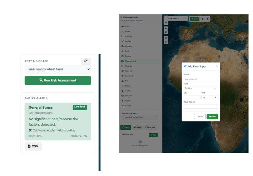
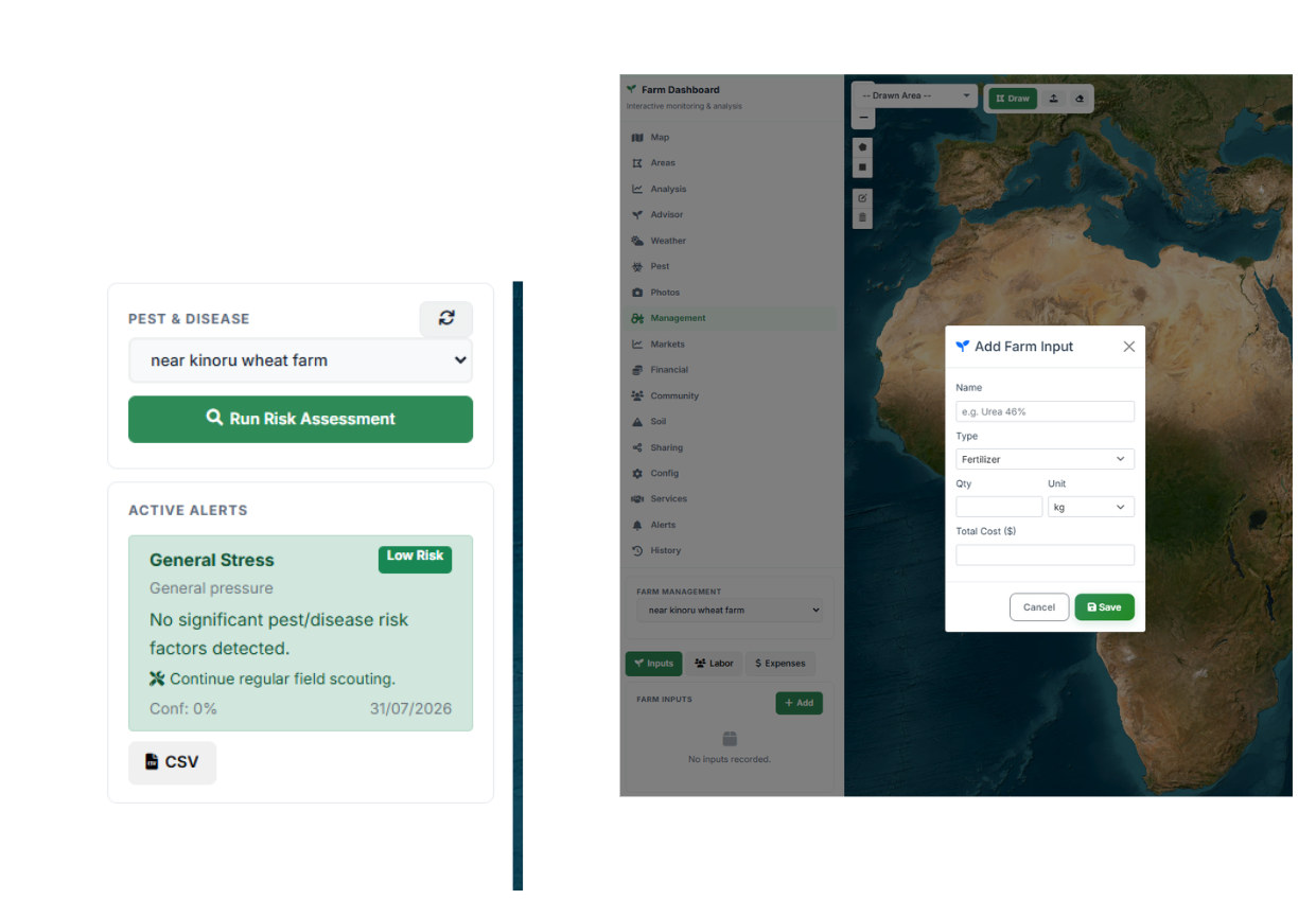
Farm management: pest control and fertilizer panel
Inspiration
Smallholder farmers face increasing pressure from climate change, unpredictable weather patterns, pest outbreaks, soil degradation, and limited access to timely agricultural information. Yet many farming decisions such as when to irrigate, fertilize, or harvest are still made using manual observations and experience alone.
We built AgriInsight to bridge this gap by transforming Earth observation data, geospatial intelligence, weather forecasts, and artificial intelligence into practical, actionable insights for farmers. Our goal was to create an accessible platform that helps farmers monitor crop health, detect risks early, optimize resource use, and make informed decisions that improve productivity and resilience.
What We Learned
Building AgriInsight gave us valuable experience in combining remote sensing, GIS, machine learning, and agricultural decision support into a single operational platform.
We learned how to process and analyse satellite imagery from multiple sources, derive and interpret vegetation indices such as NDVI, EVI, SAVI, NDMI, NDRE, and others, and translate those measurements into meaningful recommendations for farmers. We also gained deeper insight into integrating machine learning models for crop health assessment, yield prediction, anomaly detection, and advisory generation.
Beyond the technical implementation, we learned that the true value of geospatial technology lies not in displaying maps or analytics, but in converting complex environmental data into simple actions that farmers can confidently take.
How We Built It
AgriInsight is a GIS-powered agricultural intelligence platform built using a combination of geospatial, AI, and cloud technologies.
Key technologies include:
- Google Earth Engine for satellite imagery acquisition and large-scale geospatial processing.
- Sentinel-2, Landsat, and MODIS imagery for crop monitoring and environmental analysis.
- Django, GeoDjango, PostgreSQL, and PostGIS for backend services and spatial data management.
- Leaflet.js for interactive farm mapping and boundary management.
- TensorFlow, Scikit-learn, and machine learning models for crop health analysis, yield prediction, and anomaly detection.
- Celery and Redis for scalable background processing.
- RESTful APIs for system integration and data access.
The platform enables farmers to:
- Digitally map and manage farm boundaries.
- Monitor crop health using 11 vegetation indices, including NDVI, EVI, SAVI, NDMI, NDRE, and LAI.
- Track crop growth stages throughout the farming cycle.
- Access hyper-local weather forecasts and environmental insights.
- Receive AI-powered irrigation recommendations based on crop stage, soil conditions, moisture status, and weather forecasts.
- Obtain fertilizer recommendations using crop-specific nutrient requirements and vegetation analysis.
- Predict optimal harvest timing and estimate crop performance.
- Receive automated SMS and WhatsApp alerts for critical events such as crop health issues.
- Access insights even in low-connectivity environments through Progressive Web App (PWA) support.
Challenges We Faced
One of the biggest challenges was integrating multiple sources of agricultural intelligence into a unified and user-friendly platform.
Processing large volumes of satellite imagery while maintaining responsive performance required careful optimization of geospatial workflows. Combining Earth observation data, weather forecasts, crop growth models, and machine learning predictions into a coherent advisory system also introduced significant technical complexity.
Another challenge was ensuring that advanced geospatial analytics remained understandable and useful for farmers who may not have technical expertise. Designing intuitive visualizations, actionable recommendations, and automated alert mechanisms was critical to making the technology practical and accessible.
We also had to balance scalability, prediction accuracy, and usability while accounting for real-world challenges such as limited internet connectivity and diverse agricultural conditions.
Accomplishments That We're Proud Of
We successfully developed an end-to-end agricultural intelligence platform that goes beyond crop monitoring to provide actionable decision support.
Some of our key achievements include:
- Integrating satellite imagery, weather forecasting, GIS, and AI into a single platform.
- Supporting 11 vegetation indices for comprehensive crop health assessment.
- Building automated irrigation, fertilizer, and harvest advisory systems.
- Implementing machine learning models for crop analysis and predictive insights.
- Developing an offline-capable solution that remains accessible in low-connectivity regions.
By combining AI, Earth observation, and geospatial intelligence, AgriInsight aims to help farmers increase productivity, reduce resource waste, strengthen climate resilience, and make more informed decisions for sustainable agriculture.
Built With
- bootstrap
- celery+redis
- django
- gdal
- gee-api
- geodjango
- gis
- google-auth
- javascript
- jinja
- leaflet.js
- mapbox
- ml
- postgis
- postgresql
- python
- stac
- titiler
- vector-search-ai


Log in or sign up for Devpost to join the conversation.