Inspiration
Davis and college towns like it are full of cyclists, but not all of them feel equally safe on the road. Older adults, women riding alone, and students commuting at night often avoid certain streets not because they're inconvenient, but because they feel dangerous. Personally, while biking, we have experienced many near misses at dimly lit streets or streets with unprotected turns. Multiple incidents happened where cyclists were hit while riding, and existing navigation apps optimize for speed. Nobody optimizes for safety. We wanted to build an app to show users the safest route possible to optimize for safety.
What it does
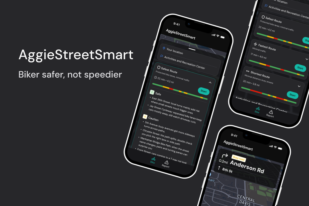
Aggie Street Smart allows cyclists to choose the safest path. It color-codes route segments by risk level: green for safe, orange for caution, red for avoid, and defaults to the safer alternate, even if it takes a few extra minutes. A street view panel uses AI vision to analyze segments in real time, surfacing tags such as lighting quality, foot traffic, and visible hazards, and pulling weather conditions, traffic speeds, dangerous intersections, and crime data from the surrounding areas.
How we built it
Next.js + shadcn/ui for the frontend and component system. Mapbox for map rendering, routing, live traffic data, road design data, and crime data. Vision model to analyze street view frames and generate safety tags. Server-sent events (SSE) to stream AI analysis into the UI without blocking the route load. Safety scoring is applied as a weight on top of Mapbox's Directions API, and segments are re-ranked by a composite score of lighting, traffic volume, and reported incident density.
Challenges we ran into
Finding live map data was tricky.
Accomplishments that we're proud of
A mixture of both deterministic and non-deterministic evaluations for safety. Evaluating using AI and real-time data. We are proud to create something that has the potential to reduce traffic incidents and make biking safer for everyone.
What we learned
A lot of streets in Davis are poorly optimized for rider safety, even though it's a town heavily known for biking. Poor lighting and road design create a lot of blind spots and dangerous intersections.
What's next for Aggie Street Smart
We want to deploy it so bikers in Davis can try it out and find the safest route, especially at night or in poor weather, as well as report this to the city of Davis to improve city infrastructure.


Log in or sign up for Devpost to join the conversation.