-
-
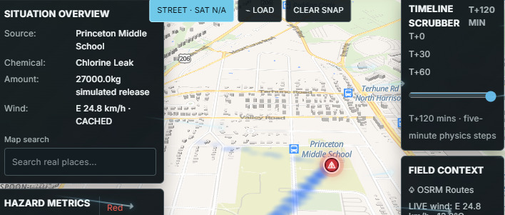
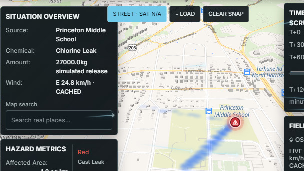
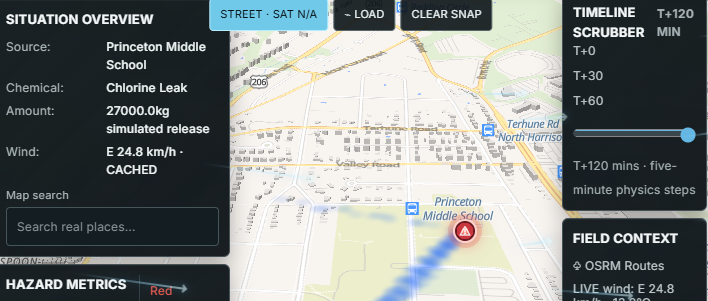
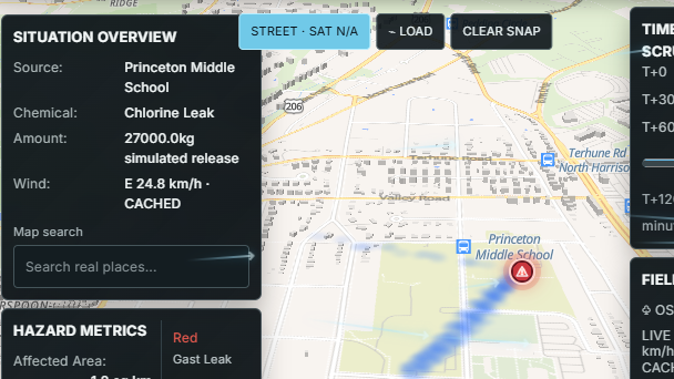
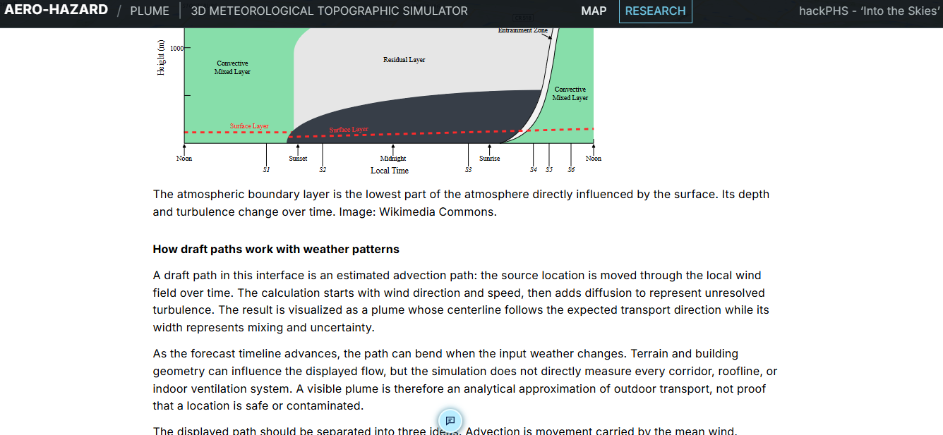
This is our dashboard. Everything is accessible without scrolling.
-
-
-
-
AeroPlume 3D — Product Documentation & Overview
Tagline: Translating complex 3D fluid dynamics into real-time, life-saving emergency action.
1. Inspiration & Problem Statement
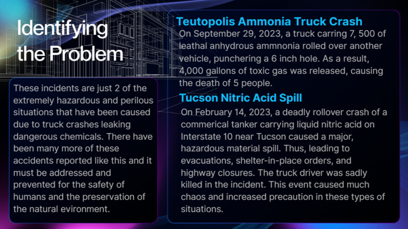
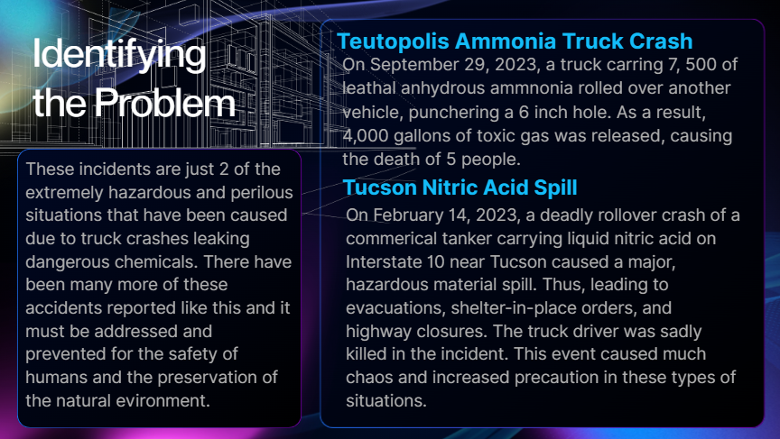
In the critical first 15 minutes of an industrial chemical leak, train derailment, or radiological release, incident commanders face a dangerous information void. Legacy atmospheric plume dispersion software tools are often static, slow to compute, or rely on flat 2D maps designed decades ago.
When hazardous airborne substances hit urban street canyons, dense building footprints, or low-elevation valleys, they do not disperse in uniform flat circles. Heavy gases pool in low terrain, drift along street corridors, and deflect off building boundaries. AeroPlume 3D was created to bridge the gap between rigorous atmospheric fluid dynamics and actionable, ground-level incident command—delivering a real-time 3D simulation and intelligent dispatch co-pilot.
2. Scientific Research & Physics Foundation
Developing AeroPlume 3D required extensive research across atmospheric science, fluid mechanics, toxicological standards, and spatial GIS engineering:
A. Atmospheric Transport & Fluid Dynamics
We researched atmospheric dispersion modeling, implementing a full 3D Advection-Diffusion Partial Differential Equation (PDE) evaluated in GPU shader space:
$$\frac{\partial C}{\partial t} = -\mathbf{u} \cdot \nabla C + D \nabla^2 C + S - \lambda C$$
Where:
- $C(\mathbf{x}, t)$ represents pollutant concentration at spatial coordinates $\mathbf{x} = (x, y, z)$ and time $t$.
- $\mathbf{u} = (u, v, w)$ is the 3D wind velocity field vector.
- $D = (D_x, D_y, D_z)$ is the atmospheric turbulent diffusion tensor.
- $S$ is the mass emission release source term.
- $\lambda$ accounts for physical decay or biological/radiological half-life ($\lambda = \frac{\ln 2}{t_{1/2}}$).
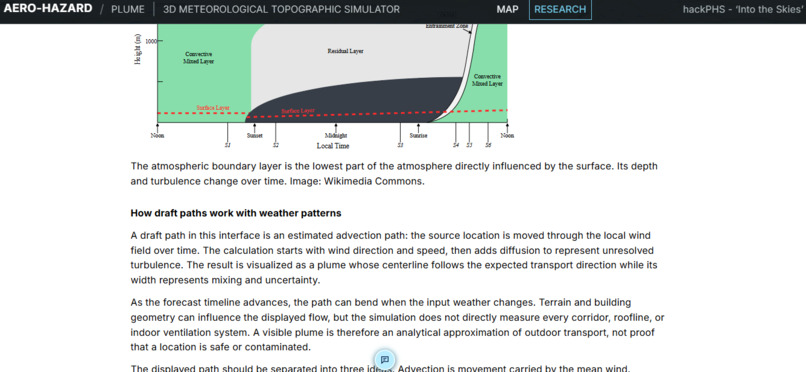
We integrated Pasquill-Gifford Atmospheric Stability Classes (A through F) to dynamically calibrate diffusion coefficients based on solar irradiance, thermal updrafts, wind shear, and night-time inversion layers.
B. Dense Gas Dynamics & Physical Hazard Profiles
We researched the physical chemistry of major industrial hazards (Chlorine, Anhydrous Ammonia, Methane, Iodine-131, and Biological Aerosols). Heavy gases—such as Chlorine ($\text{Cl}_2$), which is $2.47\times$ denser than air—do not immediately dilute into the upper atmosphere. Our physics solver simulates negative buoyancy effects, causing heavy gas clouds to hug ground contours, pool in low elevation terrain, and navigate around structural barriers.
C. Toxicological Exposure Standards
We mapped chemical concentration boundaries to established federal safety guidelines:
- IDLH (Immediately Dangerous to Life or Health): Critical evacuation zone.
- PEL (Permissible Exposure Limit): Respiratory protection required.
- AEGL (Acute Exposure Guideline Levels): 1-hour, 4-hour, and 8-hour toxic dose calculations ($C^n \cdot t$).
D. Digital Elevation Models (DEM) & Structural Geometry
We researched the integration of high-resolution Digital Elevation Model (DEM) heightmaps and OpenStreetMap (OSM) vector extrusions, enabling the WebGL physics shader to execute real-time elevation height sampling and structural barrier collisions directly on the GPU.
3. Core System Capabilities
- 3D Volumetric GPU Physics Engine: Renders real-time particle and volumetric advection-diffusion clouds in WebGL / Three.js over 3D terrain and building geometries.
- Agentic Voice Dispatch Co-Pilot: Powered by ElevenLabs text-to-speech synthesis and LLM agentic function calling, allowing commanders to state emergency reports verbally, receive spoken status updates, and trigger instant map updates.
- Hyper-Local Context & Action Plans: Automatically queries nearby OpenStreetMap micro-features (HVAC air intakes, water sources, fire hydrants, school zones) and detects responder GPS environment state (Indoors vs. Outdoors) to generate tailored Emergency Action Plans.
- Multi-Layer Tactical Controls: Includes FLIR thermal infrared vision modes, volumetric Z-axis altitude slicing planes, timeline scrubbing ($t=0$ to $t=120\text{ min}$), and standardized GeoJSON perimeter export tools.
4. Hardware Edge Integration (IoT Extension)
To bridge digital simulation with physical field hardware, AeroPlume 3D pairs with an external microcontroller telemetry node (Arduino / Grove platform):
- Serial Telemetry Relay: The web app broadcasts real-time threat levels and safest evacuation bearings to the hardware over WebSerial.
- Visual Status Indicator: The RGB LCD backlight dynamically shifts from green (Safe) to flashing red/amber (Hazard Warning) based on localized toxic thresholds.
- Mechanical Directional Servo: A physical directional arrow pointer rotates to display the safest real-world escape vector away from the downwind plume center.

Log in or sign up for Devpost to join the conversation.