The idea behind Aeris started with a simple question: with thousands of satellite images being captured every day, how do we actually make sense of all that information?
Satellite imagery contains an incredible amount of information about our planet. We can see cities expanding, roads appearing, vegetation changing, water bodies shifting, and landscapes transforming over time. But finding the right image, comparing different dates, and understanding what actually changed can be surprisingly difficult.
That was the problem we wanted to solve with Aeris.
What Inspired Us
We were inspired by the idea that satellite imagery should not just be something that experts download, inspect manually, and interpret image by image. We wanted to make Earth observation feel more searchable, understandable, and intelligent.
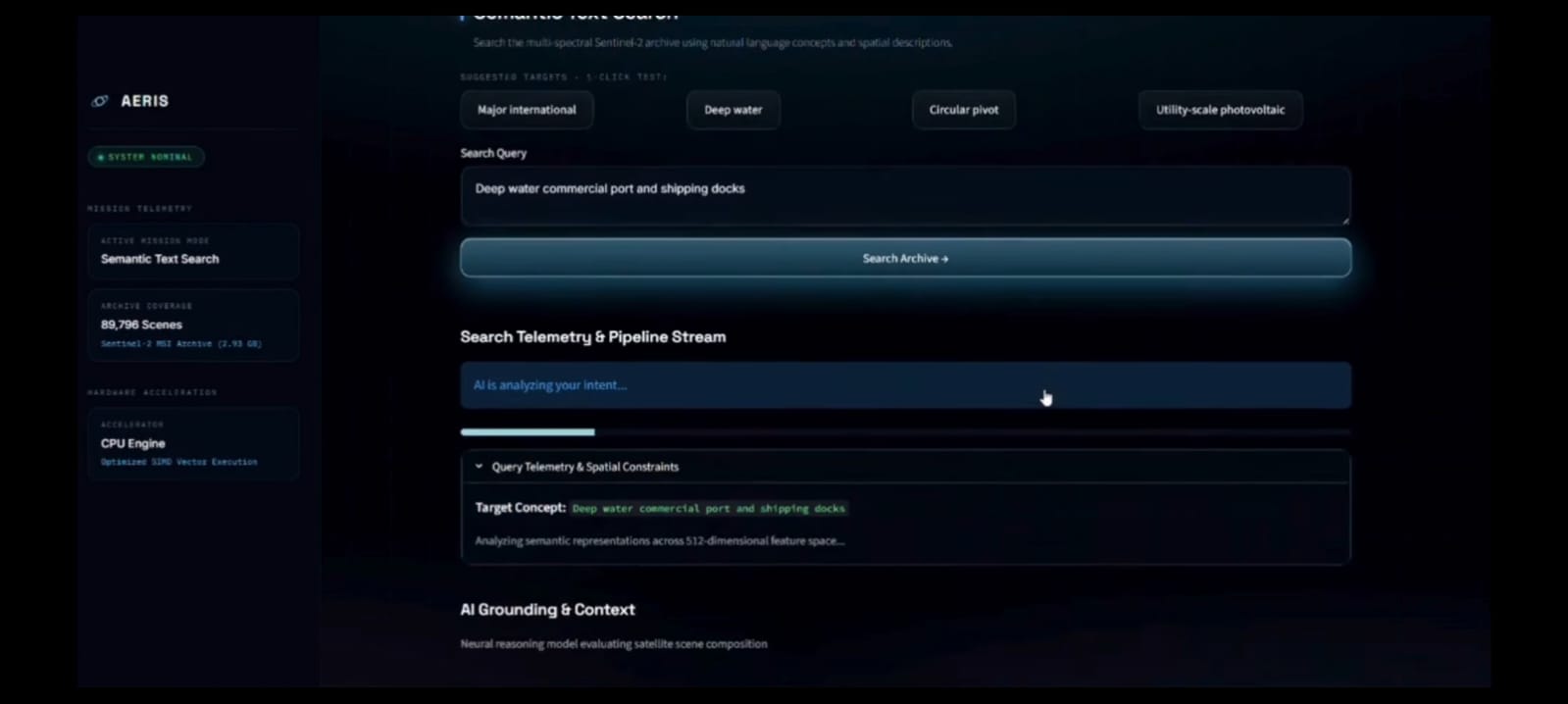
Instead of forcing someone to know exactly where an image is stored or which satellite tile they need, we wanted them to be able to describe what they are looking for in natural language.
For example, a user could search for something like:
“Find areas where new construction appeared near a city.”
The system should then help discover relevant satellite images and allow the user to understand how those locations changed over time.
That idea eventually became Aeris — an AI-powered platform for understanding our changing Earth through satellite imagery.
What We Learned
Building Aeris taught us that creating an AI system is very different from simply putting an AI model into an application.
We had to learn how different pieces of the system work together — from satellite imagery and geospatial information to computer vision, embeddings, vector search, change detection, and multimodal AI.
We explored OpenCLIP and RemoteCLIP to understand images semantically and used FAISS to make large-scale similarity search practical. We also worked with satellite image metadata, coordinates, temporal relationships, and image preprocessing.
One of the biggest lessons was that good results depend heavily on the data and the pipeline around the model. A powerful model alone does not automatically create a useful product.
We also learned how important it is to think about false positives. A difference between two satellite images does not necessarily mean that something actually changed. Clouds, shadows, seasonal vegetation, haze, lighting, and image misalignment can all create misleading differences.
That pushed us to think beyond simply detecting pixels that changed and toward understanding meaningful change.
How We Built Aeris
We designed Aeris as a combination of several AI and geospatial components.
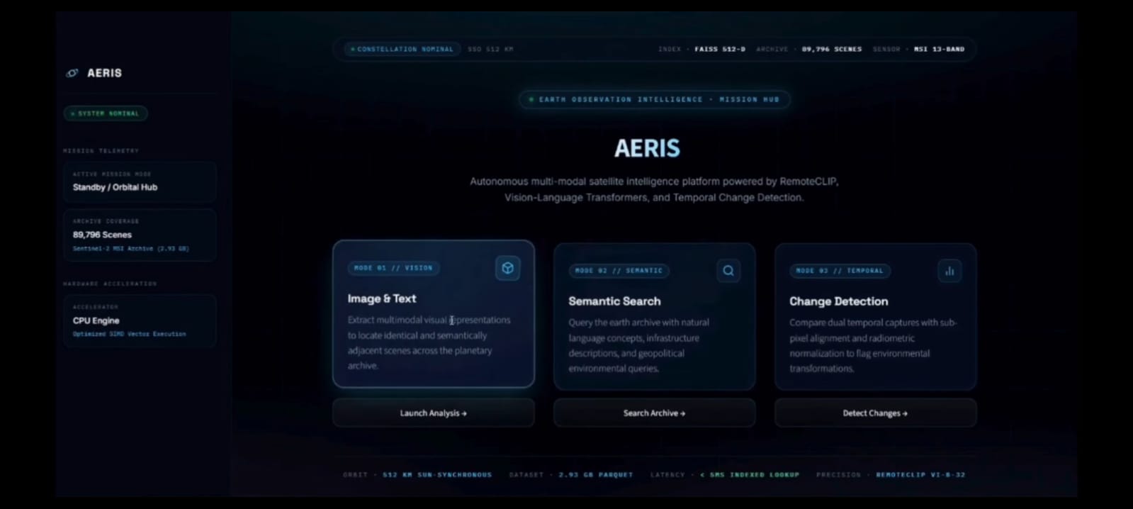
At the core is a semantic retrieval system. Satellite images are converted into meaningful vector representations using OpenCLIP and stored in a FAISS vector index. This allows users to search for visually or semantically similar locations instead of relying only on filenames or coordinates.
We also added image-based search, allowing a user to provide an image and find similar satellite scenes.
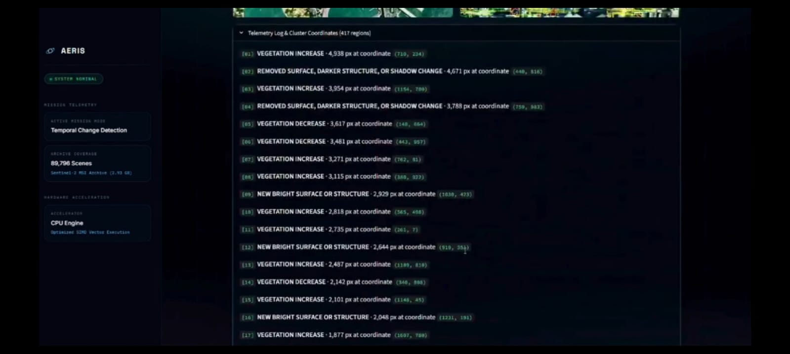
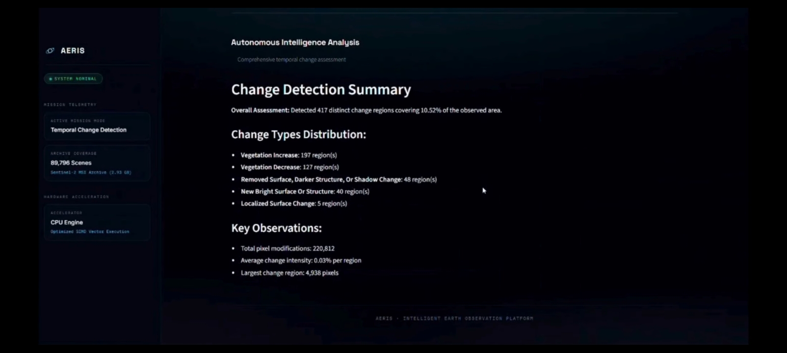
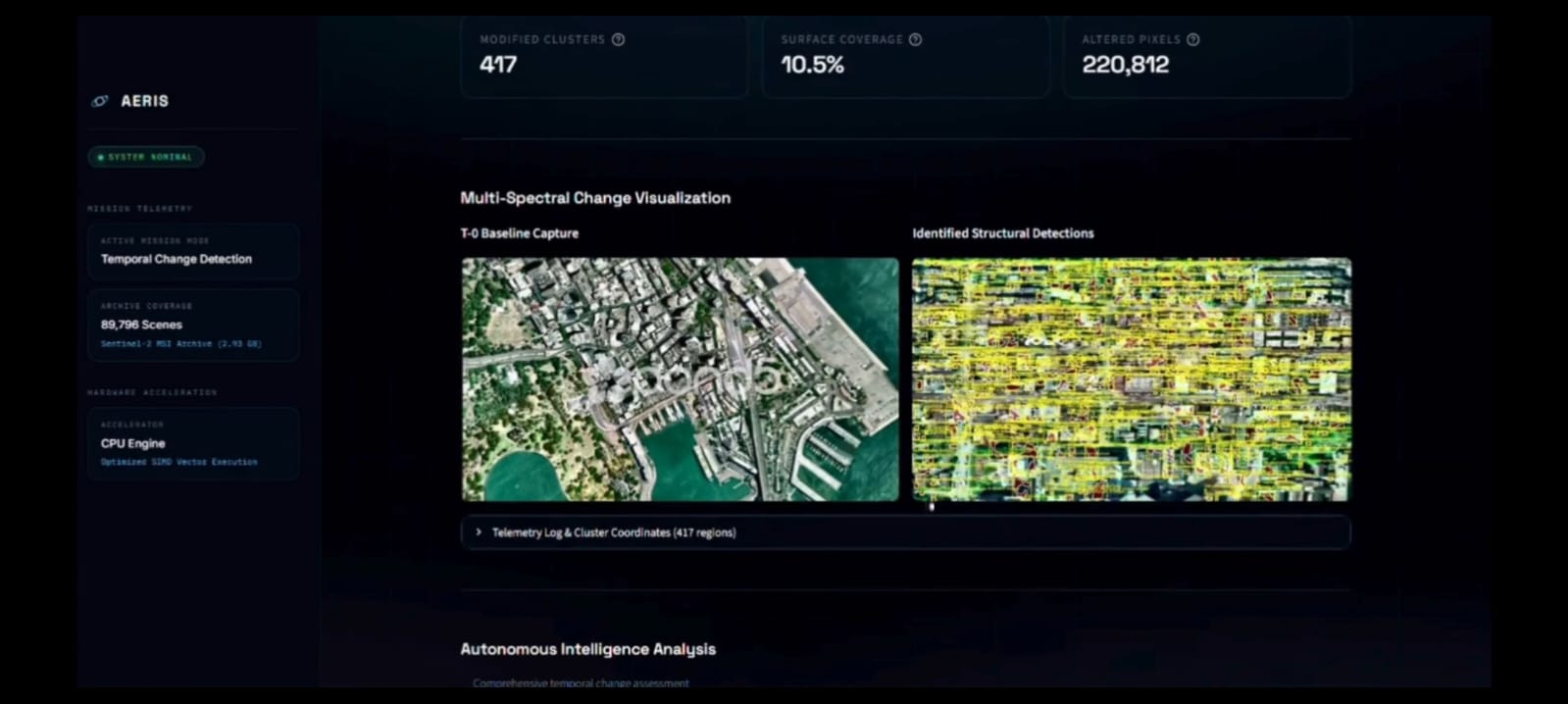
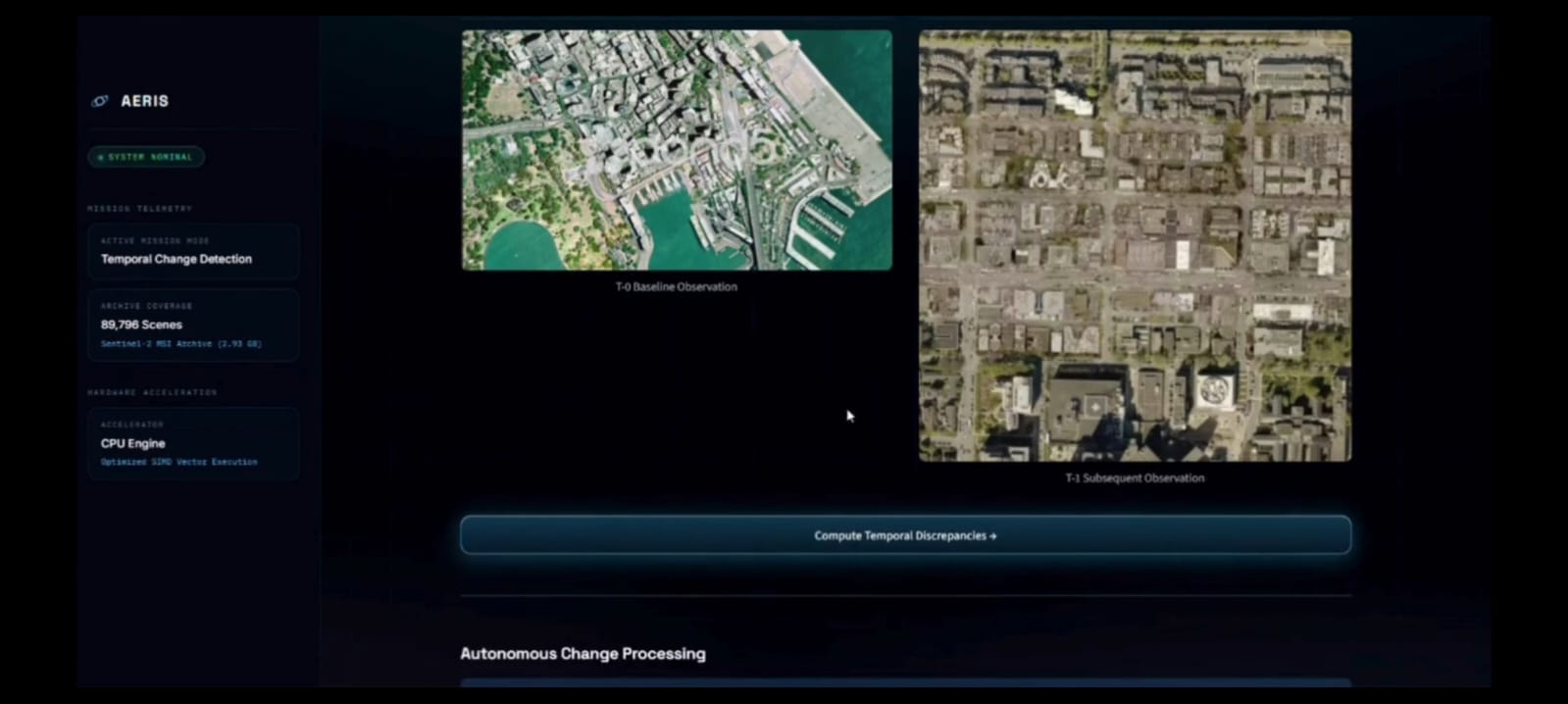
On top of retrieval, we designed the system around multi-temporal analysis. Instead of looking at satellite images independently, Aeris connects images from the same or nearby locations across different points in time.
This creates an image timeline that can help reveal changes such as:
- New construction
- Vegetation changes
- Changes in water bodies
- Road development
- Other significant land-cover changes
We also incorporated a multimodal AI component using Qwen2-VL to move toward explanations that are easier for humans to understand.
Our broader architecture combines:
Satellite Data → Preprocessing → Image Embeddings → FAISS Retrieval → Geospatial Filtering → Temporal Comparison → Change Analysis → AI Explanation
The goal is not simply to show users two images and say that they are different. The goal is to help answer:
What changed? Where did it change? When did it change? And what might that change represent?
The Challenges We Faced
The project was definitely not straightforward.
One of our biggest challenges was dealing with the sheer amount of satellite data. Working with thousands of images and their metadata forced us to think carefully about storage, indexing, preprocessing, and retrieval speed.
Another challenge was getting semantic retrieval to behave the way we expected. A model can generate embeddings successfully, but that does not automatically mean the search results will always be meaningful. We had to experiment with preprocessing, embeddings, indexing, similarity search, and filtering.
Change detection was another difficult part.
At first, it sounds simple: take two images and compare them.
In reality, satellite images can look different even when nothing meaningful has changed. Clouds, shadows, seasonal differences, atmospheric conditions, and slight differences in image alignment can all create false changes.
We also had to work within practical constraints. We wanted Aeris to be useful without depending on a complicated cloud infrastructure or requiring an enormous model-training pipeline. That meant making careful choices about which models to use, what to run locally, and how to keep the system efficient.
There were also plenty of smaller technical problems — models taking time to load, dependencies conflicting, large datasets being difficult to handle, and individual components working independently but not yet being properly connected to the complete application.
What Aeris Means to Us
Aeris is more than just a satellite-image search tool.
For us, it represents the idea that Earth observation should become easier to explore and understand.
We started with a simple question about how people could make better use of satellite imagery. Along the way, we learned about AI, computer vision, vector databases, geospatial data, multimodal models, and the challenges of building a real system instead of a simple prototype.
There is still a lot we want to improve.
But that is also what makes the project exciting.
Our long-term vision for Aeris is to build a system that can help people move from raw satellite data to meaningful understanding — whether they are monitoring cities, studying environmental changes, observing infrastructure, or simply trying to understand how a place has transformed over time.
Aeris is our attempt to make the changing Earth easier to search, see, and understand.


Log in or sign up for Devpost to join the conversation.