-
-
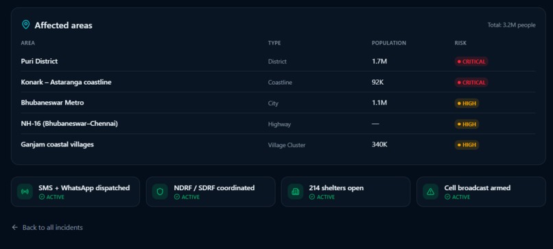
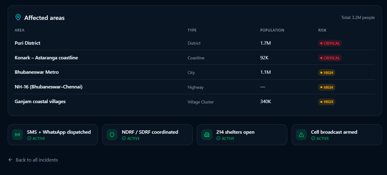
The granular impact breakdown view listing specific at-risk districts, coastlines, and highways alongside active, synchronized emergence
-
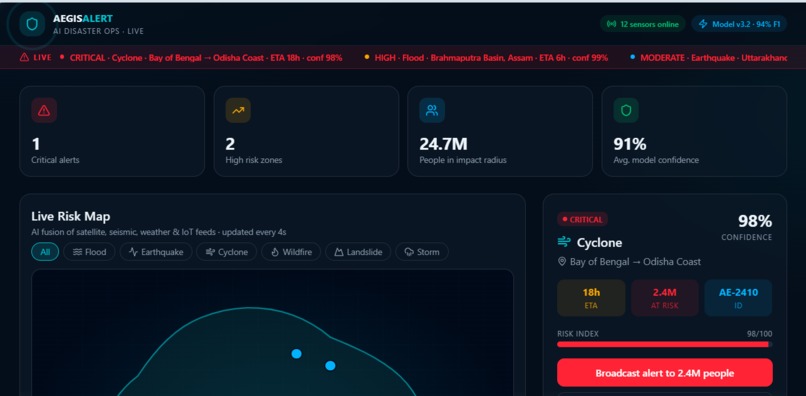
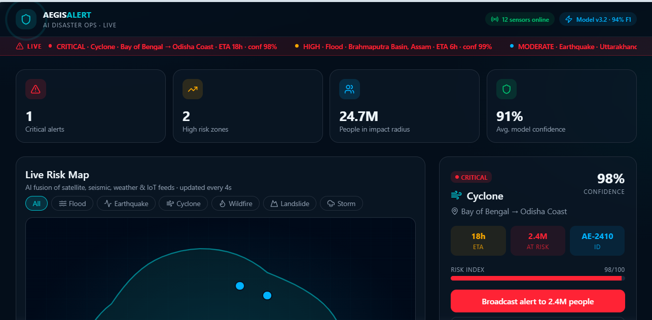
The primary operations view showing top-level emergency metrics (critical alerts, population at risk, and model confidence)
-
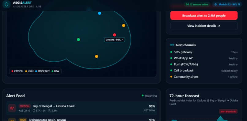
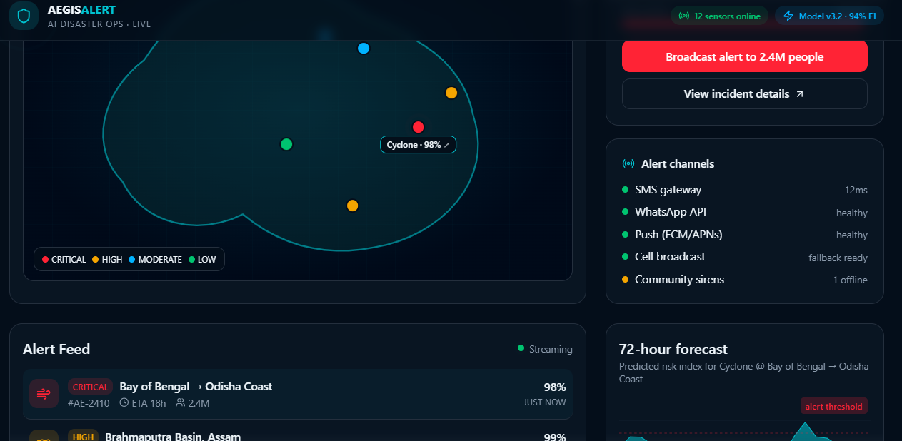
A mid-dashboard view featuring a color-coded geographic threat map alongside a real-time gateway status tracker for SMS, WhatsApp,
-
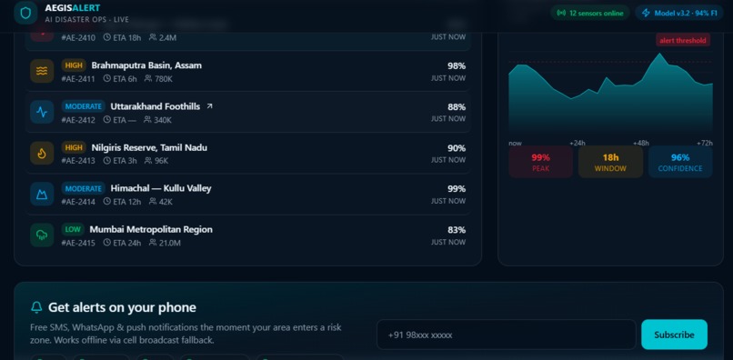
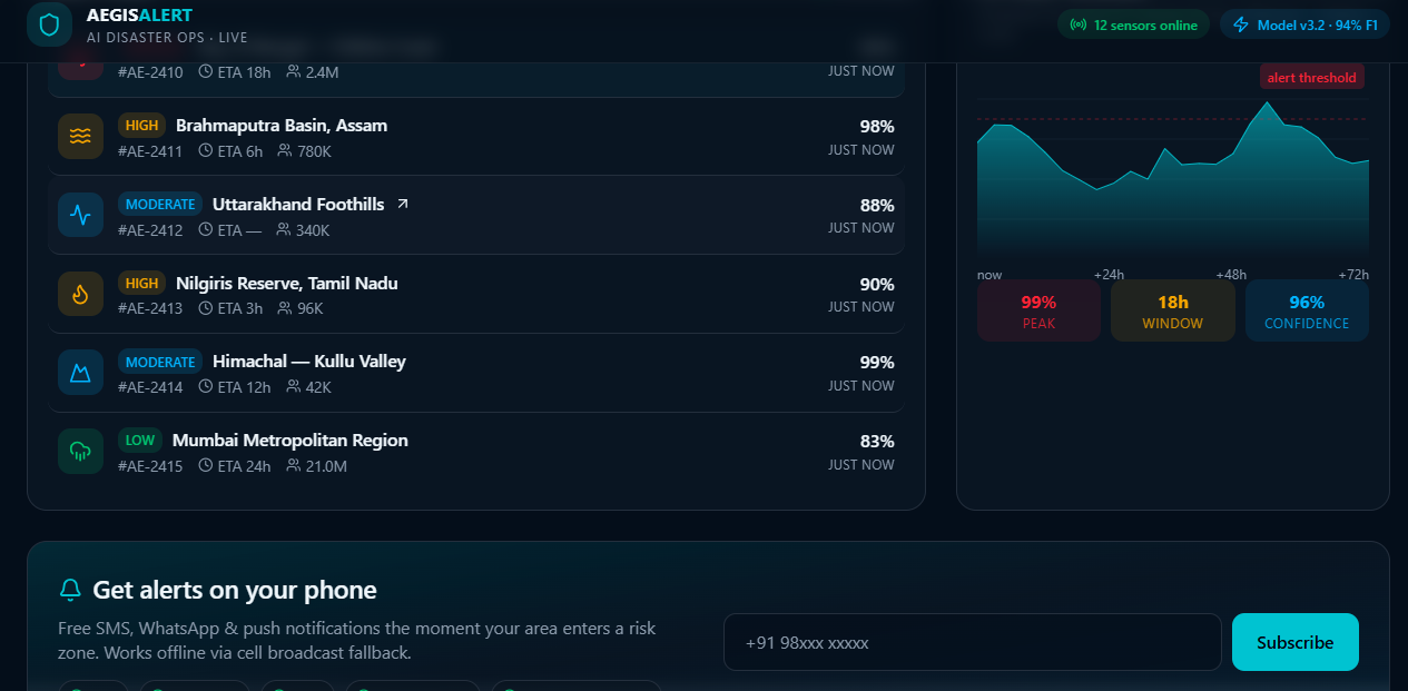
The lower dashboard view displaying an active multi-hazard streaming alert feed, a predictive 72-hour risk index forecast graph.
-
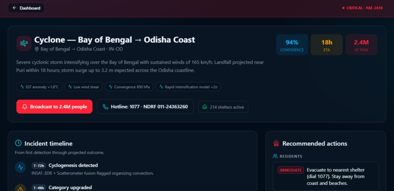
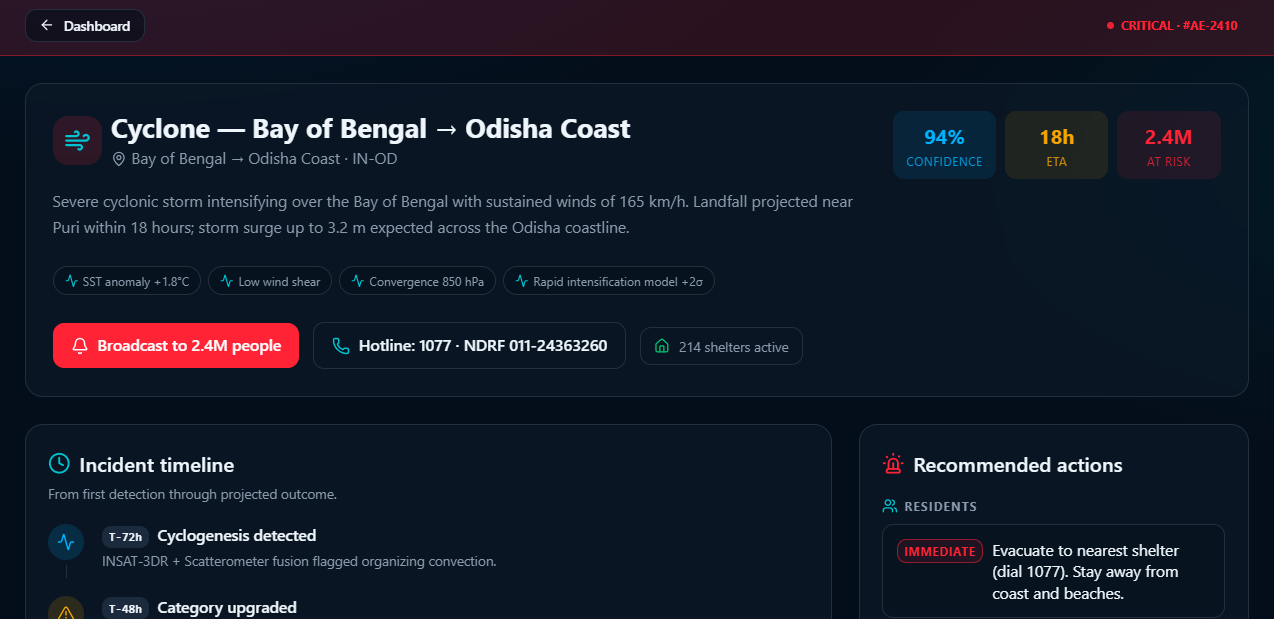
A dedicated incident detail page providing a meteorological analysis of a critical cyclone threat, immediate hotlines, active shelter counts
💡 Inspiration
During natural disasters, two things cost lives: delayed data and destroyed networks. AegisAlert was built to turn chaotic weather feeds into immediate, automated lifelines before the grid goes down.
What it does
An AI-powered disaster command center that ingests simulated satellite, seismic, and IoT feeds every 4 seconds. It predicts threats (cyclones, floods, fires), calculates impact ETAs, and broadcasts instant emergency alerts via WhatsApp, SMS, and internet-independent Cell Broadcasts.
How we built it
Frontend: React, Vite, and Tailwind CSS for a high-visibility, dark-mode dashboard.
Data Pipeline: Asynchronous state engines simulating sensor polling and 72-hour risk trajectory forecasting.
Platform: Developed and deployed via Lovable for rapid full-stack iteration.
Challenges we ran into
Data Fusion: Normalizing erratic sensor speeds (slow satellites vs. millisecond seismic feeds) into a single, cohesive Risk Index.
Offline UI Logic: Clearly communicating high-level network latencies and cell-broadcast fallbacks within a web-based prototype environment.
Accomplishments that we're proud of
Designing a dashboard that presents complex metrics (F1 scores, population tracking) cleanly without clutter.
Engineering a fail-safe communication hierarchy that bridges internet-based APIs with offline local fallback channels.
What we learned
In emergency tech, minimalism is a safety requirement—every millisecond of scanning time counts.
Raw data must always be filtered through an interpretive layer to give field operators immediate, actionable text over numbers.
What's next for AEGISALERT AI Disaster Ops
Live IoT Nodes: Connecting physical microcontrollers (ESP32) for real-time smoke and water telemetry.
Localization: Integrating AI voice/text translation to automatically broadcast alerts in regional Indian languages.
Built With
- ai
- api
- css
- data-fusion-(for-binding-satellite
- html5
- iot
- javascript
- json
- learning
- lovable
- machine
- networks
- node.js
- prediction
- react
- rest
- seismic
- sensor
- tailwind
- typescript
- vite
- weather

Log in or sign up for Devpost to join the conversation.