-
-
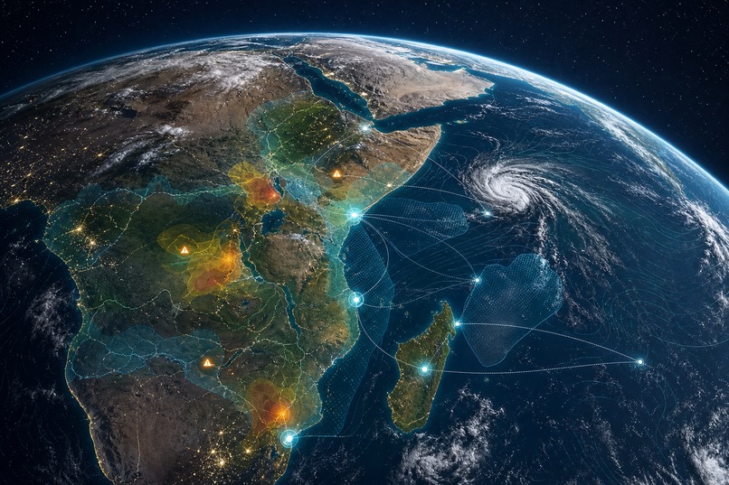
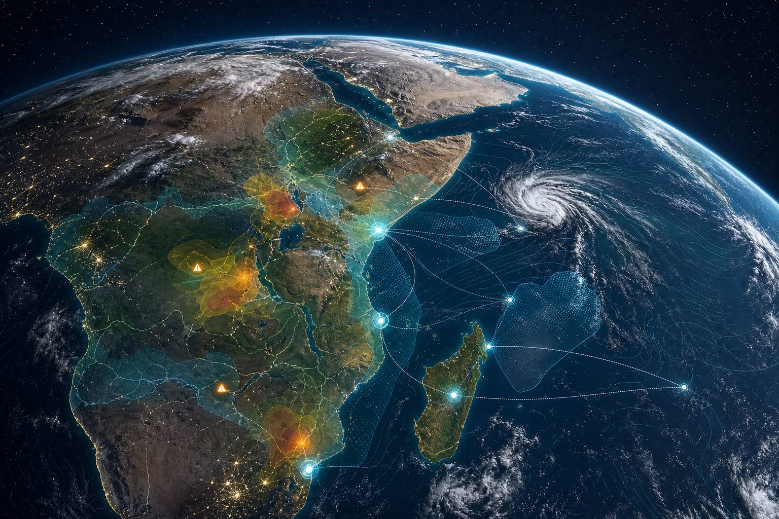
Global hazard monitoring connects weather intelligence, regional risk signals, and response coordination in one map-first platform.
-
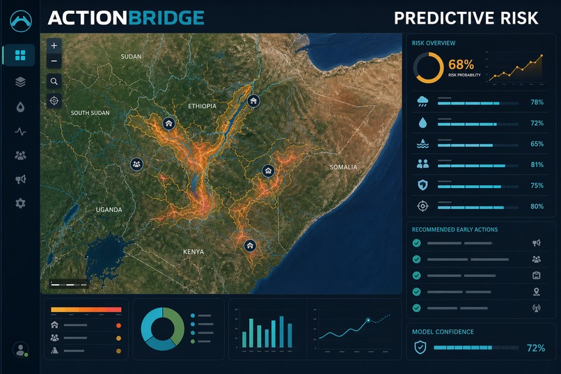
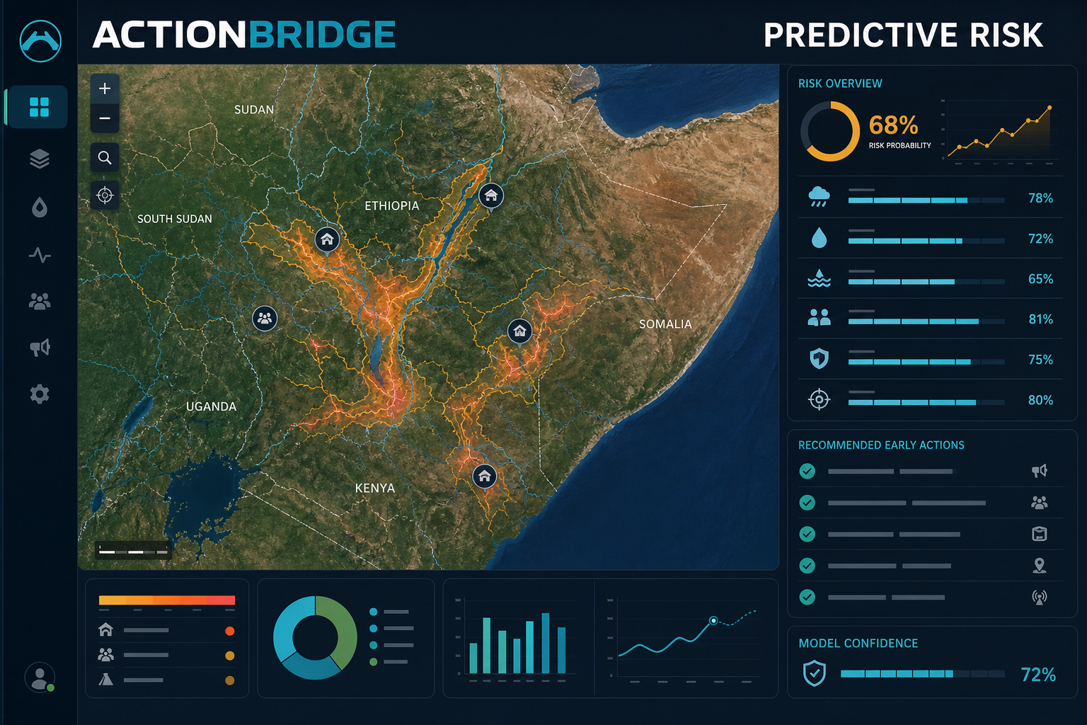
Multi-source data helps identify potential disaster zones, explain contributing risk factors, and recommend timely early actions.
-
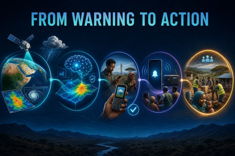
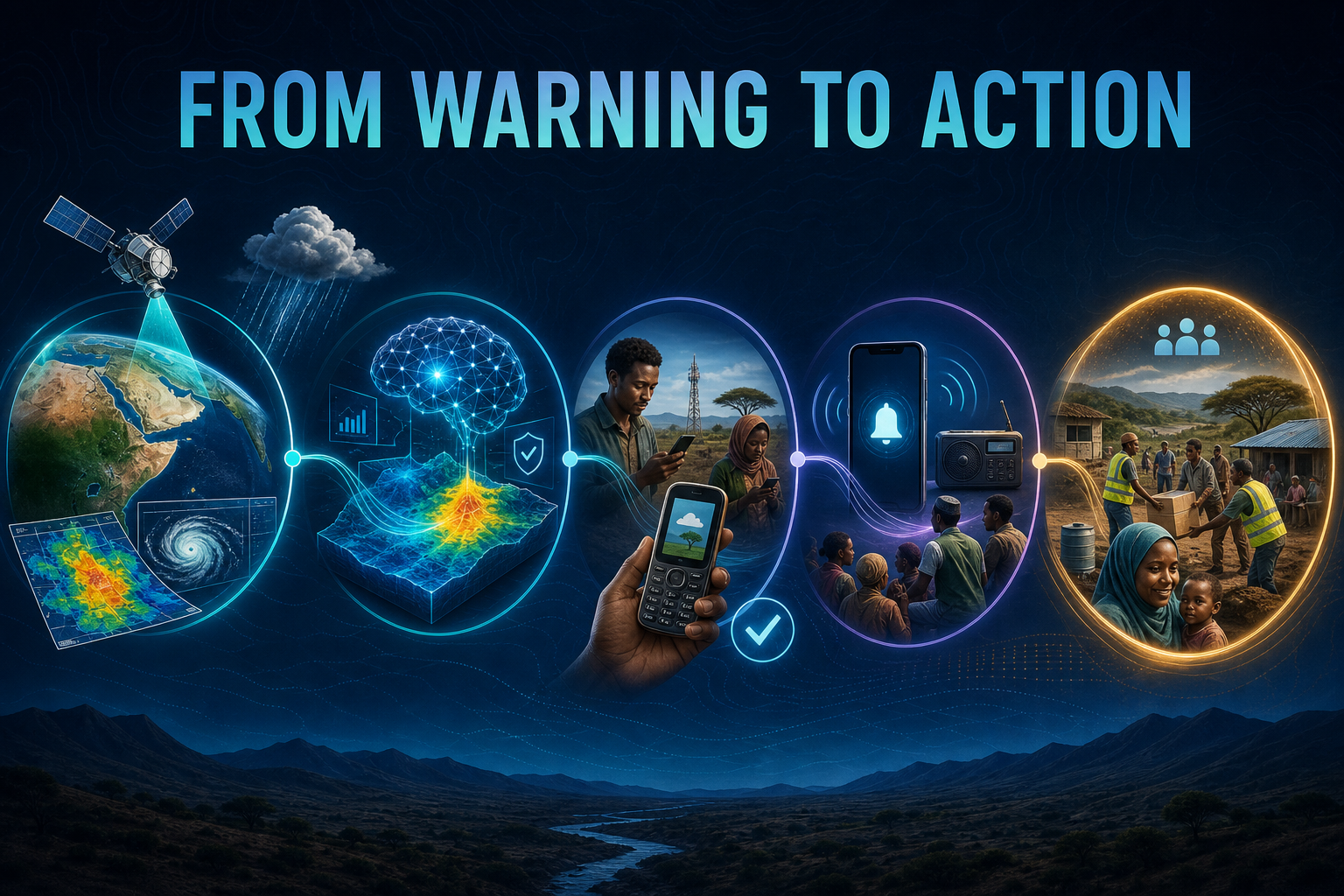
ActionBridge transforms weather observations and AI analysis into verified reports, inclusive alerts, and coordinated community action.
-
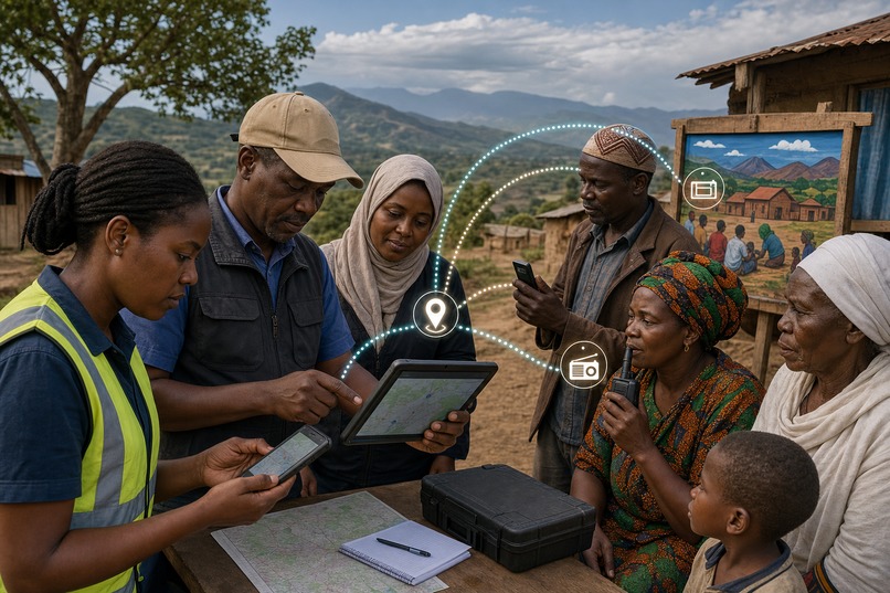
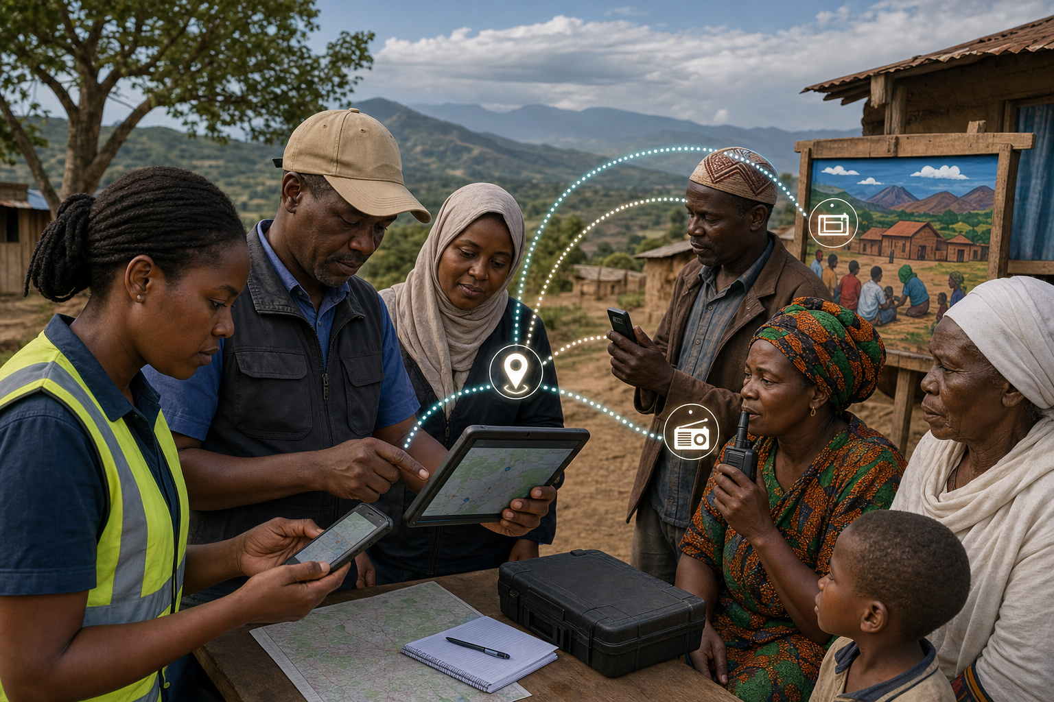
Local responders and community members verify conditions and share accessible alerts through mobile devices, radio, and community channels.
-
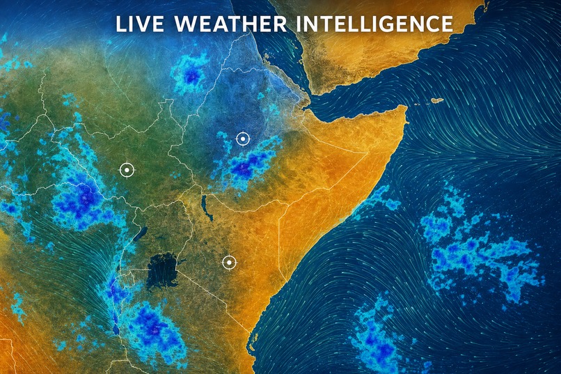
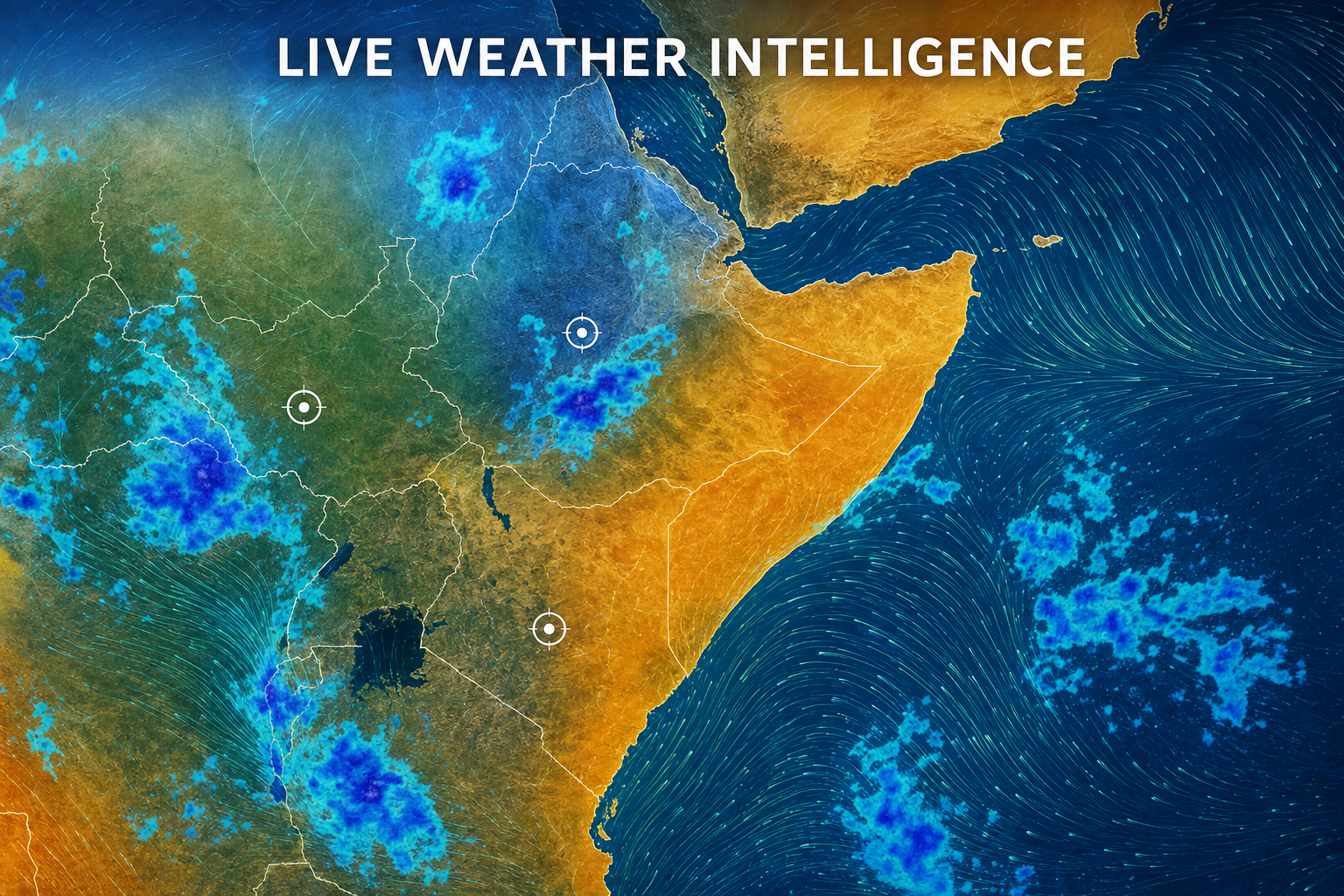
Distinct precipitation, wind, and temperature layers reveal changing weather patterns across monitored regions.
Inspiration
Communities across the IGAD region face floods, droughts, extreme heat, cyclones, landslides, food insecurity, and other hazards that can escalate quickly. Forecasts, vulnerability data, field observations, and response plans often live in separate systems, delaying action. We built ActionBridge to close the gap between knowing a threat is developing and coordinating timely, understandable early action.
What it does
ActionBridge is a map-first early-warning and early-action platform for disaster-management agencies, humanitarian organizations, local authorities, forecasters, community leaders, and first responders.
Its global satellite-style command view lets users switch monitoring regions, zoom into an area, view current weather, and explore animated precipitation, wind, and temperature layers. Teams can review active alerts, affected communities, estimated exposure, response windows, and recommended actions in one responsive workspace.
An explainable predictive risk engine combines hazard signals—such as rainfall, river level, soil saturation, satellite-water indicators, elevation, vulnerability, exposure, and verified community reports—to prioritize areas that may enter a disaster zone. Field teams can submit structured observations for verification. Authorized users can prepare multilingual, low-bandwidth alerts for SMS, voice, radio, and digital channels while tracking reach and acknowledgement.
How we built it
We built the responsive frontend with TypeScript, React, Vinext, and Vite. The backend is compatible with Cloudflare Workers and uses Cloudflare D1 with Drizzle ORM for structured alerts, reports, communities, and action plans. REST endpoints connect the interface to weather, risk-scoring, reporting, and coordination workflows.
Open-Meteo supplies model-derived current weather data, while NASA Blue Marble imagery provides geographic context. The risk service calculates an explainable score from multiple weighted signals and displays the factors contributing to each prediction. Action plans connect alerts to tasks, owners, deadlines, affected communities, and completion status.
Challenges we ran into
The largest challenge was presenting complex global risk information without overwhelming users. We redesigned the interface around the map, made navigation responsive across desktop, tablet, and mobile, and ensured metrics and controls remain readable at different screen sizes.
We also had to distinguish live weather from demonstration risk scenarios. Predictive outputs can be useful, but they must never be presented as official evacuation orders. We therefore added clear labels, explainable factors, verification steps, and human authorization for high-impact actions.
Accomplishments that we're proud of
We created a working end-to-end warning-to-action loop. ActionBridge connects live weather, predictive analytics, active alerts, community exposure, field verification, communication, and assigned response tasks in one platform.
We are especially proud of the region-switching map, distinct weather animations, explainable disaster-zone predictions, inclusive alert channels, community reporting workflow, and responsive command interface.
What we learned
We learned that trustworthy early warning depends on much more than prediction accuracy. Information must be understandable, locally relevant, accessible through low-bandwidth channels, and linked to accountable action owners.
Community feedback is not simply an additional data source—it is essential context for validating conditions on the ground. We also learned that explainability and human oversight are necessary for responsible AI in emergency decision-support systems.
What's next for ActionBridge
Next, we plan to connect additional authoritative hazard feeds, calibrate regional models using historical disaster data, expand offline-first mobile reporting, support more local languages, and pilot alert workflows with disaster-management agencies and community partners.
We also plan to strengthen role-based verification, audit trails, interoperable data exchange, and model evaluation.
Responsible-use notice: ActionBridge is decision-support software. It does not replace official forecasts, evacuation orders, emergency services, or professional judgement. Predictions and community reports require authorized verification. Demonstration risk, exposure, delivery, and action metrics must not be used operationally.
Open-source acknowledgements
The prototype uses open-source TypeScript, React, Vinext, Vite, Drizzle ORM, and Cloudflare tooling. Open-Meteo provides weather data, NASA Blue Marble provides geographic imagery, and OpenAI Codex assisted implementation and iteration.
Built With
- ai
- climate-resilience
- community-engagement
- couldflare-d1
- couldflare-workers
- data-science
- disaster-preparedness
- drizzle-orm
- early-warning
- geospatial
- machine-learning
- open-meteo
- react
- rest-api
- sms-alerts
- typescript
- vinext
- vite
- weather-analytics


Log in or sign up for Devpost to join the conversation.