Inspiration
As cities grow, road safety becomes a critical concern. We wanted to build an app that not only helps commuters reach their destination efficiently but also prioritizes safety by alerting them to accident-prone areas and real-time hazards.
What it does
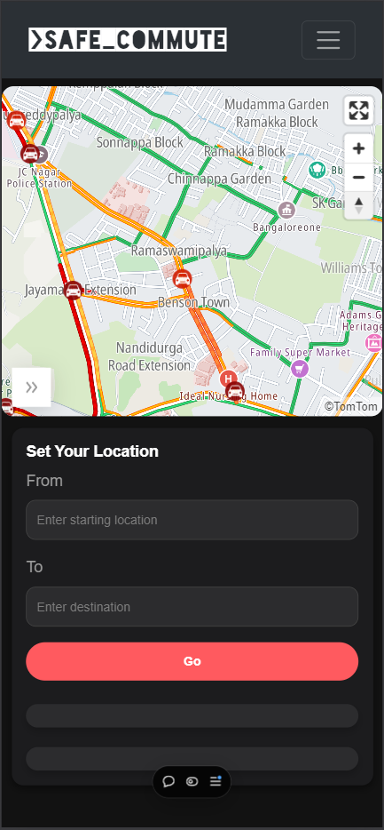
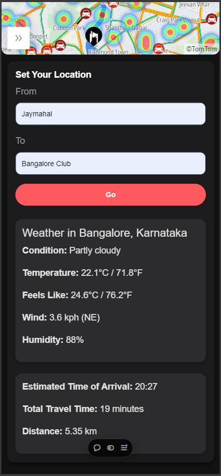
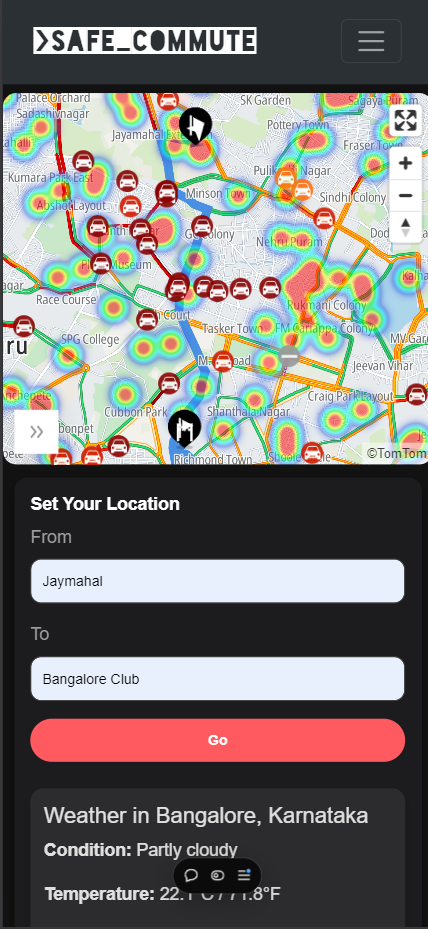
SafeCommute helps users navigate urban areas by showing accident heatmaps, providing real-time traffic and weather updates, and offering safer routes. It gives estimated travel times (ETA) and alerts for red and yellow weather warnings, ensuring safer and smarter commutes. Users can also easily access emergency contacts if needed.
How we built it
We built SafeCommute using real-time data from the TomTom API for traffic updates and map integration. Accident data is processed to generate heatmaps showing high-risk zones. The app also pulls weather data to display alerts and integrates emergency contacts for quick access.
Challenges we ran into
Handling large sets of real-time data, especially traffic and weather, required optimizing the app’s performance. Ensuring that alerts were timely without overwhelming the user was also a challenge we had to balance.
Accomplishments that we're proud of
We successfully integrated multiple APIs to provide a comprehensive solution that enhances both safety and navigation. The accident heatmap feature and the ability to provide safety alerts in real-time are aspects we’re particularly proud of.
What we learned
We learned how to work with various real-time data sources and how to effectively process and visualize this data in a way that provides actionable insights to users without causing information overload.
What's next for SafeCommute
We plan to expand SafeCommute by adding more features such as personalized route recommendations, integrating public transport options, and partnering with local authorities to provide even more precise accident data. We also aim to improve the user interface and experience for smoother navigation.


Log in or sign up for Devpost to join the conversation.