Inspiration
We saw that the old campus accessibility map was outdated (last updated in 2016), and we thought to create a new version for the new buildings and areas on campus, and one that is more interactive.
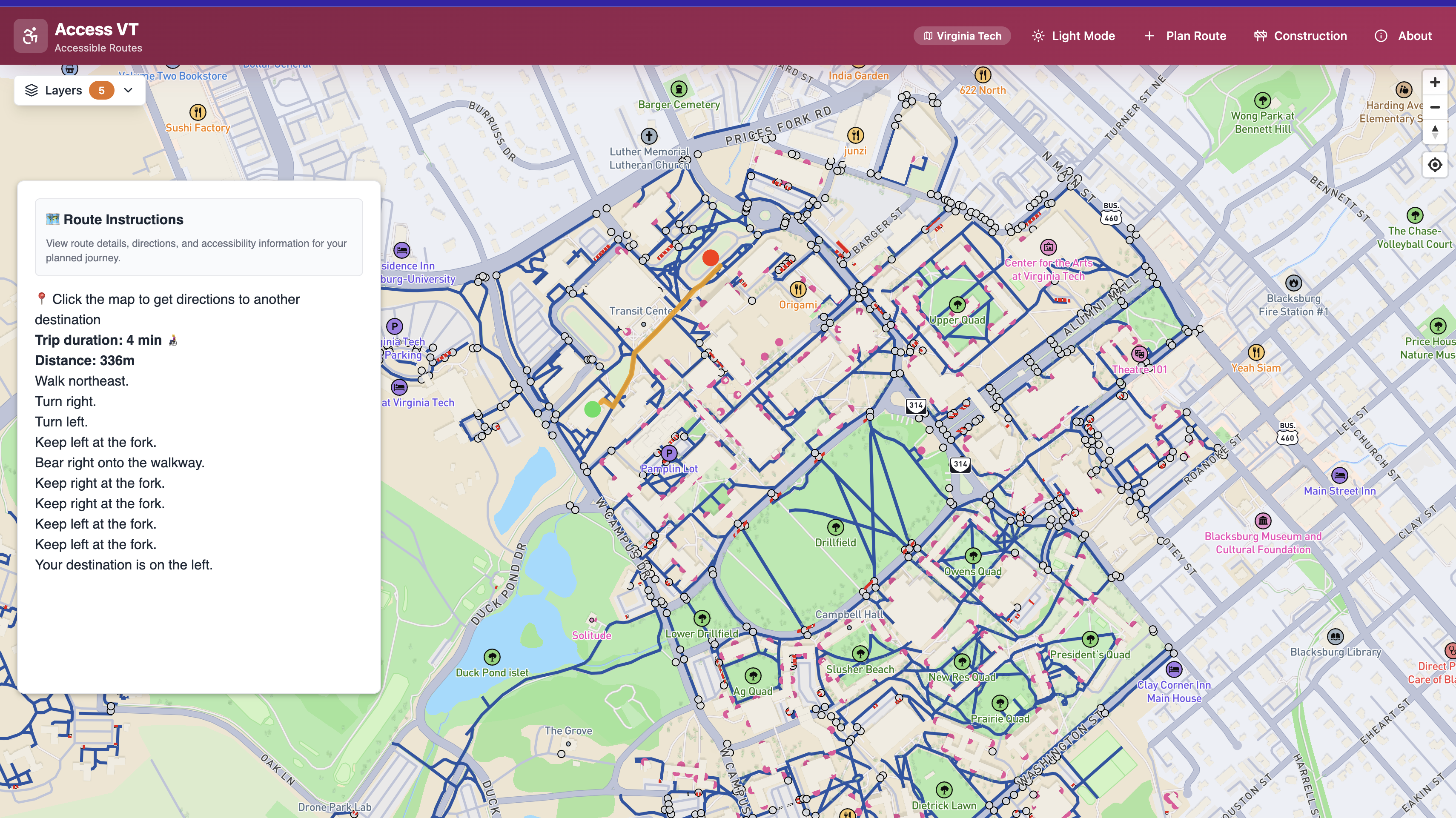
What it does
The app allows you to use your current location and set pins on a map of VT, showing the most optimal paths using accessibility routes depending on where you are. Additionally, you can plan routes in the future between buildings on campus, with the option of using AR to guide your way to your destination in the real world using a QR code and your phone's camera.
How we built it
We used React + TypeScript + Tailwind CSS for the app's design, with MapBox for the interactive map, GeoJSON for the custom accessibility routes and other notable POIs, and Claude Code, GitHub Copilot, and ChatGPT to generate the design and algorithms for optimal routing.
Challenges we ran into
We were stuck with toggling specific routes from appearing on the map, depending on what the user wants to see around them. The algorithm that Claude generated was also not as great with depending solely on the existing routes, so it wasn't as accurate as we had hoped.
Accomplishments that we're proud of
We are proud of revamping an old system and making it more useful for accessibility-needing students, and using a new JSON format that pertains to coordinate data. We also had to update the accessibility routes by hand with the format (using geojson.io). Additionally, it was the first hackathon for 2/3 members, so we were happy with how far we got in the given time frame.
What we learned
We learned about creating a map style with MapBox and having custom overlays over it, using Claude Code to get through the bulk of the project.
What's next for AccessVT
Sending this to the university for potential updating of their system and implementation of our functionality.


Log in or sign up for Devpost to join the conversation.