-
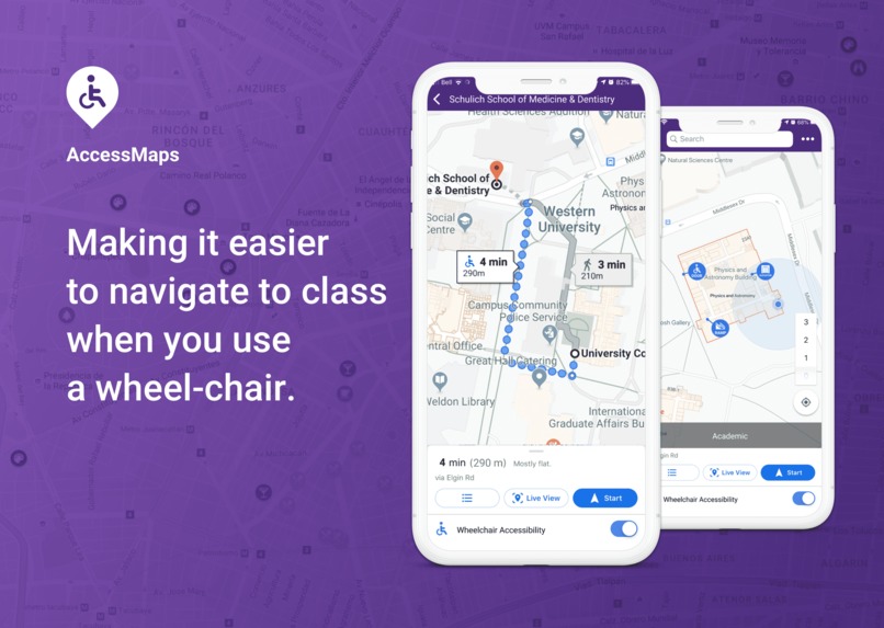
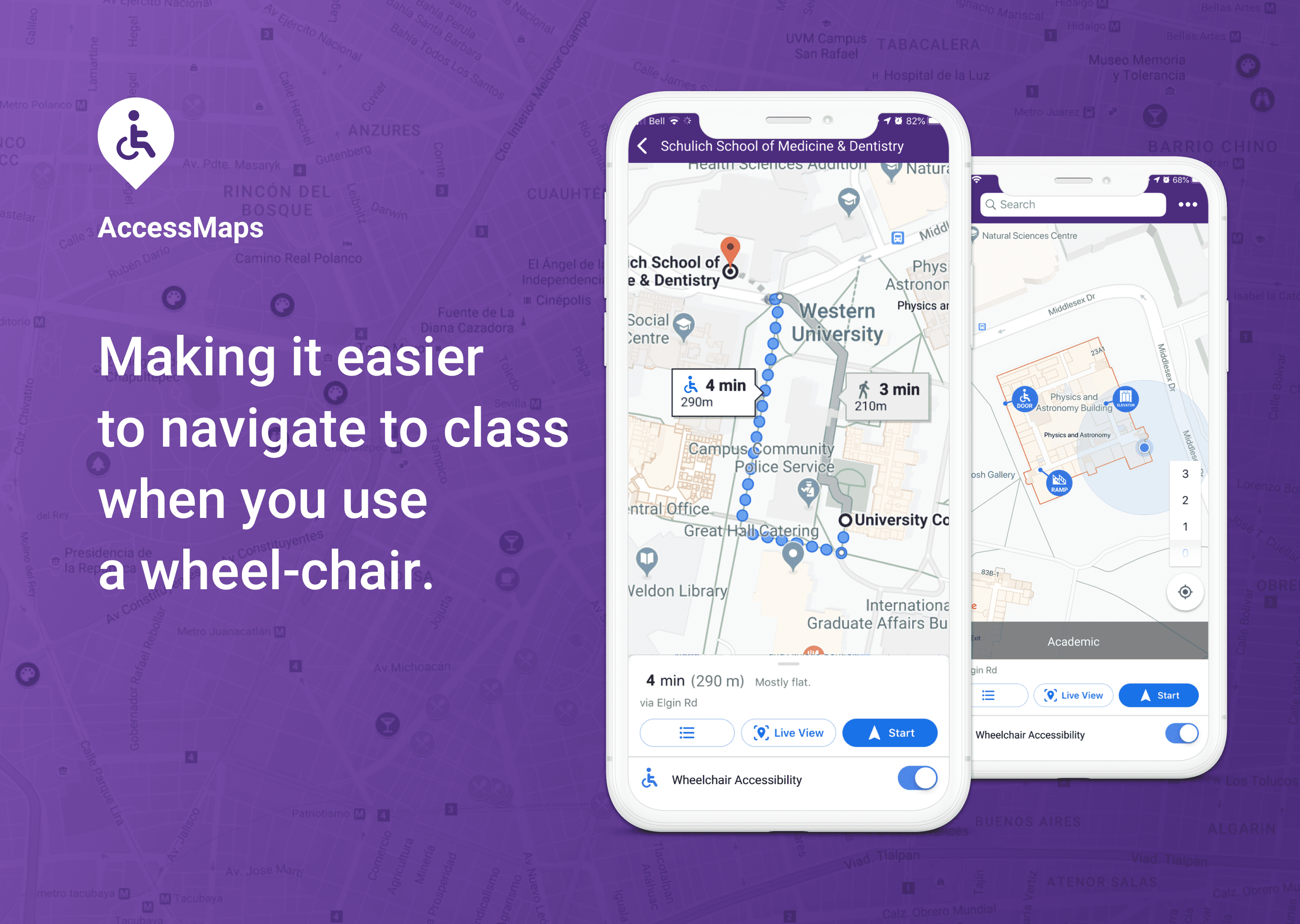
AccessMaps landing page
Inspiration
AccessMaps is inspired by the current obstacles we see in routing accessible paths. Currently, Google Maps does not offer an “accessibility” mode on their platform and it is very difficult for those who use wheelchairs to navigate their way around campus. Western University’s Multi-Year Accessibility Plan states that they are committed to creating an inclusive and accessible environment for their students, faculty and visitors; we believe that this would be a feature that moves them closer to those goals.
What it does
AccessMaps offers/will offer three primary components:
How we built it
We used Google Maps API to route directions from point A (start) to point B (end). The user can choose from a drop-down menu their starting point and desired destination. The points associated with each building were selected from pre-identified accessible entrances/exits. Polylines and waypoints were used to direct Google Maps to generate an accessible route. Polylines ruled-out inaccessible routes and waypoints guided Maps to a known accessible route.
Challenges we ran into
Too many to count, but here are a few that stand out:
Accomplishments that we're proud of
We are proud to address a huge problem that people with physical disabilities face everyday when navigating their university campus. The first step to getting an education is physically getting to classrooms. And we are proud to have created an application that helps to remove this barrier.
We also got to experiment with platforms we had never used before, such as Google Cloud products. It was interesting to see what we could accomplish with this new technology.
What we learned
We learned how to use the Google Maps platform on Google Cloud, which none of us had any experience in. We were also all inexperienced in writing programs using HTML for web page development (only one person had ever written in this language and it was 6 years ago!). We also discovered some problems about Google Maps itself (such as how it only comes up with 3 possible routes), but were able to problem-solve and come up with alternative solutions.
What's next for AccessMaps
We first want to add in the rest of the data for Western’s campus (we so far only have a prototype of a couple buildings). We would also like to include routes for people with other disabilities and really tailor the app to use each individual’s abilities. Then we want to implement our solution to other university campuses, then commercial buildings like airports and shopping centres, and eventually to entire cities. Further down the line, we would like to create another mode in Google Maps itself, in addition to Driving, Transit, Cycling, Walking, Flights, called Accessible, for all people who are differently abled.
Built With
- google-maps-platform-on-google-cloud
- html
- javascript
- maps


Log in or sign up for Devpost to join the conversation.